close
-
Layers w
- Weather Layers
- Pro
- Pro
- Pro
- Pro
- Pro
- Pro
- More Layers
- Pro
- Pro
- Pro
- Pro
-
Upgrade to

3D
Trail Conditions
- Unknown
- Snow Groomed
- Snow Packed
- Snow Covered
- Snow Cover Partial
- Freeze/thaw Cycle
- Icy
- Prevalent Mud
- Wet
- Variable
- Ideal
- Dry
- Very Dry
Trail Flow (Ridden Direction)
Trailforks scans users ridelogs to determine the most popular direction each trail is ridden. A good flowing trail network will have most trails flowing in a single direction according to their intension.
The colour categories are based on what percentage of riders are riding a trail in its intended direction.
The colour categories are based on what percentage of riders are riding a trail in its intended direction.
- > 96%
- > 90%
- > 80%
- > 70%
- > 50%
- < 50%
- bi-directional trail
- no data
Trail Last Ridden
Trailforks scans ridelogs to determine the last time a trail was ridden.
- < 2 days
- < 1 week
- < 2 weeks
- < 1 month
- < 6 months
- > 6 months
Trail Ridden Direction
The intended direction a trail should be ridden.
- Downhill Only
- Downhill Primary
- Both Directions
- Uphill Primary
- Uphill Only
- One Direction
Contribute Details
Colors indicate trail is missing specified detail.
- Description
- Photos
- Description & Photos
- Videos
Trail Popularity ?
Trailforks scans ridelogs to determine which trails are ridden the most in the last 9 months.
Trails are compared with nearby trails in the same city region with a possible 25 colour shades.
Think of this as a heatmap, more rides = more kinetic energy = warmer colors.
- most popular
- popular
- less popular
- not popular
ATV/ORV/OHV Filter
Max Vehicle Width
inches
US Cell Coverage
Legend

Radar Time
Activity Recordings
Trailforks uses anonymized public activity data.
?
Activity Recordings
Trailforks uses anonymized public activity data.
?
Personal Heatmap
▶
Activity Types
all
/
none
▶
Options
2
Date range
month
–
Winter Trails
Warning
A routing network for winter maps does not exist. Selecting trails using the winter trails layer has been disabled.
Missing Trails
Most Popular
Least Popular
Trails are colored based on popularity. The more popular a trail is, the more red. Less popular trails trend towards green.
Jump Magnitude Heatmap
Heatmap of where riders jump on trails. Zoom in to see individual jumps, click circles to view jump details.
BC Backroad Status
![map legend]()
Service Road Atlas is a free to use, community-driven service for viewing and creating reports on the numerous back-country service roads around B.C. and Alberta.

Slope Aspect
Direction the slope faces
Trails Deemphasized
Trails are shown in grey.
Only show trails with no bike usage.
Suggested Layers
Based on selected activity type
Save the current map location and zoom level as your default home location whenever this page is loaded.
Save
No description for Broxbourne has been added yet!
Login or register to submit one.
This region uses the Uk/Euro style trail grading system.
Activities Click to view
- Mountain Bike
53 trails
- E-Bike
4 trails
- Gravel Bike
0 trails
- Horse
9 trails
- Hike
57 trails
- Trail Running
57 trails
Region Details
- 5
- 40
- 8
Region Status
Open as of Aug 20, 2025Stats
- Avg Trail Rating
- Trails (view details)
- 57
- Trails Mountain Bike
- 53
- Trails E-Bike
- 4
- Trails Horse
- 9
- Trails Hike
- 57
- Trails Trail Running
- 57
- Total Distance
- 33 miles
- Total Descent
- 2,326 ft
- Total Vertical
- 320 ft
- Highest Trailhead
- 402 ft
- Reports
- 184
- Photos
- 19
- Ridden Counter
- 2,288
Sub Regions
-
Broxbourne Woods
- 30
- 8
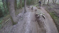
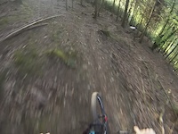
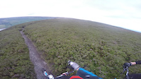
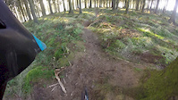
Popular Broxbourne Mountain Biking Trails
• 85 ★ 0.0 • 1 mile • 34 ft • 92 •
Popular green difficulty gravel path. This multi-use trail can be used both directions. On average it takes 9 minutes to complete this trail.
• 95 ★ 4.3 • 1,993 ft • 3 ft • 76 • • hike
is the most action packed trail here at Broxbourne. It starts off flat but then starts descending as it winds around with berms, jumps, drops and even gaps (optional)
• 90 ★ 0.0 • 1,383 ft • 0 ft • 66 • • hike
Popular green difficulty singletrack. This hike primary trail can be used both directions. On average it takes 1 minutes to complete this trail.
• 95 ★ 2.5 • 2,192 ft • 3 ft • 64 •
Multiple line choices, jumps can be rolled or ridden around.
• 65 ★ 0.0 • 1,667 ft • 70 ft • 62 • • hike
Moderately popular blue difficulty singletrack. This hike primary trail can be used both directions. On average it takes 2 minutes to complete this trail.
• 60 ★ 0.0 • 1 mile • 96 ft • 62 •
Moderately popular green difficulty family friendly doubletrack. This multi-use trail can be used both directions and has a easy overall physical rating. On average it takes 6 minutes to complete this trail.
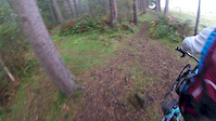
Photos of Broxbourne Mountain Bike
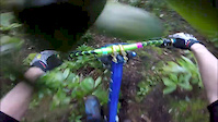
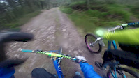
Videos of Broxbourne Mountain Bike
trail: Track
0:48 |
467 |
Aug 27, 2018
trail: Track
0:39 |
10 |
May 10, 2018

trail: Track
0:06 |
242 |
Jun 5, 2017
trail: Private Property
0:59 |
258 |
Apr 20, 2017
trail: Private Property
0:37 |
50 |
Dec 29, 2016
trail: Track
0:30 |
75 |
Oct 8, 2016
trail: Trail
2:16 |
229 |
Mar 17, 2016
trail: Private Property
0:25 |
104 |
Feb 27, 2016
Recent Trail Reports
| status | trail | date | condition | info | user |
|---|---|---|---|---|---|
| River Lea Path | Aug 20, 2025 @ 9:06am Aug 20, 2025 | Dry | joeg885 | ||
| Leap Of Faith | May 4, 2025 @ 11:58am May 4, 2025 | Variable | Lewis-56 | ||
| Tombstone | Jul 17, 2024 @ 6:51am Jul 17, 2024 | Variable | joeg885 | ||
| Hollybush DH | Jul 17, 2024 @ 6:51am Jul 17, 2024 | Dry | joeg885 | ||
| Devil's Lane | Jul 17, 2024 @ 6:50am Jul 17, 2024 | Variable | joeg885 | ||
| Backscratcher | Jun 10, 2024 @ 11:14am Jun 10, 2024 | Ideal | rzat | ||
| Trail | Jun 10, 2024 @ 11:14am Jun 10, 2024 | Variable | rzat | ||
| Danny DeVito | Jun 10, 2024 @ 11:14am Jun 10, 2024 | Ideal | rzat | ||
| Trail | Jun 10, 2024 @ 11:14am Jun 10, 2024 | Variable | rzat | ||
| Trail | Feb 16, 2024 @ 11:37pm Feb 16, 2024 | Prevalent Mud | UrbanMyth |
Activity Feed
| username | action | type | title | date |
|---|---|---|---|---|
| markholloway | update | trail | activity #93663051 | Apr 29, 2026 @ 11:47am Apr 29, 2026 |
| canadaka | update | trail | activity #93662086 | Apr 29, 2026 @ 11:33am Apr 29, 2026 |
| LyleZNps7M | ridden | trail | activity #92547545 | Apr 13, 2026 @ 10:46am Apr 13, 2026 |
| markholloway | update | trail | activity #91770382 and 2 more | Apr 2, 2026 @ 10:27am Apr 2, 2026 |
| trailforks | add | video | activity #89695237 | Feb 28, 2026 @ 8:02am Feb 28, 2026 |
Recent Comments
| username | type | title | comment | date |
|---|---|---|---|---|
| trail | Moutain bikes are not technically allowed on... | Aug 4, 2022 @ 1:42pm Aug 4, 2022 | ||
| trail | Big water cut ruts bisecting the trail.... | Feb 27, 2021 @ 8:19am Feb 27, 2021 | ||
| trail | The pictures are not the trail | Dec 7, 2019 @ 4:33am Dec 7, 2019 |
Local Badges
-

10 Green Trails66 awarded -

Epic Ride Climb 2k4 awarded -

Climbing 10k Badge25 awarded -

Climbing 100k Badge1 awarded -

Epic Ride Descent 2k4 awarded -

Descent 10k Badge27 awarded
Activity Type Stats
| activitytype | trails | distance | descent | descent distance | total vertical | rating | global rank | state rank | photos | reports | routes | ridelogs |
|---|---|---|---|---|---|---|---|---|---|---|---|---|
| Mountain Bike | 53 | 31 miles | 2,244 ft | 14 miles | 318 ft | #4,535 | #156 | 19 | 183 | 6,268 | ||
| E-Bike | 4 | 2 miles | 249 ft | 1 mile | 128 ft | #7,956 | #357 | 113 | 410 | |||
| Horse | 9 | 5 miles | 82 ft | 1 mile | 276 ft | #2,270 | #114 | 42 | 1 | |||
| Hike | 57 | 33 miles | 2,326 ft | 14 miles | 318 ft | #1,279 | #33 | 180 | 136 | |||
| Trail Running | 57 | 33 miles | 2,326 ft | 14 miles | 318 ft | #5,083 | #116 | 180 | 140 |
Frequently Asked Questions About Broxbourne
▼
What are the best places to ride in Broxbourne?
Broxbourne has 1 areas to explore for mountain biking. The top rated areas are:
▼
What are the highest rated mountain biking trails in Broxbourne?
The highest rated mountain biking trails in Broxbourne are:
- Tombstone (4.1/5)
- Danny DeVito (4.1/5)
- Backscratcher (4.1/5)
- Hollybush DH (4.1/5)
- Trail (4/5)
▼
What is the best time of the year to ride in Broxbourne?
Based on ride log data, the most popular months to ride in Broxbourne are:
- July (89 activities)
- August (76 activities)
- May (66 activities)
▼
Where can I park to ride in Broxbourne?
There are 6 parking locations listed in Broxbourne. The most popular parking spots are:
- Broxbourne Wood West Car Park
- Broxbourne Wood East Car Park
- Bencroft Wood Car Park West
- Main Car Park
- Bencroft Wood Car park East
Activities
- By brenthillier
 NSMBA TRAILFORKS & contributors
 - Admins: wisey, MathieuC, cemoorelife
- #16651 - 2,650 views
- broxbourne activity log | embed map of Broxbourne mountain bike trails | broxbourne mountain biking points of interest
Downloading of trail gps tracks in kml & gpx formats is enabled for Broxbourne.
You must login to download files.