close
-
Layers w
- Weather Layers
- Pro
- Pro
- Pro
- Pro
- Pro
- Pro
- More Layers
- Pro
- Pro
- Pro
- Pro
-
Upgrade to

3D
Trail Conditions
- Unknown
- Snow Groomed
- Snow Packed
- Snow Covered
- Snow Cover Partial
- Freeze/thaw Cycle
- Icy
- Prevalent Mud
- Wet
- Variable
- Ideal
- Dry
- Very Dry
Trail Flow (Ridden Direction)
Trailforks scans users ridelogs to determine the most popular direction each trail is ridden. A good flowing trail network will have most trails flowing in a single direction according to their intension.
The colour categories are based on what percentage of riders are riding a trail in its intended direction.
The colour categories are based on what percentage of riders are riding a trail in its intended direction.
- > 96%
- > 90%
- > 80%
- > 70%
- > 50%
- < 50%
- bi-directional trail
- no data
Trail Last Ridden
Trailforks scans ridelogs to determine the last time a trail was ridden.
- < 2 days
- < 1 week
- < 2 weeks
- < 1 month
- < 6 months
- > 6 months
Trail Ridden Direction
The intended direction a trail should be ridden.
- Downhill Only
- Downhill Primary
- Both Directions
- Uphill Primary
- Uphill Only
- One Direction
Contribute Details
Colors indicate trail is missing specified detail.
- Description
- Photos
- Description & Photos
- Videos
Trail Popularity ?
Trailforks scans ridelogs to determine which trails are ridden the most in the last 9 months.
Trails are compared with nearby trails in the same city region with a possible 25 colour shades.
Think of this as a heatmap, more rides = more kinetic energy = warmer colors.
- most popular
- popular
- less popular
- not popular
ATV/ORV/OHV Filter
Max Vehicle Width
inches
US Cell Coverage
Legend

Radar Time
Activity Recordings
Trailforks uses anonymized public activity data.
?
Activity Recordings
Trailforks uses anonymized public activity data.
?
Personal Heatmap
▶
Activity Types
all
/
none
▶
Options
2
Date range
month
–
Winter Trails
Warning
A routing network for winter maps does not exist. Selecting trails using the winter trails layer has been disabled.
Missing Trails
Most Popular
Least Popular
Trails are colored based on popularity. The more popular a trail is, the more red. Less popular trails trend towards green.
Jump Magnitude Heatmap
Heatmap of where riders jump on trails. Zoom in to see individual jumps, click circles to view jump details.
BC Backroad Status
![map legend]()
Service Road Atlas is a free to use, community-driven service for viewing and creating reports on the numerous back-country service roads around B.C. and Alberta.

Slope Aspect
Direction the slope faces
Trails Deemphasized
Trails are shown in grey.
Only show trails with no bike usage.
Suggested Layers
Based on selected activity type
Save the current map location and zoom level as your default home location whenever this page is loaded.
Save
No description for Brunico has been added yet!
Login or register to submit one.
AKA: Bruneck
This region uses the Uk/Euro style trail grading system.
Activities Click to view
- Mountain Bike
29 trails
- E-Bike
29 trails
- Adaptive Bike
0 trails
- Winter Fat Bike
0 trails
- Hike
7 trails
- Trail Running
7 trails
- Downhill Ski
90 trails
Region Details
- 3
- 1
- 11
- 6
- 6
Region Status
Open as of May 31, 2026Stats
- Avg Trail Rating
- Trails (view details)
- 115
- Trails Mountain Bike
- 29
- Trails E-Bike
- 29
- Trails Hike
- 7
- Trails Trail Running
- 7
- Trails Snowshoe
- 1
- Trails Downhill Ski
- 90
- Trails Backcountry Ski
- 1
- Trails Nordic Ski
- 1
- Total Distance
- 105 miles
- Total Descent
- 99,960 ft
- Total Vertical
- 5,021 ft
- Highest Trailhead
- 8,121 ft
- Reports
- 548
- Photos
- 131
- Ridden Counter
- 21,175
Sub Regions
-
Bike Park Kronplatz
- 1
- 5
- 11
- 7
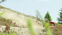
Popular Brunico Mountain Biking Trails
• 90 ★ 4.3 • 3 miles • 199 ft • 750 •
Il fratello minore del trail Herrnsteig, anche se per quanto riguarda Flow e curve non è secondo a nessuno. La discesa sul trail Furcia non è mai brusca. E questo grazie alle tantissime curve – in totale 124 – che dividono la cima...
• 85 ★ 3.8 • 1,521 ft • 5 ft • 743 •
More easy alternative to detour the root section on Herrnsteig
• 75 ★ 4.5 • 4 miles • 337 ft • 729 •
DE: Der ist Fahrspaß pur. Und das auf 7 km und einen Höhenunterschied von 1300 m. Flowige Passagen, steinigen, erdigen und wurzeligen Abschnitte: es ist alles dabei. Fitte Fahrer sowie Anfänger (im Fall kann man ja schieben ;-)...
• 90 ★ 4.6 • 1,079 ft • 0 ft • 678 •
Highly rated popular red difficulty singletrack. This mountain bike primary trail can be used downhill only. On average it takes 1 minutes to complete this trail.
• 80 ★ 3.4 • 5 miles • 0 ft • 654 •
Il trail più lungo di Plan de Corones si divide in due tratti: il primo serpeggia tortuoso sul fianco orientale della montagna fino alla stazione intermedia della cabinovia Olang 1+2 ed è adatto anche ai neofiti del mtb freeride. Il...
• 100 ★ 4.7 • 430 ft • 0 ft • 635 •
Highly rated popular red difficulty singletrack. This mountain bike primary trail can be used downhill only. On average it takes minutes to complete this trail.
• 70 ★ 3.6 • 1,444 ft • 3 ft • 556 •
Popular red difficulty machine groomed. This mountain bike primary trail can be used downhill only. It features berm, jump and pump track. On average it takes minutes to complete this trail.
Photos of Brunico Mountain Bike
Videos of Brunico Mountain Bike
trail: Sigi
0:33 |
|
Oct 31, 2023
trail: Sigi
0:34 |
|
Oct 30, 2023
trail: Furcia Trail
0:26 |
285 |
Feb 14, 2018
trail: Freeride Trail Herrnsteig
6:13 |
185 |
Jan 31, 2016
trail: Christian
2:12 |
120 |
Apr 16, 2015
youtuber
![MTB Plan de Corones- Kronplatz 06.06.2026...]()
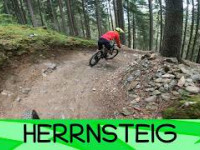
trail: Freeride Trail Herrnsteig
18 |
Jun 9, 2026 , Brunico
youtuber
![MTB Plan de Corones- Kronplatz 06.06.2026...]()
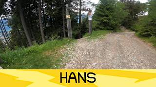
trail: Hans Trail
4:00 |
16 |
Jun 9, 2026 , Brunico
Recent Trail Reports
| status | trail | date | condition | info | user |
|---|---|---|---|---|---|
| Freeride Trail Herrnsteig | May 31, 2026 @ 9:32am (Europe/Rome) May 31, 2026 | Dry | drdentz | ||
| Telle & Co. | May 31, 2026 @ 9:32am (Europe/Rome) May 31, 2026 | Ideal | drdentz | ||
| Telle Line | May 31, 2026 @ 9:32am (Europe/Rome) May 31, 2026 | Ideal | drdentz | ||
| GASSL trail | Oct 11, 2025 @ 12:09pm (Europe/Rome) Oct 11, 2025 | Ideal | 6feet10 | ||
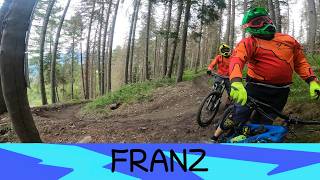
| Franz | Sep 11, 2025 @ 10:05am Sep 11, 2025 | Wet | cyklertoq | ||
| Uschi | Sep 11, 2025 @ 10:05am Sep 11, 2025 | Wet | cyklertoq | ||
| Korer Trail | Sep 11, 2025 @ 10:05am Sep 11, 2025 | Wet | cyklertoq | ||
| Andreas Trail | Sep 11, 2025 @ 10:05am Sep 11, 2025 | Wet | cyklertoq | ||
| Spitzhorn | Sep 6, 2025 @ 11:36am Sep 6, 2025 | Ideal | pigiguidi | ||
| Hans Trail | Sep 4, 2025 @ 9:20am Sep 4, 2025 | Ideal | xflowBLN |
Activity Feed
| username | action | type | title | date |
|---|---|---|---|---|
| gerison | wishlist | region | activity #97342924 | Jun 19, 2026 @ 1:55pm 1 day |
| iosonoFREERIDE | add | video | activity #96618995 and 2 more | Jun 9, 2026 @ 11:22am Jun 9, 2026 |
| iosonoFREERIDE | add | video | activity #96531339 | Jun 8, 2026 @ 4:52am Jun 8, 2026 |
| drdentz | add | report | activity #95935912 and 2 more | May 31, 2026 @ 7:03am May 31, 2026 |
| Meaty84 | add | photo | activity #95234700 and 4 more | May 22, 2026 @ 5:23am May 22, 2026 |
Recent Comments
| username | type | title | comment | date |
|---|---|---|---|---|
| trail | Spassiger Trail mit steilen Kurven und netten... | Sep 15, 2025 @ 1:58am Sep 15, 2025 | ||
| trail | Technical and narrow trail, XC guys will have... | Sep 5, 2025 @ 7:35am Sep 5, 2025 | ||
| trail | Jesus, this technical uphill thing at the... | Sep 5, 2025 @ 7:33am Sep 5, 2025 | ||
| trail | Jesus, this technical uphill thing at the... | Sep 5, 2025 @ 7:32am Sep 5, 2025 | ||
| trail | I love the moderate rocky steep section. Don't... | Sep 2, 2025 @ 3:36am Sep 2, 2025 |
Local Badges
-

Epic Ride Climb 2k818 awarded -

Climbing 10k Badge99 awarded -

Climbing 100k Badge2 awarded -

Epic Ride Descent 2k1,207 awarded -

Descent 10k Badge178 awarded -

Descent 100k Badge3 awarded
Bike & Skill Parks
| name | type | city | rating |
|---|---|---|---|
| Bike Park Kronplatz | bike park | Brunico |
Upcoming Local Events
Activity Type Stats
| activitytype | trails | distance | descent | descent distance | total vertical | rating | global rank | state rank | photos | reports | routes | ridelogs |
|---|---|---|---|---|---|---|---|---|---|---|---|---|
| Mountain Bike | 29 | 44 miles | 31,070 ft | 26 miles | 4,921 ft | #1,459 | #42 | 131 | 485 | 5,008 | ||
| E-Bike | 29 | 28 miles | 20,751 ft | 13 miles | 4,304 ft | #418 | #37 | 469 | 1,041 | |||
| Hike | 7 | 14 miles | 8,356 ft | 8 miles | 4,639 ft | #1,163 | #34 | 430 | 767 | |||
| Trail Running | 7 | 14 miles | 8,356 ft | 8 miles | 4,639 ft | #3,823 | #161 | 429 | 31 | |||
| Snowshoe | 1 | 2 miles | 2,224 ft | 16 | 4 | |||||||
| Downhill Ski | 90 | 62 miles | 65,922 ft | 57 miles | 5,020 ft | #73 | #5 | 63 | 2,323 | |||
| Backcountry Ski | 1 | 2 miles | 2,224 ft | 16 | 38 | |||||||
| Nordic Ski | 1 | 2 miles | 2,224 ft | 16 | 62 |
Frequently Asked Questions About Brunico
▼
What are the best places to ride in Brunico?
Brunico has 4 areas to explore for mountain biking. The top rated areas are:
▼
What are the highest rated mountain biking trails in Brunico?
The highest rated mountain biking trails in Brunico are:
- Franz (4.5/5)
- Hans Trail (4.5/5)
- Korer Trail (4.4/5)
- Freeride Piz de Plaies (4.4/5)
- Freeride Trail Herrnsteig (4.4/5)
▼
What is the best time of the year to ride in Brunico?
Based on ride log data, the most popular months to ride in Brunico are:
- July (156 activities)
- September (37 activities)
- August (28 activities)
▼
Where can I park to ride in Brunico?
There are 1 parking locations listed in Brunico. The most popular parking spots are:
Activities
Trails
- By brenthillier
 NSMBA TRAILFORKS & contributors
 - Admins: caval, larry81541, micheletraversi
- #6607 - 4,594 views
- brunico activity log | embed map of Brunico mountain bike trails | brunico mountain biking points of interest
Downloading of trail gps tracks in kml & gpx formats is enabled for Brunico.
You must login to download files.