close
-
Layers w
- Weather Layers
- Pro
- Pro
- Pro
- Pro
- Pro
- Pro
- More Layers
- Pro
- Pro
- Pro
- Pro
-
Upgrade to

3D
Trail Conditions
- Unknown
- Snow Groomed
- Snow Packed
- Snow Covered
- Snow Cover Partial
- Freeze/thaw Cycle
- Icy
- Prevalent Mud
- Wet
- Variable
- Ideal
- Dry
- Very Dry
Trail Flow (Ridden Direction)
Trailforks scans users ridelogs to determine the most popular direction each trail is ridden. A good flowing trail network will have most trails flowing in a single direction according to their intension.
The colour categories are based on what percentage of riders are riding a trail in its intended direction.
The colour categories are based on what percentage of riders are riding a trail in its intended direction.
- > 96%
- > 90%
- > 80%
- > 70%
- > 50%
- < 50%
- bi-directional trail
- no data
Trail Last Ridden
Trailforks scans ridelogs to determine the last time a trail was ridden.
- < 2 days
- < 1 week
- < 2 weeks
- < 1 month
- < 6 months
- > 6 months
Trail Ridden Direction
The intended direction a trail should be ridden.
- Downhill Only
- Downhill Primary
- Both Directions
- Uphill Primary
- Uphill Only
- One Direction
Contribute Details
Colors indicate trail is missing specified detail.
- Description
- Photos
- Description & Photos
- Videos
Trail Popularity ?
Trailforks scans ridelogs to determine which trails are ridden the most in the last 9 months.
Trails are compared with nearby trails in the same city region with a possible 25 colour shades.
Think of this as a heatmap, more rides = more kinetic energy = warmer colors.
- most popular
- popular
- less popular
- not popular
ATV/ORV/OHV Filter
Max Vehicle Width
inches
US Cell Coverage
Legend

Radar Time
Activity Recordings
Trailforks uses anonymized public activity data.
?
Activity Recordings
Trailforks uses anonymized public activity data.
?
Personal Heatmap
▶
Activity Types
all
/
none
▶
Options
2
Date range
month
–
Winter Trails
Warning
A routing network for winter maps does not exist. Selecting trails using the winter trails layer has been disabled.
Missing Trails
Most Popular
Least Popular
Trails are colored based on popularity. The more popular a trail is, the more red. Less popular trails trend towards green.
Jump Magnitude Heatmap
Heatmap of where riders jump on trails. Zoom in to see individual jumps, click circles to view jump details.
BC Backroad Status
![map legend]()
Service Road Atlas is a free to use, community-driven service for viewing and creating reports on the numerous back-country service roads around B.C. and Alberta.

Slope Aspect
Direction the slope faces
Trails Deemphasized
Trails are shown in grey.
Only show trails with no bike usage.
Suggested Layers
Based on selected activity type
Save the current map location and zoom level as your default home location whenever this page is loaded.
Save
No description for Bryansk has been added yet!
Login or register to submit one.
This region uses the Uk/Euro style trail grading system.
Activities Click to view
- Mountain Bike
4 trails
- E-Bike
4 trails
- Horse
0 trails
- Hike
0 trails
- Trail Running
0 trails
- Dirtbike/Moto
0 trails
- Observed Trials
0 trails
- ATV/ORV/OHV
0 trails
- Snowmobile
0 trails
- Snowshoe
0 trails
- Downhill Ski
0 trails
- Backcountry Ski
0 trails
- Nordic Ski
0 trails
Region Details
- 1
- 3
Region Status
Open as of Feb 17, 2024Stats
- Avg Trail Rating
- Trails (view details)
- 4
- Trails Mountain Bike
- 4
- Trails E-Bike
- 4
- Total Distance
- 3 miles
- Total Descent Distance
- 2 miles
- Total Descent
- 693 ft
- Total Vertical
- 200 ft
- Highest Trailhead
- 726 ft
- Reports
- 8
- Photos
- 3
- Ridden Counter
- 9
Popular Bryansk Mountain Biking Trails
• 5 ★ 5.0 • 3 miles • 542 ft • 2 •
Less popular blue difficulty singletrack. This mountain bike primary trail can be used both directions. It features bridge, drop, pump track and wallride. On average it takes 20 minutes to complete this trail.
• 100 ★ 0.0 • 991 ft • 0 ft • 2 •
Ex-4X Championship track. Still rideble nowadays, regularly repaired by local riders. Mostly downhill at the moment. Bumpy surface
• 5 ★ 0.0 • 889 ft • 0 ft • 2 •
Easy track for beginners. Gives a few options to ride it, slower and faster. Contains a few optional jumps. Good for practicing jumps, turning and pumping
• 5 ★ 0.0 • 423 ft • 0 ft • 2 •
Very easy trail meant for learning - 3 180 berm turns and a few bumps with little jump at the end. Very useful for beginners and those who want to upgrade their handling
Photos of Bryansk Mountain Bike
Videos of Bryansk Mountain Bike
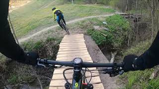
trail: ХСО v 0.2
14:16 |
253 |
Jul 5, 2020 , Bryansk
Recent Trail Reports
| status | trail | date | condition | info | user |
|---|---|---|---|---|---|
| ХСО v 0.2 | Jun 18, 2023 @ 9:37am Jun 18, 2023 | Variable | Alfredison | ||
| Ex 4X Track/Mini-Downhill | Jun 18, 2023 @ 9:36am Jun 18, 2023 | Dry | Alfredison |
Activity Feed
| username | action | type | title | date |
|---|---|---|---|---|
| Alfredison | add | report | activity #41048565 and 1 more | Jun 18, 2023 @ 9:36am Jun 18, 2023 |
| askras | update | trail | activity #23092905 and 1 more | Sep 12, 2021 @ 11:41am Sep 12, 2021 |
| Alfredison | add | trail | activity #23090380 and 1 more | Sep 12, 2021 @ 10:21am Sep 12, 2021 |
| Alfredison | difficultyvote | trail | activity #23090206 | Sep 12, 2021 @ 10:15am Sep 12, 2021 |
| Alfredison | add | report | activity #21399234 | Jul 23, 2021 @ 2:27am Jul 23, 2021 |
Activity Type Stats
| activitytype | trails | distance | descent | descent distance | total vertical | rating | global rank | state rank | photos | reports | routes | ridelogs |
|---|---|---|---|---|---|---|---|---|---|---|---|---|
| Mountain Bike | 4 | 3 miles | 692 ft | 2 miles | 200 ft | #6,050 | #30 | 3 | 8 | 335 | ||
| E-Bike | 4 | 3 miles | 692 ft | 2 miles | 200 ft | #3,131 | #42 | 4 | 25 |
- By TsermanR & contributors
- Admins: TBRU, DrumminMan, askras
- #39143 - 1,254 views
- bryansk activity log | embed map of Bryansk mountain bike trails |
Downloading of trail gps tracks in kml & gpx formats is enabled for Bryansk.
You must login to download files.