close
-
Layers w
- Weather Layers
- Pro
- Pro
- Pro
- Pro
- Pro
- Pro
- More Layers
- Pro
- Pro
- Pro
- Pro
-
Upgrade to

3D
Trail Conditions
- Unknown
- Snow Groomed
- Snow Packed
- Snow Covered
- Snow Cover Partial
- Freeze/thaw Cycle
- Icy
- Prevalent Mud
- Wet
- Variable
- Ideal
- Dry
- Very Dry
Trail Flow (Ridden Direction)
Trailforks scans users ridelogs to determine the most popular direction each trail is ridden. A good flowing trail network will have most trails flowing in a single direction according to their intension.
The colour categories are based on what percentage of riders are riding a trail in its intended direction.
The colour categories are based on what percentage of riders are riding a trail in its intended direction.
- > 96%
- > 90%
- > 80%
- > 70%
- > 50%
- < 50%
- bi-directional trail
- no data
Trail Last Ridden
Trailforks scans ridelogs to determine the last time a trail was ridden.
- < 2 days
- < 1 week
- < 2 weeks
- < 1 month
- < 6 months
- > 6 months
Trail Ridden Direction
The intended direction a trail should be ridden.
- Downhill Only
- Downhill Primary
- Both Directions
- Uphill Primary
- Uphill Only
- One Direction
Contribute Details
Colors indicate trail is missing specified detail.
- Description
- Photos
- Description & Photos
- Videos
Trail Popularity ?
Trailforks scans ridelogs to determine which trails are ridden the most in the last 9 months.
Trails are compared with nearby trails in the same city region with a possible 25 colour shades.
Think of this as a heatmap, more rides = more kinetic energy = warmer colors.
- most popular
- popular
- less popular
- not popular
ATV/ORV/OHV Filter
Max Vehicle Width
inches
US Cell Coverage
Legend

Radar Time
Activity Recordings
Trailforks uses anonymized public activity data.
?
Activity Recordings
Trailforks uses anonymized public activity data.
?
Personal Heatmap
▶
Activity Types
all
/
none
▶
Options
2
Date range
month
–
Winter Trails
Warning
A routing network for winter maps does not exist. Selecting trails using the winter trails layer has been disabled.
Missing Trails
Most Popular
Least Popular
Trails are colored based on popularity. The more popular a trail is, the more red. Less popular trails trend towards green.
Jump Magnitude Heatmap
Heatmap of where riders jump on trails. Zoom in to see individual jumps, click circles to view jump details.
BC Backroad Status
![map legend]()
Service Road Atlas is a free to use, community-driven service for viewing and creating reports on the numerous back-country service roads around B.C. and Alberta.

Slope Aspect
Direction the slope faces
Trails Deemphasized
Trails are shown in grey.
Only show trails with no bike usage.
Suggested Layers
Based on selected activity type
Save the current map location and zoom level as your default home location whenever this page is loaded.
Save
No description for Bucine has been added yet!
Login or register to submit one.
This region uses the Uk/Euro style trail grading system.
Activities Click to view
- Mountain Bike
19 trails
- E-Bike
11 trails
- Gravel Bike
0 trails
- Hike
10 trails
- Trail Running
11 trails
Region Details
- 1
- 4
- 10
Region Status
Caution as of Mar 13, 2026Stats
- Avg Trail Rating
- Trails (view details)
- 19
- Trails Mountain Bike
- 20
- Trails E-Bike
- 11
- Trails Hike
- 10
- Trails Trail Running
- 11
- Trails Dirtbike/Moto
- 1
- Total Distance
- 15 miles
- Total Descent
- 8,876 ft
- Total Vertical
- 1,752 ft
- Highest Trailhead
- 2,306 ft
- Reports
- 100
- Photos
- 20
- Ridden Counter
- 463
Popular Bucine Mountain Biking Trails
• 95 ★ 4.9 • 3,642 ft • 3 ft • 50 •
Highly rated popular black difficulty alpine singletrack. This mountain bike primary trail can be used downhill only and has a hard overall physical rating with a 3 ft blue climb. It features drop and rock garden. Trail visibility is always easy to follow. On average it takes 4 minutes to complete this trail.
• 90 ★ 4.6 • 3,268 ft • 3 ft • 50 •
Highly rated popular blue difficulty alpine singletrack. This mountain bike primary trail can be used downhill only and has a moderate overall physical rating with a 3 ft blue climb. Trail visibility is always easy to follow. On average it takes 8 minutes to complete this trail.
• 75 ★ 5.0 • 4,389 ft • 4 ft • 38 •
Popular black difficulty singletrack. This mountain bike primary trail can be used downhill primary. On average it takes 7 minutes to complete this trail.
• 80 ★ 4.8 • 3,727 ft • 0 ft • 33 •
Popular green difficulty alpine singletrack. This mountain bike primary trail can be used one direction and has a moderate overall physical rating with a 0 ft blue climb. Trail visibility is always easy to follow. On average it takes 5 minutes to complete this trail.
• 60 ★ 5.0 • 4,406 ft • 0 ft • 33 •
Moderately popular blue difficulty singletrack. This mountain bike primary trail can be used both directions. It features drop and rock garden. On average it takes 9 minutes to complete this trail.
• 5 ★ 4.6 • 4,078 ft • 27 ft • 24 •
Less popular red difficulty singletrack. This mountain bike primary trail can be used downhill only and has a hard overall physical rating with a 27 ft blue climb. It features drop, rock face, rock garden and roller coaster. Trail visibility is always easy to follow. On average it takes 4 minutes to complete this trail.
• 5 ★ 0.0 • 1 mile • 63 ft • 5 •
Less popular blue difficulty singletrack. This mountain bike primary trail can be used downhill primary and has a hard overall physical rating with a 63 ft double black diamond climb. It features rock garden. On average it takes 5 minutes to complete this trail.
• 5 ★ 2.0 • 4,591 ft • 24 ft • 5 •
Less popular blue difficulty singletrack. This mountain bike primary trail can be used downhill primary. On average it takes 24 minutes to complete this trail.
Bucine Mountain Bike Routes
★ 4.0 • 131 miles • 12,028 ft • 0 • Loop • Race •
English speakers: L'Eroica == The Heroic. Thank you! L'Eroica is an annual non-competitive cycling event...
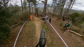
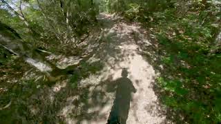
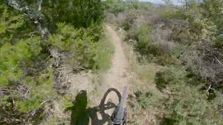
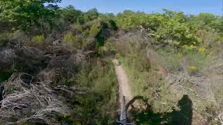
Photos of Bucine Mountain Bike
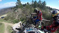
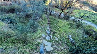
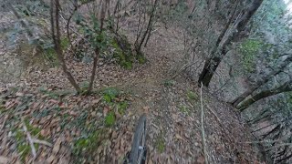
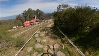
Videos of Bucine Mountain Bike
trail: Nusenna DH
4:04 |
299 |
Apr 12, 2015
trail: Impiccato
4:32 |
98 |
Jan 9, 2025 , Bucine
trail: SuperPipe
4:38 |
85 |
Jan 9, 2025 , Bucine
youtuber
![DH - Nusenna | OTUA Gravity Cup 2024 | Prova]()
trail: Nusenna DH
3:14 |
227 |
Apr 9, 2024 , Bucine
youtuber
![DH - Nusenna | OTUA Gravity Cup 2023 | Gara]()
trail: Nusenna DH
6:18 |
324 |
Apr 3, 2023 , Bucine
youtuber
![Botta Fissa/Casariccio - Galatrona Enduro Trails]()
trail: Botta Fissa/Casariccio Rock
3:32 |
192 |
Jun 6, 2022 , Bucine
Recent Trail Reports
| status | trail | date | condition | info | user |
|---|---|---|---|---|---|
| Cavatappi | Mar 13, 2026 @ 1:24pm (Europe/Rome) Mar 13, 2026 | Variable | Avoig88 | ||
| Sguerguenza | Mar 13, 2026 @ 1:24pm (Europe/Rome) Mar 13, 2026 | Variable | Avoig88 | ||
| SuperPipe | Nov 13, 2025 @ 11:56am (Europe/Rome) Nov 13, 2025 | Variable | Avoig88 | ||
| Nepo | Oct 28, 2025 @ 11:37am (Europe/Rome) Oct 28, 2025 | Variable | Avoig88 | ||
| Impiccato | Oct 28, 2025 @ 11:37am (Europe/Rome) Oct 28, 2025 | Variable | Avoig88 | ||
| Nusenna DH | Jan 14, 2025 @ 2:50am Jan 14, 2025 | Ideal | Saudade LTV | ||
| Botta Fissa/Casariccio Rock | Jul 26, 2024 @ 8:00am Jul 26, 2024 | Dry | FG5REgn | ||
| 47 DH | Jan 4, 2024 @ 8:51am Jan 4, 2024 | Dry | Ndth7 | ||
| Torrione | Nov 6, 2022 @ 6:13am Nov 6, 2022 | Ideal | Yarin-VooDoo | ||
| Carraia | Jun 22, 2021 @ 9:28pm Jun 22, 2021 | Very Dry | JackIannelli |
Activity Feed
| username | action | type | title | date |
|---|---|---|---|---|
| Markdiparo | ridden | route | activity #94539271 | May 11, 2026 @ 9:53pm May 11, 2026 |
| Avoig88 | add | report | activity #90519594 and 1 more | Mar 13, 2026 @ 4:35pm Mar 13, 2026 |
| Avoig88 | add | report | activity #84115984 and 2 more | Nov 14, 2025 @ 6:22am Nov 14, 2025 |
| Avoig88 | add | report | activity #83240125 and 1 more | Oct 29, 2025 @ 4:19pm Oct 29, 2025 |
| bananotattooer | add | report | activity #72726813 and 1 more | May 30, 2025 @ 2:09pm May 30, 2025 |
Recent Comments
| username | type | title | comment | date |
|---|---|---|---|---|
| trail | Perfetto !! | May 30, 2025 @ 2:07pm May 30, 2025 | ||
| trail | Flowy, nice rollercoaster, reminds my of the... | Jul 26, 2023 @ 11:59pm Jul 26, 2023 | ||
| trail | Proper double black diamond trail, has it all:... | Jul 26, 2023 @ 11:53pm Jul 26, 2023 | ||
| trail | Nice track, some technical drops that are not... | Jul 26, 2023 @ 11:44pm Jul 26, 2023 | ||
| trail | washed out riverbed. loose rocks. overgrown... | Sep 3, 2019 @ 3:38am Sep 3, 2019 |
Local Badges
-

Epic Mountain Bike Climb 2k104 awarded -

Climbing 10k Badge14 awarded -

Mountain Biking 100k Badge2 awarded -

Epic Ride Descent 2k104 awarded -

Descent 10k Badge14 awarded -

Descent 100k Badge2 awarded
Bike & Skill Parks
| name | type | city | rating |
|---|---|---|---|
| Crossdromo Brilli Peri (Montevarchi) | skill park | Bucine |
Activity Type Stats
| activitytype | trails | distance | descent | descent distance | total vertical | rating | global rank | state rank | photos | reports | routes | ridelogs |
|---|---|---|---|---|---|---|---|---|---|---|---|---|
| Mountain Bike | 19 | 15 miles | 8,875 ft | 13 miles | 1,752 ft | #4,101 | #253 | 14 | 100 | 1 | 4,344 | |
| E-Bike | 11 | 8 miles | 4,836 ft | 7 miles | 1,722 ft | #5,457 | #533 | 6 | 68 | 1,048 | ||
| Hike | 10 | 9 miles | 5,476 ft | 8 miles | 1,276 ft | #9,013 | #578 | 44 | 98 | |||
| Trail Running | 11 | 9 miles | 5,610 ft | 8 miles | 1,696 ft | #8,258 | #539 | 44 | 69 | |||
| Dirtbike/Moto | 1 | 1 mile | 577 ft | 1 mile | 571 ft | 3 |
Frequently Asked Questions About Bucine
▼
What are the best places to ride in Bucine?
▼
What are the highest rated mountain biking trails in Bucine?
The highest rated mountain biking trails in Bucine are:
- Nepo (4.5/5)
- Nusenna DH (4.4/5)
- SuperPipe (4.3/5)
- Sguerguenza (4.3/5)
- Torrione (4.3/5)
▼
What is the best time of the year to ride in Bucine?
Based on ride log data, the most popular months to ride in Bucine are:
- September (4 activities)
- October (4 activities)
- April (4 activities)
▼
Where can I park to ride in Bucine?
Check the Bucine trail map for trailhead and parking information. Community members regularly update access and parking details for trails in the area.
Activities
Trails
Points of Interest
- By ricchirock & contributors
- Admins: DanielePracchia
- #15272 - 2,324 views
- bucine activity log | embed map of Bucine mountain bike trails | bucine mountain biking points of interest
Downloading of trail gps tracks in kml & gpx formats is enabled for Bucine.
You must login to download files.