close
-
Layers w
- Weather Layers
- Pro
- Pro
- Pro
- Pro
- Pro
- Pro
- More Layers
- Pro
- Pro
- Pro
- Pro
-
Upgrade to

3D
Trail Conditions
- Unknown
- Snow Groomed
- Snow Packed
- Snow Covered
- Snow Cover Partial
- Freeze/thaw Cycle
- Icy
- Prevalent Mud
- Wet
- Variable
- Ideal
- Dry
- Very Dry
Trail Flow (Ridden Direction)
Trailforks scans users ridelogs to determine the most popular direction each trail is ridden. A good flowing trail network will have most trails flowing in a single direction according to their intension.
The colour categories are based on what percentage of riders are riding a trail in its intended direction.
The colour categories are based on what percentage of riders are riding a trail in its intended direction.
- > 96%
- > 90%
- > 80%
- > 70%
- > 50%
- < 50%
- bi-directional trail
- no data
Trail Last Ridden
Trailforks scans ridelogs to determine the last time a trail was ridden.
- < 2 days
- < 1 week
- < 2 weeks
- < 1 month
- < 6 months
- > 6 months
Trail Ridden Direction
The intended direction a trail should be ridden.
- Downhill Only
- Downhill Primary
- Both Directions
- Uphill Primary
- Uphill Only
- One Direction
Contribute Details
Colors indicate trail is missing specified detail.
- Description
- Photos
- Description & Photos
- Videos
Trail Popularity ?
Trailforks scans ridelogs to determine which trails are ridden the most in the last 9 months.
Trails are compared with nearby trails in the same city region with a possible 25 colour shades.
Think of this as a heatmap, more rides = more kinetic energy = warmer colors.
- most popular
- popular
- less popular
- not popular
ATV/ORV/OHV Filter
Max Vehicle Width
inches
US Cell Coverage
Legend

Radar Time
Activity Recordings
Trailforks uses anonymized public activity data.
?
Activity Recordings
Trailforks uses anonymized public activity data.
?
Personal Heatmap
▶
Activity Types
all
/
none
▶
Options
2
Date range
month
–
Winter Trails
Warning
A routing network for winter maps does not exist. Selecting trails using the winter trails layer has been disabled.
Missing Trails
Most Popular
Least Popular
Trails are colored based on popularity. The more popular a trail is, the more red. Less popular trails trend towards green.
Jump Magnitude Heatmap
Heatmap of where riders jump on trails. Zoom in to see individual jumps, click circles to view jump details.
BC Backroad Status
![map legend]()
Service Road Atlas is a free to use, community-driven service for viewing and creating reports on the numerous back-country service roads around B.C. and Alberta.

Slope Aspect
Direction the slope faces
Trails Deemphasized
Trails are shown in grey.
Only show trails with no bike usage.
Suggested Layers
Based on selected activity type
Save the current map location and zoom level as your default home location whenever this page is loaded.
Save
No description for Buckinghamshire (County) has been added yet!
Login or register to submit one.
This region uses the Uk/Euro style trail grading system.
Activities Click to view
- Mountain Bike
44 trails
- E-Bike
34 trails
- Gravel Bike
0 trails
- Adaptive Bike
0 trails
- Winter Fat Bike
0 trails
- Horse
5 trails
- Hike
41 trails
- Trail Running
41 trails
Region Details
- 4
- 25
- 13
- 2
Stats
- Avg Trail Rating
- Trails (view details)
- 53
- Trails Mountain Bike
- 44
- Trails E-Bike
- 34
- Trails Horse
- 5
- Trails Hike
- 41
- Trails Trail Running
- 41
- Total Distance
- 20 miles
- Total Descent
- 1,603 ft
- Total Vertical
- 468 ft
- Highest Trailhead
- 592 ft
- Reports
- 463
- Photos
- 825
- Ridden Counter
- 17,479
Articles
Saracen, Shimano & Madison Partner with Aston Hill Bike Park to Revive a Legendary Trail Destination
Dec 3, 2025 from pinkbike.com
The group are joining forces to restore what was once the South’s premier downhill bike park.
Sub Regions
- Amersham (1)
- Wendover (1)
- Aston Hill Bike Park (12)
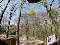
Popular Buckinghamshire (County) Mountain Biking Trails
• 100 ★ 3.2 • 2 miles • 407 ft • 52 •
Popular blue difficulty singletrack. This mountain bike primary trail can be used both directions and has a easy overall physical rating with a 407 ft green climb. On average it takes 54 minutes to complete this trail.
Buckinghamshire (County) Mountain Bike Routes
26 miles • 560 ft • 0 • Loop •
Around 26 miles around east Northamptonshire and Bedfordshire, mostly trails and footpaths with a few...
24 miles • 2,002 ft • 0 • Loop •
Six ups and downs in the Chilterns, Buckinghamshire, UK.
3 miles • 290 ft • 0 • Loop •
is a small area of natural woodland on a flint base, with several very short natural trails enabling loops...
Photos of Buckinghamshire (County) Mountain Bike
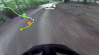
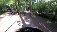
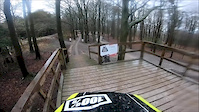
Videos of Buckinghamshire (County) Mountain Bike
trail: Surface To Air
2:35 |
316 |
Jul 12, 2020
trail: Surface To Air
2:04 |
46 |
Jun 12, 2020
trail: Ricochet DH Trail
0:59 |
75 |
May 24, 2020
trail: Surface To Air
0:41 |
184 |
May 7, 2019
trail: Ricochet
0:23 |
323 |
Sep 3, 2018
trail: Ricochet
0:37 |
115 |
Jun 12, 2018
trail: Surface To Air
2:15 |
220 |
Apr 2, 2018
trail: Surface To Air
0:10 |
184 |
Nov 7, 2017
Recent Trail Reports
| status | trail | date | condition | info | user |
|---|---|---|---|---|---|
| Connector Aston Hill Bike Park | Oct 8, 2022 @ 2:05am Oct 8, 2022 | Variable | nickdarvell | ||
| Ricochet DH Trail Aston Hill Bike Park | Apr 4, 2015 @ 3:39pm Apr 4, 2015 | Wet | gaisford |
Activity Feed
| username | action | type | title | date |
|---|---|---|---|---|
| trailforks | add | video | activity #97716211 | Jun 24, 2026 @ 12:17pm 3 days |
| MatthewxormSq | wishlist | route | activity #97679067 | Jun 24, 2026 @ 12:01am Jun 24, 2026 |
| Robx4kK0B | wishlist | route | activity #95358099 | May 23, 2026 @ 3:02pm May 23, 2026 |
| blad | wishlist | route | activity #92338079 | Apr 10, 2026 @ 12:47pm Apr 10, 2026 |
| trailforks | add | video | activity #90096624 | Mar 6, 2026 @ 7:00pm Mar 6, 2026 |
Recent Comments
| username | type | title | comment | date |
|---|---|---|---|---|
| trail | Need to check this palce | Sep 9, 2020 @ 2:26am Sep 9, 2020 | ||
| trail | Fun but wouldn't say all weather the last few... | Jan 11, 2020 @ 1:23pm Jan 11, 2020 | ||
| trail | This should be rated Black rather than Red, in... | Dec 2, 2017 @ 9:56am Dec 2, 2017 |
Local Badges
-

Epic Ride Climb 2k26 awarded -

Climbing 10k Badge55 awarded -

Climbing 100k Badge6 awarded -

Epic Ride Descent 2k27 awarded -

Descent 10k Badge55 awarded -

Descent 100k Badge6 awarded
Bike & Skill Parks
| name | type | city | rating |
|---|---|---|---|
| Aston Hill Pumptrack | skill park | Wendover | |
| Hayes BMX Track | skill park | Amersham |
Activity Type Stats
| activitytype | trails | distance | descent | descent distance | total vertical | rating | global rank | state rank | photos | reports | routes | ridelogs |
|---|---|---|---|---|---|---|---|---|---|---|---|---|
| Mountain Bike | 44 | 17 miles | 1,283 ft | 7 miles | 469 ft | 825 | 463 | 9 | 34,244 | |||
| E-Bike | 34 | 13 miles | 840 ft | 5 miles | 469 ft | 401 | 7 | 2,507 | ||||
| Horse | 5 | 3 miles | 85 ft | 1 mile | 276 ft | 96 | ||||||
| Hike | 41 | 13 miles | 814 ft | 5 miles | 469 ft | 407 | 1 | 886 | ||||
| Trail Running | 41 | 13 miles | 814 ft | 5 miles | 469 ft | 407 | 701 |
Frequently Asked Questions About Buckinghamshire (County)
▼
What are the best places to ride in Buckinghamshire (County)?
Buckinghamshire (County) has 7 areas to explore for mountain biking. The top rated areas are:
▼
What are the highest rated mountain biking trails in Buckinghamshire (County)?
The highest rated mountain biking trails in Buckinghamshire (County) are:
- Lotts Wood (3.5/5)
▼
What is the best time of the year to ride in Buckinghamshire (County)?
Based on ride log data, the most popular months to ride in Buckinghamshire (County) are:
- July (58 activities)
- August (46 activities)
- September (39 activities)
▼
What is the longest trail in Buckinghamshire (County)?
The longest trail in Buckinghamshire (County) is Lotts Wood at 2.3 miles. View all trails sorted by distance.
Activities
Trails
- Hard trails in Buckinghamshire (County)
- Easy trails in Buckinghamshire (County)
- Favorite trails in Buckinghamshire (County)
- Most ridden trails in Buckinghamshire (County)
- Singletrack in Buckinghamshire (County)
- Viewpoint trails in Buckinghamshire (County)
- Trails with technical features in Buckinghamshire (County)
- Race routes in Buckinghamshire (County)
Points of Interest
- By brenthillier
 NSMBA TRAILFORKS & contributors
 - Admins: UKTP, 20twenty-p, wisey, MathieuC, cemoorelife, jamesmackeddie
- #6819 - 19,136 views
- buckinghamshire (county) activity log | embed map of Buckinghamshire (County) mountain bike trails | buckinghamshire (county) mountain biking points of interest
Downloading of trail gps tracks in kml & gpx formats is enabled for Buckinghamshire (County).
You must login to download files.