close
-
Layers w
- Weather Layers
- Pro
- Pro
- Pro
- Pro
- Pro
- Pro
- More Layers
- Pro
- Pro
- Pro
- Pro
-
Upgrade to

3D
Trail Conditions
- Unknown
- Snow Groomed
- Snow Packed
- Snow Covered
- Snow Cover Partial
- Freeze/thaw Cycle
- Icy
- Prevalent Mud
- Wet
- Variable
- Ideal
- Dry
- Very Dry
Trail Flow (Ridden Direction)
Trailforks scans users ridelogs to determine the most popular direction each trail is ridden. A good flowing trail network will have most trails flowing in a single direction according to their intension.
The colour categories are based on what percentage of riders are riding a trail in its intended direction.
The colour categories are based on what percentage of riders are riding a trail in its intended direction.
- > 96%
- > 90%
- > 80%
- > 70%
- > 50%
- < 50%
- bi-directional trail
- no data
Trail Last Ridden
Trailforks scans ridelogs to determine the last time a trail was ridden.
- < 2 days
- < 1 week
- < 2 weeks
- < 1 month
- < 6 months
- > 6 months
Trail Ridden Direction
The intended direction a trail should be ridden.
- Downhill Only
- Downhill Primary
- Both Directions
- Uphill Primary
- Uphill Only
- One Direction
Contribute Details
Colors indicate trail is missing specified detail.
- Description
- Photos
- Description & Photos
- Videos
Trail Popularity ?
Trailforks scans ridelogs to determine which trails are ridden the most in the last 9 months.
Trails are compared with nearby trails in the same city region with a possible 25 colour shades.
Think of this as a heatmap, more rides = more kinetic energy = warmer colors.
- most popular
- popular
- less popular
- not popular
ATV/ORV/OHV Filter
Max Vehicle Width
inches
US Cell Coverage
Legend

Radar Time
Activity Recordings
Trailforks uses anonymized public activity data.
?
Activity Recordings
Trailforks uses anonymized public activity data.
?
Personal Heatmap
▶
Activity Types
all
/
none
▶
Options
2
Date range
month
–
Winter Trails
Warning
A routing network for winter maps does not exist. Selecting trails using the winter trails layer has been disabled.
Missing Trails
Most Popular
Least Popular
Trails are colored based on popularity. The more popular a trail is, the more red. Less popular trails trend towards green.
Jump Magnitude Heatmap
Heatmap of where riders jump on trails. Zoom in to see individual jumps, click circles to view jump details.
BC Backroad Status
![map legend]()
Service Road Atlas is a free to use, community-driven service for viewing and creating reports on the numerous back-country service roads around B.C. and Alberta.

Slope Aspect
Direction the slope faces
Trails Deemphasized
Trails are shown in grey.
Only show trails with no bike usage.
Suggested Layers
Based on selected activity type
Save the current map location and zoom level as your default home location whenever this page is loaded.
Save
No description for Budapest has been added yet!
Login or register to submit one.
This region uses the Uk/Euro style trail grading system.
Activities Click to view
- Mountain Bike
162 trails
- E-Bike
106 trails
- Gravel Bike
1 trails
- Adaptive Bike
0 trails
- Winter Fat Bike
0 trails
- Hike
109 trails
- Trail Running
108 trails
Region Details
- 29
- 40
- 44
- 14
- 5
- 1
Region Status
Open as of Jun 6, 2026Stats
- Avg Trail Rating
- Trails (view details)
- 139
- Trails Mountain Bike
- 162
- Trails E-Bike
- 106
- Trails Gravel Bike
- 1
- Trails Horse
- 2
- Trails Hike
- 109
- Trails Trail Running
- 108
- Total Distance
- 51 miles
- Total Descent
- 18,038 ft
- Total Vertical
- 1,440 ft
- Highest Trailhead
- 1,822 ft
- Reports
- 1,318
- Photos
- 681
- Ridden Counter
- 6,851
Sub Regions
-
Bro'Hill Freeride Park
- 2
-
Budai-hegység
- 24
- 23
- 10
- 5
- 1
-
Háromhegyek
- 2
- 8
-
Kamaraerdő
- 12
- 9
- 3
Popular Budapest Mountain Biking Trails
• 85 ★ 4.6 • 2,277 ft • 0 ft • 205 •
Medium long DH trail. The lower half is the most popular, with a gap jump, good berms, and some drops.
• 75 ★ 4.8 • 3,691 ft • 0 ft • 182 •
is a popular intermediate trail with a mostly flat elevation map. For the more advance riders, there are optional shortcuts along the way.
• 90 ★ 4.2 • 1,857 ft • 8 ft • 152 •
Highly rated popular green difficulty singletrack. This mountain bike primary trail can be used downhill only and has a easy overall physical rating with a 8 ft green climb. It features jump and other. On average it takes 4 minutes to complete this trail.
• 90 ★ 3.3 • 3,860 ft • 34 ft • 145 •
Popular green difficulty singletrack. This mountain bike primary trail can be used downhill primary with a 34 ft green climb. It features jump. On average it takes 4 minutes to complete this trail.
• 75 ★ 4.5 • 1,991 ft • 0 ft • 136 •
Gap jumps, drops and berms, there's a chicken line everywhere, so it can be performed as a blue line.
• 95 ★ 4.0 • 3,345 ft • 6 ft • 133 •
Popular green difficulty singletrack. This mountain bike primary trail can be used downhill primary. It features drop. On average it takes 2 minutes to complete this trail.
Budapest Mountain Bike Routes
★ 5.0 • 18 miles • 1,787 ft • 0 • Loop •
Pilisi út Ürömtől Pilisszentkeresztig és vissza...
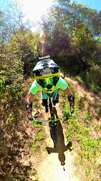
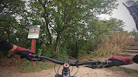
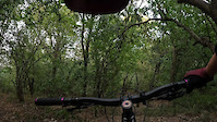
Photos of Budapest Mountain Bike
Videos of Budapest Mountain Bike
trail: Bro Hill
0:49 |
34 |
Sep 25, 2025
trail: Contest
4:00 |
|
Sep 13, 2024

trail: Contest
4:00 |
|
Sep 13, 2024

trail: CRK Finish DH
3:18 |
|
Sep 9, 2024

trail: Trinity
0:33 |
|
Sep 9, 2024
trail: Yoko HHH
2:16 |
|
Sep 7, 2024

trail: Yoko HHH
2:16 |
|
Sep 7, 2024

trail: Yoko HHH
2:16 |
|
Sep 7, 2024
Recent Trail Reports
| status | trail | date | condition | info | user |
|---|---|---|---|---|---|
| GT | Jun 7, 2026 @ 7:54am (Europe/Budapest) Jun 6, 2026 | Dry | petermolnar01 | ||
| Normafa - Libegő access road | Jun 7, 2026 @ 7:54am (Europe/Budapest) Jun 6, 2026 | Dry | petermolnar01 | ||
| Transfer from Szépjuhászné to Erzsébet-kilátó | Jun 7, 2026 @ 7:54am (Europe/Budapest) Jun 6, 2026 | Dry | petermolnar01 | ||
| Demo | Jun 7, 2026 @ 7:54am (Europe/Budapest) Jun 6, 2026 | Dry | petermolnar01 | ||
| Transfer to Szépjuhászné DH | Jun 7, 2026 @ 7:54am (Europe/Budapest) Jun 6, 2026 | Dry | petermolnar01 | ||
| Kotta Plus | Jun 7, 2026 @ 7:54am (Europe/Budapest) Jun 6, 2026 | Dry | petermolnar01 | ||
| Transfer from Csacsi-rét DH to Kotta | Jun 7, 2026 @ 7:54am (Europe/Budapest) Jun 6, 2026 | Dry | petermolnar01 | ||
| Budakeszierdő Csacsi-rét downhill | Jun 7, 2026 @ 7:54am (Europe/Budapest) Jun 6, 2026 | Dry | petermolnar01 | ||
| Transfer to Csacsi-rét | Jun 7, 2026 @ 7:54am (Europe/Budapest) Jun 6, 2026 | Dry | petermolnar01 | ||
| Transfer from Comment/Dessert/Nomercy | May 24, 2026 @ 3:13pm (Europe/Budapest) May 24, 2026 | Dry | petermolnar01 |
Activity Feed
| username | action | type | title | date |
|---|---|---|---|---|
| BarnaronRvbXCg | ridden | trail | activity #97528261 | Jun 21, 2026 @ 4:05pm 2 hours |
| belcRV0jj | add | photo | activity #97518394 | Jun 21, 2026 @ 1:55pm 4 hours |
| belcRV0jj | add | photo | activity #97048699 | Jun 15, 2026 @ 9:54am Jun 15, 2026 |
| petermolnar01 | add | report | activity #96457560 and 8 more | Jun 7, 2026 @ 7:15am Jun 7, 2026 |
| Gepezet55 | wishlist | trail | activity #95590337 and 4 more | May 26, 2026 @ 2:30pm May 26, 2026 |
Recent Comments
| username | type | title | comment | date |
|---|---|---|---|---|
| trail | Nem értem miért szavazza ezt valaki... | May 10, 2026 @ 12:51am May 10, 2026 | ||
| trail | Nem de helyenként szűk mint egy szűz lány. | May 4, 2026 @ 5:37am May 4, 2026 | ||
| trail | Arrébb raktuk a kidőlt fát most már... | Apr 7, 2026 @ 2:56am Apr 7, 2026 | ||
| trail | a feltekero egesz kedves, a palya is nagyon... | Apr 2, 2026 @ 2:12am Apr 2, 2026 | ||
| trail | Why? What happened? | Nov 19, 2025 @ 3:05am Nov 19, 2025 |
Local Badges
-

10 Green Trails81 awarded -

10 Blue Trails89 awarded -

Epic Ride Climb 2k129 awarded -

Climbing 10k Badge136 awarded -

Climbing 100k Badge23 awarded -

Epic Ride Descent 2k155 awarded
Bike & Skill Parks
| name | type | city | rating |
|---|---|---|---|
| Hermina Bringapark Pump Track | skill park | Budapest | |
| Darudomb Pumptrack | skill park | Budapest | |
| Budafok pumpapálya | skill park | Budapest | |
| Budapest Szilas Park | skill park | Budapest | |
| Kőbánya pumpapálya | skill park | Budapest |
Activity Type Stats
| activitytype | trails | distance | descent | descent distance | total vertical | rating | global rank | state rank | photos | reports | routes | ridelogs |
|---|---|---|---|---|---|---|---|---|---|---|---|---|
| Mountain Bike | 162 | 51 miles | 18,038 ft | 33 miles | 1,440 ft | #601 | #1 | 676 | 1,320 | 3 | 34,417 | |
| E-Bike | 106 | 22 miles | 6,096 ft | 10 miles | 1,440 ft | #544 | #2 | 1,087 | 1 | 4,167 | ||
| Gravel Bike | 1 | #59 | #2 | 1 | 110 | |||||||
| Horse | 2 | 81 | ||||||||||
| Hike | 109 | 45 miles | 13,593 ft | 28 miles | 1,440 ft | #886 | #2 | 1,223 | 1,271 | |||
| Trail Running | 108 | 44 miles | 12,969 ft | 27 miles | 1,440 ft | #623 | #2 | 1,215 | 996 |
Frequently Asked Questions About Budapest
▼
What are the best places to ride in Budapest?
Budapest has 4 areas to explore for mountain biking. The top rated areas are:
▼
What are the highest rated mountain biking trails in Budapest?
The highest rated mountain biking trails in Budapest are:
- Csikicsuki (4.5/5)
- Fütyülős (4.4/5)
- Köves (4.4/5)
- Contest (4.4/5)
- Comment alsó (4.4/5)
▼
What is the best time of the year to ride in Budapest?
Based on ride log data, the most popular months to ride in Budapest are:
- July (277 activities)
- August (131 activities)
- September (110 activities)
▼
Where can I park to ride in Budapest?
There are 7 parking locations listed in Budapest. The most popular parking spots are: View all parking and trailhead locations on the map to plan your visit.
Activities
Trails
Points of Interest
- By markholloway
 Trailforks Map Team & contributors
 - Admins: kelemenlajos, vanczakp, Beaust
- #25076 - 24,081 views
- budapest activity log | embed map of Budapest mountain bike trails | budapest mountain biking points of interest
Downloading of trail gps tracks in kml & gpx formats is enabled for Budapest.
You must login to download files.