close
-
Layers w
- Weather Layers
- Pro
- Pro
- Pro
- Pro
- Pro
- Pro
- More Layers
- Pro
- Pro
- Pro
- Pro
-
Upgrade to

3D
Trail Conditions
- Unknown
- Snow Groomed
- Snow Packed
- Snow Covered
- Snow Cover Partial
- Freeze/thaw Cycle
- Icy
- Prevalent Mud
- Wet
- Variable
- Ideal
- Dry
- Very Dry
Trail Flow (Ridden Direction)
Trailforks scans users ridelogs to determine the most popular direction each trail is ridden. A good flowing trail network will have most trails flowing in a single direction according to their intension.
The colour categories are based on what percentage of riders are riding a trail in its intended direction.
The colour categories are based on what percentage of riders are riding a trail in its intended direction.
- > 96%
- > 90%
- > 80%
- > 70%
- > 50%
- < 50%
- bi-directional trail
- no data
Trail Last Ridden
Trailforks scans ridelogs to determine the last time a trail was ridden.
- < 2 days
- < 1 week
- < 2 weeks
- < 1 month
- < 6 months
- > 6 months
Trail Ridden Direction
The intended direction a trail should be ridden.
- Downhill Only
- Downhill Primary
- Both Directions
- Uphill Primary
- Uphill Only
- One Direction
Contribute Details
Colors indicate trail is missing specified detail.
- Description
- Photos
- Description & Photos
- Videos
Trail Popularity ?
Trailforks scans ridelogs to determine which trails are ridden the most in the last 9 months.
Trails are compared with nearby trails in the same city region with a possible 25 colour shades.
Think of this as a heatmap, more rides = more kinetic energy = warmer colors.
- most popular
- popular
- less popular
- not popular
ATV/ORV/OHV Filter
Max Vehicle Width
inches
US Cell Coverage
Legend

Radar Time
Activity Recordings
Trailforks uses anonymized public activity data.
?
Activity Recordings
Trailforks uses anonymized public activity data.
?
Personal Heatmap
▶
Activity Types
all
/
none
▶
Options
2
Date range
month
–
Winter Trails
Warning
A routing network for winter maps does not exist. Selecting trails using the winter trails layer has been disabled.
Missing Trails
Most Popular
Least Popular
Trails are colored based on popularity. The more popular a trail is, the more red. Less popular trails trend towards green.
Jump Magnitude Heatmap
Heatmap of where riders jump on trails. Zoom in to see individual jumps, click circles to view jump details.
BC Backroad Status
![map legend]()
Service Road Atlas is a free to use, community-driven service for viewing and creating reports on the numerous back-country service roads around B.C. and Alberta.

Slope Aspect
Direction the slope faces
Trails Deemphasized
Trails are shown in grey.
Only show trails with no bike usage.
Suggested Layers
Based on selected activity type
Save the current map location and zoom level as your default home location whenever this page is loaded.
SaveBuffalo is a city in the U.S. state of Minnesota and the county seat of Wright County. It is within the Minneapolis–Saint Paul metropolitan area, located about 42 miles northwest of Minneapolis on Buffalo Lake. The population of Buffalo was 15,453 at the 2010 census. As of 2019 estimates, Buffalo has a population of 18,042.
source: Wikipedia
Activities Click to view
- Mountain Bike
5 trails
- E-Bike
2 trails
- Adaptive Bike
- Winter Fat Bike
0 trails
- Horse
0 trails
- Hike
4 trails
- Trail Running
4 trails
- Dirtbike/Moto
0 trails
- Observed Trials
0 trails
- ATV/ORV/OHV
0 trails
- Snowmobile
0 trails
- Snowshoe
0 trails
- Downhill Ski
0 trails
- Backcountry Ski
0 trails
- Nordic Ski
0 trails
Region Details
- 1
- 2
- 2
Region Status
Caution as of May 16, 2023Stats
- Trails (view details)
- 5
- Trails Mountain Bike
- 5
- Trails E-Bike
- 2
- Trails Hike
- 4
- Trails Trail Running
- 4
- Total Distance
- 4,262 ft
- Total Descent Distance
- 1,339 ft
- Total Descent
- 71 ft
- Total Vertical
- 46 ft
- Highest Trailhead
- 1,011 ft
- Reports
- 2
- Photos
- 3
- Ridden Counter
- 53
Articles
Minnesota’s Most Spectacular Hikes
Aug 23, 2021 from backpacker.com
Experience the beauty of fall foliage in Minnesota with these bucket list hikes
Sub Regions
-
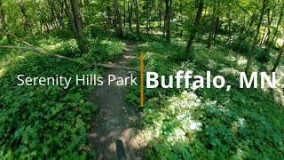
Serenity Hills Park
- 1
-
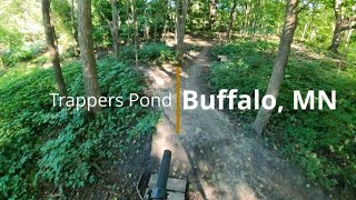
Trapper's Pond Park
- 1
- 1
- 2
Popular Buffalo Mountain Biking Trails
• 100 ★ 0.0 • 1,063 ft • 7 ft • 8 •
This little loop is managed by the City of Buffalo. A family friendly learning loop for all ages with features to ride and ride arounds just in case. This loop is made to give people a little taste of mountain biking and slowly progress.
• 80 ★ 0.0 • 951 ft • 6 ft • 7 •
A small with rollers (can be jumped with speed), some tight trees and a teeter totter (can be ridden around) to finish it off. Great for beginners and experienced riders.
• 40 ★ 0.0 • 1,886 ft • 47 ft • 5 •
Recently completed trail in 2022, this short single track trail is good for intermediate riders looking for more climbing and downhill from the Trappers Pond trails just down the street. There is some relatively steep climbs but can be...
• 60 ★ 0.0 • 223 ft • 0 ft • 4 •
Considered a Black Diamond section with a jump. Can be ridden around.
• 20 ★ 0.0 • 138 ft • 0 ft • 3 •
This little Black Diamond section has a drop to berm to drop.
Videos of Buffalo Mountain Bike
trail: Intermediate Loop
5:59 |
174 |
Sep 8, 2022 , Buffalo

trail: Advanced Jump Line
3:55 |
225 |
Sep 8, 2022 , Buffalo

trail: Intermediate Practice Loop
3:55 |
138 |
Sep 8, 2022 , Buffalo

trail: Advanced Drop Line
3:55 |
145 |
Sep 8, 2022 , Buffalo
trail: Beginner Practice Loop
3:55 |
176 |
Sep 8, 2022 , Buffalo

trail: Advanced Jump Line
3:26 |
133 |
Aug 16, 2022 , Buffalo

trail: Advanced Drop Line
3:26 |
147 |
Aug 16, 2022 , Buffalo

trail: Intermediate Practice Loop
3:26 |
254 |
Nov 19, 2021 , Buffalo
Recent Trail Reports
| status | trail | date | condition | info | user |
|---|---|---|---|---|---|
| Beginner Practice Loop | May 3, 2022 @ 4:29pm May 3, 2022 | Ideal | rhitchcock23 | ||
| Intermediate Practice Loop | May 3, 2022 @ 4:28pm May 3, 2022 | Ideal | rhitchcock23 |
Activity Feed
| username | action | type | title | date |
|---|---|---|---|---|
| update | event | activity #88675158 | Feb 10, 2026 @ 7:14am Feb 10, 2026 | |
| update | event | activity #86906779 | Jan 9, 2026 @ 12:06pm Jan 9, 2026 | |
| update | event | activity #86345717 | Dec 30, 2025 @ 2:02pm Dec 30, 2025 | |
| update | event | activity #80146285 | Sep 11, 2025 @ 5:20pm Sep 11, 2025 | |
| update | event | activity #78608970 | Aug 21, 2025 @ 7:40am Aug 21, 2025 |
Local Badges
-

Descent 10k Badge0 awarded -

Epic Mountain Bike Climb 2k0 awarded -

Climbing 10k Badge0 awarded -

Mountain Biking 100k Badge0 awarded -

Epic Ride Descent 2k0 awarded -

Big Ride 30k15 awarded
Activity Type Stats
| activitytype | trails | distance | descent | descent distance | total vertical | rating | global rank | state rank | photos | reports | routes | ridelogs |
|---|---|---|---|---|---|---|---|---|---|---|---|---|
| Mountain Bike | 5 | 4,262 ft | 72 ft | 1,339 ft | 46 ft | #15,297 | #4,803 | 3 | 2 | 472 | ||
| E-Bike | 2 | 361 ft | 3 ft | 108 ft | 3 ft | #10,935 | #3,576 | 10 | ||||
| Hike | 4 | 3,199 ft | 62 ft | 1,024 ft | 46 ft | #15,686 | #5,751 | 1 | 87 | |||
| Trail Running | 4 | 3,199 ft | 62 ft | 1,024 ft | 46 ft | #15,302 | #5,530 | 1 | 13 |
- By CycleKrieg
 & contributors
 - Admins: apply
- #52239 - 1,441 views
- buffalo activity log | embed map of Buffalo mountain bike trails |
Downloading of trail gps tracks in kml & gpx formats is enabled for Buffalo.
You must login to download files.