close
-
Layers w
- Weather Layers
- Pro
- Pro
- Pro
- Pro
- Pro
- Pro
- More Layers
- Pro
- Pro
- Pro
- Pro
-
Upgrade to

3D
Trail Conditions
- Unknown
- Snow Groomed
- Snow Packed
- Snow Covered
- Snow Cover Partial
- Freeze/thaw Cycle
- Icy
- Prevalent Mud
- Wet
- Variable
- Ideal
- Dry
- Very Dry
Trail Flow (Ridden Direction)
Trailforks scans users ridelogs to determine the most popular direction each trail is ridden. A good flowing trail network will have most trails flowing in a single direction according to their intension.
The colour categories are based on what percentage of riders are riding a trail in its intended direction.
The colour categories are based on what percentage of riders are riding a trail in its intended direction.
- > 96%
- > 90%
- > 80%
- > 70%
- > 50%
- < 50%
- bi-directional trail
- no data
Trail Last Ridden
Trailforks scans ridelogs to determine the last time a trail was ridden.
- < 2 days
- < 1 week
- < 2 weeks
- < 1 month
- < 6 months
- > 6 months
Trail Ridden Direction
The intended direction a trail should be ridden.
- Downhill Only
- Downhill Primary
- Both Directions
- Uphill Primary
- Uphill Only
- One Direction
Contribute Details
Colors indicate trail is missing specified detail.
- Description
- Photos
- Description & Photos
- Videos
Trail Popularity ?
Trailforks scans ridelogs to determine which trails are ridden the most in the last 9 months.
Trails are compared with nearby trails in the same city region with a possible 25 colour shades.
Think of this as a heatmap, more rides = more kinetic energy = warmer colors.
- most popular
- popular
- less popular
- not popular
ATV/ORV/OHV Filter
Max Vehicle Width
inches
US Cell Coverage
Legend

Radar Time
Activity Recordings
Trailforks uses anonymized public activity data.
?
Activity Recordings
Trailforks uses anonymized public activity data.
?
Personal Heatmap
▶
Activity Types
all
/
none
▶
Options
2
Date range
month
–
Winter Trails
Warning
A routing network for winter maps does not exist. Selecting trails using the winter trails layer has been disabled.
Missing Trails
Most Popular
Least Popular
Trails are colored based on popularity. The more popular a trail is, the more red. Less popular trails trend towards green.
Jump Magnitude Heatmap
Heatmap of where riders jump on trails. Zoom in to see individual jumps, click circles to view jump details.
BC Backroad Status
![map legend]()
Service Road Atlas is a free to use, community-driven service for viewing and creating reports on the numerous back-country service roads around B.C. and Alberta.

Slope Aspect
Direction the slope faces
Trails Deemphasized
Trails are shown in grey.
Only show trails with no bike usage.
Suggested Layers
Based on selected activity type
Save the current map location and zoom level as your default home location whenever this page is loaded.
SaveThe Pinnacle Mountain Tower Trail takes you to the highest point in Washington County, TN. The trail was completed in 2011 with a backhoe and has narrowed nicely to a trail that is wider than singletrack, but not quite as wide as doubletrack in most places.
source: SORBA Tri-Cities Website
 google parking directions
 Access Info:
The trailhead is right off exit 32 on I-26 at Jack Snider Park where you'll find newly built restrooms/changing area.
Activities Click to view
- Mountain Bike
25 trails
- E-Bike
11 trails
- Hike
25 trails
- Trail Running
25 trails
Region Details
- 11
- 6
- 6
Region Status
Caution as of May 24, 2026Stats
- Avg Trail Rating
- Trails (view details)
- 23
- Trails Mountain Bike
- 25
- Trails E-Bike
- 11
- Trails Hike
- 25
- Trails Trail Running
- 25
- Trails Dirtbike/Moto
- 1
- Trails ATV/ORV/OHV
- 2
- Total Distance
- 59 miles
- Total Descent Distance
- 24 miles
- Total Descent
- 11,752 ft
- Total Vertical
- 2,243 ft
- Highest Trailhead
- 3,878 ft
- Reports
- 56
- Photos
- 8
- Ridden Counter
- 719
Popular Buffalo Mountain Mountain Biking Trails
• 85 ★ 4.2 • 5 miles • 1,682 ft • 115 •
Highly rated popular blue difficulty singletrack. This multi-use trail can be used both directions. On average it takes 53 minutes to complete this trail.
• 90 ★ 5.0 • 1 mile • 70 ft • 49 •
Old school tech singletrack trail. Traverses a ridgeline so lots of good ups and downs. Mostly always ridden in one direction.
• 80 ★ 4.7 • 1 mile • 67 ft • 39 •
Old school tech singletrack trail. Mostly ridden downhill but you can hike a bike up if you want.
• 75 ★ 4.0 • 1 mile • 419 ft • 34 •
Old school double track climb to four points. Mostly used as a climb trail but is an easier downhill option if you want to skip .
• 60 ★ 4.0 • 3,730 ft • 13 ft • 28 •
Old school singletrack. This trail can be ridden in both directions.
• 45 ★ 3.0 • 4 miles • 428 ft • 26 •
Buffalo Mountain ATV Trail, NFST #29 is a 13-mile linear ATV trail located along the ridgeline of Buffalo Mountain. It is a multi-use trail for ATVs, dirt bikes, and mountain bikes. The trail is a mixture of rock, sand, smooth, and mud...
Buffalo Mountain Mountain Bike Routes
24 miles • 4,682 ft • 7 • Loop •
Ride starts and ends on Pinnacle mountain trail, the most maintained and groomed of the system and then...
★ 5.0 • 36 miles • 3,791 ft • 0 • Loop •
Head out of downtown Johnson City to loop up and over Buffalo Mountain on Trail #29. With some killer...
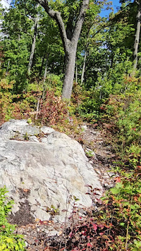
Photos of Buffalo Mountain Mountain Bike
Videos of Buffalo Mountain Mountain Bike
trail: Renegade
0:14 |
38 |
Sep 28, 2025
Recent Trail Reports
| status | trail | date | condition | info | user |
|---|---|---|---|---|---|
| Renegade | May 24, 2026 @ 1:01pm (America/Kentucky/Monticello) May 24, 2026 | Ideal | carraig042 | ||
| Green Mile | Apr 19, 2026 @ 2:52pm (America/Kentucky/Monticello) Apr 19, 2026 | Variable | carraig042 | ||
| Trail 01 | Apr 18, 2026 @ 11:12am (America/Kentucky/Monticello) Apr 18, 2026 | Ideal | carraig042 | ||
| Horse Cove Gap Road (#5352) | Apr 18, 2026 @ 11:12am (America/Kentucky/Monticello) Apr 18, 2026 | Ideal | carraig042 | ||
| Trail 03 | Oct 22, 2025 @ 6:20am (America/New_York) Oct 22, 2025 | Ideal | Smity1 | ||
| Trail 06 | Oct 13, 2025 @ 9:52am (America/New_York) Oct 13, 2025 | Unknown | Smity1 | ||
| FS 4354A Upper Briar Creek Spur | Jul 12, 2025 @ 10:16am Jul 12, 2025 | Variable | carraig042 | ||
| Trail 02 | Jul 12, 2025 @ 10:16am Jul 12, 2025 | Variable | carraig042 | ||
| Briar Creek Road (#188) | Mar 7, 2025 @ 12:32pm Mar 7, 2025 | Variable | GarretteRCTKb CVTA | ||
| Rustic Ridge | Oct 13, 2024 @ 2:09pm Oct 13, 2024 | Ideal | carraig042 |
Activity Feed
| username | action | type | title | date |
|---|---|---|---|---|
| mikeljcarr71 | wishlist | trail | activity #96666104 | Jun 10, 2026 @ 5:32am Jun 10, 2026 |
| carraig042 | add | report | activity #95430005 | May 24, 2026 @ 11:28am May 24, 2026 |
| ElRCYE | wishlist | trail | activity #94780891 | May 15, 2026 @ 5:42pm May 15, 2026 |
| carraig042 | add | report | activity #94374339 | May 9, 2026 @ 1:31pm May 9, 2026 |
| carraig042 | add | report | activity #93969719 | May 3, 2026 @ 11:58am May 3, 2026 |
Recent Comments
| username | type | title | comment | date |
|---|---|---|---|---|
| trail | This is a really fun descending trail! Narrow,... | May 24, 2023 @ 3:31pm May 24, 2023 |
Nearby Areas
| name | distance | ||||
|---|---|---|---|---|---|
| Unaka Bike Park | 3 | 3 | 5.7 km | ||
| East Tennessee University (ETSU) | 2 | 2 | 3 | 5.8 km | |
| Tannery Knobs Bike Park | 5 | 5 | 2 | 7.9 km | |
| Winged Deer Park | 2 | 5 | 2 | 12 km | |
| Hampton Watershed Trails | 1 | 3 | 1 | 12.8 km |
Local Badges
-

Completionist0 awarded
Activity Type Stats
| activitytype | trails | distance | descent | descent distance | total vertical | rating | global rank | state rank | photos | reports | routes | ridelogs |
|---|---|---|---|---|---|---|---|---|---|---|---|---|
| Mountain Bike | 25 | 59 miles | 11,752 ft | 24 miles | 2,244 ft | #4,460 | #1,568 | 11 | 56 | 2 | 1,293 | |
| E-Bike | 11 | 35 miles | 5,978 ft | 13 miles | 2,208 ft | #3,986 | #1,129 | 52 | 1 | 37 | ||
| Hike | 25 | 59 miles | 11,752 ft | 24 miles | 2,244 ft | #4,462 | #1,592 | 56 | 71 | |||
| Trail Running | 25 | 59 miles | 11,752 ft | 24 miles | 2,244 ft | #3,535 | #956 | 56 | 193 | |||
| Dirtbike/Moto | 1 | 4 miles | 1,047 ft | 2 miles | 735 ft | |||||||
| ATV/ORV/OHV | 1 | 12 miles | 3,186 ft | 6 miles | 961 ft | 1 |
Frequently Asked Questions About Buffalo Mountain
▼
What are the highest rated mountain biking trails in Buffalo Mountain?
The highest rated mountain biking trails in Buffalo Mountain are:
- Renegade (4.2/5)
- Rustic Ridge (4.2/5)
- Old Number One (4.2/5)
- Trail 01 (4.1/5)
- Pinnacle Mountain Tower Trail (4.1/5)
▼
What is the best time of the year to ride in Buffalo Mountain?
Based on ride log data, the most popular months to ride in Buffalo Mountain are:
- September (6 activities)
- August (5 activities)
- July (4 activities)
▼
Where can I park to ride in Buffalo Mountain?
There are 3 parking locations listed in Buffalo Mountain. The most popular parking spots are: View all parking and trailhead locations on the map to plan your visit.
▼
What is the longest trail in Buffalo Mountain?
The longest trail in Buffalo Mountain is Buffalo Mountain ATV Trail Upper Section at 7.8 miles. View all trails sorted by distance.
Activities
Trails
Points of Interest
- By todd
 Trailforks & contributors
 - Admins: SORBA TC
- #21452 - 7,729 views
- buffalo mountain activity log | embed map of Buffalo Mountain mountain bike trails | buffalo mountain mountain biking points of interest
Downloading of trail gps tracks in kml & gpx formats is enabled for Buffalo Mountain.
You must login to download files.