close
-
Layers w
- Weather Layers
- Pro
- Pro
- Pro
- Pro
- Pro
- Pro
- More Layers
- Pro
- Pro
- Pro
- Pro
-
Upgrade to

3D
Trail Conditions
- Unknown
- Snow Groomed
- Snow Packed
- Snow Covered
- Snow Cover Partial
- Freeze/thaw Cycle
- Icy
- Prevalent Mud
- Wet
- Variable
- Ideal
- Dry
- Very Dry
Trail Flow (Ridden Direction)
Trailforks scans users ridelogs to determine the most popular direction each trail is ridden. A good flowing trail network will have most trails flowing in a single direction according to their intension.
The colour categories are based on what percentage of riders are riding a trail in its intended direction.
The colour categories are based on what percentage of riders are riding a trail in its intended direction.
- > 96%
- > 90%
- > 80%
- > 70%
- > 50%
- < 50%
- bi-directional trail
- no data
Trail Last Ridden
Trailforks scans ridelogs to determine the last time a trail was ridden.
- < 2 days
- < 1 week
- < 2 weeks
- < 1 month
- < 6 months
- > 6 months
Trail Ridden Direction
The intended direction a trail should be ridden.
- Downhill Only
- Downhill Primary
- Both Directions
- Uphill Primary
- Uphill Only
- One Direction
Contribute Details
Colors indicate trail is missing specified detail.
- Description
- Photos
- Description & Photos
- Videos
Trail Popularity ?
Trailforks scans ridelogs to determine which trails are ridden the most in the last 9 months.
Trails are compared with nearby trails in the same city region with a possible 25 colour shades.
Think of this as a heatmap, more rides = more kinetic energy = warmer colors.
- most popular
- popular
- less popular
- not popular
ATV/ORV/OHV Filter
Max Vehicle Width
inches
US Cell Coverage
Legend

Radar Time
Activity Recordings
Trailforks uses anonymized public activity data.
?
Activity Recordings
Trailforks uses anonymized public activity data.
?
Personal Heatmap
▶
Activity Types
all
/
none
▶
Options
2
Date range
month
–
Winter Trails
Warning
A routing network for winter maps does not exist. Selecting trails using the winter trails layer has been disabled.
Missing Trails
Most Popular
Least Popular
Trails are colored based on popularity. The more popular a trail is, the more red. Less popular trails trend towards green.
Jump Magnitude Heatmap
Heatmap of where riders jump on trails. Zoom in to see individual jumps, click circles to view jump details.
BC Backroad Status
![map legend]()
Service Road Atlas is a free to use, community-driven service for viewing and creating reports on the numerous back-country service roads around B.C. and Alberta.

Slope Aspect
Direction the slope faces
Trails Deemphasized
Trails are shown in grey.
Only show trails with no bike usage.
Suggested Layers
Based on selected activity type
Save the current map location and zoom level as your default home location whenever this page is loaded.
Save
No description for Buffalo Pass has been added yet!
Login or register to submit one.
 google parking directions

Primary Trail Type: Cross-Country
Land Status: National Forest
google parking directionsLinks
IMBA Ride Center
Steamboat Bike Town
Activities Click to view
- Mountain Bike
37 trails
- E-Bike
12 trails
- Horse
16 trails
- Hike
37 trails
- Trail Running
37 trails
- Dirtbike/Moto
12 trails
Region Details
- 11
- 6
- 10
- 9
Region Status
Open as of Jun 14, 2026Stats
- Avg Trail Rating
- Trails (view details)
- 37
- Trails Mountain Bike
- 37
- Trails E-Bike
- 12
- Trails Horse
- 16
- Trails Hike
- 37
- Trails Trail Running
- 37
- Trails Dirtbike/Moto
- 12
- Total Distance
- 72 miles
- Total Descent
- 11,737 ft
- Total Vertical
- 3,663 ft
- Highest Trailhead
- 10,808 ft
- Reports
- 439
- Photos
- 210
- Ridden Counter
- 13,932
Popular Buffalo Pass Mountain Biking Trails
• 95 ★ 4.7 • 4 miles • 989 ft • 1,412 •
A great way to climb the Buffalo Pass area. Expect mostly smooth singletrack
• 95 ★ 4.2 • 3 miles • 7 ft • 1,244 •
Spring Roll runs adjacent to the always popular and original trail. However Spring Roll now provides a mountain bike and downhill only option, for those looking for a clear descent down back to town. Expect many trail features to keep...
• 95 ★ 4.0 • 4 miles • 1,162 ft • 966 •
This trail used to be used a lot as a bidirectional hike trail, but bikes mostly use it as an uphill trail now that the is complete. The trail is mostly a nice slow uphill, now that a few strategic switchbacks have been added. There are...
• 85 ★ 4.0 • 1 mile • 122 ft • 814 •
A fantastic social trail, with a wonderful canopy (SHADE)! This is a green trail, but has 10 or so intermediate techy sections. Some log bridges, 1 boardwalk, and some pedal-pinching squeezers. This is a great trail for novices (not...
• 85 ★ 3.7 • 2,295 ft • 54 ft • 787 •
Popular green difficulty singletrack. This mountain bike primary trail can be used both directions. On average it takes 4 minutes to complete this trail.
• 75 ★ 4.9 • 3 miles • 26 ft • 771 •
Originally an unauthorized trail created by equestrians and later enhanced by mountain bikers, this trail was brought into the system in 2017 after modifications that minimized resource damage.
• 80 ★ 4.0 • 2 miles • 257 ft • 683 •
Similar to the beginning section of but with more technical bits. Nothing crazy but once you cross the bridge at the creek you know you're into the more technical section.
• 75 ★ 4.5 • 2 miles • 340 ft • 628 •
Highly rated popular blue difficulty singletrack. This mountain bike primary trail can be used both directions. On average it takes 21 minutes to complete this trail.
Buffalo Pass Mountain Bike Routes
★ 5.0 • 3 miles • 28 ft • 3 • Point to Point •
Beautiful, adventurous trail. Rocky, with natural features. Optional double black diamond lines.
28 miles • 1,635 ft • 4 • Point to Point •
Point to point from Buff Pass down into the Steamboat Base Area.
20 miles • 705 ft • 10 • Shuttled •
The ultimate shuttle run from the top of Buffalo Pass to town.
★ 1.0 • 12 miles • 2,355 ft • 13 • Out & Back •
This is a great ride that begins as an easy, flowy trail. Approximately 5 miles up, the trail forks right...
Photos of Buffalo Pass Mountain Bike
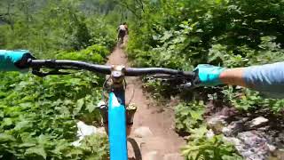
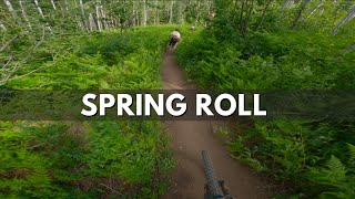
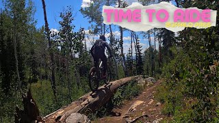
Videos of Buffalo Pass Mountain Bike
trail: Bear Tree Ridge (BTR)
0:11 |
146 |
Nov 28, 2020
trail: Grouse
0:16 |
185 |
Sep 27, 2019
trail: Bear Tree Ridge (BTR)
5:07 |
329 |
Nov 16, 2017
trail: Flash of Gold
9:39 |
224 |
Jul 22, 2023 , Steamboat Springs
trail: Spring Roll
13:36 |
289 |
Jul 22, 2023 , Steamboat Springs
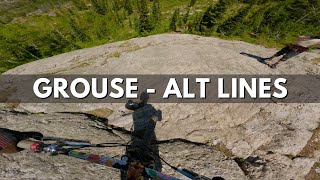
trail: Grouse
8:44 |
338 |
Jul 13, 2023 , Steamboat Springs
trail: Spring Roll
4:21 |
305 |
Jul 7, 2023 , Steamboat Springs
trail: Spring Roll
26:09 |
154 |
Jan 29, 2023 , Steamboat Springs
Recent Trail Reports
| status | trail | date | condition | info | user |
|---|---|---|---|---|---|
| Spring Creek | May 22, 2026 @ 12:38pm (America/Denver) May 22, 2026 | Variable | OlRoo | ||
| Fiddlehead | Oct 22, 2025 @ 12:41pm (America/Denver) Oct 22, 2025 | Wet | AndrewLuterVJ7 | ||
| Buffalo Billy | Aug 26, 2025 @ 9:26am Aug 26, 2025 | Dry | markegge | ||
| Flash of Gold | Aug 26, 2025 @ 9:26am Aug 26, 2025 | Dry | markegge | ||
| Spring Roll | Aug 24, 2025 @ 2:31pm Aug 24, 2025 | Ideal | markegge | ||
| Bear Tree Ridge (BTR) | Aug 24, 2025 @ 2:31pm Aug 24, 2025 | Dry | markegge | ||
| BTR Connector | Aug 24, 2025 @ 2:31pm Aug 24, 2025 | Ideal | markegge | ||
| Panorama | Jul 22, 2025 @ 9:05am Jul 22, 2025 | Ideal | bjfaulk | ||
| Flash of Gold | Jun 22, 2025 @ 3:47pm Jun 22, 2025 | Ideal | Mdeniston | ||
| Flash of Gold | Jun 22, 2025 @ 3:47pm Jun 22, 2025 | Ideal | Mdeniston |
Activity Feed
| username | action | type | title | date |
|---|---|---|---|---|
| jefrezicus | wishlist | trail | activity #97386256 | Jun 20, 2026 @ 5:57am 15 hours |
| tim-berjack | checkin | trail | activity #97384747 | Jun 20, 2026 @ 5:34am 15 hours |
| tim-berjack | ridden | trail | activity #97384712 | Jun 20, 2026 @ 5:33am 15 hours |
| C34 | vote | trail | activity #97231570 and 2 more | Jun 17, 2026 @ 9:33pm 3 days |
| C34 | ridden | trail | activity #97231494 and 3 more | Jun 17, 2026 @ 9:30pm 3 days |
Recent Comments
| username | type | title | comment | date |
|---|---|---|---|---|
| report | The first thing that popped out when we | Jun 13, 2026 @ 11:03am Jun 13, 2026 | ||
| trail | Closed May 15 - June 15 for elk calving season. | Jun 2, 2026 @ 11:54am Jun 2, 2026 | ||
| trail | If you’re expecting a downhill ripper, this... | Oct 8, 2025 @ 6:54pm Oct 8, 2025 | ||
| trail | One of the most over rated trails I’ve... | Sep 8, 2025 @ 2:58pm Sep 8, 2025 | ||
| trail | The descent on this trail is beautiful at... | Aug 18, 2025 @ 4:17pm Aug 18, 2025 |
Nearby Areas
| name | distance | ||||
|---|---|---|---|---|---|
| Rabbit Ears Pass | 1 | 3 | 5.1 km | ||
| Mount Werner | 1 | 6 | 6 | 6.5 km | |
| Steamboat Bike Park | 6 | 10 | 3 | 8.1 km | |
| In Town Trails | 6 | 1 | 9.5 km | ||
| Bear River Bike Park | 1 | 3 | 1 | 1 | 9.8 km |
Local Badges
-

Completionist0 awarded
Local Products
Activity Type Stats
| activitytype | trails | distance | descent | descent distance | total vertical | rating | global rank | state rank | photos | reports | routes | ridelogs |
|---|---|---|---|---|---|---|---|---|---|---|---|---|
| Mountain Bike | 37 | 71 miles | 11,706 ft | 32 miles | 3,665 ft | #1,591 | #542 | 208 | 434 | 6 | 4,910 | |
| E-Bike | 12 | 13 miles | 1,644 ft | 5 miles | 2,054 ft | #5,862 | #1,654 | 355 | 51 | |||
| Horse | 16 | 22 miles | 2,172 ft | 8 miles | 3,228 ft | #1,488 | #760 | 147 | ||||
| Hike | 37 | 69 miles | 10,623 ft | 29 miles | 3,665 ft | #624 | #334 | 2 | 427 | 4 | 238 | |
| Trail Running | 37 | 69 miles | 10,623 ft | 29 miles | 3,665 ft | #2,686 | #668 | 427 | 4 | 100 | ||
| Dirtbike/Moto | 12 | 13 miles | 1,644 ft | 5 miles | 2,054 ft | #757 | #287 | 124 | 2 |
Frequently Asked Questions About Buffalo Pass
▼
What are the highest rated mountain biking trails in Buffalo Pass?
The highest rated mountain biking trails in Buffalo Pass are:
- Grouse (4.7/5)
- Flash of Gold (4.5/5)
- Flash of Gold (4.2/5)
- Flash of Gold (Moto Section) (4.2/5)
- Spring Roll (4.1/5)
▼
What is the best time of the year to ride in Buffalo Pass?
Based on ride log data, the most popular months to ride in Buffalo Pass are:
- July (148 activities)
- August (92 activities)
- September (70 activities)
▼
Where can I park to ride in Buffalo Pass?
There are 3 parking locations listed in Buffalo Pass. The most popular parking spots are: View all parking and trailhead locations on the map to plan your visit.
▼
What is the longest trail in Buffalo Pass?
The longest trail in Buffalo Pass is Soda Mountain at 7.4 miles. View all trails sorted by distance.
Activities
Trails
Points of Interest
- By brenthillier
 NSMBA TRAILFORKS & contributors
 - Admins: RCR, COSS, RCR, RCR
- #7961 - 18,919 views
- buffalo pass activity log | embed map of Buffalo Pass mountain bike trails | buffalo pass mountain biking points of interest polygons
Downloading of trail gps tracks in kml & gpx formats is disabled for Buffalo Pass.