close
-
Layers w
- Weather Layers
- Pro
- Pro
- Pro
- Pro
- Pro
- Pro
- More Layers
- Pro
- Pro
- Pro
- Pro
-
Upgrade to

3D
Trail Conditions
- Unknown
- Snow Groomed
- Snow Packed
- Snow Covered
- Snow Cover Partial
- Freeze/thaw Cycle
- Icy
- Prevalent Mud
- Wet
- Variable
- Ideal
- Dry
- Very Dry
Trail Flow (Ridden Direction)
Trailforks scans users ridelogs to determine the most popular direction each trail is ridden. A good flowing trail network will have most trails flowing in a single direction according to their intension.
The colour categories are based on what percentage of riders are riding a trail in its intended direction.
The colour categories are based on what percentage of riders are riding a trail in its intended direction.
- > 96%
- > 90%
- > 80%
- > 70%
- > 50%
- < 50%
- bi-directional trail
- no data
Trail Last Ridden
Trailforks scans ridelogs to determine the last time a trail was ridden.
- < 2 days
- < 1 week
- < 2 weeks
- < 1 month
- < 6 months
- > 6 months
Trail Ridden Direction
The intended direction a trail should be ridden.
- Downhill Only
- Downhill Primary
- Both Directions
- Uphill Primary
- Uphill Only
- One Direction
Contribute Details
Colors indicate trail is missing specified detail.
- Description
- Photos
- Description & Photos
- Videos
Trail Popularity ?
Trailforks scans ridelogs to determine which trails are ridden the most in the last 9 months.
Trails are compared with nearby trails in the same city region with a possible 25 colour shades.
Think of this as a heatmap, more rides = more kinetic energy = warmer colors.
- most popular
- popular
- less popular
- not popular
ATV/ORV/OHV Filter
Max Vehicle Width
inches
US Cell Coverage
Legend

Radar Time
Activity Recordings
Trailforks uses anonymized public activity data.
?
Activity Recordings
Trailforks uses anonymized public activity data.
?
Personal Heatmap
▶
Activity Types
all
/
none
▶
Options
2
Date range
month
–
Winter Trails
Warning
A routing network for winter maps does not exist. Selecting trails using the winter trails layer has been disabled.
Missing Trails
Most Popular
Least Popular
Trails are colored based on popularity. The more popular a trail is, the more red. Less popular trails trend towards green.
Jump Magnitude Heatmap
Heatmap of where riders jump on trails. Zoom in to see individual jumps, click circles to view jump details.
BC Backroad Status
![map legend]()
Service Road Atlas is a free to use, community-driven service for viewing and creating reports on the numerous back-country service roads around B.C. and Alberta.

Slope Aspect
Direction the slope faces
Trails Deemphasized
Trails are shown in grey.
Only show trails with no bike usage.
Suggested Layers
Based on selected activity type
Save the current map location and zoom level as your default home location whenever this page is loaded.
SaveNépszerű túra útvonalak otthona. Nagyrészben Bükk-fa található itt. A talaj minősége és fajtája változhat. A legnagyobb hegyikerékpár pálya-hálózat Lillafüreden található, ahol van felvonó is. Magyarország legcsapadékosabb területe, évi 700-850mm-es átlaggal. Sok barlang is található, amelyek kedveltek a túrázók köreiben. Az itt található állatok sora hosszú, sok védett fajjal. További területekre bontható.
Popular hiking destination in Hungary. There are mostly Beech trees here, the quality and type of the dirt can vary. The biggest mountain bike trail system is in Lillafüred, there is also an elevator to go up. Hungary's most rainful area, with around 700-850mm average every year. There are lots of caves, which are liked by the hikers. There is a wide variety of animals here, with lots of protected species. It can be divided to more subregions.
Popular hiking destination in Hungary. There are mostly Beech trees here, the quality and type of the dirt can vary. The biggest mountain bike trail system is in Lillafüred, there is also an elevator to go up. Hungary's most rainful area, with around 700-850mm average every year. There are lots of caves, which are liked by the hikers. There is a wide variety of animals here, with lots of protected species. It can be divided to more subregions.
This region uses the Uk/Euro style trail grading system.
Activities Click to view
- Mountain Bike
18 trails
- E-Bike
4 trails
- Hike
3 trails
- Trail Running
4 trails
- Dirtbike/Moto
1 trails
- Snowshoe
0 trails
- Backcountry Ski
0 trails
Region Details
- 7
- 8
Region Status
Caution as of Feb 1, 2026Stats
- Avg Trail Rating
- Trails (view details)
- 18
- Trails Mountain Bike
- 18
- Trails E-Bike
- 4
- Trails Hike
- 3
- Trails Trail Running
- 4
- Trails Dirtbike/Moto
- 1
- Total Distance
- 15 miles
- Total Descent Distance
- 13 miles
- Total Descent
- 8,996 ft
- Total Vertical
- 2,432 ft
- Highest Trailhead
- 3,058 ft
- Reports
- 56
- Photos
- 52
- Ridden Counter
- 120
Popular Bükk Mountain Biking Trails
• 100 ★ 4.0 • 4,045 ft • 0 ft • 31 •
Technical, fast and skinny downhill track, with mixed obstacles, road jump, and other jumps.
• 95 ★ 4.0 • 4,984 ft • 8 ft • 31 •
Popular blue difficulty alpine singletrack. This mountain bike primary trail can be used both directions. It features jump, rock garden and skinny. On average it takes 12 minutes to complete this trail.
• 90 ★ 4.0 • 3,219 ft • 0 ft • 11 •
This is a rocky trail with loose rocks, step downs, some gap. Track contains insane parts.
• 70 ★ 4.0 • 1,526 ft • 0 ft • 8 •
Popular blue difficulty singletrack. This mountain bike primary trail can be used downhill only and has a easy overall physical rating with a 0 ft blue climb. It features drop, jump and gap jump. Trail visibility is always easy to follow. On average it takes 2 minutes to complete this trail.
• 85 ★ 5.0 • 2 miles • 3 ft • 6 •
Kellemes kis trail ami nem tartalmaz nagyobb akadályokat.
• 30 ★ 0.0 • 1 mile • 15 ft • 5 •
Less popular green difficulty singletrack. This mountain bike primary trail can be used both directions and has a easy overall physical rating with a 15 ft green climb. It features jump. On average it takes 11 minutes to complete this trail.
• 40 ★ 0.0 • 1 mile • 0 ft • 5 •
Az eleje a piros sáv jelzésen megy majd arról le kell térni egy jól követhető jelzetlen ösvényre. Egy meredek szakaszon ahol a piros jelzés elmegy balra egyenesen kell menni!
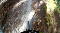
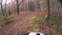
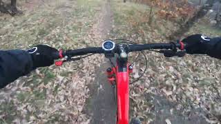
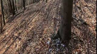
Photos of Bükk Mountain Bike
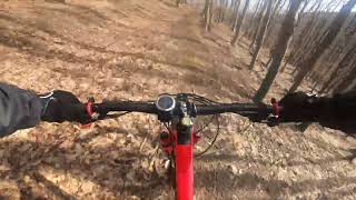
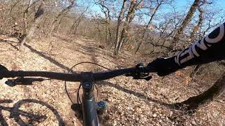
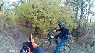
Videos of Bükk Mountain Bike
trail: Lillafüred Enduro
5:04 |
370 |
Oct 16, 2019
trail: Lillafüred DH
0:04 |
834 |
Nov 2, 2014
trail: Lillafüred DH
0:32 |
612 |
Jun 24, 2013
trail: Veres-oldal Szarvaskő
3:56 |
109 |
Mar 30, 2024 , Eger
trail: Őrkő-rét Peskő forrás trail
6:18 |
112 |
Mar 13, 2024 , Eger
trail: Gyetra cserkész
4:21 |
126 |
Mar 13, 2024 , Eger
trail: Berva Felső
0:26 |
256 |
Jan 3, 2023 , Eger
trail: Berva Felső
4:27 |
449 |
Sep 3, 2021 , Eger
Recent Trail Reports
| status | trail | date | condition | info | user |
|---|---|---|---|---|---|
| Kecskor DH | Dec 22, 2025 @ 9:50am (Europe/Budapest) Dec 22, 2025 | Wet | barczipetya | ||
| Dolomitbánya trail | Dec 10, 2025 @ 6:59pm (Europe/Budapest) Dec 10, 2025 | Prevalent Mud | barczipetya | ||
| Zöld jelzésen Szarvaskőig | Apr 8, 2024 @ 8:45am Apr 8, 2024 | Ideal | Ferenc2017 | ||
| Lillafüred DH | Mar 30, 2024 @ 4:19am Mar 30, 2024 | Ideal | rocko6 | ||
| Lillafüred Enduro | Mar 30, 2024 @ 4:19am Mar 30, 2024 | Ideal | rocko6 | ||
| Lilafüred WC | Jul 30, 2023 @ 4:03am Jul 30, 2023 | Dry | rocko6 | ||
| Egerlátó-Szarvaskő | May 8, 2022 @ 12:37am May 8, 2022 | Variable | Ferenc2017 | ||
| OKT | Apr 14, 2022 @ 11:03pm Apr 14, 2022 | Ideal | Ferenc2017 | ||
| Berva alsó | Apr 5, 2022 @ 12:54am Apr 5, 2022 | Variable | Ferenc2017 | ||
| Berva Felső | Apr 5, 2022 @ 12:54am Apr 5, 2022 | Variable | Ferenc2017 |
Activity Feed
| username | action | type | title | date |
|---|---|---|---|---|
| Kristf6lOc5r | ridden | trail | activity #92802138 | Apr 17, 2026 @ 11:29am Apr 17, 2026 |
| 6WVaQq | wishlist | trail | activity #92419922 | Apr 11, 2026 @ 12:46pm Apr 11, 2026 |
| 13Madzik | wishlist | trail | activity #91589743 | Mar 30, 2026 @ 9:10am Mar 30, 2026 |
| DanimsLciD | ridden | trail | activity #90610445 | Mar 15, 2026 @ 2:43am Mar 15, 2026 |
| DanimsLciD | wishlist | trail | activity #90553466 | Mar 14, 2026 @ 8:21am Mar 14, 2026 |
Nearby Areas
| name | distance | ||||
|---|---|---|---|---|---|
| Almás Bike Park | 5.8 km | ||||
| Komlóstető-Tapolca | 1 | 5 | 6.4 km | ||
| Tardonai-dombság | 1 | 9.9 km |
Activity Type Stats
| activitytype | trails | distance | descent | descent distance | total vertical | rating | global rank | state rank | photos | reports | routes | ridelogs |
|---|---|---|---|---|---|---|---|---|---|---|---|---|
| Mountain Bike | 18 | 15 miles | 8,996 ft | 13 miles | 2,431 ft | #1,941 | #10 | 52 | 56 | 666 | ||
| E-Bike | 4 | 2 miles | 627 ft | 2 miles | 925 ft | #1,606 | #15 | 47 | 53 | |||
| Hike | 3 | 2 miles | 732 ft | 2 miles | 781 ft | #2,429 | #17 | 41 | 44 | |||
| Trail Running | 4 | 2 miles | 787 ft | 2 miles | 925 ft | #1,699 | #17 | 41 | 11 | |||
| Dirtbike/Moto | 1 | 869 ft | 33 ft | 581 ft | 33 ft | #422 | #9 | 3 |
Frequently Asked Questions About Bükk
▼
What are the highest rated mountain biking trails in Bükk?
The highest rated mountain biking trails in Bükk are:
- Kecskor DH (4.1/5)
- Tar-kő Kecskor Dh (4.1/5)
- Lilafüred WC (4/5)
- Lillafüred DH (4/5)
- Lillafüred Enduro (4/5)
▼
What is the best time of the year to ride in Bükk?
Based on ride log data, the most popular months to ride in Bükk are:
- March (1 activities)
- May (1 activities)
- July (1 activities)
▼
Where can I park to ride in Bükk?
Check the Bükk trail map for trailhead and parking information. Community members regularly update access and parking details for trails in the area.
▼
What is the longest trail in Bükk?
The longest trail in Bükk is OKT at 3.1 km. View all trails sorted by distance.
- By marciteleki & contributors
- Admins: Ferenc2017, marciteleki
- #47423 - 3,464 views
- bükk activity log | embed map of Bükk mountain bike trails |
Downloading of trail gps tracks in kml & gpx formats is enabled for Bükk.
You must login to download files.