close
-
Layers w
- Weather Layers
- Pro
- Pro
- Pro
- Pro
- Pro
- Pro
- More Layers
- Pro
- Pro
- Pro
- Pro
-
Upgrade to

3D
Trail Conditions
- Unknown
- Snow Groomed
- Snow Packed
- Snow Covered
- Snow Cover Partial
- Freeze/thaw Cycle
- Icy
- Prevalent Mud
- Wet
- Variable
- Ideal
- Dry
- Very Dry
Trail Flow (Ridden Direction)
Trailforks scans users ridelogs to determine the most popular direction each trail is ridden. A good flowing trail network will have most trails flowing in a single direction according to their intension.
The colour categories are based on what percentage of riders are riding a trail in its intended direction.
The colour categories are based on what percentage of riders are riding a trail in its intended direction.
- > 96%
- > 90%
- > 80%
- > 70%
- > 50%
- < 50%
- bi-directional trail
- no data
Trail Last Ridden
Trailforks scans ridelogs to determine the last time a trail was ridden.
- < 2 days
- < 1 week
- < 2 weeks
- < 1 month
- < 6 months
- > 6 months
Trail Ridden Direction
The intended direction a trail should be ridden.
- Downhill Only
- Downhill Primary
- Both Directions
- Uphill Primary
- Uphill Only
- One Direction
Contribute Details
Colors indicate trail is missing specified detail.
- Description
- Photos
- Description & Photos
- Videos
Trail Popularity ?
Trailforks scans ridelogs to determine which trails are ridden the most in the last 9 months.
Trails are compared with nearby trails in the same city region with a possible 25 colour shades.
Think of this as a heatmap, more rides = more kinetic energy = warmer colors.
- most popular
- popular
- less popular
- not popular
ATV/ORV/OHV Filter
Max Vehicle Width
inches
US Cell Coverage
Legend

Radar Time
Activity Recordings
Trailforks uses anonymized public activity data.
?
Activity Recordings
Trailforks uses anonymized public activity data.
?
Personal Heatmap
▶
Activity Types
all
/
none
▶
Options
2
Date range
month
–
Winter Trails
Warning
A routing network for winter maps does not exist. Selecting trails using the winter trails layer has been disabled.
Missing Trails
Most Popular
Least Popular
Trails are colored based on popularity. The more popular a trail is, the more red. Less popular trails trend towards green.
Jump Magnitude Heatmap
Heatmap of where riders jump on trails. Zoom in to see individual jumps, click circles to view jump details.
BC Backroad Status
![map legend]()
Service Road Atlas is a free to use, community-driven service for viewing and creating reports on the numerous back-country service roads around B.C. and Alberta.

Slope Aspect
Direction the slope faces
Trails Deemphasized
Trails are shown in grey.
Only show trails with no bike usage.
Suggested Layers
Based on selected activity type
Save the current map location and zoom level as your default home location whenever this page is loaded.
Save
No description for Bukovik has been added yet!
Login or register to submit one.
Primary Trail Type: Cross-Country
Land Status: City Managed
Activities Click to view
- Mountain Bike
11 trails
- E-Bike
11 trails
- Hike
11 trails
- Trail Running
11 trails
Region Details
- 9
- 1
Region Status
Caution as of Nov 3, 2025Stats
- Avg Trail Rating
- Trails (view details)
- 10
- Trails Mountain Bike
- 11
- Trails E-Bike
- 11
- Trails Hike
- 11
- Trails Trail Running
- 11
- Total Distance
- 10 miles
- Total Descent
- 6,464 ft
- Total Vertical
- 2,299 ft
- Highest Trailhead
- 4,920 ft
- Reports
- 13
- Photos
- 33
- Ridden Counter
- 59
Popular Bukovik Mountain Biking Trails
• 5 ★ 5.0 • 1,121 ft • 157 ft • 8 •
Less popular blue difficulty singletrack. This mountain bike primary trail can be used downhill only. It features rock face.
• 60 ★ 4.4 • 4,930 ft • 36 ft • 7 •
Moderately popular blue difficulty mixed. This mountain bike primary trail can be used both directions and has a moderate overall physical rating with a 36 ft blue climb. On average it takes 8 minutes to complete this trail.
• 5 ★ 4.5 • 2 miles • 68 ft • 5 •
Nice Trail, double track, Stony, but fast to Drive.
• 5 ★ 5.0 • 3,823 ft • 39 ft • 5 •
Less popular blue difficulty singletrack. This mountain bike primary trail can be used downhill primary. It features rock face. On average it takes 15 minutes to complete this trail.
• 5 ★ 2.5 • 1,929 ft • 26 ft • 3 •
Less popular blue difficulty singletrack. This mountain bike primary trail can be used downhill primary. It features rock face.
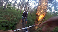
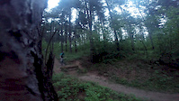
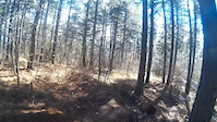
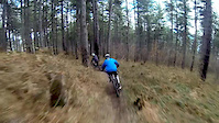
Photos of Bukovik Mountain Bike
Videos of Bukovik Mountain Bike
trail: Pashino Hill(Brza)
0:39 |
89 |
May 21, 2015
trail: Pashino Hill(Brza)
0:07 |
55 |
May 19, 2015
trail: Pashino Hill(Brza)
0:05 |
400 |
Apr 6, 2015
trail: Pashino Hill(Brza)
0:48 |
403 |
Mar 2, 2015

trail: 7 Vrela
608 |
Nov 3, 2015 , Sarajevo
Recent Trail Reports
| status | trail | date | condition | info | user |
|---|---|---|---|---|---|
| 7 Vrela | Feb 1, 2021 @ 12:30am Feb 1, 2021 | Dry | Endurogrip | ||
| Arapov Do | Jan 9, 2020 @ 4:35pm Jan 9, 2020 | Snow Packed | Wakaas | ||
| Waterfall Grasshopper | Sep 21, 2019 @ 4:36am Sep 21, 2019 | Dry | chuchu0815 | ||
| Short Link | Nov 4, 2018 @ 1:53pm Nov 4, 2018 | Dry | VeganLife | ||
| Bukovik Singletrack | Nov 4, 2018 @ 1:51pm Nov 4, 2018 | Prevalent Mud | VeganLife |
Activity Feed
| username | action | type | title | date |
|---|---|---|---|---|
| not12 | ridden | trail | activity #79055723 | Aug 27, 2025 @ 9:40am Aug 27, 2025 |
| not12 | vote | trail | activity #79055652 | Aug 27, 2025 @ 9:39am Aug 27, 2025 |
| Jusufh | ridden | trail | activity #20495179 | Jun 25, 2021 @ 3:14am Jun 25, 2021 |
| Endurogrip | add | report | activity #16334141 | Feb 1, 2021 @ 12:30am Feb 1, 2021 |
| ocnblu03 | wishlist | trail | activity #14990429 | Nov 29, 2020 @ 8:05pm Nov 29, 2020 |
Nearby Areas
| name | distance | ||||
|---|---|---|---|---|---|
| Trebevic | 9 | 13 | 3 | 6 km | |
| East Sarajevo trails | 6 | 1 | 8.3 km | ||
| Bike Park Evolution | 11 | 2 | 4 | 9.3 km | |
| Igman | 21 | 9 | 1 | 12.8 km | |
| Jahorina | 7 | 1 | 14.2 km |
Activity Type Stats
| activitytype | trails | distance | descent | descent distance | total vertical | rating | global rank | state rank | photos | reports | routes | ridelogs |
|---|---|---|---|---|---|---|---|---|---|---|---|---|
| Mountain Bike | 11 | 10 miles | 6,463 ft | 7 miles | 2,300 ft | #1,785 | #5 | 33 | 12 | 1 | 67 | |
| E-Bike | 11 | 10 miles | 6,463 ft | 7 miles | 2,300 ft | #1,216 | #9 | 9 | 2 | |||
| Hike | 11 | 10 miles | 6,463 ft | 7 miles | 2,300 ft | #1,892 | #9 | 12 | 41 | |||
| Trail Running | 11 | 10 miles | 6,463 ft | 7 miles | 2,300 ft | #1,220 | #9 | 12 | 6 |
Frequently Asked Questions About Bukovik
▼
What are the highest rated mountain biking trails in Bukovik?
The highest rated mountain biking trails in Bukovik are:
- Bukovik Singletrack (4.2/5)
- Crepoljsko Trail (4.2/5)
- Waterfall Grasshopper (4.1/5)
- 7 Vrela (4.1/5)
- Short Link (4.1/5)
▼
What is the best time of the year to ride in Bukovik?
Based on ride log data, the most popular months to ride in Bukovik are:
- July (1 activities)
- August (1 activities)
- September (1 activities)
▼
Where can I park to ride in Bukovik?
Check the Bukovik trail map for trailhead and parking information. Community members regularly update access and parking details for trails in the area.
▼
What is the longest trail in Bukovik?
The longest trail in Bukovik is Crepoljsko Trail at 2.4 miles. View all trails sorted by distance.
- By FaruK-AM & contributors
- Admins: marko-ristivojevic-evolution
- #7473 - 2,688 views
- bukovik activity log | embed map of Bukovik mountain bike trails |
Downloading of trail gps tracks in kml & gpx formats is enabled for Bukovik.
You must login to download files.