close
-
Layers w
- Weather Layers
- Pro
- Pro
- Pro
- Pro
- Pro
- Pro
- More Layers
- Pro
- Pro
- Pro
- Pro
-
Upgrade to

3D
Trail Conditions
- Unknown
- Snow Groomed
- Snow Packed
- Snow Covered
- Snow Cover Partial
- Freeze/thaw Cycle
- Icy
- Prevalent Mud
- Wet
- Variable
- Ideal
- Dry
- Very Dry
Trail Flow (Ridden Direction)
Trailforks scans users ridelogs to determine the most popular direction each trail is ridden. A good flowing trail network will have most trails flowing in a single direction according to their intension.
The colour categories are based on what percentage of riders are riding a trail in its intended direction.
The colour categories are based on what percentage of riders are riding a trail in its intended direction.
- > 96%
- > 90%
- > 80%
- > 70%
- > 50%
- < 50%
- bi-directional trail
- no data
Trail Last Ridden
Trailforks scans ridelogs to determine the last time a trail was ridden.
- < 2 days
- < 1 week
- < 2 weeks
- < 1 month
- < 6 months
- > 6 months
Trail Ridden Direction
The intended direction a trail should be ridden.
- Downhill Only
- Downhill Primary
- Both Directions
- Uphill Primary
- Uphill Only
- One Direction
Contribute Details
Colors indicate trail is missing specified detail.
- Description
- Photos
- Description & Photos
- Videos
Trail Popularity ?
Trailforks scans ridelogs to determine which trails are ridden the most in the last 9 months.
Trails are compared with nearby trails in the same city region with a possible 25 colour shades.
Think of this as a heatmap, more rides = more kinetic energy = warmer colors.
- most popular
- popular
- less popular
- not popular
ATV/ORV/OHV Filter
Max Vehicle Width
inches
US Cell Coverage
Legend

Radar Time
Activity Recordings
Trailforks uses anonymized public activity data.
?
Activity Recordings
Trailforks uses anonymized public activity data.
?
Personal Heatmap
▶
Activity Types
all
/
none
▶
Options
2
Date range
month
–
Winter Trails
Warning
A routing network for winter maps does not exist. Selecting trails using the winter trails layer has been disabled.
Missing Trails
Most Popular
Least Popular
Trails are colored based on popularity. The more popular a trail is, the more red. Less popular trails trend towards green.
Jump Magnitude Heatmap
Heatmap of where riders jump on trails. Zoom in to see individual jumps, click circles to view jump details.
BC Backroad Status
![map legend]()
Service Road Atlas is a free to use, community-driven service for viewing and creating reports on the numerous back-country service roads around B.C. and Alberta.

Slope Aspect
Direction the slope faces
Trails Deemphasized
Trails are shown in grey.
Only show trails with no bike usage.
Suggested Layers
Based on selected activity type
Save the current map location and zoom level as your default home location whenever this page is loaded.
SaveBeautiful country with vast opportunities for mountain biking. There is lots of mountains to explore with stunning landscapes.
Links
This region uses the Uk/Euro style trail grading system.
Region Details
- 123
- 1
- 62
- 194
- 22
- 5
Stats
- Avg Trail Rating
- Trails (view details)
- 492
- Trails Mountain Bike
- 488
- Trails E-Bike
- 320
- Trails Gravel Bike
- 7
- Trails Adaptive Bike
- 3
- Trails Horse
- 31
- Trails Hike
- 395
- Trails Trail Running
- 380
- Trails Dirtbike/Moto
- 21
- Trails Observed Trials
- 5
- Trails ATV/ORV/OHV
- 7
- Trails Snowshoe
- 11
- Trails Downhill Ski
- 8
- Trails Backcountry Ski
- 14
- Trails Nordic Ski
- 8
- Total Distance
- 856 miles
- Total Descent
- 353,839 ft
- Total Vertical
- 8,298 ft
- Highest Trailhead
- 8,378 ft
- Reports
- 2,877
- Photos
- 1,210
- Ridden Counter
- 11,063
Articles
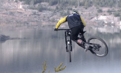
Video: Freeriding in an Eastern European Quarry
Jul 19, 2019 from pinkbike.com
Searching for Utah-esque terrain in Bulgaria.
Popular Trail Networks
view all areas »Sub Regions
- Blagoevgrad oblast (96)
- Bansko (41)
- Blagoevgrad (21)
- Garmen (4)
- Gotse Delchev (1)
- Kresna (13)
- Petrich (14)
- Razlog (1)
- Sandanski (6)
- Bansko (41)
- Burgas oblast (3)
- Dobrich oblast (0)
- Gabrovo oblast (6)
- Haskovo oblast (0)
- Kardzhali oblast (0)
- Kyustendil oblast (3)
- Dupnica (1)
- Kyustendil (2)
- Dupnica (1)
- Lovech oblast (11)
- Montana oblast (1)
- Berkovitsa (1)
- Berkovitsa (1)
- Pazardzhik oblast (51)
- Pernik oblast (0)
- Pleven oblast (1)
- Pleven (1)
- Pleven (1)
- Plovdiv oblast (67)
- Chernatitsa Ridge (51)
- Karlovo (2)
- Kuklen (12)
- Plovdiv (15)
- Sopot (1)
- Chernatitsa Ridge (51)
- Razgrad oblast (0)
- Ruse oblast (16)
- Shumen oblast (7)
- Shumen (7)
- Shumen (7)
- Silistra oblast (3)
- Silistra (3)
- Silistra (3)
- Sliven oblast (7)
- Sliven (7)
- Sliven (7)
- Smolyan oblast (55)
- Sofia City Province (108)
- Sofia (108)
- Sofia (108)
- Sofia oblast (20)
- Stara Zagora oblast (15)
- Kazanlak (10)
- Pavel Banya (3)
- Stara Zagora (2)
- Kazanlak (10)
- Targovishte oblast (2)
- Targovishte (2)
- Targovishte (2)
- Varna oblast (4)
- Varna (4)
- Varna (4)
- Veliko Tarnovo oblast (7)
- Gorna Orjahovitca (2)
- Veliko Tarnovo (5)
- Gorna Orjahovitca (2)
- Vidin oblast (6)
- Belogradchik (4)
- Chuprene (2)
- Belogradchik (4)
- Vratsa oblast (19)
- Yakoruda (0)
- Yambol oblast (0)
- Vladaya (5)
Popular Bulgaria Mountain Biking Trails
• 95 ★ 3.8 • 2,795 ft • 7 ft • 152 •
Upper part of the easiest trail from Borovets Park. Flowy with some tight corners and scattered roots. You'll have to continue on the dirt road to enter the second part
• 65 ★ 4.7 • 1 mile • 2 ft • 152 •
Highly rated moderately popular black diamond difficulty singletrack. This mountain bike primary trail can be used downhill primary. It features jump and rock face. On average it takes 10 minutes to complete this trail.
• 90 ★ 4.0 • 2,762 ft • 0 ft • 151 •
Flow trail with big berms. A lot of places where you can gap things, if you have the skills.
• 75 ★ 3.3 • 4,137 ft • 0 ft • 143 •
Popular blue difficulty singletrack. This mountain bike primary trail can be used downhill only. Trail visibility is always easy to follow. On average it takes 3 minutes to complete this trail.
• 60 ★ 4.2 • 3,570 ft • 0 ft • 135 •
The second part of the trail, a bit harder, as there are more roots on the way. You'll also find some wooden bridges.
Bulgaria Mountain Bike Routes
★ 5.0 • 21 miles • 3,465 ft • 2 • Out & Back •
A cross-country route going trough the village of Harsovo , climbing up in the mountain where you have...
★ 5.0 • 18 miles • 3,109 ft • 1 • Loop •
Another route that passes trough the villages of Harsovo and Marulevo. However this is a shorter one than...
★ 5.0 • 17 miles • 2,724 ft • 2 • Out & Back •
A route that goes trough the villa areas of Bistritsa and . The route starts with few km of asphalt road...
4 miles • 861 ft • 1 • Loop •
The iconic Pumba route is a short cycle route above the Bonsovi Polyani hut, built by TD Boeritsa with the...
★ 5.0 • 16 miles • 2,609 ft • 0 • Out & Back •
A nice route that climbs on gravel and fire roads near the village of Gorno harsovo and descends on the...
★ 2.0 • 12 miles • 2,521 ft • 1 • Loop •
What is it? The tour of Lozenska planina is a bike race that we plan to organise for the first time in...
Photos of Bulgaria Mountain Bike
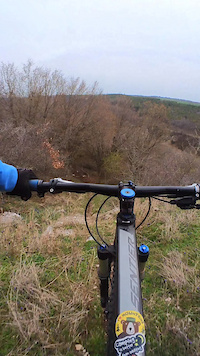
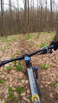
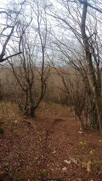
Videos of Bulgaria Mountain Bike
trail: Turtles path
0:31 |
20 |
Mar 27, 2025
trail: Forest fairy
0:31 |
13 |
Mar 27, 2025
trail: Turtles path
0:04 |
13 |
Nov 22, 2024
trail: Lunch joy.
0:10 |
20 |
Nov 22, 2024
trail: #ТЕГАТА
0:35 |
66 |
Jun 2, 2024
trail: Voynegovtzi AM Trail
0:06 |
25 |
Sep 11, 2023
trail: Voynegovtzi AM Trail
0:06 |
13 |
Sep 11, 2023

trail: Voynegovtzi AM Trail
0:09 |
13 |
Sep 11, 2023
Recent Comments
| username | type | title | comment | date |
|---|---|---|---|---|
| trail | Would not recommend if you are into jumps .... | Jun 22, 2026 @ 8:54pm 2 days | ||
| report | Дърветата и клоните са... | Jun 19, 2026 @ 3:39am Jun 19, 2026 | ||
| trail | разнообразна и интересна... | May 22, 2026 @ 10:10am May 22, 2026 | ||
| trail | добре маркирана и лесна... | May 17, 2026 @ 11:34am May 17, 2026 | ||
| trail | the obvious reason this trail is not so... | Sep 8, 2025 @ 9:37am Sep 8, 2025 |
Bike & Skill Parks
| name | type | city | rating |
|---|---|---|---|
| Pamporovo Resort | bike park | Smolyan | |
| Shambhala Bikepark | bike park | Sopot | |
| Bikepark Plovdiv | skill park | Plovdiv | |
| Four Seasons Orchard - Четири Cезона Градина | skill park | Sofia | |
| Blagoevgrad Pumptrack | skill park | Blagoevgrad |
Activity Type Stats
| activitytype | trails | distance | descent | descent distance | total vertical | rating | global rank | state rank | photos | reports | routes | ridelogs |
|---|---|---|---|---|---|---|---|---|---|---|---|---|
| Mountain Bike | 488 | 841 miles | 350,308 ft | 512 miles | 8,297 ft | #41 | 1,154 | 2,877 | 33 | 53,668 | ||
| E-Bike | 320 | 616 miles | 235,988 ft | 351 miles | 8,035 ft | #41 | 46 | 2,728 | 16 | 5,212 | ||
| Gravel Bike | 7 | 11 miles | 1,913 ft | 4 miles | 3,091 ft | #34 | 15 | 2 | 213 | |||
| Adaptive Bike | 3 | #36 | 1 | |||||||||
| Horse | 31 | 112 miles | 20,052 ft | 46 miles | 6,627 ft | #39 | 125 | 1 | ||||
| Hike | 395 | 723 miles | 276,542 ft | 424 miles | 8,284 ft | #40 | 7 | 2,802 | 20 | 5,163 | ||
| Trail Running | 380 | 686 miles | 258,110 ft | 399 miles | 8,284 ft | #38 | 1 | 2,794 | 6 | 1,176 | ||
| Dirtbike/Moto | 21 | 38 miles | 11,250 ft | 23 miles | 4,613 ft | #45 | 112 | 31 | ||||
| Observed Trials | 5 | 5 miles | 673 ft | 2 miles | 4,557 ft | #36 | 17 | 5 | ||||
| ATV/ORV/OHV | 7 | 7 miles | 850 ft | 3 miles | 3,717 ft | #47 | 112 | 1 | ||||
| Snowshoe | 11 | 8 miles | 4,662 ft | 6 miles | 6,736 ft | #24 | 2 | 8 | 17 | |||
| Downhill Ski | 8 | 6 miles | 2,569 ft | 4 miles | 5,564 ft | #26 | 7 | 2,871 | ||||
| Backcountry Ski | 14 | 10 miles | 5,712 ft | 8 miles | 6,736 ft | #26 | 12 | 995 | ||||
| Nordic Ski | 8 | 5 miles | 2,313 ft | 3 miles | 6,736 ft | #25 | 5 | 105 |
Activities
- Bulgaria Mountain Biking Trails
- Bulgaria E-Biking Trails
- Bulgaria Gravel Biking Trails
- Bulgaria Horseback Trails
- Bulgaria Hiking Trails
- Bulgaria Trail Running Trails
- Bulgaria Dirtbiking Trails
- Bulgaria Observed Trials Trails
- Bulgaria ATVing/Offroading Trails
- Bulgaria Snowshoeing Trails
- Bulgaria Skiing Trails
- Bulgaria Backcountry Skiing Trails
- Bulgaria Nordic Skiing Trails
Trails
Points of Interest
- Pametnika viewpoint
- The Old Bridge
- Dabrava Panorama Viewpoint
- Delvino Panorama Viewpoint
- Kalaukci Old Church Sight
- Golden Bridges Viewpoint
- bike park komatevo Other
- Bonsovi Poliani hut Cabin
- [falls] Waterfalls Other
- Paligoden Monastry Viewpoint
- Мусала (9,570 ft)
- Кутело 1 (9,475 ft)
- Малка Мусала (9,475 ft)
- By canadaka
 Trailforks & contributors
 - Admins: pufalot
- #3179 - 35,179 views
- bulgaria activity log | embed map of Bulgaria mountain bike trails | bulgaria mountain biking points of interest
Downloading of trail gps tracks in kml & gpx formats is enabled for Bulgaria.
You must login to download files.