close
-
Layers w
- Weather Layers
- Pro
- Pro
- Pro
- Pro
- Pro
- Pro
- More Layers
- Pro
- Pro
- Pro
- Pro
-
Upgrade to

3D
Trail Conditions
- Unknown
- Snow Groomed
- Snow Packed
- Snow Covered
- Snow Cover Partial
- Freeze/thaw Cycle
- Icy
- Prevalent Mud
- Wet
- Variable
- Ideal
- Dry
- Very Dry
Trail Flow (Ridden Direction)
Trailforks scans users ridelogs to determine the most popular direction each trail is ridden. A good flowing trail network will have most trails flowing in a single direction according to their intension.
The colour categories are based on what percentage of riders are riding a trail in its intended direction.
The colour categories are based on what percentage of riders are riding a trail in its intended direction.
- > 96%
- > 90%
- > 80%
- > 70%
- > 50%
- < 50%
- bi-directional trail
- no data
Trail Last Ridden
Trailforks scans ridelogs to determine the last time a trail was ridden.
- < 2 days
- < 1 week
- < 2 weeks
- < 1 month
- < 6 months
- > 6 months
Trail Ridden Direction
The intended direction a trail should be ridden.
- Downhill Only
- Downhill Primary
- Both Directions
- Uphill Primary
- Uphill Only
- One Direction
Contribute Details
Colors indicate trail is missing specified detail.
- Description
- Photos
- Description & Photos
- Videos
Trail Popularity ?
Trailforks scans ridelogs to determine which trails are ridden the most in the last 9 months.
Trails are compared with nearby trails in the same city region with a possible 25 colour shades.
Think of this as a heatmap, more rides = more kinetic energy = warmer colors.
- most popular
- popular
- less popular
- not popular
ATV/ORV/OHV Filter
Max Vehicle Width
inches
US Cell Coverage
Legend

Radar Time
Activity Recordings
Trailforks uses anonymized public activity data.
?
Activity Recordings
Trailforks uses anonymized public activity data.
?
Personal Heatmap
▶
Activity Types
all
/
none
▶
Options
2
Date range
month
–
Winter Trails
Warning
A routing network for winter maps does not exist. Selecting trails using the winter trails layer has been disabled.
Missing Trails
Most Popular
Least Popular
Trails are colored based on popularity. The more popular a trail is, the more red. Less popular trails trend towards green.
Jump Magnitude Heatmap
Heatmap of where riders jump on trails. Zoom in to see individual jumps, click circles to view jump details.
BC Backroad Status
![map legend]()
Service Road Atlas is a free to use, community-driven service for viewing and creating reports on the numerous back-country service roads around B.C. and Alberta.

Slope Aspect
Direction the slope faces
Trails Deemphasized
Trails are shown in grey.
Only show trails with no bike usage.
Suggested Layers
Based on selected activity type
Save the current map location and zoom level as your default home location whenever this page is loaded.
SaveXC trail network on a lake
Primary Trail Type: Cross-Country
Land Status: National Forest
 google parking directions
 Activities Click to view
- Mountain Bike
12 trails
- E-Bike
12 trails
- Hike
12 trails
- Trail Running
12 trails
Region Details
- 4
- 8
Region Status
Open as of Apr 27, 2026Stats
- Avg Trail Rating
- Trails (view details)
- 12
- Trails Mountain Bike
- 12
- Trails E-Bike
- 12
- Trails Hike
- 12
- Trails Trail Running
- 12
- Total Distance
- 18 miles
- Total Descent Distance
- 9 miles
- Total Descent
- 3,373 ft
- Total Vertical
- 853 ft
- Highest Trailhead
- 2,777 ft
- Reports
- 58
- Photos
- 9
- Ridden Counter
- 593
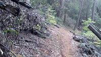
Popular Bullards Bar Mountain Biking Trails
• 95 ★ 3.0 • 3 miles • 398 ft • 105 •
Popular blue difficulty singletrack. This mountain bike primary trail can be used both directions and has a moderate overall physical rating with a 398 ft green climb. On average it takes 25 minutes to complete this trail.
• 90 ★ 2.0 • 3 miles • 250 ft • 92 •
Popular blue difficulty singletrack. This mountain bike primary trail can be used both directions and has a moderate overall physical rating with a 250 ft green climb. On average it takes 27 minutes to complete this trail.
• 80 ★ 2.0 • 2 miles • 161 ft • 71 •
Popular blue difficulty singletrack. This mountain bike primary trail can be used both directions and has a moderate overall physical rating with a 161 ft blue climb. On average it takes 23 minutes to complete this trail.
• 55 ★ 4.0 • 2 miles • 301 ft • 70 •
Pleasant XC singletrack if that's your thing. Singlespeed friendly. Advanced beginner friendly.
• 35 ★ 0.0 • 3,589 ft • 239 ft • 67 •
Less popular blue difficulty singletrack. This mountain bike primary trail can be used both directions and has a moderate overall physical rating with a 239 ft green climb. On average it takes 8 minutes to complete this trail.
• 50 ★ 4.0 • 4,419 ft • 0 ft • 67 •
Moderately popular blue difficulty singletrack. This mountain bike primary trail can be used both directions and has a moderate overall physical rating with a 0 ft blue climb. On average it takes 7 minutes to complete this trail.
• 70 ★ 0.0 • 3,376 ft • 0 ft • 59 •
Popular green difficulty singletrack. This mountain bike primary trail can be used both directions and has a moderate overall physical rating with a 0 ft green climb. On average it takes 4 minutes to complete this trail.
• 60 ★ 0.0 • 4,360 ft • 115 ft • 48 •
Moderately popular green difficulty singletrack. This mountain bike primary trail can be used both directions and has a easy overall physical rating with a 115 ft green climb. On average it takes 5 minutes to complete this trail.
Bullards Bar Mountain Bike Routes
★ 2.5 • 15 miles • 3,327 ft • 8 •
Currently the best ride at Bullards--until the big washout repair gets engineered.
8 miles • 1,873 ft • 8 • Loop •
Wanna do a race here? Fine XC singletrack.
• 12 miles • 2,705 ft • 7 •
• 13 miles • 3,282 ft • 6 •
• 15 miles • 2,029 ft • 7 •
• 13 miles • 3,125 ft • 3 •
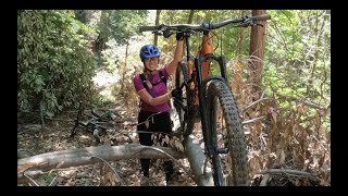
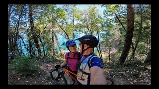
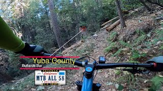
Videos of Bullards Bar Mountain Bike
0:16 |
344 |
Sep 17, 2015
27:59 |
149 |
Mar 24, 2024 , Camptonville

25:36 |
99 |
Mar 24, 2024 , Camptonville
25:36 |
118 |
Mar 24, 2024 , Camptonville

25:36 |
181 |
Mar 19, 2023 , Camptonville

27:59 |
269 |
Mar 19, 2023 , Camptonville
21:03 |
188 |
Jan 25, 2022 , Camptonville
youtuber
![Bullards Bar 2018 (Camptonville, CA) Mountain...]()

14:28 |
701 |
Jun 13, 2018 , Camptonville
Recent Trail Reports
Activity Feed
| username | action | type | title | date |
|---|---|---|---|---|
| StdjcUkQ | wishlist | region | activity #95883014 | May 30, 2026 @ 1:30pm May 30, 2026 |
| SashaH | wishlist | trail | activity #94833112 and 4 more | May 16, 2026 @ 10:47am May 16, 2026 |
| Windstoked | add | report | activity #93560117 and 4 more | Apr 27, 2026 @ 9:23pm Apr 27, 2026 |
| Tom46 | comment | trail | activity #85423018 | Dec 12, 2025 @ 3:24pm Dec 12, 2025 |
| Yuddog | wishlist | route | activity #84839249 | Nov 28, 2025 @ 3:20am Nov 28, 2025 |
Recent Comments
| username | type | title | comment | date |
|---|---|---|---|---|
| trail | There is a large tree down about two miles... | Dec 12, 2025 @ 3:24pm Dec 12, 2025 | ||
| trail | I attempted to ride it after descending Rebel... | Oct 7, 2023 @ 4:41pm Oct 7, 2023 | ||
| trail | Trail is not ridable. Blocked and overgrown.... | Oct 7, 2023 @ 4:36pm Oct 7, 2023 | ||
| report | Trail was rerouted by the Tahoe hotshots | Jun 11, 2023 @ 8:51am Jun 11, 2023 | ||
| trail | It’s all opened up again with a few reroutes | Jun 6, 2023 @ 10:01am Jun 6, 2023 |
Nearby Areas
| name | distance | ||||
|---|---|---|---|---|---|
| South Yuba River State Park | 1 | 1 | 9 km | ||
| Round Mountain | 8 | 1 | 9.7 km | ||
| Malakoff Diggins State park | 2 | 11.2 km | |||
| Harmony/Washington Ridge | 12 | 12 | 1 | 13.2 km | |
| Parliament Trails | 4 | 2 | 2 | 13.6 km |
Activity Type Stats
| activitytype | trails | distance | descent | descent distance | total vertical | rating | global rank | state rank | photos | reports | routes | ridelogs |
|---|---|---|---|---|---|---|---|---|---|---|---|---|
| Mountain Bike | 12 | 18 miles | 3,373 ft | 9 miles | 853 ft | #11,834 | #4,828 | 9 | 58 | 2 | 367 | |
| E-Bike | 12 | 18 miles | 3,373 ft | 9 miles | 853 ft | #5,854 | #1,651 | 58 | 1 | 30 | ||
| Hike | 12 | 18 miles | 3,373 ft | 9 miles | 853 ft | #10,163 | #3,979 | 58 | 3 | 28 | ||
| Trail Running | 12 | 18 miles | 3,373 ft | 9 miles | 853 ft | #9,203 | #3,300 | 58 | 1 | 38 |
Frequently Asked Questions About Bullards Bar
▼
What are the highest rated mountain biking trails in Bullards Bar?
The highest rated mountain biking trails in Bullards Bar are:
- 7 Ball Trail (4/5)
- 8 Ball Trail (Dark Day Rd-7 Ball Tr) (4/5)
- Bullards Bar Trail (Dark Day-Schoolhouse) (3.7/5)
- Bullards Bar Trail (Vista Point-Schoolhouse) (3.7/5)
- Bullards Bar Trail (Old Camptonville Rd to Rebel Ridge) (3.4/5)
▼
What is the best time of the year to ride in Bullards Bar?
Based on ride log data, the most popular months to ride in Bullards Bar are:
- June (4 activities)
- September (4 activities)
- May (4 activities)
▼
Where can I park to ride in Bullards Bar?
There are 2 parking locations listed in Bullards Bar. The most popular parking spots are:
▼
What is the longest trail in Bullards Bar?
The longest trail in Bullards Bar is Bullards Bar Trail (Old Camptonville Rd to Rebel Ridge) at 3.9 miles. View all trails sorted by distance.
Activities
- By Redhawk
 BONC & contributors
 - Admins: BONC
- #8978 - 5,360 views
- bullards bar activity log | embed map of Bullards Bar mountain bike trails | bullards bar mountain biking points of interest
Downloading of trail gps tracks in kml & gpx formats is enabled for Bullards Bar.
You must login to download files.