close
-
Layers w
- Weather Layers
- Pro
- Pro
- Pro
- Pro
- Pro
- Pro
- More Layers
- Pro
- Pro
- Pro
- Pro
-
Upgrade to

3D
Trail Conditions
- Unknown
- Snow Groomed
- Snow Packed
- Snow Covered
- Snow Cover Partial
- Freeze/thaw Cycle
- Icy
- Prevalent Mud
- Wet
- Variable
- Ideal
- Dry
- Very Dry
Trail Flow (Ridden Direction)
Trailforks scans users ridelogs to determine the most popular direction each trail is ridden. A good flowing trail network will have most trails flowing in a single direction according to their intension.
The colour categories are based on what percentage of riders are riding a trail in its intended direction.
The colour categories are based on what percentage of riders are riding a trail in its intended direction.
- > 96%
- > 90%
- > 80%
- > 70%
- > 50%
- < 50%
- bi-directional trail
- no data
Trail Last Ridden
Trailforks scans ridelogs to determine the last time a trail was ridden.
- < 2 days
- < 1 week
- < 2 weeks
- < 1 month
- < 6 months
- > 6 months
Trail Ridden Direction
The intended direction a trail should be ridden.
- Downhill Only
- Downhill Primary
- Both Directions
- Uphill Primary
- Uphill Only
- One Direction
Contribute Details
Colors indicate trail is missing specified detail.
- Description
- Photos
- Description & Photos
- Videos
Trail Popularity ?
Trailforks scans ridelogs to determine which trails are ridden the most in the last 9 months.
Trails are compared with nearby trails in the same city region with a possible 25 colour shades.
Think of this as a heatmap, more rides = more kinetic energy = warmer colors.
- most popular
- popular
- less popular
- not popular
ATV/ORV/OHV Filter
Max Vehicle Width
inches
US Cell Coverage
Legend

Radar Time
Activity Recordings
Trailforks uses anonymized public activity data.
?
Activity Recordings
Trailforks uses anonymized public activity data.
?
Personal Heatmap
▶
Activity Types
all
/
none
▶
Options
2
Date range
month
–
Winter Trails
Warning
A routing network for winter maps does not exist. Selecting trails using the winter trails layer has been disabled.
Missing Trails
Most Popular
Least Popular
Trails are colored based on popularity. The more popular a trail is, the more red. Less popular trails trend towards green.
Jump Magnitude Heatmap
Heatmap of where riders jump on trails. Zoom in to see individual jumps, click circles to view jump details.
BC Backroad Status
![map legend]()
Service Road Atlas is a free to use, community-driven service for viewing and creating reports on the numerous back-country service roads around B.C. and Alberta.

Slope Aspect
Direction the slope faces
Trails Deemphasized
Trails are shown in grey.
Only show trails with no bike usage.
Suggested Layers
Based on selected activity type
Save the current map location and zoom level as your default home location whenever this page is loaded.
Save
No description for Burlington has been added yet!
Login or register to submit one.
Activities Click to view
- Mountain Bike
58 trails
- E-Bike
11 trails
- Adaptive Bike
4 trails
- Winter Fat Bike
14 trails
- Hike
101 trails
- Trail Running
101 trails
- Snowshoe
46 trails
- Nordic Ski
5 trails
Region Details
- 23
- 4
- 12
- 6
- 6
Region Status
Open as of Jun 16, 2026Stats
- Avg Trail Rating
- Trails (view details)
- 94
- Trails Mountain Bike
- 58
- Trails E-Bike
- 11
- Trails Gravel Bike
- 10
- Trails Adaptive Bike
- 4
- Trails Winter Fat Bike
- 14
- Trails Horse
- 1
- Trails Hike
- 101
- Trails Trail Running
- 101
- Trails Snowshoe
- 46
- Trails Nordic Ski
- 5
- Total Distance
- 52 miles
- Total Descent
- 3,849 ft
- Total Vertical
- 742 ft
- Highest Trailhead
- 988 ft
- Reports
- 620
- Photos
- 368
- Ridden Counter
- 18,281
Sub Regions
-
Beachway Park
-
Bronte Creek North
- 4
- 3
-
Eileen and John Holland Nature Sanctuary
- 1
-
Hidden Valley Park
- 2
- 1
-
Ireland Park
-
Kerncliff Park
- 4
- 1
- 3
-
LaSalle Park
- 1
- 4
-
Spencer Smith Park
Popular Burlington Mountain Biking Trails
• 75 ★ 4.0 • 1,659 ft • 56 ft • 155 •
Popular green difficulty mixed. This multi-use trail can be used both directions and has a easy overall physical rating with a 56 ft green climb. On average it takes 2 minutes to complete this trail.
• 85 ★ 0.0 • 1,793 ft • 12 ft • 145 •
Popular green difficulty doubletrack. This multi-use trail can be used both directions. On average it takes 2 minutes to complete this trail.
• 55 ★ 0.0 • 1,056 ft • 0 ft • 98 •
Moderately popular green difficulty gravel path. This multi-use trail can be used both directions. On average it takes 1 minutes to complete this trail.
• 30 ★ 0.0 • 3,100 ft • 12 ft • 40 •
This Trail is a mix of paved and crushed limestone. Very easy walk or ride with the kids. Trail continues on the west side of Unsworth Ave, but is hike only at this point. Bikes are not permitted on any trails that are apart of the...
• 50 ★ 5.0 • 1,726 ft • 0 ft • 33 •
Moderately popular green difficulty singletrack. This mountain bike primary trail can be used both directions. On average it takes minutes to complete this trail.
• 45 ★ 5.0 • 4,272 ft • 0 ft • 29 •
Moderately popular white difficulty gravel path. This mountain bike primary trail can be used both directions. On average it takes 13 minutes to complete this trail.
• 30 ★ 0.0 • 600 ft • 11 ft • 25 •
Finally section of gravel portion of this loop. From here you can head out on to the pier to sit and look out into the bay. Or you can start the climb back to the parking lot and the start of the loop.
• 25 ★ 0.0 • 551 ft • 0 ft • 23 • • hike
Boardwalk portion of the main loop. Bicyclist must dismount and walk their bikes along the boardwalk.
Burlington Mountain Bike Routes
5 miles • 150 ft • 7 • Loop •
Easy Route for Beginners with some good features to start improving control.
Videos of Burlington Mountain Bike
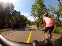
trail: Bike Path
3:16 |
122 |
Sep 16, 2012
Recent Trail Reports
| status | trail | date | condition | info | user |
|---|---|---|---|---|---|
| Suspect Device | Jun 16, 2026 @ 12:28pm (America/Toronto) Jun 16, 2026 | Ideal | traleplug | ||
| Shake A Leg | Jun 16, 2026 @ 12:28pm (America/Toronto) Jun 16, 2026 | Ideal | traleplug | ||
| Police Helicopter | Jun 16, 2026 @ 12:28pm (America/Toronto) Jun 16, 2026 | Ideal | traleplug | ||
| Kevin's Portage | Jun 16, 2026 @ 12:28pm (America/Toronto) Jun 16, 2026 | Wet | traleplug | ||
| KOA | Jun 16, 2026 @ 12:28pm (America/Toronto) Jun 16, 2026 | Ideal | traleplug | ||
| Donkey Kong | Jun 16, 2026 @ 12:28pm (America/Toronto) Jun 16, 2026 | Ideal | traleplug | ||
| Bronte Northwest | Jun 16, 2026 @ 12:28pm (America/Toronto) Jun 16, 2026 | Ideal | traleplug | ||
| Trail B | May 1, 2026 @ 1:38pm (America/Menominee) May 1, 2026 | Variable | doachs MAMB | ||
| Burlington Waterfront Trail | Aug 15, 2025 @ 3:41am Aug 15, 2025 | Dry | will-rides-bikes | ||
| Sherwood Forest Loop | Jul 11, 2025 @ 4:43pm Jul 11, 2025 | Variable | Mancanuck |
Activity Feed
| username | action | type | title | date |
|---|---|---|---|---|
| traleplug | add | report | activity #97128704 and 6 more | Jun 16, 2026 @ 11:56am Jun 16, 2026 |
| traleplug | comment | trail | activity #97068312 and 2 more | Jun 15, 2026 @ 3:15pm Jun 15, 2026 |
| traleplug | vote | trail | activity #97068022 and 2 more | Jun 15, 2026 @ 3:10pm Jun 15, 2026 |
| traleplug | add | photo | activity #96537832 | Jun 8, 2026 @ 7:22am Jun 8, 2026 |
| traleplug | add | trail | activity #96536771 | Jun 8, 2026 @ 7:01am Jun 8, 2026 |
Recent Comments
| username | type | title | comment | date |
|---|---|---|---|---|
| trail | flow trail with a fast exit. | Jun 15, 2026 @ 3:19pm Jun 15, 2026 | ||
| trail | fast flow trail with a few little jumps and... | Jun 15, 2026 @ 3:17pm Jun 15, 2026 | ||
| trail | short trail trail leading back out with a few... | Jun 15, 2026 @ 3:15pm Jun 15, 2026 | ||
| report | Were the signs just for the road? Looks like... | Jan 14, 2025 @ 7:16am Jan 14, 2025 | ||
| trail | Not for “mountain biking” but nice scenery... | Oct 1, 2020 @ 5:50am Oct 1, 2020 |
Local Badges
-

10 Green Trails209 awarded -

Epic Ride Climb 2k20 awarded -

Climbing 10k Badge102 awarded -

Climbing 100k Badge4 awarded -

Epic Ride Descent 2k20 awarded -

Descent 10k Badge104 awarded
Local Mountain Biking Directory
-
MEC (Mountain Equipment Co-op) Burlington
![MEC (Mountain Equipment Co-op) Burlington]()
-
Gears Burlington
-
Brant CycleBike Shop
![Brant Cycle]()
-
Jibs Action SportsBike Shop
![Jibs Action Sports]()
-
Rock And Road CycleBike Shop
![Rock And Road Cycle]()
-
New World CycleBike Shop
![New World Cycle]()
Activity Type Stats
| activitytype | trails | distance | descent | descent distance | total vertical | rating | global rank | state rank | photos | reports | routes | ridelogs |
|---|---|---|---|---|---|---|---|---|---|---|---|---|
| Mountain Bike | 58 | 27 miles | 2,198 ft | 13 miles | 682 ft | #2,265 | #45 | 144 | 615 | 1 | 18,304 | |
| E-Bike | 11 | 4 miles | 105 ft | 2 miles | 98 ft | #5,253 | #88 | 509 | 186 | |||
| Gravel Bike | 10 | 3 miles | 220 ft | 1 mile | 138 ft | #711 | #28 | 38 | 175 | |||
| Adaptive Bike | 4 | 2 miles | 66 ft | 2 miles | 157 ft | #306 | #74 | 10 | ||||
| Winter Fat Bike | 14 | 2 miles | 282 ft | 1 mile | 673 ft | #236 | #68 | 136 | 157 | |||
| Horse | 1 | 2,060 ft | 62 ft | 7 ft | 213 | |||||||
| Hike | 101 | 52 miles | 3,848 ft | 23 miles | 741 ft | #631 | #16 | 224 | 618 | 1 | 1,420 | |
| Trail Running | 101 | 52 miles | 3,848 ft | 23 miles | 741 ft | #2,641 | #41 | 618 | 1 | 2,424 | ||
| Snowshoe | 46 | 16 miles | 1,250 ft | 6 miles | 741 ft | #472 | #50 | 25 | 21 | |||
| Nordic Ski | 5 | 1 mile | 102 ft | 4,606 ft | 420 ft | #238 | #13 | 16 | 19 |
Frequently Asked Questions About Burlington
▼
What are the best places to ride in Burlington?
Burlington has 10 areas to explore for mountain biking. The top rated areas are:
▼
What are the highest rated mountain biking trails in Burlington?
The highest rated mountain biking trails in Burlington are:
- Maple Trail (4.1/5)
- Sherwood Forest Loop (4.1/5)
- Kerncliff Park Access Trail (4/5)
- Bruce Trail By-pass (0/5)
- Mansfield Park Trail (0/5)
▼
What is the best time of the year to ride in Burlington?
Based on ride log data, the most popular months to ride in Burlington are:
- July (424 activities)
- June (384 activities)
- August (308 activities)
▼
Where can I park to ride in Burlington?
There are 14 parking locations listed in Burlington. The most popular parking spots are: View all parking and trailhead locations on the map to plan your visit.
Activities
Trails
Points of Interest
- By brenthillier
 NSMBA TRAILFORKS & contributors
 - Admins: apply
- #4034 - 35,758 views
- burlington activity log | embed map of Burlington mountain bike trails | burlington mountain biking points of interest
Downloading of trail gps tracks in kml & gpx formats is enabled for Burlington.
You must login to download files.