close
-
Layers w
- Weather Layers
- Pro
- Pro
- Pro
- Pro
- Pro
- Pro
- More Layers
- Pro
- Pro
- Pro
- Pro
-
Upgrade to

3D
Trail Conditions
- Unknown
- Snow Groomed
- Snow Packed
- Snow Covered
- Snow Cover Partial
- Freeze/thaw Cycle
- Icy
- Prevalent Mud
- Wet
- Variable
- Ideal
- Dry
- Very Dry
Trail Flow (Ridden Direction)
Trailforks scans users ridelogs to determine the most popular direction each trail is ridden. A good flowing trail network will have most trails flowing in a single direction according to their intension.
The colour categories are based on what percentage of riders are riding a trail in its intended direction.
The colour categories are based on what percentage of riders are riding a trail in its intended direction.
- > 96%
- > 90%
- > 80%
- > 70%
- > 50%
- < 50%
- bi-directional trail
- no data
Trail Last Ridden
Trailforks scans ridelogs to determine the last time a trail was ridden.
- < 2 days
- < 1 week
- < 2 weeks
- < 1 month
- < 6 months
- > 6 months
Trail Ridden Direction
The intended direction a trail should be ridden.
- Downhill Only
- Downhill Primary
- Both Directions
- Uphill Primary
- Uphill Only
- One Direction
Contribute Details
Colors indicate trail is missing specified detail.
- Description
- Photos
- Description & Photos
- Videos
Trail Popularity ?
Trailforks scans ridelogs to determine which trails are ridden the most in the last 9 months.
Trails are compared with nearby trails in the same city region with a possible 25 colour shades.
Think of this as a heatmap, more rides = more kinetic energy = warmer colors.
- most popular
- popular
- less popular
- not popular
ATV/ORV/OHV Filter
Max Vehicle Width
inches
US Cell Coverage
Legend

Radar Time
Activity Recordings
Trailforks uses anonymized public activity data.
?
Activity Recordings
Trailforks uses anonymized public activity data.
?
Personal Heatmap
▶
Activity Types
all
/
none
▶
Options
2
Date range
month
–
Winter Trails
Warning
A routing network for winter maps does not exist. Selecting trails using the winter trails layer has been disabled.
Missing Trails
Most Popular
Least Popular
Trails are colored based on popularity. The more popular a trail is, the more red. Less popular trails trend towards green.
Jump Magnitude Heatmap
Heatmap of where riders jump on trails. Zoom in to see individual jumps, click circles to view jump details.
BC Backroad Status
![map legend]()
Service Road Atlas is a free to use, community-driven service for viewing and creating reports on the numerous back-country service roads around B.C. and Alberta.

Slope Aspect
Direction the slope faces
Trails Deemphasized
Trails are shown in grey.
Only show trails with no bike usage.
Suggested Layers
Based on selected activity type
Save the current map location and zoom level as your default home location whenever this page is loaded.
Save
No description for Burnett County has been added yet!
Login or register to submit one.
Activities Click to view
- Mountain Bike
34 trails
- E-Bike
17 trails
- Horse
1 trails
- Hike
51 trails
- Trail Running
51 trails
- Dirtbike/Moto
0 trails
- Observed Trials
0 trails
- ATV/ORV/OHV
0 trails
- Snowmobile
0 trails
- Snowshoe
17 trails
- Downhill Ski
0 trails
- Backcountry Ski
1 trails
- Nordic Ski
16 trails
Region Details
- 3
- 11
- 15
- 5
Stats
- Avg Trail Rating
- Trails (view details)
- 51
- Trails Mountain Bike
- 34
- Trails E-Bike
- 17
- Trails Horse
- 1
- Trails Hike
- 51
- Trails Trail Running
- 51
- Trails Snowshoe
- 17
- Trails Backcountry Ski
- 1
- Trails Nordic Ski
- 16
- Total Distance
- 59 miles
- Total Descent
- 4,195 ft
- Total Vertical
- 542 ft
- Highest Trailhead
- 1,460 ft
- Reports
- 123
- Photos
- 56
- Ridden Counter
- 2,282
Sub Regions
- Roosevelt (25)
- Timberland Hills (25)
- Webb Lake (9)
- Dogtown Cluster (9)
Popular Burnett County Mountain Biking Trails
• 90 ★ 0.0 • 1 mile • 179 ft • 169 •
Popular blue difficulty singletrack. This mountain bike primary trail.
• 60 ★ 0.0 • 2 miles • 86 ft • 152 •
Moderately popular blue difficulty singletrack. This mountain bike primary trail.
• 95 ★ 5.0 • 810 ft • 0 ft • 147 •
Popular green difficulty singletrack. This mountain bike primary trail.
• 85 ★ 0.0 • 3,225 ft • 21 ft • 145 •
Popular green difficulty singletrack. This mountain bike primary trail. Adaptive MTB rating: amtb green.
• 70 ★ 0.0 • 876 ft • 0 ft • 132 •
Popular green difficulty singletrack. This mountain bike primary trail.
• 75 ★ 5.0 • 3,297 ft • 36 ft • 132 •
Popular green difficulty singletrack. This mountain bike primary trail. Adaptive MTB rating: amtb green.
• 100 ★ 5.0 • 1 mile • 78 ft • 126 •
Popular green difficulty singletrack. This mountain bike primary trail. Adaptive MTB rating: amtb green.
• 65 ★ 0.0 • 4,347 ft • 52 ft • 126 •
Moderately popular green difficulty singletrack. This mountain bike primary trail. Adaptive MTB rating: amtb green.
Burnett County Mountain Bike Routes
13 miles • 952 ft • 0 •
New doubletrack multi use biking/hiking/running trail carved through the Wisconsin woods located near Web...
Photos of Burnett County Mountain Bike
Videos of Burnett County Mountain Bike
youtuber
![New Trail Alert at Timberland Hills!]()
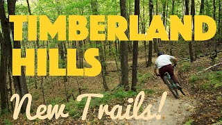
11:55 |
104 |
Jun 25, 2025
Recent Trail Reports
| status | trail | date | condition | info | user |
|---|---|---|---|---|---|
| Whipsaw Timberland Hills | Nov 16, 2025 @ 11:07am (America/Atikokan) Nov 16, 2025 | Ideal | aweldum | ||
| Crosscut 1 Timberland Hills | Nov 16, 2025 @ 11:07am (America/Atikokan) Nov 16, 2025 | Ideal | aweldum | ||
| Kickback Timberland Hills | Nov 16, 2025 @ 11:07am (America/Atikokan) Nov 16, 2025 | Ideal | aweldum | ||
| Timber Beast Timberland Hills | Nov 15, 2025 @ 12:59pm (America/Atikokan) Nov 15, 2025 | Ideal | JohnRM7PYI | ||
| Chutes and Ladders Timberland Hills | Jul 11, 2025 @ 10:37am Jul 11, 2025 | Ideal | markwakeling | ||
| Charlie Girl Timberland Hills | Jul 11, 2025 @ 10:37am Jul 11, 2025 | Ideal | markwakeling | ||
| Jillpole Timberland Hills | Jul 11, 2025 @ 10:37am Jul 11, 2025 | Ideal | markwakeling | ||
| Crosscut 2 Timberland Hills | May 25, 2025 @ 10:34am May 25, 2025 | Ideal | whitet777 | ||
| Sawdust Timberland Hills | May 25, 2025 @ 10:34am May 25, 2025 | Ideal | whitet777 | ||
| Log Jack Timberland Hills | May 25, 2025 @ 10:34am May 25, 2025 | Ideal | whitet777 |
Activity Feed
| username | action | type | title | date |
|---|---|---|---|---|
| grilled672 | ridden | trail | activity #96404283 and 3 more | Jun 6, 2026 @ 1:57pm Jun 6, 2026 |
| Matthiasv48Djr | add | photo | activity #95679789 | May 27, 2026 @ 7:11pm May 27, 2026 |
| BikingBoarderCollie | ridden | trail | activity #95574037 and 1 more | May 26, 2026 @ 10:27am May 26, 2026 |
| BikingBoarderCollie | comment | trail | activity #95574034 | May 26, 2026 @ 10:27am May 26, 2026 |
| BikingBoarderCollie | ridden | trail | activity #95562435 and 11 more | May 26, 2026 @ 7:11am May 26, 2026 |
Recent Comments
| username | type | title | comment | date |
|---|---|---|---|---|
| trail | DA DONUT! | May 26, 2026 @ 10:27am May 26, 2026 | ||
| trail | Really neat trail, drop at the start is mellow... | May 26, 2026 @ 9:26am May 26, 2026 | ||
| trail | A couple optional drops (under a foot),... | May 26, 2026 @ 7:12am May 26, 2026 | ||
| trail | Neat little flow my trail, berms and some... | May 26, 2026 @ 7:11am May 26, 2026 | ||
| trail | Incredible berms and tabletop jumps mixed with... | May 15, 2026 @ 6:09pm May 15, 2026 |
Local Badges
-

Completionist9 awarded -

Epic Mountain Bike Climb 2k0 awarded -

Climbing 10k Badge0 awarded -

Mountain Biking 100k Badge0 awarded -

Epic Ride Descent 2k0 awarded -

Descent 10k Badge0 awarded
Activity Type Stats
| activitytype | trails | distance | descent | descent distance | total vertical | rating | global rank | state rank | photos | reports | routes | ridelogs |
|---|---|---|---|---|---|---|---|---|---|---|---|---|
| Mountain Bike | 34 | 42 miles | 2,963 ft | 14 miles | 525 ft | 55 | 123 | 1 | 818 | |||
| E-Bike | 17 | 31 miles | 2,083 ft | 11 miles | 525 ft | 120 | 39 | |||||
| Horse | 1 | 3 | ||||||||||
| Hike | 51 | 59 miles | 4,196 ft | 22 miles | 541 ft | 1 | 123 | 63 | ||||
| Trail Running | 51 | 59 miles | 4,196 ft | 22 miles | 541 ft | 123 | 11 | |||||
| Snowshoe | 17 | 16 miles | 1,165 ft | 8 miles | 518 ft | 1 | 10 | |||||
| Backcountry Ski | 1 | 13 miles | 344 ft | 4 miles | 56 ft | |||||||
| Nordic Ski | 16 | 30 miles | 1,575 ft | 12 miles | 479 ft | 48 |
Frequently Asked Questions About Burnett County
▼
What are the best places to ride in Burnett County?
Burnett County has 3 areas to explore for mountain biking. The top rated areas are:
▼
What are the highest rated mountain biking trails in Burnett County?
The highest rated mountain biking trails in Burnett County are:
- Kickback (4.1/5)
- Stumpy (4.1/5)
- Fernhopper (4.1/5)
- Chutes and Ladders (4.1/5)
- Dogtown Cluster/Bear Lake Loop Conntector (4.1/5)
▼
What is the best time of the year to ride in Burnett County?
Based on ride log data, the most popular months to ride in Burnett County are:
- July (8 activities)
- October (4 activities)
- May (4 activities)
▼
What is the longest trail in Burnett County?
The longest trail in Burnett County is Timber Beast at 7.1 miles. View all trails sorted by distance.
Activities
- By brenthillier
 NSMBA TRAILFORKS & contributors
 - Admins: MW HIKING, feardabeast, CAMBA, CORBA
- #10945 - 2,982 views
- burnett county activity log | embed map of Burnett County mountain bike trails | burnett county mountain biking points of interest
Downloading of trail gps tracks in kml & gpx formats is enabled for Burnett County.
You must login to download files.