close
-
Layers w
- Weather Layers
- Pro
- Pro
- Pro
- Pro
- Pro
- Pro
- More Layers
- Pro
- Pro
- Pro
- Pro
-
Upgrade to

3D
Trail Conditions
- Unknown
- Snow Groomed
- Snow Packed
- Snow Covered
- Snow Cover Partial
- Freeze/thaw Cycle
- Icy
- Prevalent Mud
- Wet
- Variable
- Ideal
- Dry
- Very Dry
Trail Flow (Ridden Direction)
Trailforks scans users ridelogs to determine the most popular direction each trail is ridden. A good flowing trail network will have most trails flowing in a single direction according to their intension.
The colour categories are based on what percentage of riders are riding a trail in its intended direction.
The colour categories are based on what percentage of riders are riding a trail in its intended direction.
- > 96%
- > 90%
- > 80%
- > 70%
- > 50%
- < 50%
- bi-directional trail
- no data
Trail Last Ridden
Trailforks scans ridelogs to determine the last time a trail was ridden.
- < 2 days
- < 1 week
- < 2 weeks
- < 1 month
- < 6 months
- > 6 months
Trail Ridden Direction
The intended direction a trail should be ridden.
- Downhill Only
- Downhill Primary
- Both Directions
- Uphill Primary
- Uphill Only
- One Direction
Contribute Details
Colors indicate trail is missing specified detail.
- Description
- Photos
- Description & Photos
- Videos
Trail Popularity ?
Trailforks scans ridelogs to determine which trails are ridden the most in the last 9 months.
Trails are compared with nearby trails in the same city region with a possible 25 colour shades.
Think of this as a heatmap, more rides = more kinetic energy = warmer colors.
- most popular
- popular
- less popular
- not popular
ATV/ORV/OHV Filter
Max Vehicle Width
inches
US Cell Coverage
Legend

Radar Time
Activity Recordings
Trailforks uses anonymized public activity data.
?
Activity Recordings
Trailforks uses anonymized public activity data.
?
Personal Heatmap
▶
Activity Types
all
/
none
▶
Options
2
Date range
month
–
Winter Trails
Warning
A routing network for winter maps does not exist. Selecting trails using the winter trails layer has been disabled.
Missing Trails
Most Popular
Least Popular
Trails are colored based on popularity. The more popular a trail is, the more red. Less popular trails trend towards green.
Jump Magnitude Heatmap
Heatmap of where riders jump on trails. Zoom in to see individual jumps, click circles to view jump details.
BC Backroad Status
![map legend]()
Service Road Atlas is a free to use, community-driven service for viewing and creating reports on the numerous back-country service roads around B.C. and Alberta.

Slope Aspect
Direction the slope faces
Trails Deemphasized
Trails are shown in grey.
Only show trails with no bike usage.
Suggested Layers
Based on selected activity type
Save the current map location and zoom level as your default home location whenever this page is loaded.
SaveTrails here range from Intermediate through to Expert. Suitable for downhill and trail bikes.
Primary Trail Type: All-Mountain & Downhill
Land Status: City Managed
 google parking directions
 Access Info:
Head south from New Plymouth on SH3 for about 10km before turning right onto Kent Rd (at the Transport Museum). 4km down Kent Rd turn right onto Scout Rd. Park at the end of the road.
Links
Activities Click to view
- Mountain Bike
28 trails
- E-Bike
10 trails
- Hike
2 trails
- Trail Running
2 trails
Region Details
- 3
- 11
- 3
- 5
- 3
Region Status
Open as of Apr 26, 2026Local Trail Association
Stats
- Avg Trail Rating
- Trails (view details)
- 28
- Trails Mountain Bike
- 28
- Trails E-Bike
- 10
- Trails Hike
- 2
- Trails Trail Running
- 2
- Total Distance
- 6 miles
- Total Descent
- 2,963 ft
- Total Vertical
- 416 ft
- Highest Trailhead
- 1,001 ft
- Reports
- 223
- Photos
- 53
- Ridden Counter
- 1,283
Popular Busing Forest Mountain Biking Trails
• 55 ★ 3.0 • 1,293 ft • 0 ft • 67 •
Moderately popular blue difficulty singletrack. This mountain bike primary trail can be used downhill primary. On average it takes 2 minutes to complete this trail.
• 50 ★ 3.0 • 3,776 ft • 286 ft • 59 •
Moderately popular blue difficulty singletrack. This mountain bike primary trail can be used one direction and has a moderate overall physical rating with a 286 ft blue climb. It features berm, drop and jump. On average it takes 9 minutes to complete this trail.
• 65 ★ 4.0 • 807 ft • 0 ft • 57 •
Moderately popular blue difficulty singletrack. This mountain bike primary trail can be used downhill only. On average it takes 1 minutes to complete this trail.
• 30 ★ 4.7 • 1,476 ft • 27 ft • 57 •
Less popular blue difficulty singletrack. This mountain bike primary trail can be used downhill primary. It features berm and drop. On average it takes 7 minutes to complete this trail.
• 85 ★ 3.0 • 650 ft • 0 ft • 56 •
Popular blue difficulty singletrack. This mountain bike primary trail can be used both directions. On average it takes 3 minutes to complete this trail.
• 80 ★ 4.0 • 623 ft • 0 ft • 54 •
Popular proline difficulty singletrack. This mountain bike primary trail can be used one direction. It features berm, bridge, drop and gap jump. On average it takes 3 minutes to complete this trail.
• 75 ★ 4.0 • 636 ft • 0 ft • 53 •
Popular double black diamond difficulty singletrack. This mountain bike primary trail can be used one direction. It features gap jump. On average it takes 3 minutes to complete this trail.
• 70 ★ 3.0 • 538 ft • 0 ft • 52 •
Popular blue difficulty singletrack. This mountain bike primary trail can be used one direction. It features berm. On average it takes 2 minutes to complete this trail.
Busing Forest Mountain Bike Routes
• 4 miles • 761 ft • 40 •
• 3 miles • 722 ft • 16 •
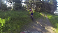
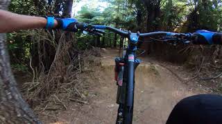
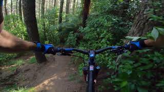
Photos of Busing Forest Mountain Bike
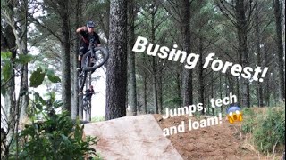
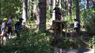
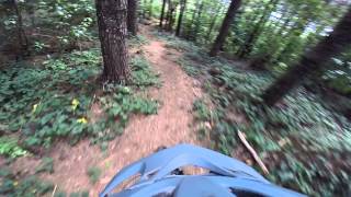
Videos of Busing Forest Mountain Bike

trail: Captain America
2:18 |
483 |
Jan 8, 2016
trail: Flow
0:28 |
487 |
Jan 2, 2014
trail: Captain America
7:17 |
362 |
Jan 6, 2021 , New Plymouth
trail: B-Line
4:36 |
271 |
Jan 6, 2021 , New Plymouth
trail: Hilltop
0:32 |
257 |
Aug 19, 2020 , New Plymouth
trail: Hard Case
0:17 |
606 |
Aug 18, 2020 , New Plymouth
trail: I90
0:14 |
372 |
Aug 18, 2020 , New Plymouth

trail: Hard Case
7:17 |
480 |
Feb 28, 2020 , New Plymouth
Recent Trail Reports
| status | trail | date | condition | info | user |
|---|---|---|---|---|---|
| Unfinished Business Extension | Mar 9, 2023 @ 8:30am Mar 9, 2023 | Ideal | Weehav123 | ||
| B-Line | Mar 9, 2023 @ 8:30am Mar 9, 2023 | Ideal | Weehav123 | ||
| Unfinished Business | Mar 9, 2023 @ 8:30am Mar 9, 2023 | Ideal | Weehav123 | ||
| Flow | Mar 9, 2023 @ 8:30am Mar 9, 2023 | Variable | Weehav123 | ||
| Gravel Road Return To The Top | Mar 9, 2023 @ 8:30am Mar 9, 2023 | Ideal | Weehav123 | ||
| DH route 2 (Tech/Avoiding Gap Jumps) | Mar 9, 2023 @ 8:30am Mar 9, 2023 | Variable | Weehav123 | ||
| I90 | Mar 9, 2023 @ 8:30am Mar 9, 2023 | Prevalent Mud | Weehav123 | ||
| D hill | Mar 9, 2023 @ 8:30am Mar 9, 2023 | Variable | Weehav123 | ||
| Access trail (Captain America, I90, D hill | Mar 9, 2023 @ 4:30pm Mar 9, 2023 | Ideal | Weehav123 | ||
| Flow Section 2 | Jan 22, 2022 @ 10:13am Jan 22, 2022 | Ideal | thebevinator |
Activity Feed
| username | action | type | title | date |
|---|---|---|---|---|
| jamiegX65TJ | ridden | trail | activity #67618563 | Mar 11, 2025 @ 6:33pm Mar 11, 2025 |
| GwimWeeper | wishlist | skillpark | activity #63290878 | Dec 20, 2024 @ 8:31pm Dec 20, 2024 |
| Eversnow | ridden | trail | activity #60399269 and 8 more | Oct 12, 2024 @ 10:35pm Oct 12, 2024 |
| Isaacaroonironaburgarina | wishlist | region | activity #58678927 | Sep 10, 2024 @ 8:17pm Sep 10, 2024 |
| jamiegX65TJ | ridden | trail | activity #58230922 and 1 more | Sep 2, 2024 @ 2:13pm Sep 2, 2024 |
Recent Comments
| username | type | title | comment | date |
|---|---|---|---|---|
| trail | Flowy trail with hump gaps | Jun 26, 2022 @ 1:45am Jun 26, 2022 | ||
| trail | Flowy trails with roots and some drops | Jun 26, 2022 @ 1:43am Jun 26, 2022 | ||
| trail | Very steep and tight sections | Jun 26, 2022 @ 1:39am Jun 26, 2022 | ||
| trail | Flowy and long trail | Jun 26, 2022 @ 1:31am Jun 26, 2022 | ||
| trail | Steep, muddy and overgrown | Jun 26, 2022 @ 12:21am Jun 26, 2022 |
Nearby Areas
| name | distance | ||||
|---|---|---|---|---|---|
| Mangamahoe Mountain Bike Park | 17 | 45 | 5 | 4 | 3.1 km |
Local Badges
-

Completionist9 awarded
Bike & Skill Parks
| name | type | city | rating |
|---|---|---|---|
| Busing Forest Skills Park | skill park | New Plymouth |
Activity Type Stats
| activitytype | trails | distance | descent | descent distance | total vertical | rating | global rank | state rank | photos | reports | routes | ridelogs |
|---|---|---|---|---|---|---|---|---|---|---|---|---|
| Mountain Bike | 28 | 6 miles | 2,963 ft | 4 miles | 417 ft | #4,277 | #96 | 53 | 223 | 1 | 714 | |
| E-Bike | 10 | 2 miles | 971 ft | 1 mile | 318 ft | #4,959 | #116 | 133 | 67 | |||
| Hike | 2 | 4,121 ft | 279 ft | 2,461 ft | 279 ft | #10,296 | #201 | 211 | 23 | |||
| Trail Running | 2 | 4,121 ft | 279 ft | 2,461 ft | 279 ft | #9,448 | #183 | 211 |
Frequently Asked Questions About Busing Forest
▼
What are the highest rated mountain biking trails in Busing Forest?
The highest rated mountain biking trails in Busing Forest are:
- River Run (4.2/5)
- Unfinished Business Extension (4.1/5)
- I90 alternative route (4.1/5)
- Unfinished Business (4.1/5)
- Romaniacs (4.1/5)
▼
What is the best time of the year to ride in Busing Forest?
Based on ride log data, the most popular months to ride in Busing Forest are:
- December (6 activities)
- November (5 activities)
- August (4 activities)
▼
Where can I park to ride in Busing Forest?
There are 1 parking locations listed in Busing Forest. The most popular parking spots are:
▼
What is the longest trail in Busing Forest?
The longest trail in Busing Forest is AM Loop at 3,776 ft. View all trails sorted by distance.
- By YogiNZ & contributors
- Admins: NPMB
- #7868 - 8,860 views
- busing forest activity log | embed map of Busing Forest mountain bike trails | busing forest mountain biking points of interest
Downloading of trail gps tracks in kml & gpx formats is enabled for Busing Forest.
You must login to download files.