close
-
Layers w
- Weather Layers
- Pro
- Pro
- Pro
- Pro
- Pro
- Pro
- More Layers
- Pro
- Pro
- Pro
- Pro
-
Upgrade to

3D
Trail Conditions
- Unknown
- Snow Groomed
- Snow Packed
- Snow Covered
- Snow Cover Partial
- Freeze/thaw Cycle
- Icy
- Prevalent Mud
- Wet
- Variable
- Ideal
- Dry
- Very Dry
Trail Flow (Ridden Direction)
Trailforks scans users ridelogs to determine the most popular direction each trail is ridden. A good flowing trail network will have most trails flowing in a single direction according to their intension.
The colour categories are based on what percentage of riders are riding a trail in its intended direction.
The colour categories are based on what percentage of riders are riding a trail in its intended direction.
- > 96%
- > 90%
- > 80%
- > 70%
- > 50%
- < 50%
- bi-directional trail
- no data
Trail Last Ridden
Trailforks scans ridelogs to determine the last time a trail was ridden.
- < 2 days
- < 1 week
- < 2 weeks
- < 1 month
- < 6 months
- > 6 months
Trail Ridden Direction
The intended direction a trail should be ridden.
- Downhill Only
- Downhill Primary
- Both Directions
- Uphill Primary
- Uphill Only
- One Direction
Contribute Details
Colors indicate trail is missing specified detail.
- Description
- Photos
- Description & Photos
- Videos
Trail Popularity ?
Trailforks scans ridelogs to determine which trails are ridden the most in the last 9 months.
Trails are compared with nearby trails in the same city region with a possible 25 colour shades.
Think of this as a heatmap, more rides = more kinetic energy = warmer colors.
- most popular
- popular
- less popular
- not popular
ATV/ORV/OHV Filter
Max Vehicle Width
inches
US Cell Coverage
Legend

Radar Time
Activity Recordings
Trailforks uses anonymized public activity data.
?
Activity Recordings
Trailforks uses anonymized public activity data.
?
Personal Heatmap
▶
Activity Types
all
/
none
▶
Options
2
Date range
month
–
Winter Trails
Warning
A routing network for winter maps does not exist. Selecting trails using the winter trails layer has been disabled.
Missing Trails
Most Popular
Least Popular
Trails are colored based on popularity. The more popular a trail is, the more red. Less popular trails trend towards green.
Jump Magnitude Heatmap
Heatmap of where riders jump on trails. Zoom in to see individual jumps, click circles to view jump details.
BC Backroad Status
![map legend]()
Service Road Atlas is a free to use, community-driven service for viewing and creating reports on the numerous back-country service roads around B.C. and Alberta.

Slope Aspect
Direction the slope faces
Trails Deemphasized
Trails are shown in grey.
Only show trails with no bike usage.
Suggested Layers
Based on selected activity type
Save the current map location and zoom level as your default home location whenever this page is loaded.
Save
No description for Butler has been added yet!
Login or register to submit one.
Activities Click to view
- Mountain Bike
43 trails
- Adaptive Bike
0 trails
- Winter Fat Bike
0 trails
- Hike
37 trails
- Trail Running
37 trails
Region Details
- 1
- 1
- 15
- 21
- 5
Region Status
Open as of Jun 13, 2026Stats
- Avg Trail Rating
- Trails (view details)
- 43
- Trails Mountain Bike
- 43
- Trails Hike
- 37
- Trails Trail Running
- 37
- Trails Snowshoe
- 1
- Total Distance
- 45 miles
- Total Descent
- 2,614 ft
- Total Vertical
- 617 ft
- Highest Trailhead
- 1,385 ft
- Reports
- 599
- Photos
- 19
- Ridden Counter
- 13,169
Sub Regions
-
Alameda Park
- 14
- 20
- 5
Popular Butler Mountain Biking Trails
• 5 ★ 5.0 • 2,546 ft • 0 ft • 457 •
Highly rated less popular black diamond difficulty singletrack. This mountain bike primary trail can be used downhill only. On average it takes 2 minutes to complete this trail.
• 70 ★ 4.5 • 705 ft • 73 ft • 438 •
Popular blue difficulty singletrack. This mountain bike primary trail can be used both directions. On average it takes 1 minutes to complete this trail.
• 95 ★ 4.0 • 1,007 ft • 0 ft • 434 •
Popular blue difficulty singletrack. This mountain bike primary trail can be used both directions and has a moderate overall physical rating with a 0 ft blue climb. On average it takes 1 minutes to complete this trail.
• 75 ★ 4.8 • 1,736 ft • 2 ft • 416 •
Popular black diamond difficulty singletrack. This mountain bike primary trail can be used downhill only. It features berm, jump, rock garden and roller coaster. On average it takes 2 minutes to complete this trail.
• 50 ★ 4.4 • 2,034 ft • 79 ft • 407 •
Moderately popular blue difficulty singletrack. This mountain bike primary trail can be used both directions. On average it takes 3 minutes to complete this trail.
• 85 ★ 5.0 • 1,542 ft • 121 ft • 397 •
Primarily a climbing trail to access the other trails. takes a slightly more scenic route near the top to break from climbing and get to the same destination.
• 100 ★ 5.0 • 787 ft • 6 ft • 390 •
Popular green difficulty singletrack. This mountain bike primary trail can be used both directions. On average it takes 1 minutes to complete this trail.
• 50 ★ 4.4 • 1,834 ft • 0 ft • 390 •
Moderately popular black diamond difficulty singletrack. This mountain bike primary trail can be used downhill only. It features jump and roller coaster. On average it takes 2 minutes to complete this trail.
Butler Mountain Bike Routes
Alameda Overview Ride 1 Featured
★ 4.8 • 10 miles • 1,006 ft • 20 •
This is a suggested way to ride the Alameda Singletrack trails in Alameda Park in Butler, PA. If you're a...
★ 5.0 • 10 miles • 1,109 ft • 21 • Loop •
This route is a decent 10-mile loop starting out at the southern end of Oddfellows Circle. The starting...
10 miles • 1,164 ft • 20 •
This route favors mileage without repeating too much. 3 of the 4 one way trails are reserved for the end...
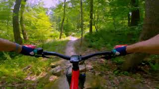
Photos of Butler Mountain Bike
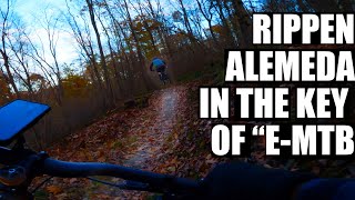
Videos of Butler Mountain Bike
trail: Country Club
249 |
Jun 21, 2023 , Butler

trail: Go With the Flow
280 |
Jun 21, 2023 , Butler

trail: Turn Down for What
272 |
Jun 21, 2023 , Butler

trail: Flying Squirrel
2:15 |
562 |
Jun 21, 2023 , Butler

trail: Janis Jumpline
28:54 |
317 |
Jul 27, 2022 , Butler

trail: Turn Down for What
28:54 |
296 |
Jul 27, 2022 , Butler
trail: Country Club
28:54 |
235 |
Jul 27, 2022 , Butler

trail: Alien Armpit
28:54 |
216 |
Jul 27, 2022 , Butler
Recent Trail Reports
| status | trail | date | condition | info | user |
|---|---|---|---|---|---|
| Flying Squirrel | Jun 13, 2026 @ 5:26pm (America/New_York) Jun 13, 2026 | Wet | JC03 | ||
| Lift Ticket | May 31, 2026 @ 4:26pm (America/New_York) May 31, 2026 | Unknown | ddiaz312 | ||
| Turn Down for What | May 31, 2026 @ 4:12pm (America/New_York) May 31, 2026 | Unknown | ddiaz312 | ||
| Alien Armpit | May 31, 2026 @ 3:40pm (America/New_York) May 31, 2026 | Unknown | ddiaz312 | ||
| Pool Boy | Sep 21, 2025 @ 10:31am (America/New_York) Sep 21, 2025 | Ideal | RobHull1 | ||
| Jesse's Girl | Sep 21, 2025 @ 10:31am (America/New_York) Sep 21, 2025 | Ideal | RobHull1 | ||
| Graveyard Shift | Sep 21, 2025 @ 10:31am (America/New_York) Sep 21, 2025 | Ideal | RobHull1 | ||
| Inner Space | Sep 21, 2025 @ 10:31am (America/New_York) Sep 21, 2025 | Ideal | RobHull1 | ||
| Pay to Play | Sep 21, 2025 @ 10:31am (America/New_York) Sep 21, 2025 | Ideal | RobHull1 | ||
| Return to Sender | Sep 21, 2025 @ 10:31am (America/New_York) Sep 21, 2025 | Ideal | RobHull1 |
Activity Feed
| username | action | type | title | date |
|---|---|---|---|---|
| JC03 | add | report | activity #96916656 | Jun 13, 2026 @ 2:26pm Jun 13, 2026 |
| smac85 | wishlist | route | activity #96213592 | Jun 4, 2026 @ 3:09am Jun 4, 2026 |
| ddiaz312 | comment | report | activity #95993034 | May 31, 2026 @ 6:34pm May 31, 2026 |
| ddiaz312 | add | report | activity #95969048 and 2 more | May 31, 2026 @ 12:40pm May 31, 2026 |
| StephenIjYhzx | wishlist | region | activity #95884841 | May 30, 2026 @ 1:53pm May 30, 2026 |
Recent Comments
| username | type | title | comment | date |
|---|---|---|---|---|
| report | Was actually on rainbows and unicorns | May 31, 2026 @ 6:34pm May 31, 2026 | ||
| report | No, it's been closed most of the season due to... | Nov 22, 2025 @ 5:29pm Nov 22, 2025 | ||
| report | Was this just closed for Month of Mud? | Oct 6, 2025 @ 6:21am Oct 6, 2025 | ||
| trail | Tree down just past drop in right before the... | Jul 21, 2025 @ 12:44pm Jul 21, 2025 | ||
| report | Appears to be cleared. | Oct 14, 2024 @ 8:08am Oct 14, 2024 |
Local Badges
-

Completionist41 awarded -

10 Blue Trails215 awarded -

Epic Mountain Bike Climb 2k3 awarded -

Climbing 10k Badge19 awarded -

Mountain Biking 100k Badge1 awarded -

Epic Ride Descent 2k3 awarded
Activity Type Stats
| activitytype | trails | distance | descent | descent distance | total vertical | rating | global rank | state rank | photos | reports | routes | ridelogs |
|---|---|---|---|---|---|---|---|---|---|---|---|---|
| Mountain Bike | 43 | 45 miles | 2,615 ft | 16 miles | 617 ft | #1,487 | #562 | 19 | 599 | 3 | 5,009 | |
| Hike | 37 | 42 miles | 2,051 ft | 14 miles | 617 ft | #5,750 | #2,022 | 573 | 1 | 54 | ||
| Trail Running | 37 | 42 miles | 2,051 ft | 14 miles | 617 ft | #5,173 | #1,621 | 573 | 1 | 41 | ||
| Snowshoe | 1 | 9 miles | 213 ft | 3 miles | 472 ft | 6 |
Frequently Asked Questions About Butler
▼
What are the best places to ride in Butler?
Butler has 1 areas to explore for mountain biking. The top rated areas are:
▼
What are the highest rated mountain biking trails in Butler?
The highest rated mountain biking trails in Butler are:
- Flying Squirrel (4.5/5)
- Country Club (4.4/5)
- Janis Jumpline (4.3/5)
- Alien Armpit (4.3/5)
- Twisted Sister (4.2/5)
▼
What is the best time of the year to ride in Butler?
Based on ride log data, the most popular months to ride in Butler are:
- October (82 activities)
- September (80 activities)
- June (58 activities)
▼
Where can I park to ride in Butler?
There are 5 parking locations listed in Butler. The most popular parking spots are: View all parking and trailhead locations on the map to plan your visit.
- By brenthillier
 NSMBA TRAILFORKS & contributors
 - Admins: apply
- #11953 - 5,061 views
- butler activity log | embed map of Butler mountain bike trails | butler mountain biking points of interest
Downloading of trail gps tracks in kml & gpx formats is enabled for Butler.
You must login to download files.