close
-
Layers w
- Weather Layers
- Pro
- Pro
- Pro
- Pro
- Pro
- Pro
- More Layers
- Pro
- Pro
- Pro
- Pro
-
Upgrade to

3D
Trail Conditions
- Unknown
- Snow Groomed
- Snow Packed
- Snow Covered
- Snow Cover Partial
- Freeze/thaw Cycle
- Icy
- Prevalent Mud
- Wet
- Variable
- Ideal
- Dry
- Very Dry
Trail Flow (Ridden Direction)
Trailforks scans users ridelogs to determine the most popular direction each trail is ridden. A good flowing trail network will have most trails flowing in a single direction according to their intension.
The colour categories are based on what percentage of riders are riding a trail in its intended direction.
The colour categories are based on what percentage of riders are riding a trail in its intended direction.
- > 96%
- > 90%
- > 80%
- > 70%
- > 50%
- < 50%
- bi-directional trail
- no data
Trail Last Ridden
Trailforks scans ridelogs to determine the last time a trail was ridden.
- < 2 days
- < 1 week
- < 2 weeks
- < 1 month
- < 6 months
- > 6 months
Trail Ridden Direction
The intended direction a trail should be ridden.
- Downhill Only
- Downhill Primary
- Both Directions
- Uphill Primary
- Uphill Only
- One Direction
Contribute Details
Colors indicate trail is missing specified detail.
- Description
- Photos
- Description & Photos
- Videos
Trail Popularity ?
Trailforks scans ridelogs to determine which trails are ridden the most in the last 9 months.
Trails are compared with nearby trails in the same city region with a possible 25 colour shades.
Think of this as a heatmap, more rides = more kinetic energy = warmer colors.
- most popular
- popular
- less popular
- not popular
ATV/ORV/OHV Filter
Max Vehicle Width
inches
US Cell Coverage
Legend

Radar Time
Activity Recordings
Trailforks uses anonymized public activity data.
?
Activity Recordings
Trailforks uses anonymized public activity data.
?
Personal Heatmap
▶
Activity Types
all
/
none
▶
Options
2
Date range
month
–
Winter Trails
Warning
A routing network for winter maps does not exist. Selecting trails using the winter trails layer has been disabled.
Missing Trails
Most Popular
Least Popular
Trails are colored based on popularity. The more popular a trail is, the more red. Less popular trails trend towards green.
Jump Magnitude Heatmap
Heatmap of where riders jump on trails. Zoom in to see individual jumps, click circles to view jump details.
BC Backroad Status
![map legend]()
Service Road Atlas is a free to use, community-driven service for viewing and creating reports on the numerous back-country service roads around B.C. and Alberta.

Slope Aspect
Direction the slope faces
Trails Deemphasized
Trails are shown in grey.
Only show trails with no bike usage.
Suggested Layers
Based on selected activity type
Save the current map location and zoom level as your default home location whenever this page is loaded.
Save
No description for Butte has been added yet!
Login or register to submit one.
Activities Click to view
- Mountain Bike
295 trails
- E-Bike
139 trails
- Gravel Bike
0 trails
- Adaptive Bike
0 trails
- Winter Fat Bike
0 trails
- Horse
105 trails
- Hike
308 trails
- Trail Running
306 trails
- Dirtbike/Moto
159 trails
- ATV/ORV/OHV
161 trails
- Snowmobile
34 trails
- Snowshoe
27 trails
- Downhill Ski
1 trails
- Backcountry Ski
4 trails
- Nordic Ski
54 trails
Region Details
- 121
- 8
- 42
- 89
- 33
- 2
Region Status
Open as of 3 hoursStats
- Avg Trail Rating
- Trails (view details)
- 364
- Trails Mountain Bike
- 295
- Trails E-Bike
- 139
- Trails Horse
- 105
- Trails Hike
- 308
- Trails Trail Running
- 306
- Trails Dirtbike/Moto
- 159
- Trails ATV/ORV/OHV
- 161
- Trails Snowmobile
- 34
- Trails Snowshoe
- 27
- Trails Downhill Ski
- 1
- Trails Backcountry Ski
- 4
- Trails Nordic Ski
- 54
- Total Distance
- 776 miles
- Total Descent
- 107,677 ft
- Total Vertical
- 5,371 ft
- Highest Trailhead
- 10,087 ft
- Reports
- 1,889
- Photos
- 470
- Ridden Counter
- 12,370
Sub Regions
-
Divide
- 1
- 5
-
Highland Mountains
- 1
- 7
- 2
-
Maud S Canyon Trails
- 1
- 3
- 1
-
Montana Tech Open Space Butte Bike Park
- 5
- 13
- 11
- 1
-
Moulton Cross Country Ski Area
- 2
-
Mt Fleecer
- 5
- 24
- 10
- 1
-
North Butte Divide
- 11
-
Sheepshead Recreation Area
-
Thompson Park
- 14
- 14
-
Wasteland
- 1
- 2
- 1
Popular Butte Mountain Biking Trails
• 100 ★ 4.0 • 1 mile • 0 ft • 373 •
This fun single track drops down from and connects across MT Hwy 2 to the /Milwaukie Road/Sagebrush Flats area of Thompson Park. The descent is very fast with some off camber corners near the top and some tight switchbacks near the...
• 100 ★ 4.0 • 1 mile • 0 ft • 372 •
Known to locals as the Chimney Trail because near the top you will find the remains of an old chimney. Part of the , this side is less steep and curvy than the other side and is more commonly used as an ascent. There used to be a fun...
• 100 ★ 3.0 • 2,139 ft • 150 ft • 341 •
A short section of fun singletrack connects Parking Lot with the .
• 100 ★ 4.0 • 4,446 ft • 392 ft • 319 •
Popular green difficulty singletrack. This multi-use trail can be used both directions. On average it takes 11 minutes to complete this trail.
• 90 ★ 4.5 • 9 miles • 1,414 ft • 276 •
Classic Butte singletrack showcases some of the best of the CDT. Hard climbs, switchbacks, granite, sand, and amazing views make this a local favorite and the final 9 miles of the Butte 100 mountain bike race.
• 100 ★ 3.0 • 4,065 ft • 5 ft • 266 •
is a sandy doubletrack continuation of Rd. It leads to the upper most part of the park, the parking lot at the end of . It is possible to see ATV's on this trail, although it is a seldom occurrence due the locked gate on the side and...
• 100 ★ 0.0 • 292 ft • 0 ft • 260 •
John's Gulch is a fun and hilly loop to do on the lower part of Thompson Park. It is often looped with the using the top of and the Connector Trail.
• 95 ★ 2.0 • 1 mile • 92 ft • 253 • • atv
This allows for great loops using the CDT and Thompson Park Trails. Short but sweet, this trail has a very steep and loose start through trees and deep moto ruts with a smooth runout on an old jeep trail. Stay right at the bottom to...
Butte Mountain Bike Routes
★ 5.0 • 26 miles • 4,404 ft • 4 • Point to Point •
This ride is a Butte classic that has you traversing the East Ridge of the Continental Divide Trail (CDT)....
17 miles • 1,581 ft • 1 • Loop •
On this great gravel bike loop you will spend about half your time on gravel and half on pavement. There...
12 miles • 1,615 ft • 7 • Loop •
This is our Highlands Cycling Club Race Night Course for Wednesday August 2nd. The route starts at the top...
3 miles • 552 ft • 3 • Loop •
This is a perfect 5km loop in the lower part of Thompson Park, great for hikers and runners, but can also...
13 miles • 1,951 ft • 4 • Loop •
The focus of this ride is "Zelda" AKA , a fun and flowy slightly technical ridge trail flanked by...
68 miles • 5,678 ft • 7 • Shuttled •
This is the the portion of the Great Divide Mountain Bike Route within the borders of Silver Bow County,...
Photos of Butte Mountain Bike
Videos of Butte Mountain Bike

trail: Upper Maud S Canyon
6:30 |
84 |
Jun 29, 2023
trail: Sketchy TwoTrack
2:39 |
|
Jan 26, 2022
trail: Neversweat
2:14 |
196 |
Dec 6, 2018

trail: CDT - Pipestone-Homestake
14:24 |
476 |
May 30, 2023 , Butte

trail: CDT - Pipestone-Homestake
17:42 |
263 |
May 30, 2023 , Butte
youtuber
![The Hardest Ride I’ve Ever Done | The Butte...]()

trail: Grading Camp Trail
28:56 |
273 |
Jul 22, 2022 , Butte
youtuber
![Riding Some Of The Best Groomed Trails In...]()

trail: John's Gulch
12:41 |
205 |
Jul 20, 2022 , Butte
youtuber
![Riding Some Of The Best Groomed Trails In...]()

12:41 |
201 |
Jul 20, 2022 , Butte
Current Trail Warnings
| status | trail | date | condition | user | info |
|---|---|---|---|---|---|
| CDT - Lowland to Four Corners | Jun 17, 2026 @ 3:17pm (America/Denver) 3 hours | Dry | HHskier | This section is mostly clear of downfall... |
Recent Trail Reports
| status | trail | date | condition | info | user |
|---|---|---|---|---|---|
| CDT - Fairy Trail | Jun 16, 2026 @ 8:59am (America/Denver) 1 day | Unknown | KyleqUv5NZ | ||
| Milwaukee Road | Jun 14, 2026 @ 12:55pm (America/Boise) Jun 14, 2026 | Dry | brianp1983 | ||
| CDT - 8 Miles of Hell | Jun 10, 2026 @ 7:48am (America/Denver) Jun 10, 2026 | Unknown | KyleqUv5NZ | ||
| CDT - Bear Gulch to Highlands TH | Jun 10, 2026 @ 7:48am (America/Denver) Jun 10, 2026 | Unknown | KyleqUv5NZ | ||
| Beaver Ponds | May 22, 2026 @ 8:50am (America/Denver) May 22, 2026 | Ideal | MattinButte ATS | ||
| CDT - Pipestone-Homestake | May 20, 2026 @ 6:22am (America/Denver) May 20, 2026 | Unknown | KyleqUv5NZ | ||
| CDT - Fly Creek to Bear Gulch | May 18, 2026 @ 4:55pm (America/Denver) May 18, 2026 | Ideal | HHskier | ||
| CDT - Four Corners to Champion Pass | May 13, 2026 @ 8:16pm (America/Denver) May 13, 2026 | Ideal | HHskier | ||
| Upper Maud S Canyon | May 6, 2026 @ 7:03pm (America/Denver) May 6, 2026 | Variable | Sutton1988 | ||
| Blacktail Ridge Trail | May 5, 2026 @ 8:03am (America/Denver) May 5, 2026 | Ideal | KyleqUv5NZ |
National Scenic Trails & Official Routes
-
Continental Divide Trail
- Mountain Bike
- Hike
- Trail Running

Activity Feed
| username | action | type | title | date |
|---|---|---|---|---|
| HHskier | add | report | activity #97209452 | Jun 17, 2026 @ 2:24pm 2 hours |
| KyleqUv5NZ | add | report | activity #97110616 | Jun 16, 2026 @ 7:59am 1 day |
| brianp1983 | add | report | activity #97057495 | Jun 15, 2026 @ 12:00pm 2 days |
| MattinButte | update | trail | activity #97036315 | Jun 15, 2026 @ 6:15am 2 days |
| bmilly | ridden | trail | activity #97008414 | Jun 14, 2026 @ 3:20pm Jun 14, 2026 |
Recent Comments
| username | type | title | comment | date |
|---|---|---|---|---|
| trail | Any updates on if this trail is clear yet? Thanks | May 25, 2026 @ 12:34pm May 25, 2026 | ||
| trail | Tried to ride this on May 15,2026, lots of... | May 25, 2026 @ 12:32pm May 25, 2026 | ||
| report | Those trees were cleared NORTH of Pipestone... | Apr 20, 2026 @ 3:33pm Apr 20, 2026 | ||
| report | Biggest pet peeve are those that cut trees too... | Apr 20, 2026 @ 8:32am Apr 20, 2026 | ||
| trail | Skeeboggen is a wonderful old school flowy... | Oct 5, 2025 @ 8:44pm Oct 5, 2025 |
Local Badges
-

Butte 50 Racecourse8 awarded -

Sorini 25 Racecourse12 awarded -

The East Ridge2 awarded -

Butte 100 Racecourse0 awarded -

Thompson Park Completionist0 awarded -
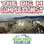
The 'M' Completionist1 awarded
Activity Type Stats
| activitytype | trails | distance | descent | descent distance | total vertical | rating | global rank | state rank | photos | reports | routes | ridelogs |
|---|---|---|---|---|---|---|---|---|---|---|---|---|
| Mountain Bike | 295 | 721 miles | 101,542 ft | 306 miles | 5,371 ft | #241 | #85 | 443 | 1,888 | 34 | 14,059 | |
| E-Bike | 139 | 413 miles | 52,024 ft | 172 miles | 4,760 ft | #211 | #669 | 1 | 789 | 9 | 172 | |
| Horse | 105 | 395 miles | 51,158 ft | 159 miles | 4,360 ft | #40 | #330 | 521 | 4 | |||
| Hike | 308 | 731 miles | 102,910 ft | 310 miles | 5,371 ft | #112 | #66 | 4 | 1,886 | 18 | 700 | |
| Trail Running | 306 | 727 miles | 101,047 ft | 307 miles | 5,371 ft | #90 | #46 | 9 | 1,884 | 20 | 986 | |
| Dirtbike/Moto | 159 | 516 miles | 66,719 ft | 212 miles | 4,984 ft | #26 | #12 | 5 | 458 | 4 | 11 | |
| ATV/ORV/OHV | 161 | 509 miles | 66,250 ft | 210 miles | 4,984 ft | #8 | #6 | 450 | 3 | 12 | ||
| Snowmobile | 34 | 150 miles | 18,753 ft | 58 miles | 3,350 ft | #32 | #23 | 18 | 1 | 3 | ||
| Snowshoe | 27 | 38 miles | 4,534 ft | 16 miles | 2,146 ft | #522 | #191 | 20 | 7 | |||
| Downhill Ski | 1 | 2 miles | 75 ft | 2,461 ft | 187 ft | #692 | #333 | 5 | ||||
| Backcountry Ski | 4 | 14 miles | 1,585 ft | 7 miles | 1,499 ft | #434 | #101 | 1 | 31 | |||
| Nordic Ski | 54 | 28 miles | 3,123 ft | 11 miles | 1,644 ft | #427 | #123 | 17 | 333 |
Frequently Asked Questions About Butte
▼
What are the best places to ride in Butte?
Butte has 12 areas to explore for mountain biking. The top rated areas are:
▼
What are the highest rated mountain biking trails in Butte?
The highest rated mountain biking trails in Butte are:
- CDT - Homestake to top of Maud-S (4.4/5)
- CDT - 8 Miles of Hell (4.3/5)
- CDT - Pipestone-Homestake (4.3/5)
- CDT - Fairy Trail (4.2/5)
- BA&P Hill Trail (4.1/5)
▼
What is the best time of the year to ride in Butte?
Based on ride log data, the most popular months to ride in Butte are:
- July (272 activities)
- August (200 activities)
- June (198 activities)
▼
Where can I park to ride in Butte?
Activities
Trails
Points of Interest
- [river crossing] Jerry Creek Other
- Rock Slab TTF
- Little Moab TTF
- Rock slabs TTF
- Homestake Yurt Cabin
- Queen of the Hills Mine Other
- [river crossing] Jerry Creek Other
- [river crossing] Long Tom Creek Other
- Bridge across Long Tom Creek
- [river crossing] Jerry Creek Other
- Table Mountain (10,213 ft)
- Red Mountain (10,023 ft)
- East Peak (9,898 ft)
- By DanishHeat
 & contributors
 - Admins: ATS, FTP
- #7326 - 26,178 views
- butte activity log | embed map of Butte mountain bike trails | butte mountain biking points of interest polygons
Downloading of trail gps tracks in kml & gpx formats is enabled for Butte.
You must login to download files.