close
-
Layers w
- Weather Layers
- Pro
- Pro
- Pro
- Pro
- Pro
- Pro
- More Layers
- Pro
- Pro
- Pro
- Pro
-
Upgrade to

3D
Trail Conditions
- Unknown
- Snow Groomed
- Snow Packed
- Snow Covered
- Snow Cover Partial
- Freeze/thaw Cycle
- Icy
- Prevalent Mud
- Wet
- Variable
- Ideal
- Dry
- Very Dry
Trail Flow (Ridden Direction)
Trailforks scans users ridelogs to determine the most popular direction each trail is ridden. A good flowing trail network will have most trails flowing in a single direction according to their intension.
The colour categories are based on what percentage of riders are riding a trail in its intended direction.
The colour categories are based on what percentage of riders are riding a trail in its intended direction.
- > 96%
- > 90%
- > 80%
- > 70%
- > 50%
- < 50%
- bi-directional trail
- no data
Trail Last Ridden
Trailforks scans ridelogs to determine the last time a trail was ridden.
- < 2 days
- < 1 week
- < 2 weeks
- < 1 month
- < 6 months
- > 6 months
Trail Ridden Direction
The intended direction a trail should be ridden.
- Downhill Only
- Downhill Primary
- Both Directions
- Uphill Primary
- Uphill Only
- One Direction
Contribute Details
Colors indicate trail is missing specified detail.
- Description
- Photos
- Description & Photos
- Videos
Trail Popularity ?
Trailforks scans ridelogs to determine which trails are ridden the most in the last 9 months.
Trails are compared with nearby trails in the same city region with a possible 25 colour shades.
Think of this as a heatmap, more rides = more kinetic energy = warmer colors.
- most popular
- popular
- less popular
- not popular
ATV/ORV/OHV Filter
Max Vehicle Width
inches
US Cell Coverage
Legend

Radar Time
Activity Recordings
Trailforks uses anonymized public activity data.
?
Activity Recordings
Trailforks uses anonymized public activity data.
?
Personal Heatmap
▶
Activity Types
all
/
none
▶
Options
2
Date range
month
–
Winter Trails
Warning
A routing network for winter maps does not exist. Selecting trails using the winter trails layer has been disabled.
Missing Trails
Most Popular
Least Popular
Trails are colored based on popularity. The more popular a trail is, the more red. Less popular trails trend towards green.
Jump Magnitude Heatmap
Heatmap of where riders jump on trails. Zoom in to see individual jumps, click circles to view jump details.
BC Backroad Status
![map legend]()
Service Road Atlas is a free to use, community-driven service for viewing and creating reports on the numerous back-country service roads around B.C. and Alberta.

Slope Aspect
Direction the slope faces
Trails Deemphasized
Trails are shown in grey.
Only show trails with no bike usage.
Suggested Layers
Based on selected activity type
Save the current map location and zoom level as your default home location whenever this page is loaded.
SaveCaberston Forest, or the Golfie as its commonly known, is home to some of the legendary Tweed Valley natural trails. 3G, Repeat Offender, Flat White and Waterworld all twist their way down the steep slopes of this unassuming hill to the north of Innerleithen. Once the exclusive playground of those in the know, this area has been catapulted into the spotlight in the last few years thanks to the many race series who visit the area and use the trails to test those riders who dare to take on the challenge.
Difficulty Rating.
To aid new visitors to the area, we are trialling a difficulty indicator. The trails name is followed by a value from 1-5. This will help give you an indication of how difficult the trail is compared to other trails on the hill. Due to the limitations of the current grading system, there is currently no way of knowing the difference in level between the various black grade trails. This will hopefully go a little way to sort that out. (1) is least technical, (5) is most technical. First time here? we recommend NYNY to get you started.
Primary Trail Type: All-Mountain & Downhill
AKA: Golfie
Land Status: National Forest
Land Manager: Forest and Land Scotland
 google parking directions
 Access Info:
Innerleithen - Park at the Trail Centre/Downhill car park (the one the Uplift runs from) and pay a couple of quid to contribute to the upkeep of the forests and parking by Forestry Land Scotland. There is also a Car park as you start on the B709 Leithen Road in Innerleithen. Please don't park on residential streets and try to be low impact! The small parking area at the gate to the forest belongs to the local Golf Club, so please don't wind them up by parking there or on anything else that looks like a private road or farm access. Please also, do not block the roads by parking on the B709 when the very limited number of spaces at the cauld are already taken.
This region uses the Uk/Euro style trail grading system.
Activities Click to view
- Mountain Bike
116 trails
- E-Bike
114 trails
- Horse
35 trails
- Hike
48 trails
- Trail Running
50 trails
Region Details
- 36
- 3
- 3
- 7
- 52
- 3
Region Status
Caution as of Jun 14, 2026Local Trail Association
Stats
- Avg Trail Rating
- Trails (view details)
- 106
- Trails Mountain Bike
- 119
- Trails E-Bike
- 114
- Trails Horse
- 35
- Trails Hike
- 50
- Trails Trail Running
- 50
- Total Distance
- 41 miles
- Total Descent Distance
- 27 miles
- Total Descent
- 22,097 ft
- Total Vertical
- 1,658 ft
- Highest Trailhead
- 2,128 ft
- Reports
- 2,562
- Photos
- 560
- Ridden Counter
- 115,962
Popular Caberston Mountain Biking Trails
• 95 ★ 4.3 • 4,505 ft • 0 ft • 5,185 •
1500m of fun. This was the beginner trail for the Golfie but due to traffic has increased in technicality - Try Plan B to determine if these trails are for you before heading up the hill to the more technical trails. Fast open section...
• 100 ★ 4.5 • 2,411 ft • 0 ft • 2,458 •
WAS : "Berm, Berm, Berm, Berm, Rock garden, Berm, Berm, Jump, Jump, Berm, steep chute, (brake pads gone), berm, berm, Finish, Fall over. Hugely over simplified but you get the general idea. For realism throw in a healthy dose of steep,...
• 100 ★ 4.4 • 1,588 ft • 93 ft • 2,346 •
A joint venture led by the TVTA and enabled by the support of FLS, Paydirt and EWS. The primary route up onto the ridge is now surfaced and circumnavigates the bog of doom.
• 95 ★ 4.9 • 2,382 ft • 0 ft • 2,248 •
With the loss of New Wolf to felling operations, The whole trail has now be reverted back to as it's almost completely back to following the original route..
• 95 ★ 4.8 • 2,871 ft • 0 ft • 1,907 •
Longest trail in the forest. Middle section is steep and twisty. Not for beginners!
• 90 ★ 4.8 • 1,424 ft • 0 ft • 1,801 •
Highly rated popular black difficulty singletrack. This mountain bike primary trail can be used one direction and has a moderate overall physical rating. It features berm. Trail visibility is always easy to follow. On average it takes 4 minutes to complete this trail.
• 95 ★ 4.0 • 541 ft • 0 ft • 1,797 •
Highly rated popular black difficulty singletrack. This mountain bike primary trail can be used one direction and has a moderate overall physical rating with a 0 ft blue climb. It features drop and rock garden. Trail visibility is always easy to follow. On average it takes 2 minutes to complete this trail.
Caberston Mountain Bike Routes
9 miles • 3,929 ft • 15 •
Trails ridden during the testing of the Raaw Jibb LT
10 miles • 2,740 ft • 13 •
Some tracks ridden during testing of the 2022 Pivot Shadowcat
12 miles • 3,687 ft • 17 •
Tracks used for testing of Norco Fluid VLT eMTB
2 miles • 851 ft • 1 • Point to Point •
Temporary route to the top of the Golfie during felling, March - April 2023. FLS contractors will only be...
16 miles • 3,545 ft • 16 • Loop •
A challenging route taking in some of the toughest trails in the valley. (C) S Deas. 2013
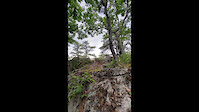
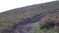
Photos of Caberston Mountain Bike
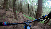
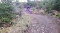
Videos of Caberston Mountain Bike
trail: Boner - (4)
0:47 |
144 |
Jun 21, 2022

trail: NY, NY - (2)
219:0:00 |
111 |
Jun 9, 2022
trail: Upper Big Baw - (4)
0:00 |
197 |
Jun 26, 2019

trail: Flat White - (1)
3:49 |
180 |
Jan 22, 2019

trail: Lone Wolf (3)
6:04 |
123 |
Jan 20, 2019
trail: Upper Aussie Rules - (5)
0:07 |
421 |
Sep 12, 2018
trail: Flat White - (1)
0:59 |
253 |
Aug 15, 2018
trail: Flat White - (1)
2:25 |
347 |
May 27, 2018
Current Trail Warnings
| status | trail | date | condition | user | info |
|---|---|---|---|---|---|
| Pre Drinks | Jun 2, 2026 @ 10:44am (Europe/Isle_of_Man) Jun 2, 2026 | Ideal | weridemtbskillscoaching | ||
| Community Service - (3) | May 29, 2026 @ 4:50pm (Europe/London) May 29, 2026 | Unknown | Ekkys TVTA | Closed for rebuild by TVTA |
Recent Trail Reports
Activity Feed
| username | action | type | title | date |
|---|---|---|---|---|
| SteveFaz | ridden | trail | activity #97166533 | Jun 17, 2026 @ 12:22am 15 hours |
| 9PpiiL | ridden | trail | activity #97098326 | Jun 16, 2026 @ 4:00am 1 day |
| weridemtbskillscoaching | add | report | activity #97026076 and 13 more | Jun 15, 2026 @ 12:10am 3 days |
| Neilpaterson1969 | ridden | trail | activity #96996258 and 7 more | Jun 14, 2026 @ 12:36pm Jun 14, 2026 |
| RemconZB4rx | checkin | trail | activity #96953985 and 4 more | Jun 14, 2026 @ 4:22am Jun 14, 2026 |
Recent Comments
| username | type | title | comment | date |
|---|---|---|---|---|
| report | I | Jun 5, 2026 @ 12:49pm Jun 5, 2026 | ||
| report | Tree cleared, added new section at the end,... | Apr 8, 2026 @ 10:04am Apr 8, 2026 | ||
| trail | So good! Well done for the massive effort from... | Mar 29, 2026 @ 8:47am Mar 29, 2026 | ||
| report | That’s not Swagdaddy | Mar 5, 2026 @ 11:26pm Mar 5, 2026 | ||
| trail | 10/10 - straight up loose rocky gnar | Dec 22, 2025 @ 6:31am Dec 22, 2025 |
Nearby Areas
| name | distance | ||||
|---|---|---|---|---|---|
| Traquair Trails | 1 | 4 | 2.7 km | ||
| Elibank | 2 | 3.1 km | |||
| Cardrona | 1 | 2 | 3.3 km | ||
| Thornielee | 9 | 3.5 km | |||
| Glentress | 17 | 26 | 4.5 km |
Local Badges
-

Tweedlove: 1500m Climb Challenge458 awarded -

i-Cycles: 1000m Descending Challenge2,036 awarded -

i-Cycles 2500m Up'n'Down Challenge.30 awarded -

Completionist0 awarded
Activity Type Stats
| activitytype | trails | distance | descent | descent distance | total vertical | rating | global rank | state rank | photos | reports | routes | ridelogs |
|---|---|---|---|---|---|---|---|---|---|---|---|---|
| Mountain Bike | 116 | 40 miles | 22,057 ft | 27 miles | 1,660 ft | #72 | #6 | 560 | 2,584 | 8 | 31,654 | |
| E-Bike | 114 | 39 miles | 20,912 ft | 26 miles | 1,660 ft | #74 | #21 | 1 | 2,467 | 4 | 7,680 | |
| Horse | 35 | 20 miles | 3,330 ft | 10 miles | 1,660 ft | #163 | #15 | 393 | ||||
| Hike | 48 | 24 miles | 4,249 ft | 11 miles | 1,660 ft | #1,495 | #29 | 1,936 | 1 | 384 | ||
| Trail Running | 50 | 24 miles | 4,249 ft | 11 miles | 1,660 ft | #970 | #23 | 1,936 | 1 | 1,200 |
Frequently Asked Questions About Caberston
▼
What are the highest rated mountain biking trails in Caberston?
The highest rated mountain biking trails in Caberston are:
- Repeat Offender (top) - (3) (4.7/5)
- Lone Wolf (3) (4.6/5)
- Community Service - (3) (4.6/5)
- Upper Big Baw - (4) (4.5/5)
- Feed The Pony - (3) (4.5/5)
▼
What is the best time of the year to ride in Caberston?
Based on ride log data, the most popular months to ride in Caberston are:
- July (118 activities)
- September (77 activities)
- June (71 activities)
▼
Where can I park to ride in Caberston?
There are 5 parking locations listed in Caberston. The most popular parking spots are: View all parking and trailhead locations on the map to plan your visit.
▼
What is the longest trail in Caberston?
The longest trail in Caberston is Access Trail at 5,246 ft. View all trails sorted by distance.
Activities
Trails
Points of Interest
- By 20twenty-p
 TVTA & contributors
 - Admins: TVTA, TVTA
- #5885 - 103,667 views
- caberston activity log | embed map of Caberston mountain bike trails | caberston mountain biking points of interest polygons
Downloading of trail gps tracks in kml & gpx formats is enabled for Caberston.
You must login to download files.