close
-
Layers w
- Weather Layers
- Pro
- Pro
- Pro
- Pro
- Pro
- Pro
- More Layers
- Pro
- Pro
- Pro
- Pro
-
Upgrade to

3D
Trail Conditions
- Unknown
- Snow Groomed
- Snow Packed
- Snow Covered
- Snow Cover Partial
- Freeze/thaw Cycle
- Icy
- Prevalent Mud
- Wet
- Variable
- Ideal
- Dry
- Very Dry
Trail Flow (Ridden Direction)
Trailforks scans users ridelogs to determine the most popular direction each trail is ridden. A good flowing trail network will have most trails flowing in a single direction according to their intension.
The colour categories are based on what percentage of riders are riding a trail in its intended direction.
The colour categories are based on what percentage of riders are riding a trail in its intended direction.
- > 96%
- > 90%
- > 80%
- > 70%
- > 50%
- < 50%
- bi-directional trail
- no data
Trail Last Ridden
Trailforks scans ridelogs to determine the last time a trail was ridden.
- < 2 days
- < 1 week
- < 2 weeks
- < 1 month
- < 6 months
- > 6 months
Trail Ridden Direction
The intended direction a trail should be ridden.
- Downhill Only
- Downhill Primary
- Both Directions
- Uphill Primary
- Uphill Only
- One Direction
Contribute Details
Colors indicate trail is missing specified detail.
- Description
- Photos
- Description & Photos
- Videos
Trail Popularity ?
Trailforks scans ridelogs to determine which trails are ridden the most in the last 9 months.
Trails are compared with nearby trails in the same city region with a possible 25 colour shades.
Think of this as a heatmap, more rides = more kinetic energy = warmer colors.
- most popular
- popular
- less popular
- not popular
ATV/ORV/OHV Filter
Max Vehicle Width
inches
US Cell Coverage
Legend

Radar Time
Activity Recordings
Trailforks uses anonymized public activity data.
?
Activity Recordings
Trailforks uses anonymized public activity data.
?
Personal Heatmap
▶
Activity Types
all
/
none
▶
Options
2
Date range
month
–
Winter Trails
Warning
A routing network for winter maps does not exist. Selecting trails using the winter trails layer has been disabled.
Missing Trails
Most Popular
Least Popular
Trails are colored based on popularity. The more popular a trail is, the more red. Less popular trails trend towards green.
Jump Magnitude Heatmap
Heatmap of where riders jump on trails. Zoom in to see individual jumps, click circles to view jump details.
BC Backroad Status
![map legend]()
Service Road Atlas is a free to use, community-driven service for viewing and creating reports on the numerous back-country service roads around B.C. and Alberta.

Slope Aspect
Direction the slope faces
Trails Deemphasized
Trails are shown in grey.
Only show trails with no bike usage.
Suggested Layers
Based on selected activity type
Save the current map location and zoom level as your default home location whenever this page is loaded.
Savebalnearios de Cachagua
Activities Click to view
- Mountain Bike
14 trails
- E-Bike
14 trails
- Adaptive Bike
0 trails
- Hike
11 trails
- Trail Running
11 trails
Region Details
- 4
- 2
- 6
Region Status
Open as of Aug 12, 2025Stats
- Avg Trail Rating
- Trails (view details)
- 12
- Trails Mountain Bike
- 14
- Trails E-Bike
- 14
- Trails Hike
- 11
- Trails Trail Running
- 11
- Total Distance
- 9 miles
- Total Descent
- 2,210 ft
- Total Vertical
- 681 ft
- Highest Trailhead
- 866 ft
- Reports
- 22
- Photos
- 2
- Ridden Counter
- 793
Sub Regions
-
Parque Aguas Claras by Outlife
- 2
- 5
Popular Cachagua Mountain Biking Trails
• 70 ★ 0.0 • 1,762 ft • 211 ft • 155 •
Popular blue difficulty singletrack. This mountain bike primary trail. On average it takes 6 minutes to complete this trail.
• 20 ★ 0.0 • 3,182 ft • 0 ft • 113 •
Intermediate trail belonging to the Aguas Claras trail grid. It starts with a gentle dirt road, and then, reaching a gate, into a nice single track uphill with just one big uphill climb, after that you reach a balcony with a great...
• 35 ★ 0.0 • 4,589 ft • 58 ft • 56 •
Very nice trail, easy and family friendly. Takes about 1 to 2 hours. Great spots to take pictures, especially in September October after the winter when the lagoon is full of water and green pastures. Also the forest at the end of the...
• 10 ★ 5.0 • 5 miles • 906 ft • 47 •
Less popular green difficulty singletrack. This mountain bike primary trail can be used uphill primary and has a moderate overall physical rating with a 906 ft blue climb. It features jump and rock garden. Trail visibility is always easy to follow. On average it takes 48 minutes to complete this trail.
• 60 ★ 0.0 • 4,895 ft • 51 ft • 46 •
Moderately popular blue difficulty family friendly singletrack. This mountain bike primary trail can be used downhill only and has a moderate overall physical rating. Trail visibility is always easy to follow. On average it takes 5 minutes to complete this trail.
• 85 ★ 0.0 • 3,684 ft • 0 ft • 34 •
Popular blue difficulty family friendly singletrack. This mountain bike primary trail can be used downhill only. Trail visibility is always easy to follow.
• 25 ★ 0.0 • 1,530 ft • 3 ft • 21 •
Less popular blue difficulty singletrack. This mountain bike primary trail. On average it takes 2 minutes to complete this trail.
Cachagua Mountain Bike Routes
4 miles • 760 ft • 0 •
Intermediate trail belonging to the Aguas Claras trail grid. It starts with a gentle dirt road, and then,...
5 miles • 951 ft • 0 •
★ 1.0 • 20 miles • 3,656 ft • 0 • Loop •
Bonita travesia que une sectores de Zapallar con Papudo.
• 3 miles • 369 ft • 1 •
• 10 miles • 2,043 ft • 0 •
• 7 miles • 1,486 ft • 0 •
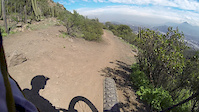
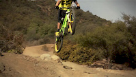
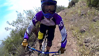
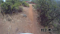
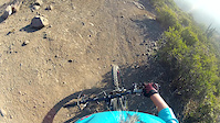
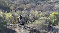
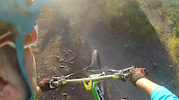
Videos of Cachagua Mountain Bike
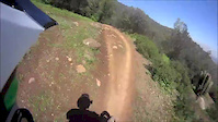
trail: RKF Aguas Claras
0:11 |
90 |
Jan 12, 2015
trail: RKF Aguas Claras
6:40 |
194 |
Sep 4, 2014
trail: RKF Aguas Claras
2:28 |
43116 |
Mar 10, 2014
trail: RKF Aguas Claras
6:49 |
281 |
Oct 20, 2013
trail: RKF Aguas Claras
9:00 |
212 |
Jul 15, 2013
trail: RKF Aguas Claras
4:06 |
184 |
Jun 6, 2013
trail: RKF Aguas Claras
0:15 |
146 |
Jan 2, 2013
trail: RKF Aguas Claras
5:44 |
99 |
Dec 3, 2012
Recent Trail Reports
| status | trail | date | condition | info | user |
|---|---|---|---|---|---|
| Sendero MHW | Nov 16, 2024 @ 2:05pm Nov 16, 2024 | Very Dry | adeprado2 | ||
| Sendero Merrell 2 | Apr 3, 2021 @ 6:44am Apr 3, 2021 | Dry | egorchs | ||
| Sendero Merrell 1 | Apr 3, 2021 @ 6:44am Apr 3, 2021 | Dry | egorchs | ||
| RKF Aguas Claras | Mar 16, 2019 @ 6:16pm Mar 16, 2019 | Dry | megasoft200 |
Activity Feed
| username | action | type | title | date |
|---|---|---|---|---|
| backyardadventuregirl | wishlist | region | activity #79304071 | Aug 30, 2025 @ 10:12pm Aug 30, 2025 |
| Parrieta | ridden | trail | activity #73019717 | Jun 3, 2025 @ 1:25pm Jun 3, 2025 |
| Parrieta | add | trail | activity #71767841 and 1 more | May 16, 2025 @ 8:45am May 16, 2025 |
| Parrieta | add | trail | activity #68913479 | Apr 3, 2025 @ 6:55am Apr 3, 2025 |
| Parrieta | ridden | trail | activity #68834696 | Apr 1, 2025 @ 4:57pm Apr 1, 2025 |
Recent Comments
| username | type | title | comment | date |
|---|---|---|---|---|
| trail | The track has some misplaced parts and some... | Apr 11, 2018 @ 7:51pm Apr 11, 2018 | ||
| trail | Trail not corresponding to real one and some... | Apr 11, 2018 @ 7:48pm Apr 11, 2018 | ||
| trail | The trail is not corresponding to reality and... | Apr 11, 2018 @ 7:45pm Apr 11, 2018 | ||
| trail | The route name does not correspond ! This is... | Apr 11, 2018 @ 7:42pm Apr 11, 2018 |
Local Badges
-

Epic Mountain Bike Climb 2k0 awarded -

Climbing 10k Badge0 awarded -

Mountain Biking 100k Badge0 awarded -

Epic Ride Descent 2k0 awarded -

Descent 10k Badge0 awarded -

Descent 100k Badge0 awarded
Activity Type Stats
| activitytype | trails | distance | descent | descent distance | total vertical | rating | global rank | state rank | photos | reports | routes | ridelogs |
|---|---|---|---|---|---|---|---|---|---|---|---|---|
| Mountain Bike | 14 | 9 miles | 2,211 ft | 5 miles | 682 ft | #3,021 | #16 | 2 | 22 | 3 | 3,128 | |
| E-Bike | 14 | 9 miles | 2,211 ft | 5 miles | 682 ft | #1,496 | #10 | 22 | 1 | 697 | ||
| Hike | 11 | 8 miles | 1,768 ft | 4 miles | 682 ft | #2,526 | #21 | 20 | 88 | |||
| Trail Running | 11 | 8 miles | 1,768 ft | 4 miles | 682 ft | #2,036 | #21 | 20 | 24 |
Frequently Asked Questions About Cachagua
▼
What are the best places to ride in Cachagua?
Cachagua has 1 areas to explore for mountain biking. The top rated areas are:
▼
What are the highest rated mountain biking trails in Cachagua?
The highest rated mountain biking trails in Cachagua are:
- RKF Aguas Claras (4.1/5)
- Sendero MHW (4/5)
- Sendero Merrell 2 (0/5)
- Los Bellotos (0/5)
- Cometocino (0/5)
▼
What is the best time of the year to ride in Cachagua?
Based on ride log data, the most popular months to ride in Cachagua are:
- January (18 activities)
- July (6 activities)
- September (5 activities)
▼
Where can I park to ride in Cachagua?
Check the Cachagua trail map for trailhead and parking information. Community members regularly update access and parking details for trails in the area.
Activities
Trails
Points of Interest
- By aearriagada & contributors
- Admins: MB
- #7449 - 2,957 views
- cachagua activity log | embed map of Cachagua mountain bike trails | cachagua mountain biking points of interest
Downloading of trail gps tracks in kml & gpx formats is enabled for Cachagua.
You must login to download files.