close
-
Layers w
- Weather Layers
- Pro
- Pro
- Pro
- Pro
- Pro
- Pro
- More Layers
- Pro
- Pro
- Pro
- Pro
-
Upgrade to

3D
Trail Conditions
- Unknown
- Snow Groomed
- Snow Packed
- Snow Covered
- Snow Cover Partial
- Freeze/thaw Cycle
- Icy
- Prevalent Mud
- Wet
- Variable
- Ideal
- Dry
- Very Dry
Trail Flow (Ridden Direction)
Trailforks scans users ridelogs to determine the most popular direction each trail is ridden. A good flowing trail network will have most trails flowing in a single direction according to their intension.
The colour categories are based on what percentage of riders are riding a trail in its intended direction.
The colour categories are based on what percentage of riders are riding a trail in its intended direction.
- > 96%
- > 90%
- > 80%
- > 70%
- > 50%
- < 50%
- bi-directional trail
- no data
Trail Last Ridden
Trailforks scans ridelogs to determine the last time a trail was ridden.
- < 2 days
- < 1 week
- < 2 weeks
- < 1 month
- < 6 months
- > 6 months
Trail Ridden Direction
The intended direction a trail should be ridden.
- Downhill Only
- Downhill Primary
- Both Directions
- Uphill Primary
- Uphill Only
- One Direction
Contribute Details
Colors indicate trail is missing specified detail.
- Description
- Photos
- Description & Photos
- Videos
Trail Popularity ?
Trailforks scans ridelogs to determine which trails are ridden the most in the last 9 months.
Trails are compared with nearby trails in the same city region with a possible 25 colour shades.
Think of this as a heatmap, more rides = more kinetic energy = warmer colors.
- most popular
- popular
- less popular
- not popular
ATV/ORV/OHV Filter
Max Vehicle Width
inches
US Cell Coverage
Legend

Radar Time
Activity Recordings
Trailforks uses anonymized public activity data.
?
Activity Recordings
Trailforks uses anonymized public activity data.
?
Personal Heatmap
▶
Activity Types
all
/
none
▶
Options
2
Date range
month
–
Winter Trails
Warning
A routing network for winter maps does not exist. Selecting trails using the winter trails layer has been disabled.
Missing Trails
Most Popular
Least Popular
Trails are colored based on popularity. The more popular a trail is, the more red. Less popular trails trend towards green.
Jump Magnitude Heatmap
Heatmap of where riders jump on trails. Zoom in to see individual jumps, click circles to view jump details.
BC Backroad Status
![map legend]()
Service Road Atlas is a free to use, community-driven service for viewing and creating reports on the numerous back-country service roads around B.C. and Alberta.

Slope Aspect
Direction the slope faces
Trails Deemphasized
Trails are shown in grey.
Only show trails with no bike usage.
Suggested Layers
Based on selected activity type
Save the current map location and zoom level as your default home location whenever this page is loaded.
SaveUnofficial. No facilities. Not for beginners. Take your rubbish home These trails aren't built for the high numbers of users, and they're built by people on their own free time. Big groups riding them ruins these trails.
Primary Trail Type: Cross-Country
Land Status: Community Forest
 google parking directions
This region uses the Uk/Euro style trail grading system.
Activities Click to view
- Mountain Bike
45 trails
- E-Bike
45 trails
- Horse
17 trails
- Hike
21 trails
- Trail Running
21 trails
Region Details
- 7
- 12
- 5
- 19
Region Status
Open as of May 20, 2026Stats
- Avg Trail Rating
- Trails (view details)
- 43
- Trails Mountain Bike
- 45
- Trails E-Bike
- 45
- Trails Horse
- 17
- Trails Hike
- 21
- Trails Trail Running
- 21
- Total Distance
- 13 miles
- Total Descent
- 5,659 ft
- Total Vertical
- 742 ft
- Highest Trailhead
- 1,388 ft
- Reports
- 507
- Photos
- 56
- Ridden Counter
- 12,751
Popular Cademuir Mountain Biking Trails
Danger Mouse Permanently Closed
• 60 ★ 4.9 • 948 ft • 0 ft • 607 •
Starts off quite flat but then gets v. steep further down. Lots of berms etc and fun to ride but quite difficult in places. There is a new drop near the top of the trail which is approx. 2 feet
• 70 ★ 2.0 • 1,394 ft • 164 ft • 535 • • hike
Popular blue difficulty family friendly gravel path. This hike primary trail can be used both directions and has a moderate overall physical rating with a 164 ft blue climb. Trail visibility is always easy to follow. On average it takes 6 minutes to complete this trail.
• 50 ★ 4.2 • 1,227 ft • 9 ft • 523 •
Highly rated moderately popular black difficulty singletrack. This mountain bike primary trail can be used downhill only and has a moderate overall physical rating with a 9 ft blue climb. On average it takes 2 minutes to complete this trail.
• 50 ★ 4.1 • 1,440 ft • 0 ft • 519 •
Starts to the left of the old starting point.
• 60 ★ 4.8 • 1,332 ft • 0 ft • 460 •
Its fast and tech buy may contain a roll able gap jump and also a double drop
• 45 ★ 4.9 • 1,345 ft • 0 ft • 443 •
Steep, loose and off camber at the top. Not for beginners. Unofficial trail.
• 45 ★ 4.4 • 541 ft • 0 ft • 345 •
A fun and fast trail with berms which I am gradually improving and a twisty, techy section in the middle.
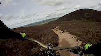
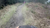
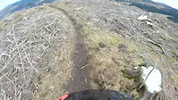
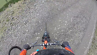
Photos of Cademuir Mountain Bike
Videos of Cademuir Mountain Bike

trail: Cademuir DH Upper
0:22 |
267 |
Aug 27, 2020
trail: Path7
4:13 |
62 |
Apr 24, 2017
trail: RTT
0:51 |
379 |
Mar 13, 2016
trail: Cademuir DH Upper
3:39 |
816 |
Mar 13, 2016
trail: Vinyl Justice
0:36 |
587 |
Mar 13, 2016

trail: Dark Side
0:13 |
795 |
Oct 18, 2010
trail: Dark Side
11:40 |
541 |
May 24, 2010
trail: Jerry Can
0:47 |
290 |
Aug 22, 2022 , Peebles
Recent Trail Reports
| status | trail | date | condition | info | user |
|---|---|---|---|---|---|
| Path10 | Dec 11, 2025 @ 2:17pm (Europe/London) Dec 11, 2025 | Ideal | marccr0wley FLS | ||
| Path2 | Dec 11, 2025 @ 2:17pm (Europe/London) Dec 11, 2025 | Ideal | marccr0wley FLS | ||
| Harem Scarem Bottom | Dec 11, 2025 @ 2:16pm (Europe/London) Dec 11, 2025 | Variable | marccr0wley FLS | ||
| Harem Scarem | Dec 11, 2025 @ 2:16pm (Europe/London) Dec 11, 2025 | Variable | marccr0wley FLS | ||
| Trail004 | Nov 10, 2025 @ 3:21pm (Europe/London) Nov 10, 2025 | Unknown | marccr0wley FLS | ||
| Trail002 | Nov 10, 2025 @ 3:21pm (Europe/London) Nov 10, 2025 | Unknown | marccr0wley FLS | ||
| Tom and Jerry | Nov 10, 2025 @ 3:21pm (Europe/London) Nov 10, 2025 | Unknown | marccr0wley FLS | ||
| Trail003 | Nov 10, 2025 @ 3:21pm (Europe/London) Nov 10, 2025 | Unknown | marccr0wley FLS | ||
| Not Cademuir DH | Nov 10, 2025 @ 3:21pm (Europe/London) Nov 10, 2025 | Unknown | marccr0wley FLS | ||
| Forest Road 004 | Oct 14, 2025 @ 5:29pm (Europe/Isle_of_Man) Oct 14, 2025 | Variable | Tom78iYnS |
Activity Feed
| username | action | type | title | date |
|---|---|---|---|---|
| sw-mtb | wishlist | trail | activity #95265111 | May 22, 2026 @ 1:33pm May 22, 2026 |
| hardtail4thewin | add | report | activity #95094167 and 1 more | May 20, 2026 @ 1:54am May 20, 2026 |
| gordmax | add | report | activity #94759267 and 1 more | May 15, 2026 @ 11:31am May 15, 2026 |
| davejcb | add | report | activity #93264350 | Apr 23, 2026 @ 11:34pm Apr 23, 2026 |
| davejcb | add | report | activity #93003532 | Apr 19, 2026 @ 11:48pm Apr 19, 2026 |
Recent Comments
| username | type | title | comment | date |
|---|---|---|---|---|
| trail | Meaty tree down 30m from entrance of trail.... | Dec 11, 2025 @ 3:20am Dec 11, 2025 | ||
| trail | Fun trail! | Sep 13, 2025 @ 10:29am Sep 13, 2025 | ||
| trail | Top section is overgrown. Had to clear away... | Aug 8, 2025 @ 3:29am Aug 8, 2025 | ||
| trail | Someone has worked on exit, but it’s very... | Jun 29, 2025 @ 1:57pm Jun 29, 2025 | ||
| report | What about the exit onto the fire road ? Has... | Jan 30, 2025 @ 10:51am Jan 30, 2025 |
Nearby Areas
| name | distance | ||||
|---|---|---|---|---|---|
| Hamilton Hill | 1.8 km | ||||
| Glentress | 17 | 26 | 3.4 km | ||
| Cardrona | 1 | 2 | 3.4 km | ||
| Cloich Hills | 4 | 4.8 km | |||
| Leithenwater Forest | 1 | 5.5 km |
Local Badges
-

Completionist3 awarded
Activity Type Stats
| activitytype | trails | distance | descent | descent distance | total vertical | rating | global rank | state rank | photos | reports | routes | ridelogs |
|---|---|---|---|---|---|---|---|---|---|---|---|---|
| Mountain Bike | 45 | 13 miles | 5,659 ft | 7 miles | 741 ft | #2,305 | #72 | 56 | 506 | 5,105 | ||
| E-Bike | 45 | 13 miles | 5,659 ft | 7 miles | 741 ft | #3,163 | #114 | 469 | 533 | |||
| Horse | 17 | 7 miles | 745 ft | 2 miles | 738 ft | #1,241 | #66 | 132 | 1 | |||
| Hike | 21 | 8 miles | 1,240 ft | 3 miles | 738 ft | #7,062 | #167 | 314 | 598 | |||
| Trail Running | 21 | 8 miles | 1,240 ft | 3 miles | 738 ft | #6,908 | 314 | 880 |
Frequently Asked Questions About Cademuir
▼
What are the highest rated mountain biking trails in Cademuir?
The highest rated mountain biking trails in Cademuir are:
- Vinyl Justice (4.6/5)
- RTT (4.5/5)
- Jerry Can (4.5/5)
- Decade (4.4/5)
- Penfold (4.4/5)
▼
What is the best time of the year to ride in Cademuir?
Based on ride log data, the most popular months to ride in Cademuir are:
- July (18 activities)
- August (14 activities)
- April (8 activities)
▼
Where can I park to ride in Cademuir?
▼
What is the longest trail in Cademuir?
The longest trail in Cademuir is Path1 at 4,813 ft. View all trails sorted by distance.
- By 20twenty-p
 TVTA & contributors
 - Admins: TVTA, TVTA
- #5909 - 14,655 views
- cademuir activity log | embed map of Cademuir mountain bike trails | cademuir mountain biking points of interest polygons
Downloading of trail gps tracks in kml & gpx formats is enabled for Cademuir.
You must login to download files.