close
-
Layers w
- Weather Layers
- Pro
- Pro
- Pro
- Pro
- Pro
- Pro
- More Layers
- Pro
- Pro
- Pro
- Pro
-
Upgrade to

3D
Trail Conditions
- Unknown
- Snow Groomed
- Snow Packed
- Snow Covered
- Snow Cover Partial
- Freeze/thaw Cycle
- Icy
- Prevalent Mud
- Wet
- Variable
- Ideal
- Dry
- Very Dry
Trail Flow (Ridden Direction)
Trailforks scans users ridelogs to determine the most popular direction each trail is ridden. A good flowing trail network will have most trails flowing in a single direction according to their intension.
The colour categories are based on what percentage of riders are riding a trail in its intended direction.
The colour categories are based on what percentage of riders are riding a trail in its intended direction.
- > 96%
- > 90%
- > 80%
- > 70%
- > 50%
- < 50%
- bi-directional trail
- no data
Trail Last Ridden
Trailforks scans ridelogs to determine the last time a trail was ridden.
- < 2 days
- < 1 week
- < 2 weeks
- < 1 month
- < 6 months
- > 6 months
Trail Ridden Direction
The intended direction a trail should be ridden.
- Downhill Only
- Downhill Primary
- Both Directions
- Uphill Primary
- Uphill Only
- One Direction
Contribute Details
Colors indicate trail is missing specified detail.
- Description
- Photos
- Description & Photos
- Videos
Trail Popularity ?
Trailforks scans ridelogs to determine which trails are ridden the most in the last 9 months.
Trails are compared with nearby trails in the same city region with a possible 25 colour shades.
Think of this as a heatmap, more rides = more kinetic energy = warmer colors.
- most popular
- popular
- less popular
- not popular
ATV/ORV/OHV Filter
Max Vehicle Width
inches
US Cell Coverage
Legend

Radar Time
Activity Recordings
Trailforks uses anonymized public activity data.
?
Activity Recordings
Trailforks uses anonymized public activity data.
?
Personal Heatmap
▶
Activity Types
all
/
none
▶
Options
2
Date range
month
–
Winter Trails
Warning
A routing network for winter maps does not exist. Selecting trails using the winter trails layer has been disabled.
Missing Trails
Most Popular
Least Popular
Trails are colored based on popularity. The more popular a trail is, the more red. Less popular trails trend towards green.
Jump Magnitude Heatmap
Heatmap of where riders jump on trails. Zoom in to see individual jumps, click circles to view jump details.
BC Backroad Status
![map legend]()
Service Road Atlas is a free to use, community-driven service for viewing and creating reports on the numerous back-country service roads around B.C. and Alberta.

Slope Aspect
Direction the slope faces
Trails Deemphasized
Trails are shown in grey.
Only show trails with no bike usage.
Suggested Layers
Based on selected activity type
Save the current map location and zoom level as your default home location whenever this page is loaded.
SavePathways has 8 loops of trails from .75 miles to a total of 13. The outer figure 8 loop is 11 miles. The north end is fairly flat, with the trails getting hillier as you approach the south end. Calf Cramper Climb is .7 miles long located between markers 4 and 8, and Baby, Momma, and Big Kahuna are the biggest hills located between markers 8 and 12. Several unmarked singletrack sections veer off of and return to the main trail. Sand pits are prevalent at the bottoms of most hills and several hills are armored with rubber matting.
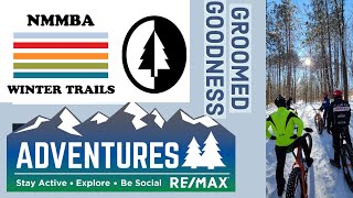
The north end parking lot has an outhouse, but there are no facilities available at the south end. All main trails are groomed for X country skiing. Trails ARE directional and are well marked with maps at each intersection.
The north end parking lot has an outhouse, but there are no facilities available at the south end. All main trails are groomed for X country skiing. Trails ARE directional and are well marked with maps at each intersection.
Primary Trail Type: Cross-Country
 google parking directions
 Activities Click to view
- Mountain Bike
26 trails
- Hike
26 trails
- Trail Running
26 trails
- Snowshoe
0 trails
- Nordic Ski
0 trails
Region Details
- 2
- 4
- 18
- 2
Region Status
Open as of Sep 3, 2025Stats
- Avg Trail Rating
- Trails (view details)
- 26
- Trails Mountain Bike
- 26
- Trails Hike
- 26
- Trails Trail Running
- 26
- Total Distance
- 17 miles
- Total Descent
- 1,976 ft
- Total Vertical
- 252 ft
- Highest Trailhead
- 1,505 ft
- Reports
- 122
- Photos
- 11
- Ridden Counter
- 2,206
Popular Cadillac Pathway Mountain Biking Trails
• 95 ★ 1.0 • 1 mile • 79 ft • 142 •
Popular black diamond difficulty singletrack. This mountain bike primary trail can be used downhill primary. On average it takes 7 minutes to complete this trail.
• 100 ★ 0.0 • 2 miles • 150 ft • 130 •
Popular black diamond difficulty singletrack. This mountain bike primary trail can be used both directions. On average it takes 9 minutes to complete this trail.
• 85 ★ 0.0 • 2,432 ft • 87 ft • 119 •
Popular blue difficulty singletrack. This mountain bike primary trail can be used both directions. On average it takes 3 minutes to complete this trail.
• 95 ★ 0.0 • 3,179 ft • 27 ft • 106 •
Popular blue difficulty singletrack. This mountain bike primary trail can be used downhill primary. On average it takes 3 minutes to complete this trail.
• 75 ★ 0.0 • 3,923 ft • 101 ft • 91 •
Popular blue difficulty singletrack. This mountain bike primary trail can be used both directions. On average it takes 4 minutes to complete this trail.
• 90 ★ 0.0 • 2,945 ft • 22 ft • 91 •
Popular green difficulty singletrack. This multi-use trail can be used both directions. On average it takes 4 minutes to complete this trail.
• 90 ★ 0.0 • 4,094 ft • 219 ft • 88 •
Popular blue difficulty singletrack. This mountain bike primary trail can be used both directions. On average it takes 6 minutes to complete this trail.
• 80 ★ 0.0 • 2,233 ft • 38 ft • 81 •
Popular green difficulty doubletrack. This mountain bike primary trail can be used both directions. On average it takes 2 minutes to complete this trail.
Videos of Cadillac Pathway Mountain Bike
trail: Cadillac TH - #2
26:46 |
322 |
Jan 25, 2021 , Cadillac
youtuber
![The Cadillac Pathway Trail - Groomed Fat bike...]()
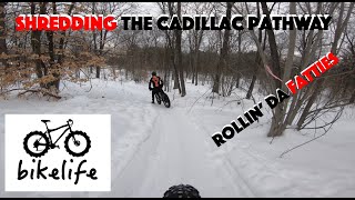
49:58 |
261 |
Jan 19, 2021
Recent Trail Reports
| status | trail | date | condition | info | user |
|---|---|---|---|---|---|
| Cadillac #12 - #8 | Jul 28, 2025 @ 9:22am Jul 28, 2025 | Dry | DJMcTrails | ||
| Unknown Name | Jul 8, 2023 @ 7:26am Jul 8, 2023 | Variable | Tkeating61 | ||
| Cadillac #10 - #11 | Jul 8, 2023 @ 7:26am Jul 8, 2023 | Variable | Tkeating61 | ||
| Cadillac #9 - #10 | Jul 8, 2023 @ 7:26am Jul 8, 2023 | Variable | Tkeating61 | ||
| Unknown Name | Jul 8, 2023 @ 7:26am Jul 8, 2023 | Variable | Tkeating61 | ||
| Cadillac #8 - #9 | Jul 8, 2023 @ 7:26am Jul 8, 2023 | Ideal | Tkeating61 | ||
| Unknown Name | Mar 1, 2022 @ 9:07am Mar 1, 2022 | Snow Groomed | Getrad68 | ||
| Unknown Name | Jan 22, 2022 @ 9:50am Jan 22, 2022 | Snow Groomed | spinman | ||
| Unknown Name | Jan 22, 2022 @ 9:50am Jan 22, 2022 | Snow Groomed | spinman | ||
| Cadillac #10 - #12 | Jul 3, 2018 @ 5:03pm Jul 3, 2018 | Dry | cmwestdo |
Activity Feed
| username | action | type | title | date |
|---|---|---|---|---|
| WillieJacobsz | update | region | activity #84301822 | Nov 17, 2025 @ 9:10am Nov 17, 2025 |
| WillieJacobsz | add | poi | activity #84301318 | Nov 17, 2025 @ 8:59am Nov 17, 2025 |
| DJMcTrails | add | report | activity #76893835 | Jul 28, 2025 @ 9:22am Jul 28, 2025 |
| Gagliardo1 | wishlist | region | activity #76469993 | Jul 22, 2025 @ 11:15am Jul 22, 2025 |
| Smasheroni | wishlist | trail | activity #74690143 | Jun 27, 2025 @ 3:59pm Jun 27, 2025 |
Nearby Areas
| name | distance | ||||
|---|---|---|---|---|---|
| Cadillac Forest | 2 | 1 | 3 | 16.4 km | |
| Mackenzie XC Ski/Mountain Bike Trails | 14 | 5 | 2 | 18.3 km | |
| Huron / Manistee National Forest | 1 | 9 | 1 | 24.7 km | |
| Pine Valley Pathway | 6 | 25.8 km | |||
| Muncie Lakes Pathway | 4 | 10 | 3 | 27.3 km |
Local Badges
-

Completionist0 awarded
Activity Type Stats
| activitytype | trails | distance | descent | descent distance | total vertical | rating | global rank | state rank | photos | reports | routes | ridelogs |
|---|---|---|---|---|---|---|---|---|---|---|---|---|
| Mountain Bike | 26 | 17 miles | 1,975 ft | 7 miles | 253 ft | #10,981 | #4,395 | 11 | 122 | 1,609 | ||
| Hike | 26 | 17 miles | 1,975 ft | 7 miles | 253 ft | #9,727 | #3,764 | 122 | 22 | |||
| Trail Running | 26 | 17 miles | 1,975 ft | 7 miles | 253 ft | #8,816 | #3,119 | 122 | 21 |
Frequently Asked Questions About Cadillac Pathway
▼
What are the highest rated mountain biking trails in Cadillac Pathway?
The highest rated mountain biking trails in Cadillac Pathway are:
- Unknown Name (4/5)
- Cadillac #8 - #9 (3.6/5)
- Unknown Name (0/5)
- Cadillac #12 - #8 (0/5)
- Cadillac #10 - #12 (0/5)
▼
What is the best time of the year to ride in Cadillac Pathway?
Based on ride log data, the most popular months to ride in Cadillac Pathway are:
- September (14 activities)
- June (11 activities)
- July (10 activities)
▼
Where can I park to ride in Cadillac Pathway?
▼
What is the longest trail in Cadillac Pathway?
The longest trail in Cadillac Pathway is Winter Sports Trail at 5.0 miles. View all trails sorted by distance.
Activities
Trails
Points of Interest
- By markholloway
 Trailforks Map Team & contributors
 - Admins: apply
- #11418 - 5,621 views
- cadillac pathway activity log | embed map of Cadillac Pathway mountain bike trails | cadillac pathway mountain biking points of interest
Downloading of trail gps tracks in kml & gpx formats is enabled for Cadillac Pathway.
You must login to download files.