close
-
Layers w
- Weather Layers
- Pro
- Pro
- Pro
- Pro
- Pro
- Pro
- More Layers
- Pro
- Pro
- Pro
- Pro
-
Upgrade to

3D
Trail Conditions
- Unknown
- Snow Groomed
- Snow Packed
- Snow Covered
- Snow Cover Partial
- Freeze/thaw Cycle
- Icy
- Prevalent Mud
- Wet
- Variable
- Ideal
- Dry
- Very Dry
Trail Flow (Ridden Direction)
Trailforks scans users ridelogs to determine the most popular direction each trail is ridden. A good flowing trail network will have most trails flowing in a single direction according to their intension.
The colour categories are based on what percentage of riders are riding a trail in its intended direction.
The colour categories are based on what percentage of riders are riding a trail in its intended direction.
- > 96%
- > 90%
- > 80%
- > 70%
- > 50%
- < 50%
- bi-directional trail
- no data
Trail Last Ridden
Trailforks scans ridelogs to determine the last time a trail was ridden.
- < 2 days
- < 1 week
- < 2 weeks
- < 1 month
- < 6 months
- > 6 months
Trail Ridden Direction
The intended direction a trail should be ridden.
- Downhill Only
- Downhill Primary
- Both Directions
- Uphill Primary
- Uphill Only
- One Direction
Contribute Details
Colors indicate trail is missing specified detail.
- Description
- Photos
- Description & Photos
- Videos
Trail Popularity ?
Trailforks scans ridelogs to determine which trails are ridden the most in the last 9 months.
Trails are compared with nearby trails in the same city region with a possible 25 colour shades.
Think of this as a heatmap, more rides = more kinetic energy = warmer colors.
- most popular
- popular
- less popular
- not popular
ATV/ORV/OHV Filter
Max Vehicle Width
inches
US Cell Coverage
Legend

Radar Time
Activity Recordings
Trailforks uses anonymized public activity data.
?
Activity Recordings
Trailforks uses anonymized public activity data.
?
Personal Heatmap
▶
Activity Types
all
/
none
▶
Options
2
Date range
month
–
Winter Trails
Warning
A routing network for winter maps does not exist. Selecting trails using the winter trails layer has been disabled.
Missing Trails
Most Popular
Least Popular
Trails are colored based on popularity. The more popular a trail is, the more red. Less popular trails trend towards green.
Jump Magnitude Heatmap
Heatmap of where riders jump on trails. Zoom in to see individual jumps, click circles to view jump details.
BC Backroad Status
![map legend]()
Service Road Atlas is a free to use, community-driven service for viewing and creating reports on the numerous back-country service roads around B.C. and Alberta.

Slope Aspect
Direction the slope faces
Trails Deemphasized
Trails are shown in grey.
Only show trails with no bike usage.
Suggested Layers
Based on selected activity type
Save the current map location and zoom level as your default home location whenever this page is loaded.
Save
No description for Caersws has been added yet!
Login or register to submit one.
This region uses the Uk/Euro style trail grading system.
Activities Click to view
- Mountain Bike
11 trails
- Adaptive Bike
- Hike
2 trails
- Trail Running
2 trails
Region Details
- 1
- 1
- 2
- 2
Region Status
Open as of Dec 6, 2025Stats
- Trails (view details)
- 8
- Trails Mountain Bike
- 11
- Trails Hike
- 2
- Trails Trail Running
- 2
- Reports
- 11
- Photos
- 5
- Ridden Counter
- 654
Sub Regions
-
Caersws DH Bikepark
- 1
- 2
- 2
Popular Caersws Mountain Biking Trails
• 50 ★ 0.0 • 2,703 ft • 0 ft • 185 •
'Originally featured in the classic Dragon Downhill Series this track (formerly known as the Welsh Champs track) is a firm favourite with riders. Featuring a road jump, big berms, tight challenging corners, roots, drops and gaps, as...
• 40 ★ 0.0 • 3,825 ft • 8 ft • 166 •
"Our steepest and most technical track, the Scorcher (formerly known as the NPS track) hosts national standard downhill race events. Comprising of steep switchbacks, drops, and some of the biggest jumps on the hill. It has everything to...
• 80 ★ 0.0 • 679 ft • 3 ft • 92 •
"New in 2024 this is our advanced line, that branches off the Freeride trail. Technically one of the hardest jump lines in the UK with doubles, left and right hips followed by the Helfare step up." - Caersws Bike Park
• 90 ★ 0.0 • 2,375 ft • 0 ft • 92 •
"A fun run to start your day on. This trail is a firm rider favourite. Fast flowing from the off with speed steadily increasing. There’s a couple of steep undulations to help get you into the groove along with progressive jump lines....
• 70 ★ 0.0 • 2,054 ft • 20 ft • 91 •
"Our revamped and re-named Quarry Line, This red trail has it all: fast berms, lipped tables, and endless flow. Get ready to shred!" - Caersws Bike Park
• 60 ★ 0.0 • 771 ft • 0 ft • 85 •
"New in 2024 this is our advanced line, that branches off the Freeride trail. Technically one of the hardest jump lines in the UK with doubles, left and right hips followed by the Helfare step up." - Caersws Bike Park
• 5 ★ 0.0 • 0 ft • 0 ft •
Downhill track at private uplift BikePark . Access via event ticket booked via venues Facebook page - CaerswsDH BikePark . Track was part of the old Dragon series downhill races and is one of the venues favourites. Featuring a huge...
• 5 ★ 0.0 • 0 ft • 0 ft •
Used for National race events. This track starts at the same point as the Welsh track but has a series of berms then some tabletops before dropping into the old forest part where you encounter roots , drop sections and some steep...
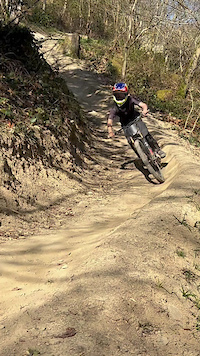
Photos of Caersws Mountain Bike
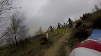
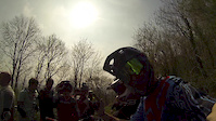
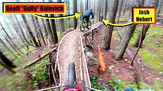
Videos of Caersws Mountain Bike
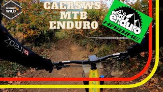
trail: Scorcher!
0:06 |
68 |
Apr 8, 2025
trail: WelshTrack
3:10 |
127 |
Apr 16, 2017
trail: English track
3:46 |
169 |
Apr 11, 2017
youtuber
![Most INSANE Moments of 2022! (Pt. 3) - 'Land...]()

trail: The Dragon's Tail
11:01 |
108 |
Mar 8, 2023 , Caersws
7:06 |
141 |
Oct 23, 2021
Recent Trail Reports
| status | trail | date | condition | info | user |
|---|---|---|---|---|---|
| The Dragon's Tail | Dec 6, 2025 @ 10:36am (Europe/London) Dec 6, 2025 | Wet | weridemtbskillscoaching | ||
| Scorcher! | Dec 6, 2025 @ 10:36am (Europe/London) Dec 6, 2025 | Wet | weridemtbskillscoaching | ||
| Helfare Highway (Upper) | Dec 6, 2025 @ 10:36am (Europe/London) Dec 6, 2025 | Wet | weridemtbskillscoaching | ||
| Helfare Highway (Lower) | Dec 6, 2025 @ 10:36am (Europe/London) Dec 6, 2025 | Wet | weridemtbskillscoaching | ||
| Quarry Line | Dec 6, 2025 @ 10:36am (Europe/London) Dec 6, 2025 | Wet | weridemtbskillscoaching | ||
| Freeride | Dec 6, 2025 @ 10:36am (Europe/London) Dec 6, 2025 | Wet | weridemtbskillscoaching | ||
| Shuttle Road | Apr 26, 2025 @ 1:56pm Apr 26, 2025 | Dry | Linco |
Activity Feed
| username | action | type | title | date |
|---|---|---|---|---|
| weridemtbskillscoaching | add | report | activity #85220056 and 5 more | Dec 6, 2025 @ 11:01am Dec 6, 2025 |
| Linco | add | report | activity #70683961 and 2 more | Apr 30, 2025 @ 7:13am Apr 30, 2025 |
| jamgormac | ridden | trail | activity #70441349 | Apr 26, 2025 @ 2:46pm Apr 26, 2025 |
| pmw007 | add | video | activity #69220876 | Apr 8, 2025 @ 2:47am Apr 8, 2025 |
| samsonUfnLxo | wishlist | region | activity #68285071 | Mar 23, 2025 @ 10:54am Mar 23, 2025 |
Local Badges
-

Epic Mountain Bike Climb 2k10 awarded -

Climbing 10k Badge0 awarded -

Mountain Biking 100k Badge0 awarded -

Big Ride 30k12 awarded -

Epic Ride 50k1 awarded
Activity Type Stats
| activitytype | trails | distance | descent | descent distance | total vertical | rating | global rank | state rank | photos | reports | routes | ridelogs |
|---|---|---|---|---|---|---|---|---|---|---|---|---|
| Mountain Bike | 11 | #13,271 | #501 | 5 | 11 | 1,850 | ||||||
| Hike | 2 | #14,561 | #543 | 11 | 19 | |||||||
| Trail Running | 2 | #14,120 | #535 | 11 |
Frequently Asked Questions About Caersws
▼
What are the best places to ride in Caersws?
Caersws has 1 areas to explore for mountain biking. The top rated areas are:
▼
What are the highest rated mountain biking trails in Caersws?
The highest rated mountain biking trails in Caersws are:
- Freeride (0/5)
- Helfare Highway (Lower) (0/5)
- Quarry Line (0/5)
- Helfare Highway (Upper) (0/5)
- Scorcher! (0/5)
▼
What is the best time of the year to ride in Caersws?
Based on ride log data, the most popular months to ride in Caersws are:
- October (5 activities)
- August (3 activities)
- September (3 activities)
▼
Where can I park to ride in Caersws?
Check the Caersws trail map for trailhead and parking information. Community members regularly update access and parking details for trails in the area.
- By Malc89 & contributors
- Admins: apply
- #18386 - 1,769 views
- caersws activity log | embed map of Caersws mountain bike trails | caersws mountain biking points of interest
Downloading of trail gps tracks in kml & gpx formats is enabled for Caersws.
You must login to download files.