close
-
Layers w
- Weather Layers
- Pro
- Pro
- Pro
- Pro
- Pro
- Pro
- More Layers
- Pro
- Pro
- Pro
- Pro
-
Upgrade to

3D
Trail Conditions
- Unknown
- Snow Groomed
- Snow Packed
- Snow Covered
- Snow Cover Partial
- Freeze/thaw Cycle
- Icy
- Prevalent Mud
- Wet
- Variable
- Ideal
- Dry
- Very Dry
Trail Flow (Ridden Direction)
Trailforks scans users ridelogs to determine the most popular direction each trail is ridden. A good flowing trail network will have most trails flowing in a single direction according to their intension.
The colour categories are based on what percentage of riders are riding a trail in its intended direction.
The colour categories are based on what percentage of riders are riding a trail in its intended direction.
- > 96%
- > 90%
- > 80%
- > 70%
- > 50%
- < 50%
- bi-directional trail
- no data
Trail Last Ridden
Trailforks scans ridelogs to determine the last time a trail was ridden.
- < 2 days
- < 1 week
- < 2 weeks
- < 1 month
- < 6 months
- > 6 months
Trail Ridden Direction
The intended direction a trail should be ridden.
- Downhill Only
- Downhill Primary
- Both Directions
- Uphill Primary
- Uphill Only
- One Direction
Contribute Details
Colors indicate trail is missing specified detail.
- Description
- Photos
- Description & Photos
- Videos
Trail Popularity ?
Trailforks scans ridelogs to determine which trails are ridden the most in the last 9 months.
Trails are compared with nearby trails in the same city region with a possible 25 colour shades.
Think of this as a heatmap, more rides = more kinetic energy = warmer colors.
- most popular
- popular
- less popular
- not popular
ATV/ORV/OHV Filter
Max Vehicle Width
inches
US Cell Coverage
Legend

Radar Time
Activity Recordings
Trailforks uses anonymized public activity data.
?
Activity Recordings
Trailforks uses anonymized public activity data.
?
Personal Heatmap
▶
Activity Types
all
/
none
▶
Options
2
Date range
month
–
Winter Trails
Warning
A routing network for winter maps does not exist. Selecting trails using the winter trails layer has been disabled.
Missing Trails
Most Popular
Least Popular
Trails are colored based on popularity. The more popular a trail is, the more red. Less popular trails trend towards green.
Jump Magnitude Heatmap
Heatmap of where riders jump on trails. Zoom in to see individual jumps, click circles to view jump details.
BC Backroad Status
![map legend]()
Service Road Atlas is a free to use, community-driven service for viewing and creating reports on the numerous back-country service roads around B.C. and Alberta.

Slope Aspect
Direction the slope faces
Trails Deemphasized
Trails are shown in grey.
Only show trails with no bike usage.
Suggested Layers
Based on selected activity type
Save the current map location and zoom level as your default home location whenever this page is loaded.
SaveRegione Calabria
This region uses the Uk/Euro style trail grading system.
Region Details
- 12
- 5
- 44
- 56
- 1
Stats
- Avg Trail Rating
- Trails (view details)
- 128
- Trails Mountain Bike
- 148
- Trails E-Bike
- 107
- Trails Gravel Bike
- 41
- Trails Horse
- 68
- Trails Hike
- 94
- Trails Trail Running
- 95
- Trails Dirtbike/Moto
- 36
- Trails Observed Trials
- 29
- Trails ATV/ORV/OHV
- 35
- Trails Snowmobile
- 2
- Trails Snowshoe
- 3
- Trails Downhill Ski
- 3
- Trails Backcountry Ski
- 3
- Trails Nordic Ski
- 3
- Total Distance
- 194 miles
- Total Descent
- 59,572 ft
- Total Vertical
- 6,376 ft
- Highest Trailhead
- 6,382 ft
- Reports
- 336
- Photos
- 657
- Ridden Counter
- 557
Popular Trail Networks
view all areas »Sub Regions
- Catanzaro (34)
- Davoli (6)
- Guardavalle (3)
- Isca Sullo Ionio (5)
- San Sostene (1)
- Sant'Andrea Apostolo Dello Ionio (3)
- Soverato (1)
- Stallettì (1)
- Reventino (9)
- Davoli (6)
- Cosenza (84)
- Belmonte Calabro (35)
- Calabria Bike Resort (35)
- Canna (47)
- Soprano Sport Arena (15)
- Rocca Imperiale (3)
- San Giovanni In Fiore (3)
- Belmonte Calabro (35)
- Reggio Calabria (19)
- Caulonia (5)
- Pazzano (1)
- Reggio Calabria (4)
- Santo Stefano D'Aspromonte (9)
- Caulonia (5)
- Vibo Valentia (9)
- Fabrizia (1)
- Fabrizia (1)
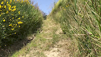
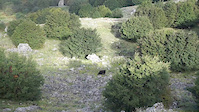
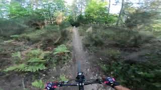
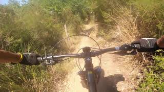
Popular Calabria Mountain Biking Trails
• 100 ★ 4.0 • 3,868 ft • 0 ft • 25 •
Popular blue difficulty singletrack. This mountain bike primary trail and has a hard overall physical rating. It features drop, jump and rock garden. Exposure: Normal Injury Risk. Trail visibility is sometimes hard to follow. On average it takes 3 minutes to complete this trail.
• 65 ★ 4.5 • 1 mile • 2 ft • 19 •
Moderately popular green difficulty family friendly singletrack. This mountain bike primary trail can be used downhill only. It features berm, bridge, drop, jump, gap jump, rock face and rock garden. Trail visibility is always easy to follow. On average it takes 8 minutes to complete this trail.
• 95 ★ 5.0 • 971 ft • 0 ft • 18 •
Popular blue difficulty singletrack. This mountain bike primary trail can be used downhill only and has a moderate overall physical rating. Trail visibility is always easy to follow. On average it takes 1 minutes to complete this trail.
• 95 ★ 5.0 • 3,911 ft • 0 ft • 18 •
Popular blue difficulty singletrack. This mountain bike primary trail can be used downhill primary. It features berm, bridge, drop, jump and skinny. Trail visibility is always easy to follow. On average it takes 17 minutes to complete this trail.
• 100 ★ 4.0 • 906 ft • 0 ft • 18 •
Popular red difficulty singletrack. This mountain bike primary trail can be used downhill only. It features berm, drop and jump. Trail visibility is always easy to follow. On average it takes 3 minutes to complete this trail.
• 90 ★ 4.0 • 4,298 ft • 6 ft • 16 •
Popular black difficulty singletrack. This mountain bike primary trail and has a moderate overall physical rating. It features berm, drop and jump. Exposure: High Risk of Serious Injury. Trail visibility is always easy to follow. On average it takes 15 minutes to complete this trail.
• 90 ★ 4.0 • 1,985 ft • 3 ft • 16 •
Popular green difficulty singletrack. This mountain bike primary trail and has a moderate overall physical rating. It features berm, jump and gap jump. Exposure: Normal Injury Risk. Trail visibility is always easy to follow. On average it takes 6 minutes to complete this trail.
• 75 ★ 4.0 • 719 ft • 7 ft • 16 •
Popular green difficulty singletrack. This mountain bike primary trail can be used downhill primary. It features a-frame, jump, gap jump and rock garden. Trail visibility is always easy to follow. On average it takes 1 minutes to complete this trail.
Calabria Mountain Bike Routes
23 miles • 2,877 ft • 1 • Loop •
Amazing tour along the coast. Spectacular views, lovely village wich is include Belonte and Fiumefreddo...
★ 5.0 • 16 miles • 3,380 ft • 0 • Loop •
Magnifico giro che dalla zona pique-nique di Davoli attraversa tutta la montagna nel cuore del parco delle...
23 miles • 3,549 ft • 4 • Shuttled •
The most famous XC route in Calabria Bike Resort. Up to the Mt. Cocuzzo and down back to the sea. This is...
34 miles • 2,957 ft • 3 • Shuttled •
The most emotional route. A beautiful tour from the top of Monte Cocuzzo, across woods, lovely village,...
★ 3.0 • 6 miles • 403 ft • 0 • Point to Point •
Il percorso prende l'avvio dall'inizio della Pista Azzurra e prevede un breve tratto su un agevole...
★ 3.0 • 8 miles • 729 ft • 0 •
Il percorso prende l'avvio dall'inizio della Pista Azzurra e prevede un breve tratto (in comune con il...
Photos of Calabria Mountain Bike
Videos of Calabria Mountain Bike
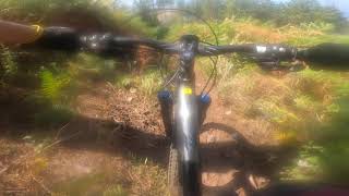
trail: Hydra
0:13 |
169 |
Jun 12, 2019
3:28 |
92 |
Nov 4, 2018
trail: Flow & Air Line #ARULLO
8:10 |
36 |
Dec 22, 2025 , San Giovanni In Fiore
trail: Zefiro
2:52 |
350 |
Oct 31, 2022 , Belmonte Calabro
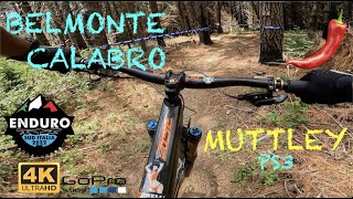
trail: Muttley
3:16 |
275 |
Oct 31, 2022 , Belmonte Calabro
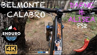
trail: Dafne
2:49 |
278 |
Oct 25, 2022 , Belmonte Calabro
trail: Muttley
2:39 |
291 |
Oct 25, 2022 , Belmonte Calabro
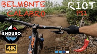
trail: Riot
4:20 |
276 |
Oct 25, 2022 , Belmonte Calabro
Current Trail Warnings
| status | trail | date | condition | user | info |
|---|---|---|---|---|---|
| Sentiero per la cima Soprano Sport Arena | May 29, 2026 @ 3:10pm (Europe/Tirane) May 29, 2026 | Dry | DylanAllGravity | E-Bike |
Recent Trail Reports
Activity Feed
| username | action | type | title | date |
|---|---|---|---|---|
| DylanAllGravity | add | report | activity #96450481 and 1 more | Jun 7, 2026 @ 5:37am Jun 7, 2026 |
| DylanAllGravity | add | report | activity #96450480 | Jun 7, 2026 @ 5:37am Jun 7, 2026 |
| DylanAllGravity | add | report | activity #95790106 and 4 more | May 29, 2026 @ 11:06am May 29, 2026 |
| DylanAllGravity | add | report | activity #95790105 | May 29, 2026 @ 11:06am May 29, 2026 |
| DylanAllGravity | update | region | activity #93568372 | Apr 28, 2026 @ 2:44am Apr 28, 2026 |
Recent Comments
| username | type | title | comment | date |
|---|---|---|---|---|
| report | trail al momento chiuso | Feb 12, 2026 @ 8:36am Feb 12, 2026 | ||
| trail | Flow line molto bella, piena di salti | Dec 22, 2025 @ 9:51am Dec 22, 2025 | ||
| trail | Il trail inizia subit con una bella discesa su... | Jul 19, 2024 @ 1:37am Jul 19, 2024 | ||
| trail | Magnifica discesa tra castagni e aria pura | Oct 7, 2023 @ 1:49pm Oct 7, 2023 | ||
| trail | Attenzione: come da descrizione la maggior... | May 30, 2023 @ 1:15am May 30, 2023 |
Local Badges
-

10 Blue Trails3 awarded -

Epic Ride Climb 2k50 awarded -

Climbing 10k Badge4 awarded -

Climbing 100k Badge1 awarded -

Epic Ride Descent 2k54 awarded -

Descent 10k Badge6 awarded
Bike & Skill Parks
| name | type | city | rating |
|---|---|---|---|
| Calabria Bike Resort | bike park | Belmonte Calabro |
Activity Type Stats
| activitytype | trails | distance | descent | descent distance | total vertical | rating | global rank | state rank | photos | reports | routes | ridelogs |
|---|---|---|---|---|---|---|---|---|---|---|---|---|
| Mountain Bike | 148 | 194 miles | 59,570 ft | 106 miles | 6,378 ft | 657 | 336 | 19 | 4,880 | |||
| E-Bike | 107 | 104 miles | 35,446 ft | 63 miles | 5,682 ft | 333 | 13 | 408 | ||||
| Gravel Bike | 41 | 2 | 44 | |||||||||
| Horse | 68 | 59 miles | 19,859 ft | 35 miles | 5,059 ft | 212 | ||||||
| Hike | 94 | 133 miles | 31,591 ft | 64 miles | 6,378 ft | 304 | 1 | 416 | ||||
| Trail Running | 95 | 136 miles | 33,081 ft | 66 miles | 6,378 ft | 304 | 1 | 11 | ||||
| Dirtbike/Moto | 36 | 13 miles | 3,041 ft | 7 miles | 4,078 ft | 185 | ||||||
| Observed Trials | 29 | 30 miles | 9,068 ft | 16 miles | 3,780 ft | 16 | ||||||
| ATV/ORV/OHV | 35 | 6 miles | 1,512 ft | 3 miles | 3,438 ft | 185 | ||||||
| Snowmobile | 2 | 5 miles | 643 ft | 2 miles | 945 ft | |||||||
| Snowshoe | 3 | 6 miles | 1,312 ft | 3 miles | 3,438 ft | 3 | ||||||
| Downhill Ski | 3 | 6 miles | 1,312 ft | 3 miles | 3,438 ft | 28 | ||||||
| Backcountry Ski | 3 | 6 miles | 1,312 ft | 3 miles | 3,438 ft | 2 | ||||||
| Nordic Ski | 3 | 6 miles | 1,312 ft | 3 miles | 3,438 ft |
Activities
Trails
- By brenthillier
 NSMBA TRAILFORKS & contributors
 - Admins: denitopia, marcoangeletti, cemoorelife
- #9479 - 7,519 views
- calabria activity log | embed map of Calabria mountain bike trails | calabria mountain biking points of interest
Downloading of trail gps tracks in kml & gpx formats is enabled for Calabria.
You must login to download files.