close
-
Layers w
- Weather Layers
- Pro
- Pro
- Pro
- Pro
- Pro
- Pro
- More Layers
- Pro
- Pro
- Pro
- Pro
-
Upgrade to

3D
Trail Conditions
- Unknown
- Snow Groomed
- Snow Packed
- Snow Covered
- Snow Cover Partial
- Freeze/thaw Cycle
- Icy
- Prevalent Mud
- Wet
- Variable
- Ideal
- Dry
- Very Dry
Trail Flow (Ridden Direction)
Trailforks scans users ridelogs to determine the most popular direction each trail is ridden. A good flowing trail network will have most trails flowing in a single direction according to their intension.
The colour categories are based on what percentage of riders are riding a trail in its intended direction.
The colour categories are based on what percentage of riders are riding a trail in its intended direction.
- > 96%
- > 90%
- > 80%
- > 70%
- > 50%
- < 50%
- bi-directional trail
- no data
Trail Last Ridden
Trailforks scans ridelogs to determine the last time a trail was ridden.
- < 2 days
- < 1 week
- < 2 weeks
- < 1 month
- < 6 months
- > 6 months
Trail Ridden Direction
The intended direction a trail should be ridden.
- Downhill Only
- Downhill Primary
- Both Directions
- Uphill Primary
- Uphill Only
- One Direction
Contribute Details
Colors indicate trail is missing specified detail.
- Description
- Photos
- Description & Photos
- Videos
Trail Popularity ?
Trailforks scans ridelogs to determine which trails are ridden the most in the last 9 months.
Trails are compared with nearby trails in the same city region with a possible 25 colour shades.
Think of this as a heatmap, more rides = more kinetic energy = warmer colors.
- most popular
- popular
- less popular
- not popular
ATV/ORV/OHV Filter
Max Vehicle Width
inches
US Cell Coverage
Legend

Radar Time
Activity Recordings
Trailforks uses anonymized public activity data.
?
Activity Recordings
Trailforks uses anonymized public activity data.
?
Personal Heatmap
▶
Activity Types
all
/
none
▶
Options
2
Date range
month
–
Winter Trails
Warning
A routing network for winter maps does not exist. Selecting trails using the winter trails layer has been disabled.
Missing Trails
Most Popular
Least Popular
Trails are colored based on popularity. The more popular a trail is, the more red. Less popular trails trend towards green.
Jump Magnitude Heatmap
Heatmap of where riders jump on trails. Zoom in to see individual jumps, click circles to view jump details.
BC Backroad Status
![map legend]()
Service Road Atlas is a free to use, community-driven service for viewing and creating reports on the numerous back-country service roads around B.C. and Alberta.

Slope Aspect
Direction the slope faces
Trails Deemphasized
Trails are shown in grey.
Only show trails with no bike usage.
Suggested Layers
Based on selected activity type
Save the current map location and zoom level as your default home location whenever this page is loaded.
Save
No description for Callander has been added yet!
Login or register to submit one.
This region uses the Uk/Euro style trail grading system.
Activities Click to view
- Mountain Bike
92 trails
- E-Bike
91 trails
- Gravel Bike
9 trails
- Adaptive Bike
2 trails
- Winter Fat Bike
3 trails
- Horse
1 trails
- Hike
78 trails
- Trail Running
78 trails
Region Details
- 37
- 17
- 8
- 15
- 13
Region Status
Caution as of May 31, 2026Stats
- Avg Trail Rating
- Trails (view details)
- 92
- Trails Mountain Bike
- 92
- Trails E-Bike
- 91
- Trails Gravel Bike
- 9
- Trails Adaptive Bike
- 2
- Trails Winter Fat Bike
- 3
- Trails Horse
- 1
- Trails Hike
- 78
- Trails Trail Running
- 78
- Total Distance
- 61 miles
- Total Descent
- 13,626 ft
- Total Vertical
- 2,659 ft
- Highest Trailhead
- 2,831 ft
- Reports
- 249
- Photos
- 120
- Ridden Counter
- 6,514
Sub Regions
-
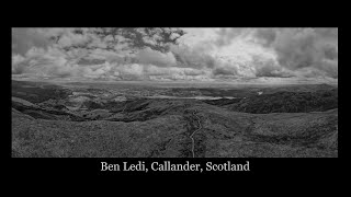
Ben Ledi
- 1
- 2
- 5
- 3
-
Bracklinn Falls
- 2
- 2
-
Callander Craig
- 3
-
Cock Hill Trails
- 3
- 2
- 2
- 2
-
Stank Glen
- 3
- 1
- 5
- 6
Popular Callander Mountain Biking Trails
• 100 ★ 0.0 • 2 miles • 5 ft • 583 •
Popular green difficulty family friendly paved path. This multi-use trail can be used both directions and has a easy overall physical rating with a 5 ft blue climb. Trail visibility is always easy to follow. On average it takes 7 minutes to complete this trail.
• 100 ★ 0.0 • 466 ft • 0 ft • 248 •
Popular green difficulty family friendly gravel path. This multi-use trail can be used both directions and has a easy overall physical rating with a 0 ft green climb. Trail visibility is always easy to follow. On average it takes 1 minutes to complete this trail.
• 100 ★ 0.0 • 1 mile • 6 ft • 243 •
Popular green difficulty family friendly paved path. This multi-use trail can be used both directions and has a easy overall physical rating with a 6 ft blue climb. Trail visibility is always easy to follow. On average it takes 6 minutes to complete this trail.
• 65 ★ 3.5 • 2 miles • 2,388 ft • 136 •
Moderately popular red difficulty mixed. This multi-use trail can be used both directions and has a hard overall physical rating with a 2,388 ft black diamond climb. Trail visibility is always easy to follow. On average it takes 50 minutes to complete this trail.
• 80 ★ 1.0 • 1,158 ft • 0 ft • 112 • • hike
Popular red difficulty singletrack. This hike primary trail can be used downhill primary. On average it takes 3 minutes to complete this trail.
• 85 ★ 0.0 • 751 ft • 0 ft • 91 • • hike
Popular red difficulty singletrack. This hike primary trail can be used downhill primary. On average it takes 1 minutes to complete this trail.
• 90 ★ 4.5 • 1,083 ft • 0 ft • 83 •
Popular black difficulty singletrack. This mountain bike primary trail can be used one direction and has a moderate overall physical rating with a 0 ft blue climb. Trail visibility is sometimes hard to follow. On average it takes 3 minutes to complete this trail.
• 45 ★ 0.0 • 3,927 ft • 946 ft • 77 • • hike
Moderately popular black difficulty singletrack. This hike primary trail can be used both directions and has a hard overall physical rating with a 946 ft black diamond climb. Trail visibility is sometimes hard to follow. On average it takes 36 minutes to complete this trail.
Callander Mountain Bike Routes
★ 5.0 • 18 miles • 3,790 ft • 5 • Loop •
Ben Ledi Loop from Coilhallan
23 miles • 2,332 ft • 1 • Loop •
The Invertrossachs Car Park, the launching point for the ride, involves passing through Callander - a...
15 miles • 2,106 ft • 2 • Loop •
Loop from Callander linking various trails through Leny Woods, above Loch Lubnaig and into Bracklinn....
10 miles • 1,284 ft • 4 • Loop •
Mostly gravel road with a section of gravel path and a section of singletrack. Most of the ride is fairly...
11 miles • 1,727 ft • 10 • Loop •
Route around the trails near Coilhallan woods. Suitable for hardtail or full suspension.
4 miles • 227 ft • 11 • Out & Back •
An alternative route up to Ben Ledi from the main car park. Avoids the main footpath, so should be less...
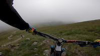
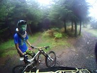
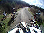
Photos of Callander Mountain Bike
Videos of Callander Mountain Bike
trail: Ben Ledi Path
0:12 |
394 |
Jul 3, 2019

trail: Fireroad
2:27 |
192 |
Jun 20, 2013
trail: Fireroad
0:21 |
66 |
Oct 3, 2011
trail: Fireroad
0:46 |
139 |
Oct 3, 2011
trail: Fireroad
0:26 |
285 |
Apr 8, 2011
4:38 |
212 |
Apr 18, 2021

trail: Access Road
6:29 |
729 |
Oct 18, 2020 , Callander

trail: Ben Ledi Path
6:29 |
544 |
Oct 18, 2020 , Callander
Current Trail Warnings
| status | trail | date | condition | user | info |
|---|---|---|---|---|---|
| Spine Road | May 30, 2026 @ 10:32pm (Pacific/Midway) May 31, 2026 | Ideal | mtcerio | Gravel Bike |
Recent Trail Reports
National Scenic Trails & Official Routes
-
Great Trossachs Path
- Mountain Bike
- E-Bike
- Hike
- Trail Running
-
Rob Roy Way
- Mountain Bike
- E-Bike
- Hike
- Trail Running
Activity Feed
| username | action | type | title | date |
|---|---|---|---|---|
| Bally12 | wishlist | route | activity #97295481 | Jun 18, 2026 @ 9:05pm 10 hours |
| Bally12 | wishlist | route | activity #97295465 | Jun 18, 2026 @ 9:05pm 10 hours |
| mtcerio | add | report | activity #96044181 | Jun 1, 2026 @ 3:26pm Jun 1, 2026 |
| mtcerio | add | report | activity #96044176 and 4 more | Jun 1, 2026 @ 3:26pm Jun 1, 2026 |
| mtcerio | add | report | activity #96044172 and 5 more | Jun 1, 2026 @ 3:26pm Jun 1, 2026 |
Recent Comments
| username | type | title | comment | date |
|---|---|---|---|---|
| trail | Running sweet! | Nov 17, 2025 @ 6:49am Nov 17, 2025 | ||
| trail | Now reopened | Sep 21, 2025 @ 12:14pm Sep 21, 2025 | ||
| report | Trail has now been resurrected and is riding well | Aug 20, 2025 @ 1:21am Aug 20, 2025 | ||
| trail | Closed due to fallen trees | Jul 9, 2025 @ 2:56pm Jul 9, 2025 | ||
| trail | Pretty pointless effort this trail is really a... | Jun 22, 2025 @ 7:42am Jun 22, 2025 |
Local Badges
-

Epic Ride Climb 2k57 awarded -

Climbing 10k Badge26 awarded -

Climbing 100k Badge3 awarded -

Epic Ride Descent 2k60 awarded -

Descent 10k Badge26 awarded -

Descent 100k Badge3 awarded
Activity Type Stats
| activitytype | trails | distance | descent | descent distance | total vertical | rating | global rank | state rank | photos | reports | routes | ridelogs |
|---|---|---|---|---|---|---|---|---|---|---|---|---|
| Mountain Bike | 92 | 60 miles | 12,008 ft | 29 miles | 2,657 ft | #2,812 | #90 | 102 | 248 | 10 | 5,002 | |
| E-Bike | 91 | 60 miles | 12,008 ft | 29 miles | 2,657 ft | #2,144 | #77 | 1 | 235 | 5 | 307 | |
| Gravel Bike | 9 | 5 miles | 1,119 ft | 3 miles | 797 ft | #165 | #155 | 68 | 1 | 23 | ||
| Adaptive Bike | 2 | #191 | #213 | 44 | ||||||||
| Winter Fat Bike | 3 | 3,993 ft | 446 ft | 3,947 ft | 292 ft | #137 | #186 | 14 | ||||
| Horse | 1 | #1,847 | #94 | 31 | ||||||||
| Hike | 78 | 57 miles | 10,328 ft | 26 miles | 2,657 ft | #3,394 | #72 | 9 | 200 | 3 | 638 | |
| Trail Running | 78 | 57 miles | 10,328 ft | 26 miles | 2,657 ft | #3,111 | #64 | 200 | 2 | 591 |
Frequently Asked Questions About Callander
▼
What are the best places to ride in Callander?
Callander has 5 areas to explore for mountain biking. The top rated areas are:
▼
What are the highest rated mountain biking trails in Callander?
The highest rated mountain biking trails in Callander are:
- Nae Baws (4.2/5)
- Nae Brakes (4.2/5)
- The Wall (4.1/5)
- Callander Craig (4.1/5)
- Franken Popper (4.1/5)
▼
What is the best time of the year to ride in Callander?
Based on ride log data, the most popular months to ride in Callander are:
- June (10 activities)
- July (8 activities)
- August (7 activities)
▼
Where can I park to ride in Callander?
Activities
Trails
- By gav-s
 & contributors
 - Admins: DMBinS, FLS, OTA
- #20127 - 5,914 views
- callander activity log | embed map of Callander mountain bike trails | callander mountain biking points of interest
Downloading of trail gps tracks in kml & gpx formats is enabled for Callander.
You must login to download files.