close
-
Layers w
- Weather Layers
- Pro
- Pro
- Pro
- Pro
- Pro
- Pro
- More Layers
- Pro
- Pro
- Pro
- Pro
-
Upgrade to

3D
Trail Conditions
- Unknown
- Snow Groomed
- Snow Packed
- Snow Covered
- Snow Cover Partial
- Freeze/thaw Cycle
- Icy
- Prevalent Mud
- Wet
- Variable
- Ideal
- Dry
- Very Dry
Trail Flow (Ridden Direction)
Trailforks scans users ridelogs to determine the most popular direction each trail is ridden. A good flowing trail network will have most trails flowing in a single direction according to their intension.
The colour categories are based on what percentage of riders are riding a trail in its intended direction.
The colour categories are based on what percentage of riders are riding a trail in its intended direction.
- > 96%
- > 90%
- > 80%
- > 70%
- > 50%
- < 50%
- bi-directional trail
- no data
Trail Last Ridden
Trailforks scans ridelogs to determine the last time a trail was ridden.
- < 2 days
- < 1 week
- < 2 weeks
- < 1 month
- < 6 months
- > 6 months
Trail Ridden Direction
The intended direction a trail should be ridden.
- Downhill Only
- Downhill Primary
- Both Directions
- Uphill Primary
- Uphill Only
- One Direction
Contribute Details
Colors indicate trail is missing specified detail.
- Description
- Photos
- Description & Photos
- Videos
Trail Popularity ?
Trailforks scans ridelogs to determine which trails are ridden the most in the last 9 months.
Trails are compared with nearby trails in the same city region with a possible 25 colour shades.
Think of this as a heatmap, more rides = more kinetic energy = warmer colors.
- most popular
- popular
- less popular
- not popular
ATV/ORV/OHV Filter
Max Vehicle Width
inches
US Cell Coverage
Legend

Radar Time
Activity Recordings
Trailforks uses anonymized public activity data.
?
Activity Recordings
Trailforks uses anonymized public activity data.
?
Personal Heatmap
▶
Activity Types
all
/
none
▶
Options
2
Date range
month
–
Winter Trails
Warning
A routing network for winter maps does not exist. Selecting trails using the winter trails layer has been disabled.
Missing Trails
Most Popular
Least Popular
Trails are colored based on popularity. The more popular a trail is, the more red. Less popular trails trend towards green.
Jump Magnitude Heatmap
Heatmap of where riders jump on trails. Zoom in to see individual jumps, click circles to view jump details.
BC Backroad Status
![map legend]()
Service Road Atlas is a free to use, community-driven service for viewing and creating reports on the numerous back-country service roads around B.C. and Alberta.

Slope Aspect
Direction the slope faces
Trails Deemphasized
Trails are shown in grey.
Only show trails with no bike usage.
Suggested Layers
Based on selected activity type
Save the current map location and zoom level as your default home location whenever this page is loaded.
Save
No description for Cambridge has been added yet!
Login or register to submit one.
Activities Click to view
- Mountain Bike
50 trails
- E-Bike
45 trails
- Gravel Bike
0 trails
- Adaptive Bike
0 trails
- Winter Fat Bike
0 trails
- Hike
53 trails
- Trail Running
53 trails
Region Details
- 1
- 24
- 7
- 3
Region Status
Open as of Jun 11, 2026Stats
- Avg Trail Rating
- Trails (view details)
- 50
- Trails Mountain Bike
- 50
- Trails E-Bike
- 45
- Trails Hike
- 53
- Trails Trail Running
- 53
- Total Distance
- 37 miles
- Total Descent
- 2,546 ft
- Total Vertical
- 1,148 ft
- Highest Trailhead
- 1,209 ft
- Reports
- 165
- Photos
- 55
- Ridden Counter
- 9,673
Sub Regions
-
Birkenhead Domain
- 1
-
Long Bay Regional Park
- 1
- 2
-
Maraetai Forest
- 7
- 22
- 8
- 5
-
Orewa trails
- 8
- 4
-
Puhinui Reserve
- 10
-
Royal Albany Trail
- 1
- 22
- 1
-
Runway MTB Park
- 1
- 6
- 2
-
Sanders Reserve
- 1
- 3
-
Scandrett Regional Park
-
Unsworth Reserve
- 1
- 3
- 6
- 3
-
Waharau
- 1
-
Waitawa Regional Park
- 1
- 6
- 8
- 1
-
Waiuku Forest
- 5
-
Whitford Forest
- 1
- 10
- 2
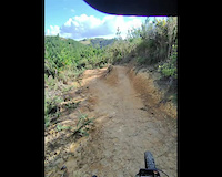
Popular Cambridge Mountain Biking Trails
• 100 ★ 4.2 • 1 mile • 281 ft • 1,553 •
Grade 3 Intermediate up trail to advanced trail network.
• 95 ★ 4.5 • 2,812 ft • 47 ft • 457 •
Originally built by Brent Rayner and Chris Brown, and revamped in November 2020 by Trail Pro. A clay based trail that winds its way from the upper park to the lower. Fast and dusty in summer but muddy and wild in winter. Has many berms...
• 95 ★ 4.5 • 2,710 ft • 263 ft • 410 •
Another Trailer masterpiece . Easiest way up. Up track only for bikers. Also a dual direction walking/running track so look out!
• 90 ★ 3.8 • 2,740 ft • 39 ft • 375 •
Starts with a flatish windy loop, then heads down the hill through a series of nicely bermed corners, before dumping you on the forest road below
• 90 ★ 5.0 • 1,824 ft • 6 ft • 367 •
Popular blue difficulty singletrack. This mountain bike primary trail can be used downhill primary. On average it takes 2 minutes to complete this trail.
• 90 ★ 4.3 • 1,919 ft • 9 ft • 348 •
Recently rebuilt. Generally non-technical and bermy, but with some flat loose corners.
• 100 ★ 5.0 • 1,818 ft • 72 ft • 345 •
Grade 3 XC trail through the natives to get up to area
Cambridge Mountain Bike Routes
★ 5.0 • 9 miles • 716 ft • 31 • Point to Point •
Full Royal Route of all the trails. This followed by the route is the recommended way to ride the Royal...
★ 4.0 • 1 mile • 90 ft • 8 • Point to Point •
Exit route recycling trails via a couple of short exit links. The route together with the covers all the...
8 miles • 598 ft • 8 • Point to Point •
Part of the Te Awa River Ride from Avantidrome to Lake Karapiro.
23 miles • 1,806 ft • 0 • Loop •
Enjoy a mix of gravel and tarseal roads and an interesting variety of rural, bush and harbour views....
16 miles • 1,692 ft • 1 • Loop •
A spectacular ride, predominantly through native forest. Start at Donnellys Crossing and follow Katui Road...
19 miles • 1,054 ft • 0 • Out & Back •
Enjoy some beautiful waterfront riding along the Ruawai Stopbank Trail, then a mix of gravel and tarseal,...
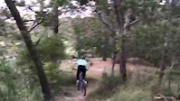
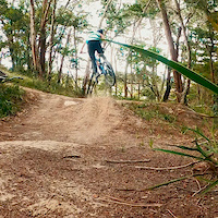
Videos of Cambridge Mountain Bike
trail: Skinny Dipping
0:48 |
24 |
May 15, 2025

trail: Huck Yeah
3:03 |
251 |
Apr 26, 2021
trail: Huck Yeah
0:29 |
|
Apr 26, 2021

trail: Long Bay Coastal Track
5:03 |
325 |
May 1, 2020
trail: Full Send
0:06 |
359 |
Jan 9, 2020
trail: Unsworth Jump Trail
2:40 |
328 |
Jan 8, 2020
trail: Unsworth Jump Trail
0:09 |
97 |
Jul 7, 2019
trail: Race Line
0:08 |
207 |
Jul 7, 2019
Recent Trail Reports
| status | trail | date | condition | info | user |
|---|---|---|---|---|---|
| Comfortably Numb | Jun 12, 2026 @ 9:18am (Pacific/Auckland) Jun 11, 2026 | Ideal | Pukie123 | ||
| Shortcut | May 30, 2026 @ 8:12am (Pacific/Auckland) May 29, 2026 | Dry | Tomjerry | ||
| Unsworth Reserve Bush Bash | Mar 8, 2026 @ 3:29pm (Pacific/Auckland) Mar 7, 2026 | Variable | artinamr | ||
| Crazy Train | Feb 8, 2026 @ 11:45am (Pacific/Auckland) Feb 7, 2026 | Ideal | Shedmtb | ||
| 50/50 | Feb 8, 2026 @ 11:23am (Pacific/Auckland) Feb 7, 2026 | Ideal | Shedmtb | ||
| Fire Break | Feb 8, 2026 @ 11:22am (Pacific/Auckland) Feb 7, 2026 | Dry | Shedmtb | ||
| Boundary Run | Jan 23, 2026 @ 5:06pm (Pacific/Auckland) Jan 22, 2026 | Unknown | bretthudson | ||
| Ngataringa Park Track | Jan 17, 2026 @ 8:56am (Pacific/Auckland) Jan 16, 2026 | Ideal | Tweedledee | ||
| Northboro Reserve Track | Jan 17, 2026 @ 8:56am (Pacific/Auckland) Jan 16, 2026 | Ideal | Tweedledee | ||
| Velodrome to Alpha St, Cambridge | Dec 25, 2025 @ 1:59pm (Pacific/Auckland) Dec 24, 2025 | Ideal | zachbonetti-nz |
Activity Feed
| username | action | type | title | date |
|---|---|---|---|---|
| Mroizzo | add | video | activity #97095883 | Jun 16, 2026 @ 2:45am 2 days |
| spydermite | add | photo | activity #96844878 and 3 more | Jun 12, 2026 @ 7:48pm Jun 12, 2026 |
| Pukie123 | add | report | activity #96792102 | Jun 12, 2026 @ 3:21am Jun 12, 2026 |
| spydermite | add | photo | activity #96778796 | Jun 11, 2026 @ 7:23pm Jun 11, 2026 |
| spydermite | add | photo | activity #96707234 | Jun 10, 2026 @ 5:42pm Jun 10, 2026 |
Recent Comments
| username | type | title | comment | date |
|---|---|---|---|---|
| trail | Currently closed | Jan 22, 2026 @ 1:28pm Jan 22, 2026 | ||
| trail | Trails party still there needs a clean up | Nov 13, 2025 @ 6:47pm Nov 13, 2025 | ||
| trail | Runs still there , gap jump needs some work... | Nov 13, 2025 @ 6:44pm Nov 13, 2025 | ||
| trail | Just covered over grass. No trail or path even | Nov 1, 2025 @ 2:53pm Nov 1, 2025 | ||
| trail | The three climbs on are steep and a bit of a... | May 26, 2025 @ 3:51pm May 26, 2025 |
Local Badges
-

Epic Ride Climb 2k50 awarded -

Climbing 10k Badge69 awarded -

Climbing 100k Badge3 awarded -

Epic Ride Descent 2k50 awarded -

Descent 10k Badge70 awarded -

Descent 100k Badge3 awarded
Bike & Skill Parks
| name | type | city | rating |
|---|---|---|---|
| Kowhai Reserve Bike Track | skill park | Cambridge | |
| Birkenhead Pump Track | skill park | Cambridge | |
| Mountain Raiders BMX Track | skill park | Cambridge | |
| Papakura BMX Track | skill park | Cambridge | |
| Cambridge BMX Track | skill park | Cambridge |
Activity Type Stats
| activitytype | trails | distance | descent | descent distance | total vertical | rating | global rank | state rank | photos | reports | routes | ridelogs |
|---|---|---|---|---|---|---|---|---|---|---|---|---|
| Mountain Bike | 50 | 33 miles | 1,467 ft | 10 miles | 223 ft | #504 | #18 | 44 | 153 | 1 | 30,002 | |
| E-Bike | 45 | 29 miles | 1,079 ft | 9 miles | 217 ft | #1,449 | #30 | 139 | 2,775 | |||
| Hike | 53 | 35 miles | 2,369 ft | 12 miles | 1,145 ft | #2,579 | #43 | 9 | 155 | 784 | ||
| Trail Running | 53 | 35 miles | 2,369 ft | 12 miles | 1,145 ft | #1,955 | #30 | 156 | 4,157 |
Frequently Asked Questions About Cambridge
▼
What are the best places to ride in Cambridge?
Cambridge has 1 areas to explore for mountain biking. The top rated areas are:
▼
What are the highest rated mountain biking trails in Cambridge?
The highest rated mountain biking trails in Cambridge are:
- Native Addiction (4.4/5)
- B's Track (4.4/5)
- Ground Effect (4.3/5)
- Shipwrecks (4.3/5)
- Screamers (4.3/5)
▼
What is the best time of the year to ride in Cambridge?
Based on ride log data, the most popular months to ride in Cambridge are:
- October (63 activities)
- November (47 activities)
- July (45 activities)
▼
Where can I park to ride in Cambridge?
There are 26 parking locations listed in Cambridge. The most popular parking spots are: View all parking and trailhead locations on the map to plan your visit.
Activities
Trails
- By nakinoah
 & contributors
 - Admins: apply
- #8531 - 8,412 views
- cambridge activity log | embed map of Cambridge mountain bike trails | cambridge mountain biking points of interest
Downloading of trail gps tracks in kml & gpx formats is enabled for Cambridge.
You must login to download files.