close
-
Layers w
- Weather Layers
- Pro
- Pro
- Pro
- Pro
- Pro
- Pro
- More Layers
- Pro
- Pro
- Pro
- Pro
-
Upgrade to

3D
Trail Conditions
- Unknown
- Snow Groomed
- Snow Packed
- Snow Covered
- Snow Cover Partial
- Freeze/thaw Cycle
- Icy
- Prevalent Mud
- Wet
- Variable
- Ideal
- Dry
- Very Dry
Trail Flow (Ridden Direction)
Trailforks scans users ridelogs to determine the most popular direction each trail is ridden. A good flowing trail network will have most trails flowing in a single direction according to their intension.
The colour categories are based on what percentage of riders are riding a trail in its intended direction.
The colour categories are based on what percentage of riders are riding a trail in its intended direction.
- > 96%
- > 90%
- > 80%
- > 70%
- > 50%
- < 50%
- bi-directional trail
- no data
Trail Last Ridden
Trailforks scans ridelogs to determine the last time a trail was ridden.
- < 2 days
- < 1 week
- < 2 weeks
- < 1 month
- < 6 months
- > 6 months
Trail Ridden Direction
The intended direction a trail should be ridden.
- Downhill Only
- Downhill Primary
- Both Directions
- Uphill Primary
- Uphill Only
- One Direction
Contribute Details
Colors indicate trail is missing specified detail.
- Description
- Photos
- Description & Photos
- Videos
Trail Popularity ?
Trailforks scans ridelogs to determine which trails are ridden the most in the last 9 months.
Trails are compared with nearby trails in the same city region with a possible 25 colour shades.
Think of this as a heatmap, more rides = more kinetic energy = warmer colors.
- most popular
- popular
- less popular
- not popular
ATV/ORV/OHV Filter
Max Vehicle Width
inches
US Cell Coverage
Legend

Radar Time
Activity Recordings
Trailforks uses anonymized public activity data.
?
Activity Recordings
Trailforks uses anonymized public activity data.
?
Personal Heatmap
▶
Activity Types
all
/
none
▶
Options
2
Date range
month
–
Winter Trails
Warning
A routing network for winter maps does not exist. Selecting trails using the winter trails layer has been disabled.
Missing Trails
Most Popular
Least Popular
Trails are colored based on popularity. The more popular a trail is, the more red. Less popular trails trend towards green.
Jump Magnitude Heatmap
Heatmap of where riders jump on trails. Zoom in to see individual jumps, click circles to view jump details.
BC Backroad Status
![map legend]()
Service Road Atlas is a free to use, community-driven service for viewing and creating reports on the numerous back-country service roads around B.C. and Alberta.

Slope Aspect
Direction the slope faces
Trails Deemphasized
Trails are shown in grey.
Only show trails with no bike usage.
Suggested Layers
Based on selected activity type
Save the current map location and zoom level as your default home location whenever this page is loaded.
Save
No description for Cambusbarron has been added yet!
Login or register to submit one.
 google parking directions
Primary Trail Type: Cross-Country
Land Status: Community Forest
google parking directionsThis region uses the Uk/Euro style trail grading system.
Activities Click to view
- Mountain Bike
64 trails
- E-Bike
64 trails
- Hike
56 trails
- Trail Running
56 trails
Region Details
- 17
- 29
- 5
- 7
- 5
Region Status
Open as of Jun 15, 2026Stats
- Avg Trail Rating
- Trails (view details)
- 63
- Trails Mountain Bike
- 64
- Trails E-Bike
- 64
- Trails Gravel Bike
- 1
- Trails Horse
- 2
- Trails Hike
- 56
- Trails Trail Running
- 56
- Total Distance
- 17 miles
- Total Descent Distance
- 8 miles
- Total Descent
- 2,757 ft
- Total Vertical
- 1,188 ft
- Highest Trailhead
- 1,353 ft
- Reports
- 1,168
- Photos
- 147
- Ridden Counter
- 12,176
Popular Cambusbarron Mountain Biking Trails
• 80 ★ 4.7 • 2,333 ft • 39 ft • 376 •
Natural trail, with gradients in places. Expect roots, rock gardens, and jumps on the lower portions. This is a multi use so expect and be kind to other trail users.
• 90 ★ 0.0 • 577 ft • 0 ft • 320 • • hike
Popular green difficulty singletrack. This hike primary trail can be used both directions and has a easy overall physical rating with a 0 ft green climb. Trail visibility is sometimes hard to follow. On average it takes 4 minutes to complete this trail.
• 75 ★ 4.0 • 951 ft • 54 ft • 297 • • hike
Popular green difficulty singletrack. This hike primary trail can be used both directions. Trail visibility is always easy to follow. On average it takes 4 minutes to complete this trail.
• 85 ★ 0.0 • 394 ft • 3 ft • 295 • • hike
Popular green difficulty singletrack. This hike primary trail can be used both directions and has a easy overall physical rating. On average it takes 4 minutes to complete this trail.
• 100 ★ 0.0 • 738 ft • 56 ft • 268 • • hike
Popular green difficulty singletrack. This hike primary trail can be used both directions and has a easy overall physical rating with a 56 ft green climb. On average it takes 3 minutes to complete this trail.
• 75 ★ 4.6 • 1,444 ft • 0 ft • 259 •
Highly rated popular red difficulty singletrack. This multi-use trail can be used one direction and has a moderate overall physical rating with a 0 ft blue climb. It features berm, drop and jump. Trail visibility is always easy to follow. On average it takes 2 minutes to complete this trail.
• 100 ★ 4.5 • 1,079 ft • 0 ft • 233 •
Upper section of berms through an open clearing then down a greasy descent into a right hand catcher berm/rut. The middle section of trail is relatively flat and boggy, this will be having further work carried out. at the end of the...
Cambusbarron Mountain Bike Routes
★ 2.0 • 14 miles • 2,599 ft • 18 • Loop •
Kiwis ride best of Stirlingshire
• 4 miles • 676 ft • 10 •
• 6 miles • 1,196 ft • 16 •
• 6 miles • 652 ft • 11 •
• 1 mile • 255 ft • 3 •
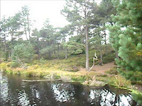
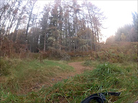
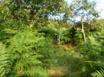
Videos of Cambusbarron Mountain Bike
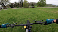
trail: Twist 'n' Shout
2:39 |
459 |
Apr 25, 2020

trail: Path
6:15 |
106 |
Aug 18, 2015
trail: Path
0:44 |
109 |
Aug 31, 2013

trail: Path
11:21 |
321 |
Aug 23, 2013

trail: Old Track
0:52 |
289 |
Dec 18, 2012
trail: Path
0:53 |
199 |
Nov 3, 2012

trail: Path
4:49 |
224 |
Jan 23, 2011
trail: Old Track
0:50 |
441 |
Aug 7, 2009
Recent Trail Reports
| status | trail | date | condition | info | user |
|---|---|---|---|---|---|
| Path | Jun 15, 2026 @ 6:26pm (Europe/Isle_of_Man) Jun 15, 2026 | Variable | ShoodNoBetter BCDC | ||
| Path | Jun 15, 2026 @ 6:26pm (Europe/Isle_of_Man) Jun 15, 2026 | Variable | ShoodNoBetter BCDC | ||
| Yer Maw's Revenge | Jun 15, 2026 @ 6:26pm (Europe/Isle_of_Man) Jun 15, 2026 | Variable | ShoodNoBetter BCDC | ||
| Trail | Jun 15, 2026 @ 6:26pm (Europe/Isle_of_Man) Jun 15, 2026 | Variable | ShoodNoBetter BCDC | ||
| Quarry Trail | Jun 15, 2026 @ 6:26pm (Europe/Isle_of_Man) Jun 15, 2026 | Variable | ShoodNoBetter BCDC | ||
| Access | Jun 15, 2026 @ 6:26pm (Europe/Isle_of_Man) Jun 15, 2026 | Variable | ShoodNoBetter BCDC | ||
| Path | Jun 15, 2026 @ 6:26pm (Europe/Isle_of_Man) Jun 15, 2026 | Variable | ShoodNoBetter BCDC | ||
| Path | May 28, 2026 @ 8:27am (Europe/Isle_of_Man) May 28, 2026 | Dry | ShoodNoBetter BCDC | ||
| Streetfighter | May 28, 2026 @ 8:27am (Europe/Isle_of_Man) May 28, 2026 | Dry | ShoodNoBetter BCDC | ||
| SF to the House | May 10, 2026 @ 10:35pm (Europe/London) May 10, 2026 | Dry | stuartw OTA |
Activity Feed
| username | action | type | title | date |
|---|---|---|---|---|
| ShoodNoBetter | add | report | activity #97132508 and 6 more | Jun 16, 2026 @ 12:49pm 2 days |
| ooB88Y | ridden | poi | activity #95713139 | May 28, 2026 @ 9:30am May 28, 2026 |
| ShoodNoBetter | add | report | activity #95693246 and 2 more | May 28, 2026 @ 2:18am May 28, 2026 |
| ooB88Y | add | photo | activity #95526887 and 1 more | May 25, 2026 @ 3:10pm May 25, 2026 |
| RoddyRA6T7k | add | poi | activity #95094215 | May 20, 2026 @ 1:56am May 20, 2026 |
Recent Comments
| username | type | title | comment | date |
|---|---|---|---|---|
| trail | Blocked by fallen tree next to the quarry... | Oct 6, 2025 @ 7:24am Oct 6, 2025 | ||
| trail | Full of fallen trees | Aug 31, 2025 @ 1:48pm Aug 31, 2025 | ||
| trail | Full of fallen tree | Aug 31, 2025 @ 1:46pm Aug 31, 2025 | ||
| trail | Berms are very wet/splippy | Jan 18, 2025 @ 11:13am Jan 18, 2025 | ||
| trail | Always enjoy this one always wee opportunities... | Oct 8, 2024 @ 11:51am Oct 8, 2024 |
Nearby Areas
| name | distance | ||||
|---|---|---|---|---|---|
| North Third | 3 | 9 | 1.5 km | ||
| Carron Valley | 10 | 16 | 4.7 km | ||
| Mine Woods | 6 | 5 | 5.6 km | ||
| Plean Country Park | 15 | 1 | 5.9 km | ||
| Uni Wood | 1 | 5 | 5.9 km |
Local Badges
-

Completionist5 awarded
Activity Type Stats
| activitytype | trails | distance | descent | descent distance | total vertical | rating | global rank | state rank | photos | reports | routes | ridelogs |
|---|---|---|---|---|---|---|---|---|---|---|---|---|
| Mountain Bike | 64 | 17 miles | 2,756 ft | 8 miles | 1,188 ft | #2,201 | #71 | 146 | 1,168 | 2 | 7,526 | |
| E-Bike | 64 | 17 miles | 2,756 ft | 8 miles | 1,188 ft | #2,263 | #81 | 1 | 1,128 | 2 | 834 | |
| Gravel Bike | 1 | #1,479 | #77 | 3 | ||||||||
| Horse | 2 | 1 mile | 23 ft | 1,076 ft | 335 ft | 114 | ||||||
| Hike | 56 | 15 miles | 1,890 ft | 6 miles | 1,188 ft | #3,845 | 1,076 | 2 | 250 | |||
| Trail Running | 56 | 15 miles | 1,890 ft | 6 miles | 1,188 ft | #3,824 | #73 | 1,076 | 2 | 453 |
Frequently Asked Questions About Cambusbarron
▼
What are the highest rated mountain biking trails in Cambusbarron?
The highest rated mountain biking trails in Cambusbarron are:
- Quarry Woods Descent (4.4/5)
- Twist 'n' Shout (4.3/5)
- Old Track (4.2/5)
- Yer Maw's Revenge (4.2/5)
- Bit on the Side (4.2/5)
▼
What is the best time of the year to ride in Cambusbarron?
Based on ride log data, the most popular months to ride in Cambusbarron are:
- June (35 activities)
- September (33 activities)
- July (32 activities)
▼
Where can I park to ride in Cambusbarron?
There are 4 parking locations listed in Cambusbarron. The most popular parking spots are:
- Gateside Road Car Park
- Quarry Road Car Park
- Community Centre Car Park
- Battle of Bannockburn Visitor Centre Car Park
▼
What is the longest trail in Cambusbarron?
The longest trail in Cambusbarron is Trail at 1.9 km. View all trails sorted by distance.
Activities
Trails
- By gav-s
 & contributors
 - Admins: OTA, Cambu
- #7241 - 24,335 views
- cambusbarron activity log | embed map of Cambusbarron mountain bike trails | cambusbarron mountain biking points of interest
Downloading of trail gps tracks in kml & gpx formats is enabled for Cambusbarron.
You must login to download files.