close
-
Layers w
- Weather Layers
- Pro
- Pro
- Pro
- Pro
- Pro
- Pro
- More Layers
- Pro
- Pro
- Pro
- Pro
-
Upgrade to

3D
Trail Conditions
- Unknown
- Snow Groomed
- Snow Packed
- Snow Covered
- Snow Cover Partial
- Freeze/thaw Cycle
- Icy
- Prevalent Mud
- Wet
- Variable
- Ideal
- Dry
- Very Dry
Trail Flow (Ridden Direction)
Trailforks scans users ridelogs to determine the most popular direction each trail is ridden. A good flowing trail network will have most trails flowing in a single direction according to their intension.
The colour categories are based on what percentage of riders are riding a trail in its intended direction.
The colour categories are based on what percentage of riders are riding a trail in its intended direction.
- > 96%
- > 90%
- > 80%
- > 70%
- > 50%
- < 50%
- bi-directional trail
- no data
Trail Last Ridden
Trailforks scans ridelogs to determine the last time a trail was ridden.
- < 2 days
- < 1 week
- < 2 weeks
- < 1 month
- < 6 months
- > 6 months
Trail Ridden Direction
The intended direction a trail should be ridden.
- Downhill Only
- Downhill Primary
- Both Directions
- Uphill Primary
- Uphill Only
- One Direction
Contribute Details
Colors indicate trail is missing specified detail.
- Description
- Photos
- Description & Photos
- Videos
Trail Popularity ?
Trailforks scans ridelogs to determine which trails are ridden the most in the last 9 months.
Trails are compared with nearby trails in the same city region with a possible 25 colour shades.
Think of this as a heatmap, more rides = more kinetic energy = warmer colors.
- most popular
- popular
- less popular
- not popular
ATV/ORV/OHV Filter
Max Vehicle Width
inches
US Cell Coverage
Legend

Radar Time
Activity Recordings
Trailforks uses anonymized public activity data.
?
Activity Recordings
Trailforks uses anonymized public activity data.
?
Personal Heatmap
▶
Activity Types
all
/
none
▶
Options
2
Date range
month
–
Winter Trails
Warning
A routing network for winter maps does not exist. Selecting trails using the winter trails layer has been disabled.
Missing Trails
Most Popular
Least Popular
Trails are colored based on popularity. The more popular a trail is, the more red. Less popular trails trend towards green.
Jump Magnitude Heatmap
Heatmap of where riders jump on trails. Zoom in to see individual jumps, click circles to view jump details.
BC Backroad Status
![map legend]()
Service Road Atlas is a free to use, community-driven service for viewing and creating reports on the numerous back-country service roads around B.C. and Alberta.

Slope Aspect
Direction the slope faces
Trails Deemphasized
Trails are shown in grey.
Only show trails with no bike usage.
Suggested Layers
Based on selected activity type
Save the current map location and zoom level as your default home location whenever this page is loaded.
SaveGreat network of short trails for all skill levels. Everything from XC to DH. The original line from the BC Summer games is still active. Great place to learn to Mtb.
Currently no signage, so just try to enjoy yourself and dont get hung-up on where you are. It is a small network and can easily get mixed around.
Currently no signage, so just try to enjoy yourself and dont get hung-up on where you are. It is a small network and can easily get mixed around.
Primary Trail Type: Cross-Country
eBikes Allowed:
Yes
 google parking directions
 Access Info:
From nearly any point in Penticton, you can easily spot Campbell Mountain, look East and spot a couple radio towers. There are 2 main entrances to Campbell. Head North East out of Penticton towards Naramata, all roads funnel down to 1 (McMillan Ave) before you get there. Turn off (right on Reservoir Rd) and head up the hill towards the Landfill.
The first parking is called the Morgenstern’s or red gate, it is at the entry to 1550 Reservoir Rd, please respect the private property. Park on either side of the road but NOT on the driveway, they are kind enough to allow us access through their property.
The main parking is past and above the landfill entry. Turn left on Spiller Rd and the parking entrance is on the left. Access to the trails is across the road above the cattle guard.
Activities Click to view
- Mountain Bike
46 trails
- E-Bike
46 trails
- Hike
44 trails
- Trail Running
44 trails
Region Details
- 4
- 21
- 20
- 1
Region Status
Open as of Jun 10, 2026Stats
- Avg Trail Rating
- Trails (view details)
- 46
- Trails Mountain Bike
- 46
- Trails E-Bike
- 46
- Trails Gravel Bike
- 3
- Trails Hike
- 44
- Trails Trail Running
- 44
- Total Distance
- 32 miles
- Total Descent
- 8,001 ft
- Total Vertical
- 1,036 ft
- Highest Trailhead
- 2,769 ft
- Reports
- 1,714
- Photos
- 241
- Ridden Counter
- 18,374
Popular Campbell Mountain Mountain Biking Trails
• 100 ★ 3.5 • 4,601 ft • 223 ft • 1,101 •
Sometimes referred to as 'Classic Campbell' or 'Campbell Classic', this trail begins just past the Yellow Gate and meanders up to an old Dairy Queen table poised with some epic views. Originally, the trail went all the way up to the DH...
• 100 ★ 4.0 • 2,581 ft • 173 ft • 929 •
A beautiful climb that can be ridden right from Suffer'n Switchbacks or Tee'd in if you have taken or Road. It meanders up past an old DH line with some decrepit stunts. A couple of moderate grunts but mostly just a spin.
• 100 ★ 3.7 • 3,142 ft • 233 ft • 888 •
I am unsure of the original name, this is just what I have been told. It does make sense because the initial climb from the DQ table ( ) is punishing to the uninitiated. However, it is an excellent singletrack climb to get to the summit.
• 100 ★ 0.0 • 421 ft • 0 ft • 856 •
Links the Summit via the DH trail to . Berms berms berms. In the future, this will continue to the original DH trail.
• 100 ★ 4.5 • 4,113 ft • 11 ft • 740 •
was created as a way to recover from an injury from one of our friends. We wanted a fun flowy trail just for ourselves, but it turned into something so much more. People were finding it way before it was finished and it became an...
• 95 ★ 3.8 • 2 miles • 87 ft • 685 •
Fast, flowy, all around fun way around the mountain without going to the summit. The 'whoops' as the locals call it is a ludicrously fast steady downhill with small ditches that the trail zips through. Very fun in a train of riders....
• 95 ★ 4.4 • 4,658 ft • 253 ft • 648 •
has some exposure ... but phenomenal views of the canyon. Just stick to the trail, pay attention and enjoy. The climb out used to go straight up the fenceline but now has an amazing switchback climb back up the road.
• 100 ★ 4.5 • 1,104 ft • 8 ft • 646 •
The old dirt bikers 4x track. Somehow they still remain descent after all these years. Nice 6' tables and berms.
Campbell Mountain Mountain Bike Routes
★ 4.0 • 14 miles • 2,247 ft • 11 •
Swagman's Backyard Ride Guide is back - this time, in two parts for the largest of the Penticton Trail...
★ 3.7 • 6 miles • 1,023 ft • 11 • Loop •
Park at Morgensterns Gate. Ride up to . There is a new switchback climb bypassing a longer loop on Red...
10 miles • 1,539 ft • 8 • Loop •
Born in the biking haven of Penticton, BC, Swagman's passion extends beyond bike racks to the very thrill...
★ 4.0 • 7 miles • 872 ft • 37 •
A fun mix circling the mid elevation of Campbell with the high speed flow of the Backside and a climb to...
8 miles • 995 ft • 9 • Loop •
Start at the 'Yellow Gate', just past the cattleguard you will see the entranceway. Gate is recessed back...
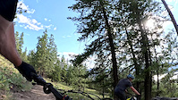
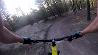
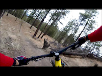
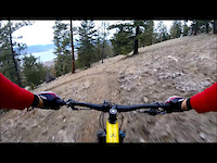
Photos of Campbell Mountain Mountain Bike
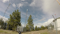
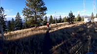
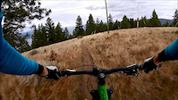
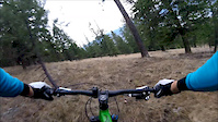
Videos of Campbell Mountain Mountain Bike
trail: Trench Fickler
3:43 |
85 |
Dec 23, 2025
trail: Campbell DH
0:00 |
176 |
Apr 10, 2020
trail: She Goes Down
4:15 |
168 |
Jan 2, 2019
trail: Blue Flamingo
3:21 |
180 |
Jan 2, 2019
trail: She Goes Down
12:06 |
304 |
Apr 17, 2018
trail: The Whoop! Trail
2:36 |
238 |
Dec 20, 2017
trail: Blue Flamingo
3:12 |
253 |
Dec 1, 2016
trail: Campbell DH
5:30 |
126 |
Nov 29, 2016
Recent Trail Reports
| status | trail | date | condition | info | user |
|---|---|---|---|---|---|
| She Goes Down | Jun 10, 2026 @ 2:11pm (America/Vancouver) Jun 10, 2026 | Unknown | 9M5HGd1 | ||
| Campbell 4x | Apr 16, 2026 @ 7:14pm (America/Vancouver) Apr 16, 2026 | Ideal | Bricklin69 | ||
| She Goes Down Connector | Apr 16, 2026 @ 7:14pm (America/Vancouver) Apr 16, 2026 | Ideal | Bricklin69 | ||
| Tower Road | Apr 16, 2026 @ 7:14pm (America/Vancouver) Apr 16, 2026 | Ideal | Bricklin69 | ||
| Suffer'n to DQ | Apr 13, 2026 @ 6:28am (America/Vancouver) Apr 13, 2026 | Unknown | CZlY0Evq | ||
| Blue Flamingo | Apr 9, 2026 @ 1:44pm (America/Vancouver) Apr 9, 2026 | Unknown | Bundi | ||
| Suffer'n Switchbacks | Mar 10, 2026 @ 4:53pm (America/Vancouver) Mar 10, 2026 | Unknown | Daynaseaward | ||
| Fiori | Mar 8, 2026 @ 4:03pm (America/Vancouver) Mar 8, 2026 | Ideal | dangerdonny | ||
| Canyon Trail | Mar 8, 2026 @ 4:03pm (America/Vancouver) Mar 8, 2026 | Ideal | dangerdonny | ||
| The Whoop! Trail | Mar 8, 2026 @ 4:03pm (America/Vancouver) Mar 8, 2026 | Ideal | dangerdonny |
Activity Feed
| username | action | type | title | date |
|---|---|---|---|---|
| ChesusRice | wishlist | route | activity #97010893 | Jun 14, 2026 @ 4:02pm 3 days |
| James0byUWl | wishlist | region | activity #96891217 | Jun 13, 2026 @ 10:04am Jun 13, 2026 |
| 9M5HGd1 | add | report | activity #96695396 | Jun 10, 2026 @ 2:11pm Jun 10, 2026 |
| MarkIvdbJQ | wishlist | route | activity #96627267 | Jun 9, 2026 @ 1:41pm Jun 9, 2026 |
| Vandy07med | wishlist | region | activity #96289099 | Jun 5, 2026 @ 5:47am Jun 5, 2026 |
Recent Comments
| username | type | title | comment | date |
|---|---|---|---|---|
| trail | The lower switch back is quite unrelentingly... | May 18, 2026 @ 8:26am May 18, 2026 | ||
| trail | Narrow trail, steep turns , some loose sand... | May 6, 2026 @ 2:36pm May 6, 2026 | ||
| trail | I guess Dave died or something ? LOL IT WILL... | Feb 11, 2026 @ 11:22am Feb 11, 2026 | ||
| trail | This trail should just go straight down... | Aug 22, 2025 @ 10:08pm Aug 22, 2025 | ||
| trail | Super fun and flowy | May 5, 2025 @ 7:52pm May 5, 2025 |
Nearby Areas
| name | distance | ||||
|---|---|---|---|---|---|
| Esplanade Trail Network | 1 | 2 | 2.1 km | ||
| Wiltse | 2 | 5 | 6 | 3.3 km | |
| Carmi | 8 | 4 | 1 | 3.5 km | |
| Three Blind Mice | 9 | 54 | 21 | 2 | 3.7 km |
| Skaha Bluffs | 1 | 5 | 2 | 5.6 km |
Local Badges
-

Completionist3 awarded
Activity Type Stats
| activitytype | trails | distance | descent | descent distance | total vertical | rating | global rank | state rank | photos | reports | routes | ridelogs |
|---|---|---|---|---|---|---|---|---|---|---|---|---|
| Mountain Bike | 46 | 32 miles | 8,002 ft | 15 miles | 1,037 ft | #978 | #78 | 241 | 1,714 | 12 | 13,156 | |
| E-Bike | 46 | 32 miles | 8,002 ft | 15 miles | 1,037 ft | #2,546 | #85 | 1 | 1,595 | 2 | 1,159 | |
| Gravel Bike | 3 | 5 miles | 965 ft | 2 miles | 827 ft | #479 | #69 | 35 | 13 | |||
| Hike | 44 | 31 miles | 7,598 ft | 14 miles | 1,037 ft | #4,926 | #205 | 2 | 1,691 | 934 | ||
| Trail Running | 44 | 31 miles | 7,598 ft | 14 miles | 1,037 ft | #3,727 | #118 | 1,690 | 1,173 |
Frequently Asked Questions About Campbell Mountain
▼
What are the highest rated mountain biking trails in Campbell Mountain?
The highest rated mountain biking trails in Campbell Mountain are:
- She Goes Down (4.3/5)
- Canyon Trail (4.2/5)
- Pork and Beans (4.1/5)
- Summer Climb 1 (4.1/5)
- Glenno's Limelight (4.1/5)
▼
What is the best time of the year to ride in Campbell Mountain?
Based on ride log data, the most popular months to ride in Campbell Mountain are:
- July (263 activities)
- May (224 activities)
- June (205 activities)
▼
Where can I park to ride in Campbell Mountain?
There are 2 parking locations listed in Campbell Mountain. The most popular parking spots are:
▼
What is the longest trail in Campbell Mountain?
The longest trail in Campbell Mountain is South Canyon at 2.8 km. View all trails sorted by distance.
Activities
Trails
- By FreedomBikeShop
 & contributors
 - Admins: NPCCSC, 1partatatime, terrymcw, PACApenticton, PACA, PACA, 1partatatime, PACApenticton
- #5178 - 32,680 views
- campbell mountain activity log | embed map of Campbell Mountain mountain bike trails | campbell mountain mountain biking points of interest
Downloading of trail gps tracks in kml & gpx formats is enabled for Campbell Mountain.
You must login to download files.