close
-
Layers w
- Weather Layers
- Pro
- Pro
- Pro
- Pro
- Pro
- Pro
- More Layers
- Pro
- Pro
- Pro
- Pro
-
Upgrade to

3D
Trail Conditions
- Unknown
- Snow Groomed
- Snow Packed
- Snow Covered
- Snow Cover Partial
- Freeze/thaw Cycle
- Icy
- Prevalent Mud
- Wet
- Variable
- Ideal
- Dry
- Very Dry
Trail Flow (Ridden Direction)
Trailforks scans users ridelogs to determine the most popular direction each trail is ridden. A good flowing trail network will have most trails flowing in a single direction according to their intension.
The colour categories are based on what percentage of riders are riding a trail in its intended direction.
The colour categories are based on what percentage of riders are riding a trail in its intended direction.
- > 96%
- > 90%
- > 80%
- > 70%
- > 50%
- < 50%
- bi-directional trail
- no data
Trail Last Ridden
Trailforks scans ridelogs to determine the last time a trail was ridden.
- < 2 days
- < 1 week
- < 2 weeks
- < 1 month
- < 6 months
- > 6 months
Trail Ridden Direction
The intended direction a trail should be ridden.
- Downhill Only
- Downhill Primary
- Both Directions
- Uphill Primary
- Uphill Only
- One Direction
Contribute Details
Colors indicate trail is missing specified detail.
- Description
- Photos
- Description & Photos
- Videos
Trail Popularity ?
Trailforks scans ridelogs to determine which trails are ridden the most in the last 9 months.
Trails are compared with nearby trails in the same city region with a possible 25 colour shades.
Think of this as a heatmap, more rides = more kinetic energy = warmer colors.
- most popular
- popular
- less popular
- not popular
ATV/ORV/OHV Filter
Max Vehicle Width
inches
US Cell Coverage
Legend

Radar Time
Activity Recordings
Trailforks uses anonymized public activity data.
?
Activity Recordings
Trailforks uses anonymized public activity data.
?
Personal Heatmap
▶
Activity Types
all
/
none
▶
Options
2
Date range
month
–
Winter Trails
Warning
A routing network for winter maps does not exist. Selecting trails using the winter trails layer has been disabled.
Missing Trails
Most Popular
Least Popular
Trails are colored based on popularity. The more popular a trail is, the more red. Less popular trails trend towards green.
Jump Magnitude Heatmap
Heatmap of where riders jump on trails. Zoom in to see individual jumps, click circles to view jump details.
BC Backroad Status
![map legend]()
Service Road Atlas is a free to use, community-driven service for viewing and creating reports on the numerous back-country service roads around B.C. and Alberta.

Slope Aspect
Direction the slope faces
Trails Deemphasized
Trails are shown in grey.
Only show trails with no bike usage.
Suggested Layers
Based on selected activity type
Save the current map location and zoom level as your default home location whenever this page is loaded.
SaveCannock Chase is a mixed area of countryside in the county of Staffordshire, England. The area has been designated as the Cannock Chase Area of Outstanding Natural Beauty. The Chase gives its name to the Cannock Chase local government district.
source: Chase Trails
Primary Trail Type: Cross-Country
eBikes Allowed:
Yes
Land Status: National Forest
Land Manager: Forestry England
 google parking directions
 Access Info:
Various, though the most common is located at Birches Valley (WS15 2UQ).
Links
- Forestry England (Landowner)
- Cannock Chase Forest Cycling Group (Forestry England)
- Chase Trails (Official MTB Trail Builders)
- Chase Trails Community Facebook Group (Local Riding Community)
This region uses the Uk/Euro style trail grading system.
Activities Click to view
- Mountain Bike
110 trails
- E-Bike
108 trails
- Horse
51 trails
- Hike
54 trails
- Trail Running
65 trails
- Observed Trials
0 trails
Region Details
- 49
- 2
- 13
- 42
- 4
Region Status
Open as of Jun 13, 2026Stats
- Avg Trail Rating
- Trails (view details)
- 110
- Trails Mountain Bike
- 110
- Trails E-Bike
- 108
- Trails Horse
- 51
- Trails Hike
- 54
- Trails Trail Running
- 65
- Total Distance
- 51 miles
- Total Descent
- 7,297 ft
- Total Vertical
- 513 ft
- Highest Trailhead
- 784 ft
- Reports
- 3,487
- Photos
- 185
- Ridden Counter
- 121,497
Articles
Video: RutFest Returns With More Loamy Madness
Mar 24, 2020 from pinkbike.com
Trail Maps let 200 riders loose on a whole load of loamy turns
Popular Cannock Chase Mountain Biking Trails
• 100 ★ 3.7 • 660 ft • 16 ft • 2,329 •
Popular red difficulty singletrack. This mountain bike primary trail can be used uphill primary and has a easy overall physical rating with a 16 ft green climb. On average it takes minutes to complete this trail.
• 100 ★ 4.0 • 2,173 ft • 5 ft • 2,286 •
Highly rated popular red difficulty singletrack. This mountain bike primary trail can be used downhill only. It features berm, drop and jump. On average it takes 2 minutes to complete this trail.
• 85 ★ 3.2 • 1,765 ft • 34 ft • 2,253 •
Popular red difficulty singletrack. This mountain bike primary trail can be used downhill only and has a hard overall physical rating. It features berm, bridge and rock garden. On average it takes 3 minutes to complete this trail.
• 95 ★ 3.9 • 934 ft • 13 ft • 2,249 •
One of the most fun sections of the Follow the Dog trail - fast and flowy, albeit with a few braking bumps now.
• 90 ★ 4.0 • 1,457 ft • 112 ft • 2,236 •
Popular red difficulty singletrack. This mountain bike primary trail can be used uphill only and has a easy overall physical rating with a 112 ft green climb. On average it takes 3 minutes to complete this trail.
• 95 ★ 3.0 • 1,649 ft • 42 ft • 2,144 •
Popular red difficulty singletrack. This mountain bike primary trail can be used downhill only and has a moderate overall physical rating. It features berm and jump. On average it takes 2 minutes to complete this trail.
• 100 ★ 3.4 • 1,163 ft • 41 ft • 2,143 •
Popular red difficulty singletrack. This mountain bike primary trail can be used downhill primary and has a easy overall physical rating with a 41 ft green climb. It features berm and jump. On average it takes 1 minutes to complete this trail.
Cannock Chase Mountain Bike Routes
Follow the Dog Featured
★ 3.6 • 6 miles • 709 ft • 19 • Loop •
The Midlands' first dedicated mountain bike trail. Follow the Dog is a red graded 6.7 mile intermediate...
★ 3.9 • 12 miles • 1,760 ft • 40 • Loop •
This is the full 14.1 mile red route which includes both Follow the Dog and The Monkey Trail. Opened in...
★ 5.0 • 16 miles • 2,258 ft • 50 • Loop •
A circular route that covers as much as possible of Cannock chase main routes. Does not include Stile Cop...
15 miles • 1,354 ft • 0 • Loop •
A little bit of Off-Piste at Cannock Chase not the most difficult but enjoyable.
• 15 miles • 2,438 ft • 52 •
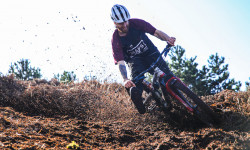
Photos of Cannock Chase Mountain Bike
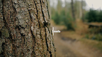
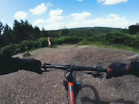
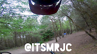
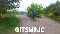
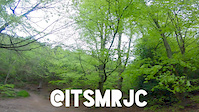
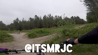
Videos of Cannock Chase Mountain Bike
trail: Rollercoaster
4:01 |
92 |
Mar 16, 2022
trail: Lower Cliff
0:46 |
227 |
Jul 19, 2020
trail: Snap It
3:46 |
121 |
May 21, 2020

trail: Pot of Gold
0:50 |
97 |
May 21, 2020
trail: Lower Cliff
2:59 |
177 |
May 20, 2020
trail: Insidious Incline
3:29 |
103 |
May 20, 2020
trail: Deer Skull
0:50 |
79 |
May 20, 2020

trail: Cannock Chase Fairoak Trail
12:18 |
138 |
Jul 22, 2018
Recent Trail Reports
| status | trail | date | condition | info | user |
|---|---|---|---|---|---|
| Cannock Chase Blue Route (Section 3) | Apr 11, 2026 @ 7:20pm (Europe/London) Apr 11, 2026 | Ideal | joeg885 | ||
| Cannock Chase Blue Route (Section 2) | Apr 11, 2026 @ 7:20pm (Europe/London) Apr 11, 2026 | Ideal | joeg885 | ||
| Follow the Dog Qualifier | Apr 11, 2026 @ 7:19pm (Europe/London) Apr 11, 2026 | Ideal | joeg885 | ||
| Snakes 'n' Adders | Apr 11, 2026 @ 7:19pm (Europe/London) Apr 11, 2026 | Variable | joeg885 | ||
| Hugh's Bridge | Apr 11, 2026 @ 7:19pm (Europe/London) Apr 11, 2026 | Variable | joeg885 | ||
| Are We There Yet? | Apr 11, 2026 @ 7:18pm (Europe/London) Apr 11, 2026 | Variable | joeg885 | ||
| Let Loose | Apr 11, 2026 @ 7:18pm (Europe/London) Apr 11, 2026 | Variable | joeg885 | ||
| Pain in the Hardtail | Apr 11, 2026 @ 7:18pm (Europe/London) Apr 11, 2026 | Variable | joeg885 | ||
| The Seven Dwarfs | Apr 11, 2026 @ 7:17pm (Europe/London) Apr 11, 2026 | Variable | joeg885 | ||
| Snow White | Apr 11, 2026 @ 7:17pm (Europe/London) Apr 11, 2026 | Variable | joeg885 |
Activity Feed
| username | action | type | title | date |
|---|---|---|---|---|
| jiml34 | wishlist | route | activity #97347263 | Jun 19, 2026 @ 3:06pm 5 hours |
| JoshuaAf0RXOC | vote | route | activity #96929345 | Jun 13, 2026 @ 5:40pm Jun 13, 2026 |
| JoshuaAf0RXOC | ridden | route | activity #96929300 | Jun 13, 2026 @ 5:40pm Jun 13, 2026 |
| DanC0510 | wishlist | route | activity #96892024 | Jun 13, 2026 @ 10:13am Jun 13, 2026 |
| username2307 | wishlist | route | activity #95428624 | May 24, 2026 @ 11:14am May 24, 2026 |
Recent Comments
| username | type | title | comment | date |
|---|---|---|---|---|
| trail | Short bridge after a rock garden turb, with a... | Jul 5, 2025 @ 5:43am Jul 5, 2025 | ||
| trail | Super easy ride great for a warm up before... | May 4, 2025 @ 11:31am May 4, 2025 | ||
| report | Appreciated thank you | May 23, 2023 @ 10:41am May 23, 2023 | ||
| report | Love it! | May 22, 2023 @ 7:13pm May 22, 2023 | ||
| trail | this section were closed on 09102022 | Jan 11, 2022 @ 3:42am Jan 11, 2022 |
Nearby Areas
| name | distance | ||||
|---|---|---|---|---|---|
| Stile Cop | 1.6 km | ||||
| Blithfield Reservoir | 5.6 km | ||||
| Hopwas Woods | 2 | 12 km | |||
| Downs Banks | 2 | 2 | 14.5 km | ||
| Sandwell Valley | 15 km |
Local Badges
-

Completionist0 awarded
Activity Type Stats
| activitytype | trails | distance | descent | descent distance | total vertical | rating | global rank | state rank | photos | reports | routes | ridelogs |
|---|---|---|---|---|---|---|---|---|---|---|---|---|
| Mountain Bike | 110 | 51 miles | 7,297 ft | 24 miles | 512 ft | #51 | #4 | 185 | 3,475 | 5 | 32,738 | |
| E-Bike | 108 | 51 miles | 7,238 ft | 24 miles | 512 ft | #96 | #22 | 3,458 | 4 | 5,930 | ||
| Horse | 51 | 37 miles | 4,193 ft | 17 miles | 502 ft | #161 | #14 | 713 | 2 | |||
| Hike | 54 | 37 miles | 4,393 ft | 17 miles | 502 ft | #3,351 | #54 | 3,348 | 268 | |||
| Trail Running | 65 | 41 miles | 4,803 ft | 19 miles | 502 ft | #2,269 | #41 | 3,351 | 605 |
Frequently Asked Questions About Cannock Chase
▼
What are the highest rated mountain biking trails in Cannock Chase?
The highest rated mountain biking trails in Cannock Chase are:
- Cannock Chase Blue Route (Section 1) (4.2/5)
- Cannock Chase Blue Route (Section 9) (4.2/5)
- Cannock Chase Blue Route (Section 7) (4.2/5)
- Lower Cliff (4.2/5)
- Cannock Chase Blue Route (Section 3) (4.1/5)
▼
What is the best time of the year to ride in Cannock Chase?
Based on ride log data, the most popular months to ride in Cannock Chase are:
- July (127 activities)
- August (91 activities)
- June (84 activities)
▼
Where can I park to ride in Cannock Chase?
There are 3 parking locations listed in Cannock Chase. The most popular parking spots are: View all parking and trailhead locations on the map to plan your visit.
▼
What is the longest trail in Cannock Chase?
The longest trail in Cannock Chase is Chase Heritage Trail at 5.0 km. View all trails sorted by distance.
Activities
Trails
- By WilliamTM Chase Trails & contributors
- Admins: Chase Trails
- #4407 - 41,508 views
- cannock chase activity log | embed map of Cannock Chase mountain bike trails | cannock chase mountain biking points of interest
Downloading of trail gps tracks in kml & gpx formats is enabled for Cannock Chase.
You must login to download files.