close
-
Layers w
- Weather Layers
- Pro
- Pro
- Pro
- Pro
- Pro
- Pro
- More Layers
- Pro
- Pro
- Pro
- Pro
-
Upgrade to

3D
Trail Conditions
- Unknown
- Snow Groomed
- Snow Packed
- Snow Covered
- Snow Cover Partial
- Freeze/thaw Cycle
- Icy
- Prevalent Mud
- Wet
- Variable
- Ideal
- Dry
- Very Dry
Trail Flow (Ridden Direction)
Trailforks scans users ridelogs to determine the most popular direction each trail is ridden. A good flowing trail network will have most trails flowing in a single direction according to their intension.
The colour categories are based on what percentage of riders are riding a trail in its intended direction.
The colour categories are based on what percentage of riders are riding a trail in its intended direction.
- > 96%
- > 90%
- > 80%
- > 70%
- > 50%
- < 50%
- bi-directional trail
- no data
Trail Last Ridden
Trailforks scans ridelogs to determine the last time a trail was ridden.
- < 2 days
- < 1 week
- < 2 weeks
- < 1 month
- < 6 months
- > 6 months
Trail Ridden Direction
The intended direction a trail should be ridden.
- Downhill Only
- Downhill Primary
- Both Directions
- Uphill Primary
- Uphill Only
- One Direction
Contribute Details
Colors indicate trail is missing specified detail.
- Description
- Photos
- Description & Photos
- Videos
Trail Popularity ?
Trailforks scans ridelogs to determine which trails are ridden the most in the last 9 months.
Trails are compared with nearby trails in the same city region with a possible 25 colour shades.
Think of this as a heatmap, more rides = more kinetic energy = warmer colors.
- most popular
- popular
- less popular
- not popular
ATV/ORV/OHV Filter
Max Vehicle Width
inches
US Cell Coverage
Legend

Radar Time
Activity Recordings
Trailforks uses anonymized public activity data.
?
Activity Recordings
Trailforks uses anonymized public activity data.
?
Personal Heatmap
▶
Activity Types
all
/
none
▶
Options
2
Date range
month
–
Winter Trails
Warning
A routing network for winter maps does not exist. Selecting trails using the winter trails layer has been disabled.
Missing Trails
Most Popular
Least Popular
Trails are colored based on popularity. The more popular a trail is, the more red. Less popular trails trend towards green.
Jump Magnitude Heatmap
Heatmap of where riders jump on trails. Zoom in to see individual jumps, click circles to view jump details.
BC Backroad Status
![map legend]()
Service Road Atlas is a free to use, community-driven service for viewing and creating reports on the numerous back-country service roads around B.C. and Alberta.

Slope Aspect
Direction the slope faces
Trails Deemphasized
Trails are shown in grey.
Only show trails with no bike usage.
Suggested Layers
Based on selected activity type
Save the current map location and zoom level as your default home location whenever this page is loaded.
SaveMost people don’t realize that Cape Cod offers many hundreds of miles of excellent off pavement mountain bike trails. Hardly a town on the Cape doesn't have a local bike trail system worth exploring.
These bike trails which are enjoyed by hikers, dog walkers, runners and in season snowshoes and x-country skis are also enjoyed from the saddle of a mountain bike.
There is a rumor that the Cape’s mountain bike trails lack hills. Sure we don’t have mountains, but you’ll not lack climbing and descending on our trails. What we don’t have are the endless series of rocky, rooty trails that are common in most of the rest of the Northeast. What you will find are smooth, windy singletracks that are fun to ride for all levels of riding ability.
Looking for trail conditions and locals to ride with? Check out the Cape Cod NEMBA Facebook page.
Explore the Cape’s trails – You won’t be disappointed.
AKA: The Cape
Links
Stats
- Avg Trail Rating
- Trails (view details)
- 2,777
- Trails Mountain Bike
- 2,525
- Trails E-Bike
- 15
- Trails Gravel Bike
- 1
- Trails Winter Fat Bike
- 1
- Trails Horse
- 159
- Trails Hike
- 2,808
- Trails Trail Running
- 2,806
- Trails Dirtbike/Moto
- 5
- Trails Observed Trials
- 1
- Trails ATV/ORV/OHV
- 75
- Trails Snowmobile
- 2
- Trails Snowshoe
- 2,072
- Trails Nordic Ski
- 5
- Total Distance
- 1,081 miles
- Total Descent
- 58,118 ft
- Total Vertical
- 286 ft
- Highest Trailhead
- 287 ft
- Reports
- 7,986
- Photos
- 2,383
- Ridden Counter
- 181,223
Popular Trail Networks
view all areas »Sub Regions
- Lower Cape (279)
- Brewster (171)
- Nickerson State Park (77)
- Punkhorn Parklands (82)
- Chatham (2)
- Harwich (95)
- Orleans (14)
- Brewster (171)
- Mid Cape (685)
- Barnstable (349)
- Allan F. Pierce Conservation Area (28)
- Bridge Creek Conservation Area (10)
- Clay Hill Conservation / Barnstable SF (35)
- Crocker Neck Conservation Area (10)
- Old Jail Lane / Hathaway's Pond (65)
- Otis Atwood Conservation Area (4)
- Sandy Neck Beach (15)
- West Barnstable Conservation Area (WBCA) (109)
- Willow Street (42)
- Dennis (110)
- Yarmouth (221)
- Camp Greenough (34)
- Dennis Pond Conservation Area (3)
- Higgins Crowell (89)
- The Badlands (76)
- Barnstable (349)
- Outer Cape (142)
- Upper Cape (1,429)
- Bourne (360)
- Baxendale Woods (10)
- Bourne Sisters (16)
- Bournedale Woods/Nightingale Pond (68)
- Cataumet Greenway & Red Brook Pond (25)
- Four Ponds Conservation / Pocasset SF (81)
- Joint Base Cape Cod (1)
- Little Bay / Monks Park (23)
- Otis (Bourne) (68)
- Red Brook Pond Conservation Area (12)
- Seawatch Open Space (23)
- South East Bourne (26)
- Falmouth (494)
- Beebe Woods (42)
- Collins Woodlot / Kettle Holes (44)
- Coonamessett Greenway (57)
- Crane Wildlife Management Area - North (53)
- Crane Wildlife Management Area - South (20)
- Devils Lane (MBL) (6)
- Long Pond (30)
- Mares Pond Reservation (13)
- Mock Moraine Conservation Area (14)
- Otis (Falmouth) (85)
- Oyster Pond Headwaters (10)
- Peterson Farm (17)
- SOO (South of Otis) (59)
- WHOI Campus Trails (7)
- Mashpee (236)
- Sandwich (361)
- Bourne (360)
Popular Cape Cod (Barnstable County) Trails
• 100 ★ 0.0 • 2,228 ft • 69 ft • 944 •
Park your car and get ready for a little climb, some nice roots and rock gardens and a crossing.
• 100 ★ 4.5 • 2,930 ft • 37 ft • 814 •
After you cross the powerlines, this trail starts and you'll come to a four-way cross path, follow the path to the right down a short hill and after a couple hundred yards you'll enter the . Bring momentum and try to clear the walls....
• 100 ★ 4.7 • 3,655 ft • 42 ft • 778 •
This trail runs along Route 28 in a north and south direction, you're either heading into the Otis network or ending your ride on this trail. This trail is buff, fast, and has some berms. It is a lot of fun to ride.
• 100 ★ 4.0 • 1 mile • 60 ft • 766 •
Popular green difficulty doubletrack. This multi-use trail. On average it takes 6 minutes to complete this trail.
• 100 ★ 5.0 • 2,854 ft • 8 ft • 681 •
Look for the super fast section ahead, open it up and go as fast as your lungs and legs allow on one of the most fun sections of packed dirt on the Cape.
• 100 ★ 5.0 • 1,204 ft • 18 ft • 674 •
Popular blue difficulty family friendly singletrack. This multi-use trail can be used both directions and has a moderate overall physical rating with a 18 ft blue climb. Trail visibility is sometimes hard to follow. On average it takes 2 minutes to complete this trail.
• 100 ★ 4.7 • 1,161 ft • 3 ft • 640 •
A TOT favorite, this short section of trail is a natural pumptrack going over many dirt mounds.
Mountain Bike Routes
★ 5.0 • 28 miles • 1,912 ft • 43 • Point to Point •
Leg #2 – Sandwich to Hyannis The second leg of this journey (and segment) starts as you pass the guard...
★ 5.0 • 16 miles • 1,057 ft • 1 • Out & Back •
Nice ride from 151 out to Monks Cove on Buzzards Bay and back again. Careful crossing 28, most of the ride...
★ 3.5 • 42 miles • 981 ft • 19 • Loop •
This route was designed with gravel bikes in mind, but a mountain bike is a viable option. It is a mix of...
★ 5.0 • 15 miles • 1,361 ft • 23 • Loop •
This is a tentative loop for the CCNEMBA Spring Fling 2024
★ 3.8 • 8 miles • 534 ft • 16 • Loop •
This route consists of the best trails in West Barnstable Conservation Area. It has some of the best...
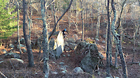
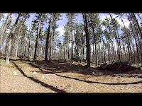
Photos of Cape Cod (Barnstable County) Mountain Bike
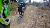
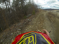
Videos of Cape Cod (Barnstable County) Mountain Bike
0:18 |
40 |
Aug 23, 2020
trail: Graveyard
0:37 |
357 |
Jul 19, 2020
trail: Backdoor
0:06 |
169 |
Jan 10, 2020
0:08 |
968 |
Jun 9, 2019
trail: Aya's Wild Ride
0:30 |
802 |
May 10, 2016
trail: Miguel
4:26 |
723 |
May 9, 2015
trail: The Race
2:40 |
283 |
May 6, 2014
trail: Sand Pit
0:43 |
130 |
Apr 14, 2013
Current Trail Warnings
| status | trail | date | condition | user | info |
|---|---|---|---|---|---|
| Humpty Dumpty The Badlands | Jun 21, 2026 @ 10:29am (America/New_York) 2 days | Ideal | dhjunkie | Super overgrown | |
| Slap 'n Tickle Trail Otis (Falmouth) | Jun 21, 2026 @ 4:37pm (America/New_York) 2 days | Unknown | jfamely | ||
| Buzzard's Trail Otis (Bourne) | Jun 21, 2026 @ 3:43pm (America/New_York) 2 days | Unknown | jfamely |
Recent Trail Reports
Activity Feed
| username | action | type | title | date |
|---|---|---|---|---|
| dhjunkie | add | report | activity #97600993 | Jun 22, 2026 @ 7:55pm 14 hours |
| Nukingfuts | ridden | trail | activity #97571303 | Jun 22, 2026 @ 10:33am 23 hours |
| jfamely | add | report | activity #97516860 | Jun 21, 2026 @ 1:37pm 2 days |
| jfamely | add | report | activity #97511949 | Jun 21, 2026 @ 12:43pm 2 days |
| MikeOnHisB1ke | wishlist | region | activity #97483944 | Jun 21, 2026 @ 7:44am 2 days |
Recent Comments
| username | type | title | comment | date |
|---|---|---|---|---|
| report | Needs a chain da a log blocking g the trail | Jun 21, 2026 @ 4:52am 2 days | ||
| report | I meant Kathleen not Karen LOL. | Jun 20, 2026 @ 9:13am Jun 20, 2026 | ||
| report | Hi Karen! The best way to get action on a... | Jun 20, 2026 @ 9:12am Jun 20, 2026 | ||
| report | Trail is permanently closed | Jun 17, 2026 @ 10:43am Jun 17, 2026 | ||
| report | Hollow Rd, all clear | Jun 16, 2026 @ 7:40pm Jun 16, 2026 |
Local Badges
-

Completionist - Green Briar/Pine Hill - CC10009 awarded -

Completionist - Higgins Crowell - CC10005 awarded -

Completionist - Willow St - CC10004 awarded -

Completionist - Clay Hill / Barnstable SF - CC10008 awarded -

Completionist - Long Pond - CC10008 awarded -

Completionist - Discovery Hill Conservation - CC10008 awarded
Bike & Skill Parks
| name | type | city | rating |
|---|---|---|---|
| Sandwich Skate Board Park | skill park | Sandwich |
Local Trail Supporters
![]()
![]()
![]()
![]()
- East Coast Greenway
![]()
![]()
Activity Type Stats
| activitytype | trails | distance | descent | descent distance | total vertical | rating | global rank | state rank | photos | reports | routes | ridelogs |
|---|---|---|---|---|---|---|---|---|---|---|---|---|
| Mountain Bike | 2,524 | 960 miles | 51,903 ft | 327 miles | 285 ft | 2,160 | 7,985 | 174 | 89,636 | |||
| E-Bike | 15 | 32 miles | 564 ft | 10 miles | 69 ft | 10 | 4,674 | 5 | 2,168 | |||
| Gravel Bike | 1 | 7 | 27 | 10 | 742 | |||||||
| Winter Fat Bike | 1 | 249 | 4 | 13 | ||||||||
| Horse | 159 | 106 miles | 2,510 ft | 36 miles | 243 ft | 8 | 530 | 1 | 16 | |||
| Hike | 2,808 | 1,081 miles | 58,117 ft | 368 miles | 285 ft | 186 | 8,001 | 41 | 4,420 | |||
| Trail Running | 2,806 | 1,081 miles | 58,110 ft | 367 miles | 285 ft | 18 | 8,004 | 36 | 4,106 | |||
| Dirtbike/Moto | 5 | 4 miles | 151 ft | 2 miles | 98 ft | 217 | 31 | |||||
| Observed Trials | 1 | 1,293 ft | 30 ft | 318 ft | 39 ft | 11 | 17 | 47 | ||||
| ATV/ORV/OHV | 75 | 17 miles | 144 ft | 3 miles | 121 ft | 261 | 15 | |||||
| Snowmobile | 2 | 2,096 ft | 30 ft | 318 ft | 39 ft | 3 | 5 | |||||
| Snowshoe | 2,072 | 881 miles | 45,978 ft | 300 miles | 285 ft | 2,386 | 4 | 54 | ||||
| Nordic Ski | 5 | 36 miles | 453 ft | 14 miles | 115 ft | 4 | 118 |
Activities
- Cape Cod (Barnstable County) Mountain Biking Trails
- Cape Cod (Barnstable County) E-Biking Trails
- Cape Cod (Barnstable County) Horseback Trails
- Cape Cod (Barnstable County) Hiking Trails
- Cape Cod (Barnstable County) Trail Running Trails
- Cape Cod (Barnstable County) Dirtbiking Trails
- Cape Cod (Barnstable County) ATVing/Offroading Trails
- Cape Cod (Barnstable County) Snowshoeing Trails
- Cape Cod (Barnstable County) Nordic Skiing Trails
Trails
- Hard trails in Cape Cod (Barnstable County)
- Easy trails in Cape Cod (Barnstable County)
- Favorite trails in Cape Cod (Barnstable County)
- Most ridden trails in Cape Cod (Barnstable County)
- Singletrack in Cape Cod (Barnstable County)
- Viewpoint trails in Cape Cod (Barnstable County)
- Trails with technical features in Cape Cod (Barnstable County)
- Race routes in Cape Cod (Barnstable County)
Points of Interest
- By waterbooy
 CC NEMBA & contributors
 - Admins: NEMBAEXEC, BCT, JimBallantyne, brucerioux, pjahnige, mappermook, CC NEMBA, capecolin
- #18657 - 30,241 views
- cape cod (barnstable county) activity log | embed map of Cape Cod (Barnstable County) mountain bike trails | cape cod (barnstable county) mountain biking points of interest polygons
Downloading of trail gps tracks in kml & gpx formats is enabled for Cape Cod (Barnstable County).
You must login to download files.