close
-
Layers w
- Weather Layers
- Pro
- Pro
- Pro
- Pro
- Pro
- Pro
- More Layers
- Pro
- Pro
- Pro
- Pro
-
Upgrade to

3D
Trail Conditions
- Unknown
- Snow Groomed
- Snow Packed
- Snow Covered
- Snow Cover Partial
- Freeze/thaw Cycle
- Icy
- Prevalent Mud
- Wet
- Variable
- Ideal
- Dry
- Very Dry
Trail Flow (Ridden Direction)
Trailforks scans users ridelogs to determine the most popular direction each trail is ridden. A good flowing trail network will have most trails flowing in a single direction according to their intension.
The colour categories are based on what percentage of riders are riding a trail in its intended direction.
The colour categories are based on what percentage of riders are riding a trail in its intended direction.
- > 96%
- > 90%
- > 80%
- > 70%
- > 50%
- < 50%
- bi-directional trail
- no data
Trail Last Ridden
Trailforks scans ridelogs to determine the last time a trail was ridden.
- < 2 days
- < 1 week
- < 2 weeks
- < 1 month
- < 6 months
- > 6 months
Trail Ridden Direction
The intended direction a trail should be ridden.
- Downhill Only
- Downhill Primary
- Both Directions
- Uphill Primary
- Uphill Only
- One Direction
Contribute Details
Colors indicate trail is missing specified detail.
- Description
- Photos
- Description & Photos
- Videos
Trail Popularity ?
Trailforks scans ridelogs to determine which trails are ridden the most in the last 9 months.
Trails are compared with nearby trails in the same city region with a possible 25 colour shades.
Think of this as a heatmap, more rides = more kinetic energy = warmer colors.
- most popular
- popular
- less popular
- not popular
ATV/ORV/OHV Filter
Max Vehicle Width
inches
US Cell Coverage
Legend

Radar Time
Activity Recordings
Trailforks uses anonymized public activity data.
?
Activity Recordings
Trailforks uses anonymized public activity data.
?
Personal Heatmap
▶
Activity Types
all
/
none
▶
Options
2
Date range
month
–
Winter Trails
Warning
A routing network for winter maps does not exist. Selecting trails using the winter trails layer has been disabled.
Missing Trails
Most Popular
Least Popular
Trails are colored based on popularity. The more popular a trail is, the more red. Less popular trails trend towards green.
Jump Magnitude Heatmap
Heatmap of where riders jump on trails. Zoom in to see individual jumps, click circles to view jump details.
BC Backroad Status
![map legend]()
Service Road Atlas is a free to use, community-driven service for viewing and creating reports on the numerous back-country service roads around B.C. and Alberta.

Slope Aspect
Direction the slope faces
Trails Deemphasized
Trails are shown in grey.
Only show trails with no bike usage.
Suggested Layers
Based on selected activity type
Save the current map location and zoom level as your default home location whenever this page is loaded.
Save
No description for Cape Town has been added yet!
Login or register to submit one.
Activities Click to view
- Mountain Bike
138 trails
- E-Bike
93 trails
- Gravel Bike
0 trails
- Adaptive Bike
0 trails
- Winter Fat Bike
0 trails
- Horse
33 trails
- Hike
709 trails
- Trail Running
659 trails
- Dirtbike/Moto
29 trails
- Observed Trials
29 trails
- ATV/ORV/OHV
29 trails
Region Details
- 40
- 20
- 56
- 18
Region Status
Open as of May 26, 2026Stats
- Avg Trail Rating
- Trails (view details)
- 711
- Trails Mountain Bike
- 138
- Trails E-Bike
- 93
- Trails Horse
- 33
- Trails Hike
- 710
- Trails Trail Running
- 659
- Trails Dirtbike/Moto
- 29
- Trails Observed Trials
- 29
- Trails ATV/ORV/OHV
- 29
- Total Distance
- 311 miles
- Total Descent
- 70,000 ft
- Total Vertical
- 3,518 ft
- Highest Trailhead
- 3,524 ft
- Reports
- 2,196
- Photos
- 241
- Ridden Counter
- 45,777
Articles

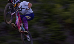
Video: Jason Boulle Riding Some of Cape Town's Finest Trails
Nov 28, 2025 from pinkbike.com
Some stunning scenes from South Africa's finest.

Video: Kaidan Ingersoll Rookie Debut at DarkFest 2025
May 28, 2025 from pinkbike.com
Kaiden showed he's not just a slopestyle phenom in his first year at the iconic freeride event.

Video: Official Highlights From Darkfest 2025
May 14, 2025 from pinkbike.com
27 minutes of mind-melting action from one of the best freeride events on earth.
Video: Wild Action From DarkFest 2025
May 5, 2025 from pinkbike.com
Take a behind-the-scenes look at DarkFest 2025.
Sub Regions
-
Blackhill MTB Trails
- 2
-
Constantia Greenbelt
- 3
- 9
-
Helderberg Nature Reserve
-
Lion's Head & Signal Hill
- 8
- 3
-
Table Mountain National Park
- 15
- 29
- 13
-
The Twelve Apostles
- 9
-
Tygerberg Nature Reserve
Popular Cape Town Mountain Biking Trails
• 100 ★ 5.0 • 3,245 ft • 107 ft • 509 •
Cork Tree Trail: This multi-use blue graded trail is situated on land controlled by the Table Mountain National Park and is not part of the City of Cape Town’s Green Belt Trails. It can be ridden either as a descent or climb. As a...
• 100 ★ 5.0 • 2,822 ft • 0 ft • 463 •
Diep River Trail: This forms part of the Constantia Greenbelt Trail network. As a descent, the track is huge fun and starts on Southern Cross Drive and crosses three tar roads as it makes its way down. High speeds are possible and care...
• 100 ★ 3.7 • 2,503 ft • 30 ft • 457 •
Belle Ombre Meadow Trail: This multi-use, green graded bi-directional trail consists of a smooth compacted sandy single track that winds under oaks and other ancient trees. From the Southern Cross Drive side, the trail crosses...
• 100 ★ 4.4 • 1 mile • 146 ft • 454 •
Greenbelt Trail: This gentle hardpack and sand trail is shared with dog walkers and other pedestrians. Ride it in either direction. Heading away from the mountain it is a very gentle downhill, almost too slight to notice as it passes...
• 100 ★ 0.0 • 3 miles • 1,015 ft • 441 •
Popular green difficulty dirt/gravel road. This multi-use trail can be used both directions and has a moderate overall physical rating with a 1,015 ft green climb. On average it takes 21 minutes to complete this trail.
• 95 ★ 0.0 • 1 mile • 41 ft • 371 •
Popular green difficulty singletrack. This multi-use trail can be used both directions. On average it takes 5 minutes to complete this trail.
• 100 ★ 5.0 • 843 ft • 8 ft • 368 •
The alternative. This is the mellower berm filled route up or down the same hill as the more direct route of the old pedestrian trail. Watch out for other trail users and especially other cyclists on this busy route. Note that two...
• 100 ★ 4.5 • 696 ft • 20 ft • 331 •
A short loop that starts off the original track just below the start near Duntaw Close. Its a contour trail through the trees and crosses a stream via a small bridge. The most technical feature is a large log roll over made from fallen...
Cape Town Mountain Bike Routes
UCT to Fork Featured
3 miles • 627 ft • 1 • Point to Point •
This Route was first added to Trailforks by D0ug-1 as a trail.
17 miles • 2,800 ft • 5 • Out & Back •
Add descriotion and review and edit trails included.
Chelmsford Rd to Rhodes Gate Featured
4 miles • 663 ft • 1 • Point to Point •
This route was first uploaded as one long trail by D0ug-1. The trail connects Chelmsford rd and Rhodes gate.
Kirstenbosch Link Featured
5 miles • 1,033 ft • 1 • Point to Point •
This Route was first uploaded by D0ug-01 as a trail. It links Kirstenbosch to the MTB trails at UCT
★ 5.0 • 24 miles • 4,348 ft • 2 •
Constantia Green Belt -Newlands Forest - Table Mountain - Rhodes Blockhouse
29 miles • 3,951 ft • 4 •
Easy start from Peddlars to Tokai and link up with the Keyser River trail. Ride along the Constantia...
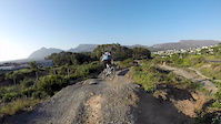
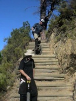
Photos of Cape Town Mountain Bike
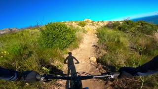
Videos of Cape Town Mountain Bike
trail: Blackhill Flow Trail
0:47 |
168 |
Oct 22, 2015
trail: Blackhill Flow Trail
6:37 |
145 |
Jul 24, 2015

trail: Pat's Track Signal Hill
3:30 |
270 |
Sep 27, 2022 , Cape Town
trail: Lions Head
0:15 |
192 |
Jul 7, 2009
youtuber
![Getting Skinned on The Favorite Cape Town MTB...]()

7:48 |
667 |
Mar 8, 2021 , Cape Town
youtuber
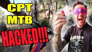
![Here's Why This Is Cape Town's Worst MTB Trail...]()

11:46 |
831 |
Oct 5, 2020 , Cape Town
3:29 |
1835 |
Aug 4, 2020 , Cape Town
Recent Trail Reports
Activity Feed
| username | action | type | title | date |
|---|---|---|---|---|
| AssialwuReT | comment | trail | activity #97381972 and 1 more | Jun 20, 2026 @ 4:46am 19 hours |
| AssialwuReT | checkin | trail | activity #97381832 and 1 more | Jun 20, 2026 @ 4:44am 19 hours |
| AssialwuReT | ridden | trail | activity #97381754 and 1 more | Jun 20, 2026 @ 4:42am 19 hours |
| guy_74 | wishlist | region | activity #97368306 | Jun 19, 2026 @ 11:25pm 1 day |
| lancelot27 | wishlist | trail | activity #97238899 | Jun 18, 2026 @ 2:13am 3 days |
Recent Comments
| username | type | title | comment | date |
|---|---|---|---|---|
| trail | Rocks / bouncy . Beginners be aware of well... | Jun 20, 2026 @ 4:48am 19 hours | ||
| trail | Can slide or fall easily on those corners .... | Jun 20, 2026 @ 4:47am 19 hours | ||
| trail | Easy, fun gravel | Jun 20, 2026 @ 4:46am 19 hours | ||
| report | A a s a A sz2…z.2 | Nov 1, 2025 @ 2:25am Nov 1, 2025 | ||
| report | C | Nov 22, 2024 @ 2:48am Nov 22, 2024 |
Local Badges
-

Top 10 Trails0 awarded -

Descent 100k Badge76 awarded -

Big Ride 30k14,903 awarded -

Epic Ride 50k7,628 awarded -

Descent 10k Badge384 awarded -

Completionist1 awarded
Bike & Skill Parks
| name | type | city | rating |
|---|---|---|---|
| The Bike Park at Constantia Uitsig | skill park | Cape Town |
Activity Type Stats
| activitytype | trails | distance | descent | descent distance | total vertical | rating | global rank | state rank | photos | reports | routes | ridelogs |
|---|---|---|---|---|---|---|---|---|---|---|---|---|
| Mountain Bike | 138 | 94 miles | 23,048 ft | 43 miles | 3,169 ft | #545 | #13 | 203 | 2,190 | 17 | 67,129 | |
| E-Bike | 93 | 68 miles | 14,974 ft | 30 miles | 2,175 ft | #618 | #51 | 2,127 | 3 | 5,554 | ||
| Horse | 33 | 9 miles | 2,464 ft | 4 miles | 2,060 ft | #69 | #3 | 91 | 3 | |||
| Hike | 709 | 310 miles | 69,528 ft | 125 miles | 3,517 ft | #87 | #5 | 35 | 2,189 | 2 | 7,149 | |
| Trail Running | 659 | 272 miles | 60,886 ft | 112 miles | 3,491 ft | #112 | #5 | 3 | 2,181 | 9 | 13,627 | |
| Dirtbike/Moto | 29 | 9 miles | 2,133 ft | 4 miles | 2,060 ft | #266 | #3 | 86 | ||||
| Observed Trials | 29 | 9 miles | 2,133 ft | 4 miles | 2,060 ft | #51 | #4 | 2 | ||||
| ATV/ORV/OHV | 29 | 9 miles | 2,133 ft | 4 miles | 2,060 ft | #156 | #4 | 86 | 1 |
Frequently Asked Questions About Cape Town
▼
What are the best places to ride in Cape Town?
Cape Town has 9 areas to explore for mountain biking. The top rated areas are:
▼
What are the highest rated mountain biking trails in Cape Town?
The highest rated mountain biking trails in Cape Town are:
- Corktree Trail (4.3/5)
- Granite Slabs Traverse (4.1/5)
- Upper Magic Link - North Section (4.1/5)
- Upper Magic Link - Mid Section (4.1/5)
- Lower Magic Link - Mid Section (4.1/5)
▼
What is the best time of the year to ride in Cape Town?
Based on ride log data, the most popular months to ride in Cape Town are:
- July (106 activities)
- October (90 activities)
- August (78 activities)
▼
Where can I park to ride in Cape Town?
There are 33 parking locations listed in Cape Town. The most popular parking spots are:
- Cecilia Forest Parking
- Cecilia Forest Parking
- Middelpad Parking Lot
- Middle Sister Parking
- Other Sister Parking
Activities
Trails
Points of Interest
- Chains TTF
- Steep climb/descent - rutted and loose TTF
- Wooden bridge over stream TTF
- Two waterbar style "jumps" TTF
- Tricky corner with rocks and erosion ruts TTF
- Pulpit Viewpoint
- Old School Ruin Sight
- Turret Gulley Sight
- Loosestone Gully Sight
- Black Slab Gully Sight
- Table Mountain (Maclear's beacon) (1,080 m)
- Fountain Peak (1,052 m)
- Ascension Buttress (1,021 m)
- By hartmut & contributors
- Admins: TMB, Cape, TokaiMTB
- #5083 - 42,552 views
- cape town activity log | embed map of Cape Town mountain bike trails | cape town mountain biking points of interest polygons
Downloading of trail gps tracks in kml & gpx formats is enabled for Cape Town.
You must login to download files.