close
-
Layers w
- Weather Layers
- Pro
- Pro
- Pro
- Pro
- Pro
- Pro
- More Layers
- Pro
- Pro
- Pro
- Pro
-
Upgrade to

3D
Trail Conditions
- Unknown
- Snow Groomed
- Snow Packed
- Snow Covered
- Snow Cover Partial
- Freeze/thaw Cycle
- Icy
- Prevalent Mud
- Wet
- Variable
- Ideal
- Dry
- Very Dry
Trail Flow (Ridden Direction)
Trailforks scans users ridelogs to determine the most popular direction each trail is ridden. A good flowing trail network will have most trails flowing in a single direction according to their intension.
The colour categories are based on what percentage of riders are riding a trail in its intended direction.
The colour categories are based on what percentage of riders are riding a trail in its intended direction.
- > 96%
- > 90%
- > 80%
- > 70%
- > 50%
- < 50%
- bi-directional trail
- no data
Trail Last Ridden
Trailforks scans ridelogs to determine the last time a trail was ridden.
- < 2 days
- < 1 week
- < 2 weeks
- < 1 month
- < 6 months
- > 6 months
Trail Ridden Direction
The intended direction a trail should be ridden.
- Downhill Only
- Downhill Primary
- Both Directions
- Uphill Primary
- Uphill Only
- One Direction
Contribute Details
Colors indicate trail is missing specified detail.
- Description
- Photos
- Description & Photos
- Videos
Trail Popularity ?
Trailforks scans ridelogs to determine which trails are ridden the most in the last 9 months.
Trails are compared with nearby trails in the same city region with a possible 25 colour shades.
Think of this as a heatmap, more rides = more kinetic energy = warmer colors.
- most popular
- popular
- less popular
- not popular
ATV/ORV/OHV Filter
Max Vehicle Width
inches
US Cell Coverage
Legend

Radar Time
Activity Recordings
Trailforks uses anonymized public activity data.
?
Activity Recordings
Trailforks uses anonymized public activity data.
?
Personal Heatmap
▶
Activity Types
all
/
none
▶
Options
2
Date range
month
–
Winter Trails
Warning
A routing network for winter maps does not exist. Selecting trails using the winter trails layer has been disabled.
Missing Trails
Most Popular
Least Popular
Trails are colored based on popularity. The more popular a trail is, the more red. Less popular trails trend towards green.
Jump Magnitude Heatmap
Heatmap of where riders jump on trails. Zoom in to see individual jumps, click circles to view jump details.
BC Backroad Status
![map legend]()
Service Road Atlas is a free to use, community-driven service for viewing and creating reports on the numerous back-country service roads around B.C. and Alberta.

Slope Aspect
Direction the slope faces
Trails Deemphasized
Trails are shown in grey.
Only show trails with no bike usage.
Suggested Layers
Based on selected activity type
Save the current map location and zoom level as your default home location whenever this page is loaded.
Save
No description for Caples Creek has been added yet!
Login or register to submit one.
Primary Trail Type: Cross-Country
Land Status: National Forest
Activities Click to view
- Mountain Bike
20 trails
- E-Bike
10 trails
- Horse
18 trails
- Hike
19 trails
- Trail Running
19 trails
- Dirtbike/Moto
9 trails
- ATV/ORV/OHV
8 trails
Region Details
- 9
- 2
- 7
- 1
Region Status
Caution as of Mar 4, 2026Stats
- Avg Trail Rating
- Trails (view details)
- 19
- Trails Mountain Bike
- 20
- Trails E-Bike
- 10
- Trails Horse
- 18
- Trails Hike
- 19
- Trails Trail Running
- 19
- Trails Dirtbike/Moto
- 9
- Trails ATV/ORV/OHV
- 8
- Total Distance
- 26 miles
- Total Descent
- 4,833 ft
- Total Vertical
- 3,237 ft
- Highest Trailhead
- 8,660 ft
- Reports
- 45
- Photos
- 9
- Ridden Counter
- 517
Popular Caples Creek Mountain Biking Trails
• 95 ★ 3.0 • 2 miles • 544 ft • 161 •
This is the connector trail to avoid riding on highway 88. Great view of Caples Creek and Thunder MT. Mostly single track.
• 5 ★ 4.0 • 3 miles • 26 ft • 27 •
The start of this trail isn't always maintained the best. But has been cleared in the last year. After the first 0.6 miles it clears out is regularly kept up. It is best done as a point to point. The trail gets steep in spots and have...
• 65 ★ 4.0 • 1 mile • 0 ft • 24 •
Extremely narrow and steep downhill trail. Lots of rock drops and slow technical riding. Ride up pack saddle pass road to get to trail head. Can be shuttled.
• 55 ★ 0.0 • 2 miles • 30 ft • 13 •
Moderately popular black diamond difficulty alpine singletrack. This multi-use trail can be used downhill primary and has a hard overall physical rating with a 30 ft double black diamond climb. Trail visibility is sometimes hard to follow. On average it takes 12 minutes to complete this trail.
• 50 ★ 0.0 • 3,038 ft • 0 ft • 7 • • hike
Moderately popular black diamond difficulty alpine singletrack. This hike primary trail can be used both directions and has a hard overall physical rating with a 0 ft double black diamond climb. Trail visibility is sometimes hard to follow. On average it takes 5 minutes to complete this trail.
• 5 ★ 0.0 • 2 miles • 770 ft • 1 • • hike
Less popular black diamond difficulty alpine singletrack. This hike primary trail can be used downhill primary and has a hard overall physical rating with a 770 ft double black diamond climb. Trail visibility is sometimes hard to follow.
Photos of Caples Creek Mountain Bike
Videos of Caples Creek Mountain Bike
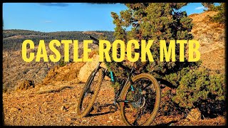
trail: Castle Rock Trail
4:40 |
59 |
Oct 13, 2024 , Kirkwood
trail: Castle Rock Trail
17:47 |
87 |
Nov 15, 2023 , Kirkwood

trail: Castle Rock Trail
32:42 |
245 |
Sep 8, 2020 , Kirkwood

trail: Caples Creek Trail (Upper)
4:29 |
916 |
Nov 6, 2018 , Kirkwood
youtuber
![Thunder Mountain 2018 (Kirkwood,CA) Mountain...]()

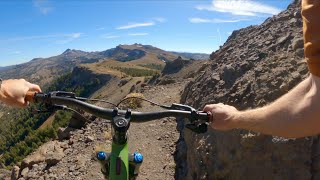
trail: Castle Rock Trail
9:49 |
446 |
Oct 22, 2018 , Kirkwood

trail: Silver Fork Trail
3:05 |
899 |
Jul 25, 2018 , Kirkwood
youtuber
![There's still plenty of gold in El Dorado...]()

trail: Caples Creek Trail (Upper)
15:57 |
1529 |
Jul 20, 2018 , Kirkwood
Recent Trail Reports
| status | trail | date | condition | info | user |
|---|---|---|---|---|---|
| Old Silver Lake Trail | Sep 7, 2025 @ 6:49pm Sep 7, 2025 | Variable | cbarrett8853 | ||
| Castle Rock Trail | Jul 28, 2025 @ 8:17pm Jul 28, 2025 | Dry | TheGomez | ||
| Caples Creek Trail (Middle) | Jul 26, 2025 @ 10:16pm Jul 26, 2025 | Unknown | Mkrol | ||
| West Martin Meadow Raod | Jul 6, 2024 @ 9:33am Jul 6, 2024 | Dry | RickCdlkcc | ||
| Caples Creek Trail (Upper) | May 27, 2024 @ 10:13am May 27, 2024 | Dry | lphtahoe | ||
| Government Meadow Trail | May 7, 2021 @ 7:28am May 7, 2021 | Unknown | brick94513 | ||
| Packsaddle Pass Rd (Silver Fork to 10N14) | Jul 4, 2020 @ 9:53pm Jul 4, 2020 | Ideal | jshute | ||
| Silver Fork Trail | Jun 30, 2020 @ 1:35pm Jun 30, 2020 | Snow Covered | whoisadam |
Activity Feed
| username | action | type | title | date |
|---|---|---|---|---|
| brust1979 | wishlist | trail | activity #90853080 | Mar 19, 2026 @ 6:11am Mar 19, 2026 |
| zacharydstewart | wishlist | region | activity #86362673 | Dec 30, 2025 @ 8:29pm Dec 30, 2025 |
| PeterNFi1uy | vote | trail | activity #80402243 and 1 more | Sep 15, 2025 @ 7:22am Sep 15, 2025 |
| PeterNFi1uy | ridden | trail | activity #80402237 and 1 more | Sep 15, 2025 @ 7:21am Sep 15, 2025 |
| cbarrett8853 | add | report | activity #79893577 | Sep 7, 2025 @ 6:49pm Sep 7, 2025 |
Recent Comments
| username | type | title | comment | date |
|---|---|---|---|---|
| trail | Trail did survive the fire, majority of the... | Jul 26, 2025 @ 10:20pm Jul 26, 2025 | ||
| trail | not currently rideable since caldor fire.... | Jul 21, 2025 @ 7:48am Jul 21, 2025 | ||
| trail | This part is not single-track! Mostly rough,... | Jul 6, 2024 @ 5:23pm Jul 6, 2024 | ||
| trail | Both upper and lower entry points are hard to... | Jul 6, 2024 @ 5:21pm Jul 6, 2024 | ||
| trail | Most boring part of the Thunder Mountain loop.... | Oct 7, 2023 @ 2:07pm Oct 7, 2023 |
Nearby Areas
| name | distance | ||||
|---|---|---|---|---|---|
| Packsaddle Pass | 1 | 5.2 km | |||
| Carson Spur | 4 | 5.7 km | |||
| Kirkwood Mountain Resort | 6 | 15 | 8 | 7.3 km | |
| Wrights Lake | 3 | 6 | 10.9 km | ||
| Meiss Country | 6 | 8 | 1 | 11.2 km |
Activity Type Stats
| activitytype | trails | distance | descent | descent distance | total vertical | rating | global rank | state rank | photos | reports | routes | ridelogs |
|---|---|---|---|---|---|---|---|---|---|---|---|---|
| Mountain Bike | 20 | 26 miles | 4,833 ft | 12 miles | 3,238 ft | #10,705 | #4,272 | 9 | 45 | 128 | ||
| E-Bike | 10 | 15 miles | 1,742 ft | 4 miles | 3,238 ft | #5,898 | #1,659 | 19 | 7 | |||
| Horse | 18 | 20 miles | 4,554 ft | 11 miles | 3,068 ft | #1,728 | #904 | 17 | ||||
| Hike | 19 | 22 miles | 4,728 ft | 11 miles | 3,068 ft | #7,746 | #2,859 | 39 | 2 | 59 | ||
| Trail Running | 19 | 22 miles | 4,728 ft | 11 miles | 3,068 ft | #7,249 | #2,397 | 39 | 2 | |||
| Dirtbike/Moto | 9 | 10 miles | 1,637 ft | 4 miles | 1,437 ft | #1,061 | #495 | 3 | ||||
| ATV/ORV/OHV | 8 | 9 miles | 1,637 ft | 4 miles | 1,398 ft | #788 | #404 | 3 |
Frequently Asked Questions About Caples Creek
▼
What are the highest rated mountain biking trails in Caples Creek?
The highest rated mountain biking trails in Caples Creek are:
- Caples Creek Trail (Upper) (4/5)
- Silver Fork Trail (4/5)
- Castle Rock Trail (3.8/5)
- Caples Creek Trail (Lower) (0/5)
- Caples Creek Trail (Middle) (0/5)
▼
What is the best time of the year to ride in Caples Creek?
Based on ride log data, the most popular months to ride in Caples Creek are:
- July (14 activities)
- August (2 activities)
- June (1 activities)
▼
Where can I park to ride in Caples Creek?
Check the Caples Creek trail map for trailhead and parking information. Community members regularly update access and parking details for trails in the area.
▼
What is the longest trail in Caples Creek?
The longest trail in Caples Creek is Silver Fork Trail at 2.7 miles. View all trails sorted by distance.
Activities
- By MLTS
 MLTS & contributors
 - Admins: TAMBA
- #34903 - 2,769 views
- caples creek activity log | embed map of Caples Creek mountain bike trails |
Downloading of trail gps tracks in kml & gpx formats is enabled for Caples Creek.
You must login to download files.