close
-
Layers w
- Weather Layers
- Pro
- Pro
- Pro
- Pro
- Pro
- Pro
- More Layers
- Pro
- Pro
- Pro
- Pro
-
Upgrade to

3D
Trail Conditions
- Unknown
- Snow Groomed
- Snow Packed
- Snow Covered
- Snow Cover Partial
- Freeze/thaw Cycle
- Icy
- Prevalent Mud
- Wet
- Variable
- Ideal
- Dry
- Very Dry
Trail Flow (Ridden Direction)
Trailforks scans users ridelogs to determine the most popular direction each trail is ridden. A good flowing trail network will have most trails flowing in a single direction according to their intension.
The colour categories are based on what percentage of riders are riding a trail in its intended direction.
The colour categories are based on what percentage of riders are riding a trail in its intended direction.
- > 96%
- > 90%
- > 80%
- > 70%
- > 50%
- < 50%
- bi-directional trail
- no data
Trail Last Ridden
Trailforks scans ridelogs to determine the last time a trail was ridden.
- < 2 days
- < 1 week
- < 2 weeks
- < 1 month
- < 6 months
- > 6 months
Trail Ridden Direction
The intended direction a trail should be ridden.
- Downhill Only
- Downhill Primary
- Both Directions
- Uphill Primary
- Uphill Only
- One Direction
Contribute Details
Colors indicate trail is missing specified detail.
- Description
- Photos
- Description & Photos
- Videos
Trail Popularity ?
Trailforks scans ridelogs to determine which trails are ridden the most in the last 9 months.
Trails are compared with nearby trails in the same city region with a possible 25 colour shades.
Think of this as a heatmap, more rides = more kinetic energy = warmer colors.
- most popular
- popular
- less popular
- not popular
ATV/ORV/OHV Filter
Max Vehicle Width
inches
US Cell Coverage
Legend

Radar Time
Activity Recordings
Trailforks uses anonymized public activity data.
?
Activity Recordings
Trailforks uses anonymized public activity data.
?
Personal Heatmap
▶
Activity Types
all
/
none
▶
Options
2
Date range
month
–
Winter Trails
Warning
A routing network for winter maps does not exist. Selecting trails using the winter trails layer has been disabled.
Missing Trails
Most Popular
Least Popular
Trails are colored based on popularity. The more popular a trail is, the more red. Less popular trails trend towards green.
Jump Magnitude Heatmap
Heatmap of where riders jump on trails. Zoom in to see individual jumps, click circles to view jump details.
BC Backroad Status
![map legend]()
Service Road Atlas is a free to use, community-driven service for viewing and creating reports on the numerous back-country service roads around B.C. and Alberta.

Slope Aspect
Direction the slope faces
Trails Deemphasized
Trails are shown in grey.
Only show trails with no bike usage.
Suggested Layers
Based on selected activity type
Save the current map location and zoom level as your default home location whenever this page is loaded.
SaveAugust 27,2022 update: The crew has completed work for the season on phase 1 of a major re-route of the historic Moose trail. Lower Moose and the Viewloop are ready and a portion of Phase 2 is rideable but please respect the the closed sign and don't hike thru to connect to Beaver. Next year we will complete the last section and finish the upper section to the same level as Lower Moose. The goal is to create an attractive uphill access that is an alternative to Dei Kwann and the road as a way up and away from the contamination issues at the former site of the Arctic Gold and Silver ore concentrator (big open area at mid mountain). If riding or shutting in this area please don't stop, or block the gates and be aware that air-borne dust from the site is best to be avoided.
Because the crew have been busy with new construction the rest of the trails on the mountain are open are due to the work of several local volunteers so please respect their efforts and help out by carrying a folding saw and stopping to move deadfall. It's also really helpful to log any major issues on Trailforks by using the trail report function.
The crew is hoping to get back on the trails late this fall to install some boardwalks, and some other cool improvements but first we will be finishing up a new loop trail at the Conrad Campground that we roughed in during the spring before things got to busy.
Users are reminded that Mountain Biking is a high risk sport and be mindful of strategies to reduce risk (posted on the area maps located around the network as well as in the Trail Guide pamphlet).
Activities Click to view
- Mountain Bike
42 trails
- E-Bike
50 trails
- Gravel Bike
0 trails
- Adaptive Bike
0 trails
- Hike
49 trails
- Trail Running
47 trails
Region Details
- 8
- 1
- 11
- 16
- 5
Region Status
Caution as of Jun 8, 2026Local Trail Association
Stats
- Avg Trail Rating
- Trails (view details)
- 44
- Trails Mountain Bike
- 42
- Trails E-Bike
- 50
- Trails Hike
- 49
- Trails Trail Running
- 47
- Trails Snowmobile
- 1
- Trails Backcountry Ski
- 1
- Trails Nordic Ski
- 1
- Total Distance
- 63 miles
- Total Descent
- 17,813 ft
- Total Vertical
- 5,021 ft
- Highest Trailhead
- 7,184 ft
- Reports
- 445
- Photos
- 241
- Ridden Counter
- 9,928
Articles

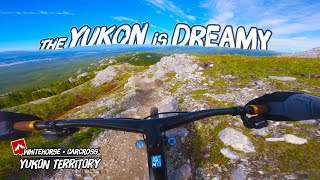
The Yukon: Land of the Midnight Fun
Sep 8, 2025 from pinkbike.com
Mountain biking the Yukon: deep loam, no lines and the days never end.
Sub Regions
-
Montana Mountain
- 1
- 7
- 15
- 3
Popular Carcross Mountain Biking Trails
• 100 ★ 4.5 • 3,281 ft • 0 ft • 612 •
Super fun, super fast, super flowy berm trail with some ground level wooden features suitable for almost all riders.
• 100 ★ 4.4 • 5,213 ft • 567 ft • 507 •
The grade steepens slightly on this upper part of the “People’s Trail”, but trees provide welcome shade and there are views of Lake Bennett and the rock garden.
• 95 ★ 4.7 • 3,539 ft • 371 ft • 502 •
Built as a singletrack alternative to the Montana Mountain road, this “People’s Trail” follows a steady grade up to .
• 90 ★ 4.9 • 4,523 ft • 12 ft • 448 •
Super fun rock garden mazes. A must ride for advanced bikers.
• 95 ★ 4.4 • 1,589 ft • 1 ft • 394 •
A fast and twisty ride through a beautiful mossy forest. It's the best route to town - head left after finishing the trail and cross the pedestrian bridge.
• 85 ★ 4.0 • 4,442 ft • 78 ft • 388 •
Twisty cross-country with multiple wooden features to test riders of all levels. Downhill primarily
• 90 ★ 4.2 • 3,944 ft • 12 ft • 377 •
An entirely different trail than . You get gorgeous views of Bennett Lake as you whip around sandy berms and over small table tops.
Carcross Mountain Bike Routes
★ 5.0 • 36 miles • 7,585 ft • 25 • Loop •
If you're pressed for time or just feel like a challenge this route hits every trail on the lower mountain...
2 miles • 371 ft • 2 • Loop •
Beginner Loop on the world famous Montana Mountain in Carcross, YT. Riders will start at the Parking lot,...
4 miles • 931 ft • 5 • Loop •
From the parking lot Riders will ride up the access rode to the entry of up track. At the top, take a...
★ 3.0 • 29 miles • 5,357 ft • 3 • Loop •
The ride begins in the historic town of Carcross with a strenuous climb up old mining roads on Montana...
10 miles • 2,500 ft • 22 • Loop •
Loop. Alternatively substitute for Wolf on the descent
6 miles • 1,253 ft • 3 • Loop •
Advanced Loop on Montana Mountain! Start the ascent on Grouse, which will meet up with the Up Track ....
Photos of Carcross Mountain Bike
Videos of Carcross Mountain Bike

trail: Grizzly Bear
0:50 |
829 |
Sep 30, 2017
trail: Lower Wolverine
2:37 |
385 |
Nov 10, 2014
youtuber
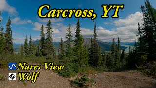
![Best MTB trails in Carcross, YT - Nares View...]()

trail: Nares View
12:21 |
96 |
Jun 28, 2025 , Carcross
trail: Lower Wolverine
20:33 |
93 |
Jan 6, 2025 , Carcross

trail: Upper Wolverine
20:33 |
112 |
Jan 6, 2025 , Carcross

trail: Grizzly Bear
20:33 |
96 |
Jan 6, 2025 , Carcross

trail: Black Bear
20:33 |
80 |
Jan 6, 2025 , Carcross
Current Trail Warnings
| status | trail | date | condition | user | info |
|---|---|---|---|---|---|
| Beaver | Jun 1, 2026 @ 2:52pm (America/Whitehorse) Jun 1, 2026 | Snow Cover Partial | michael1969 | Lots of snow patches. I’d wait a month... |
Recent Trail Reports
| status | trail | date | condition | info | user |
|---|---|---|---|---|---|
| Wolf | Jun 8, 2026 @ 7:12am (America/Whitehorse) Jun 8, 2026 | Ideal | knopf | ||
| Grizzly Bear | Jun 8, 2026 @ 7:11am (America/Whitehorse) Jun 8, 2026 | Ideal | knopf | ||
| Moose | Jun 8, 2026 @ 7:11am (America/Whitehorse) Jun 8, 2026 | Dry | knopf | ||
| Lower Dei Kwáan | May 31, 2026 @ 11:24am (America/Whitehorse) May 31, 2026 | Wet | martin-turpin | ||
| Sheep | May 27, 2026 @ 2:18pm (America/Whitehorse) May 27, 2026 | Ideal | redunn | ||
| Upper Dei Kwáan | May 27, 2026 @ 2:18pm (America/Whitehorse) May 27, 2026 | Variable | redunn | ||
| Goat | May 27, 2026 @ 2:17pm (America/Whitehorse) May 27, 2026 | Variable | redunn | ||
| Porcupine | May 27, 2026 @ 2:14pm (America/Whitehorse) May 27, 2026 | Variable | redunn | ||
| AK DNR | May 27, 2026 @ 2:13pm (America/Whitehorse) May 27, 2026 | Ideal | redunn | ||
| Black Bear | May 27, 2026 @ 2:12pm (America/Whitehorse) May 27, 2026 | Ideal | redunn |
Activity Feed
| username | action | type | title | date |
|---|---|---|---|---|
| mulletator | comment | trail | activity #97135371 | Jun 16, 2026 @ 1:38pm 2 days |
| vdzsno | wishlist | region | activity #97122541 | Jun 16, 2026 @ 10:42am 2 days |
| Mapa | wishlist | route | activity #97108911 and 1 more | Jun 16, 2026 @ 7:32am 3 days |
| Mapa | wishlist | route | activity #96962494 | Jun 14, 2026 @ 6:36am Jun 14, 2026 |
| knopf | add | report | activity #96537324 and 3 more | Jun 8, 2026 @ 7:10am Jun 8, 2026 |
Recent Comments
| username | type | title | comment | date |
|---|---|---|---|---|
| trail | Great trail! First one I rode in Carcross. ... | Jun 16, 2026 @ 1:38pm 2 days | ||
| trail | Agree with below this is a looong road of... | Aug 31, 2025 @ 6:51pm Aug 31, 2025 | ||
| report | @canadaka: Thanks for posting all the trail... | Jul 24, 2025 @ 7:17pm Jul 24, 2025 | ||
| trail | Rod this today. On a Trek Rail ebike. It’s a... | Jul 22, 2025 @ 11:15pm Jul 22, 2025 | ||
| report | Edited! The phot geo tagged to wrong trail | Jul 16, 2025 @ 11:18pm Jul 16, 2025 |
Local Badges
-

10 Blue Trails61 awarded -

Epic Ride Climb 2k9 awarded -

Climbing 10k Badge8 awarded -

Climbing 100k Badge0 awarded -

Epic Ride Descent 2k15 awarded -

Descent 10k Badge14 awarded
Activity Type Stats
| activitytype | trails | distance | descent | descent distance | total vertical | rating | global rank | state rank | photos | reports | routes | ridelogs |
|---|---|---|---|---|---|---|---|---|---|---|---|---|
| Mountain Bike | 42 | 56 miles | 15,505 ft | 27 miles | 3,497 ft | #1,932 | #2 | 227 | 445 | 8 | 2,929 | |
| E-Bike | 50 | 2 miles | 413 ft | 1 mile | 1,417 ft | #4,875 | #4 | 6 | 222 | 4 | 77 | |
| Hike | 49 | 62 miles | 17,513 ft | 28 miles | 5,020 ft | #3,454 | #3 | 8 | 435 | 448 | ||
| Trail Running | 47 | 57 miles | 15,207 ft | 26 miles | 3,497 ft | #3,484 | #3 | 435 | 65 | |||
| Snowmobile | 1 | 5,249 ft | 220 ft | 4,144 ft | 223 ft | 3 | ||||||
| Backcountry Ski | 1 | 5,249 ft | 220 ft | 4,144 ft | 223 ft | 3 | 16 | |||||
| Nordic Ski | 1 | 5,249 ft | 220 ft | 4,144 ft | 223 ft | 3 | 17 |
Frequently Asked Questions About Carcross
▼
What are the best places to ride in Carcross?
Carcross has 1 areas to explore for mountain biking. The top rated areas are:
▼
What are the highest rated mountain biking trails in Carcross?
The highest rated mountain biking trails in Carcross are:
- Upper Wolverine (4.7/5)
- Grizzly Bear (4.4/5)
- McDonald Creek Trail (4.4/5)
- Goat (4.3/5)
- AK DNR (4.3/5)
▼
What is the best time of the year to ride in Carcross?
Based on ride log data, the most popular months to ride in Carcross are:
- July (113 activities)
- August (111 activities)
- September (71 activities)
▼
Where can I park to ride in Carcross?
There are 9 parking locations listed in Carcross. The most popular parking spots are:
- Lower mountain parking lot
- Caribou parking lot/trailhead
- Carcross Commons Parking Lot
- Public parking
- Parking
Activities
Trails
Points of Interest
- Lower mountain trail map Information
- Caribou trailhead map Information
- Dail Peak Summit
- Mount Perkins Summit
- Mount Anderson Summit
- Beeker Mountain Summit
- Tank Creek Monitoring station Other
- Tin Cup Staging yard Other
- AGS trail crew staging area Other
- Mid Tank Creek Other
- Crozier Peak (7,316 ft)
- Teepee Peak (7,260 ft)
- Montana Mountain (7,208 ft)
- By ryanroberts & contributors
- Admins: brittseels, S2S, derekcrowe
- #6585 - 20,818 views
- carcross activity log | embed map of Carcross mountain bike trails | carcross mountain biking points of interest
Downloading of trail gps tracks in kml & gpx formats is enabled for Carcross.
You must login to download files.