close
-
Layers w
- Weather Layers
- Pro
- Pro
- Pro
- Pro
- Pro
- Pro
- More Layers
- Pro
- Pro
- Pro
- Pro
-
Upgrade to

3D
Trail Conditions
- Unknown
- Snow Groomed
- Snow Packed
- Snow Covered
- Snow Cover Partial
- Freeze/thaw Cycle
- Icy
- Prevalent Mud
- Wet
- Variable
- Ideal
- Dry
- Very Dry
Trail Flow (Ridden Direction)
Trailforks scans users ridelogs to determine the most popular direction each trail is ridden. A good flowing trail network will have most trails flowing in a single direction according to their intension.
The colour categories are based on what percentage of riders are riding a trail in its intended direction.
The colour categories are based on what percentage of riders are riding a trail in its intended direction.
- > 96%
- > 90%
- > 80%
- > 70%
- > 50%
- < 50%
- bi-directional trail
- no data
Trail Last Ridden
Trailforks scans ridelogs to determine the last time a trail was ridden.
- < 2 days
- < 1 week
- < 2 weeks
- < 1 month
- < 6 months
- > 6 months
Trail Ridden Direction
The intended direction a trail should be ridden.
- Downhill Only
- Downhill Primary
- Both Directions
- Uphill Primary
- Uphill Only
- One Direction
Contribute Details
Colors indicate trail is missing specified detail.
- Description
- Photos
- Description & Photos
- Videos
Trail Popularity ?
Trailforks scans ridelogs to determine which trails are ridden the most in the last 9 months.
Trails are compared with nearby trails in the same city region with a possible 25 colour shades.
Think of this as a heatmap, more rides = more kinetic energy = warmer colors.
- most popular
- popular
- less popular
- not popular
ATV/ORV/OHV Filter
Max Vehicle Width
inches
US Cell Coverage
Legend

Radar Time
Activity Recordings
Trailforks uses anonymized public activity data.
?
Activity Recordings
Trailforks uses anonymized public activity data.
?
Personal Heatmap
▶
Activity Types
all
/
none
▶
Options
2
Date range
month
–
Winter Trails
Warning
A routing network for winter maps does not exist. Selecting trails using the winter trails layer has been disabled.
Missing Trails
Most Popular
Least Popular
Trails are colored based on popularity. The more popular a trail is, the more red. Less popular trails trend towards green.
Jump Magnitude Heatmap
Heatmap of where riders jump on trails. Zoom in to see individual jumps, click circles to view jump details.
BC Backroad Status
![map legend]()
Service Road Atlas is a free to use, community-driven service for viewing and creating reports on the numerous back-country service roads around B.C. and Alberta.

Slope Aspect
Direction the slope faces
Trails Deemphasized
Trails are shown in grey.
Only show trails with no bike usage.
Suggested Layers
Based on selected activity type
Save the current map location and zoom level as your default home location whenever this page is loaded.
SavePopular Trail Networks
view all areas »
No description for Kärnten has been added yet!
Login or register to submit one.
AKA: Carinthia
This region uses the Uk/Euro style trail grading system.
Region Details
- 70
- 3
- 42
- 44
- 30
- 23
- 4
Stats
- Avg Trail Rating
- Trails (view details)
- 241
- Trails Mountain Bike
- 249
- Trails E-Bike
- 202
- Trails Gravel Bike
- 2
- Trails Adaptive Bike
- 1
- Trails Horse
- 6
- Trails Hike
- 133
- Trails Trail Running
- 130
- Trails Dirtbike/Moto
- 1
- Trails ATV/ORV/OHV
- 1
- Trails Snowshoe
- 2
- Trails Downhill Ski
- 27
- Trails Backcountry Ski
- 4
- Trails Nordic Ski
- 1
- Total Distance
- 245 miles
- Total Descent
- 85,326 ft
- Total Vertical
- 8,063 ft
- Highest Trailhead
- 9,517 ft
- Reports
- 2,211
- Photos
- 1,110
- Ridden Counter
- 20,372
Sub Regions
- Bezirk Völkermarkt (5)
- Bleiburg (5)
- Feldkirchen (15)
- Hermagor (18)
- Klagenfurt am Wörthersee (28)
- Klagenfurt (28)
- Ossiach (3)
- Spittal an der Drau (6)
- Bad Kleinkirchheim (5)
- Obervellach (2)
- Turracher Höhe (39)
- Turracher Höhe (38)
- Villach (78)
- Villach (78)
- Afritz Am See (1)
- Althofen (5)
- Feistritz ob Bleiburg (1)
- Feld Am See (8)
- Mallnitz (5)
- Millstatt am See (2)
- St. Veit a.d. Glan (2)
- Koralpe Flow Country Trails (2)
- Simonhöhe Trail Area (22)
- Weissensee (8)
Popular Kärnten Mountain Biking Trails
• 100 ★ 4.8 • 6 miles • 24 ft • 859 •
The longest "Flow Trail" in Europe. 11 km long, the is one of the longest flow trail in Europe. This route was honoured in 2014 by the International Mountain Bicycling Association (IMBA) as the best Flow Trail of 2014. With your bike...
• 40 ★ 4.8 • 4 miles • 213 ft • 470 •
Handbuilt trail. Loose rocks, tight corners, sometimes steep.
• 90 ★ 4.7 • 1 mile • 71 ft • 354 •
The Flowgartner Trail (T25) is a mountain bike trail for beginners, which is also a lot of fun for advanced bikers. It is characterized by its flowy design and the permanently fabulous views of the turquoise Lake Faaker See. The trail...
• 85 ★ 4.6 • 3,547 ft • 44 ft • 339 •
The Lowgartner Trail (T26) is a mountain bike trail for beginners, but which is also a lot of fun for advanced bikers. He is characterized by its flowy design and the diverese surrounding nature. The trail itself is 1 km long.
• 20 ★ 4.5 • 3 miles • 55 ft • 287 •
Challenging, steep trail that was built as a stage for the Enduro World Series event in 2018. In the wet it gets very slippery...
• 75 ★ 4.5 • 2,329 ft • 2 ft • 256 •
The Latschacher Trail section 1, is a hand-build mountainbike trail as its best. The Trail itself is difficult but well build and has some jumps in it, which are pretty sketchy.
• 100 ★ 4.2 • 476 ft • 31 ft • 239 •
The Linkgartner Trail is for more experienced riders the ideal connection between the via the forest road and the entrance of the Flowgartner Trail. The name Linkgartner was created because of the idea of connection. The trail itself...
• 100 ★ 4.2 • 686 ft • 10 ft • 236 •
The (T46) is a mountain bike trail for beginners, which, however, is also a lot of fun for more advanced bikers. It is characterized by its flowing design and the varied nature.
Kärnten Mountain Bike Routes
★ 5.0 • 22 miles • 4,469 ft • 7 •
The area between Falkenberg and Goritschnigkogel around Lake Wörthersee offers mountain bikers a variety...
★ 5.0 • 11 miles • 3,394 ft • 23 •
Falkenberg —> The MTB Trail Paradise in Klagenfurt If you’re an enduro mountain biker looking for a...
18 miles • 3,661 ft • 1 • Out & Back •
A taxing ride up to the "Annahütte" (currently not active). From Faak you ride on a paved road towards...
★ 5.0 • 8 miles • 1,625 ft • 0 • Out & Back •
From the village center follow the cycle path towards Alt Ossiach and its elementary school, where you...
★ 3.5 • 7 miles • 920 ft • 0 • Loop •
This tour starts directly at Lake Vassach. From there it is only a short way to Vassach, a borough of...
★ 4.0 • 11 miles • 1,716 ft • 0 •
Tour in close proximity to the Wörthersee.
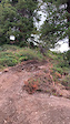
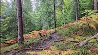
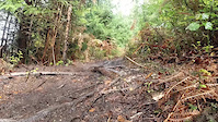
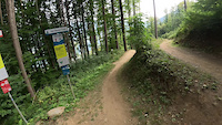
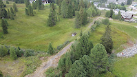
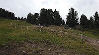
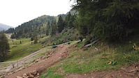
Photos of Kärnten Mountain Bike
Videos of Kärnten Mountain Bike
0:22 |
8 |
Dec 18, 2025
trail: Biene Maya
0:13 |
26 |
Oct 12, 2025
trail: Biene Maya
0:16 |
17 |
Oct 12, 2025
trail: VAN DURREN TRAIL
0:07 |
10 |
Sep 10, 2025
trail: ANDY TRAIL
3:24 |
39 |
Jul 25, 2025
0:32 |
|
Sep 30, 2024
0:12 |
|
Sep 30, 2024
0:18 |
|
Sep 30, 2024
Current Trail Warnings
| status | trail | date | condition | user | info |
|---|---|---|---|---|---|
| Turbine Trail Trailcenter Faaker See | Jun 15, 2026 @ 7:00pm (Europe/Vienna) 2 days | Ideal | andrea-campaner | Fallen tree! be careful! |
Recent Trail Reports
Activity Feed
| username | action | type | title | date |
|---|---|---|---|---|
| lakebiketrails | add | report | activity #97105873 | Jun 16, 2026 @ 6:42am 1 day |
| andrea-campaner | add | report | activity #97049142 | Jun 15, 2026 @ 10:00am 2 days |
| sebobo | wishlist | trail | activity #96946081 | Jun 14, 2026 @ 2:08am Jun 14, 2026 |
| a5Sa9GUC | wishlist | trail | activity #96888426 | Jun 13, 2026 @ 9:38am Jun 13, 2026 |
| FlorianKlgKq6 | wishlist | route | activity #96863259 | Jun 13, 2026 @ 4:47am Jun 13, 2026 |
Recent Comments
| username | type | title | comment | date |
|---|---|---|---|---|
| trail | cooler natürlicher single-trail. hat durchaus... | Jun 12, 2026 @ 2:42am Jun 12, 2026 | ||
| trail | Viel Straße, die Trailabschnitte würde ich... | May 23, 2026 @ 11:53am May 23, 2026 | ||
| skillpark | Firma is pleite gegangen...Pumptrack neben an... | Jan 4, 2026 @ 10:31am Jan 4, 2026 | ||
| trail | Since the last report 2021 a lot of updates... | Sep 30, 2025 @ 4:52am Sep 30, 2025 | ||
| trail | Disclaimer: I really enjoy janky akward... | Sep 23, 2025 @ 9:32am Sep 23, 2025 |
Local Badges
-

Baumgartner36 awarded -

lake.bike NORTH1 awarded -

lake.bike SOUTH1 awarded -

Epic Ride Descent 2k3 awarded -
Epic Ride Descent 2k9 awarded -
Epic Ride Descent 2k18 awarded
Bike & Skill Parks
| name | type | city | rating |
|---|---|---|---|
| MTB-ZONE Bikepark Petzen | bike park | Bleiburg | |
| Weissensee | bike park | ||
| Trail Area Turracher Höhe | bike park | Turracher Höhe | |
| Pumptrack Unterburg | skill park | Bleiburg | |
| Kids Bikepark Gerlitzen Alpe | skill park | Villach |
Local Products
Local Trail Supporters
- mtb9020
Activity Type Stats
| activitytype | trails | distance | descent | descent distance | total vertical | rating | global rank | state rank | photos | reports | routes | ridelogs |
|---|---|---|---|---|---|---|---|---|---|---|---|---|
| Mountain Bike | 246 | 216 miles | 67,188 ft | 102 miles | 5,732 ft | 1,070 | 2,206 | 41 | 22,906 | |||
| E-Bike | 202 | 172 miles | 52,966 ft | 81 miles | 5,725 ft | 10 | 1,990 | 11 | 3,071 | |||
| Gravel Bike | 2 | 8 | 4 | 291 | ||||||||
| Adaptive Bike | 1 | 22 | ||||||||||
| Horse | 6 | 3 miles | 253 ft | 3,045 ft | 705 ft | 138 | 1 | |||||
| Hike | 133 | 165 miles | 42,392 ft | 64 miles | 6,962 ft | 3 | 1,559 | 1 | 3,588 | |||
| Trail Running | 130 | 159 miles | 42,080 ft | 62 miles | 6,962 ft | 1,539 | 1 | 302 | ||||
| Dirtbike/Moto | 1 | 6 miles | 285 ft | 1 mile | 1,880 ft | 129 | ||||||
| ATV/ORV/OHV | 1 | 6 miles | 285 ft | 1 mile | 1,880 ft | 129 | 2 | |||||
| Snowshoe | 2 | 2,090 ft | 348 ft | 1,831 ft | 341 ft | 5 | 18 | |||||
| Downhill Ski | 27 | 4 | 3,909 | |||||||||
| Backcountry Ski | 4 | 12 miles | 4,646 ft | 3 miles | 6,929 ft | 4 | 1,255 | |||||
| Nordic Ski | 1 | 7 | 575 |
Activities
Trails
Points of Interest
- Chairlift Drop-Off (Gartnerkofel Sesselbahn) Other
- Pension Hoogerland Lodge
- NO PARKING Other
- Essen & Trinken beim Fischerwirrt Other
- Essen & Trinken (BIER) beim Felsenkeller Other
- T-Bar Pick-Up Other
- T-Bar Drop-Off Other
- Restaurant Schweizerhaus Other
- BIER_TRAM Other
- Chairlift Pick-Up (Burgstallofenbahn) Other
- Großelendkopf (3,271 m)
- Hochalmspitze (3,254 m)
- Ankogel (3,190 m)
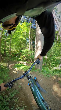
- By brenthillier
 NSMBA TRAILFORKS & contributors
 - Admins: ktm-boy-69, mpecsi, lines, larry81541, mpecsi
- #9908 - 13,316 views
- kärnten activity log | embed map of Kärnten mountain bike trails | kärnten mountain biking points of interest polygons
Downloading of trail gps tracks in kml & gpx formats is enabled for Kärnten.
You must login to download files.