close
-
Layers w
- Weather Layers
- Pro
- Pro
- Pro
- Pro
- Pro
- Pro
- More Layers
- Pro
- Pro
- Pro
- Pro
-
Upgrade to

3D
Trail Conditions
- Unknown
- Snow Groomed
- Snow Packed
- Snow Covered
- Snow Cover Partial
- Freeze/thaw Cycle
- Icy
- Prevalent Mud
- Wet
- Variable
- Ideal
- Dry
- Very Dry
Trail Flow (Ridden Direction)
Trailforks scans users ridelogs to determine the most popular direction each trail is ridden. A good flowing trail network will have most trails flowing in a single direction according to their intension.
The colour categories are based on what percentage of riders are riding a trail in its intended direction.
The colour categories are based on what percentage of riders are riding a trail in its intended direction.
- > 96%
- > 90%
- > 80%
- > 70%
- > 50%
- < 50%
- bi-directional trail
- no data
Trail Last Ridden
Trailforks scans ridelogs to determine the last time a trail was ridden.
- < 2 days
- < 1 week
- < 2 weeks
- < 1 month
- < 6 months
- > 6 months
Trail Ridden Direction
The intended direction a trail should be ridden.
- Downhill Only
- Downhill Primary
- Both Directions
- Uphill Primary
- Uphill Only
- One Direction
Contribute Details
Colors indicate trail is missing specified detail.
- Description
- Photos
- Description & Photos
- Videos
Trail Popularity ?
Trailforks scans ridelogs to determine which trails are ridden the most in the last 9 months.
Trails are compared with nearby trails in the same city region with a possible 25 colour shades.
Think of this as a heatmap, more rides = more kinetic energy = warmer colors.
- most popular
- popular
- less popular
- not popular
ATV/ORV/OHV Filter
Max Vehicle Width
inches
US Cell Coverage
Legend

Radar Time
Activity Recordings
Trailforks uses anonymized public activity data.
?
Activity Recordings
Trailforks uses anonymized public activity data.
?
Personal Heatmap
▶
Activity Types
all
/
none
▶
Options
2
Date range
month
–
Winter Trails
Warning
A routing network for winter maps does not exist. Selecting trails using the winter trails layer has been disabled.
Missing Trails
Most Popular
Least Popular
Trails are colored based on popularity. The more popular a trail is, the more red. Less popular trails trend towards green.
Jump Magnitude Heatmap
Heatmap of where riders jump on trails. Zoom in to see individual jumps, click circles to view jump details.
BC Backroad Status
![map legend]()
Service Road Atlas is a free to use, community-driven service for viewing and creating reports on the numerous back-country service roads around B.C. and Alberta.

Slope Aspect
Direction the slope faces
Trails Deemphasized
Trails are shown in grey.
Only show trails with no bike usage.
Suggested Layers
Based on selected activity type
Save the current map location and zoom level as your default home location whenever this page is loaded.
Save
No description for Carlisle has been added yet!
Login or register to submit one.
Activities Click to view
- Mountain Bike
108 trails
- Gravel Bike
2 trails
- Adaptive Bike
0 trails
- Hike
108 trails
- Trail Running
108 trails
- Snowshoe
0 trails
- Nordic Ski
34 trails
Region Details
- 3
- 5
- 68
- 31
- 1
Region Status
Open as of Nov 4, 2025Stats
- Avg Trail Rating
- Trails (view details)
- 143
- Trails Mountain Bike
- 108
- Trails Gravel Bike
- 2
- Trails Hike
- 108
- Trails Trail Running
- 108
- Trails Nordic Ski
- 34
- Total Distance
- 47 miles
- Total Descent Distance
- 15 miles
- Total Descent
- 2,071 ft
- Total Vertical
- 183 ft
- Highest Trailhead
- 295 ft
- Reports
- 169
- Photos
- 20
- Ridden Counter
- 25,145
Sub Regions
-
Conant Land
- 3
-
Davi's Corridor
- 8
- 2
-
Elliott Concord River Preserve
- 2
-
Great Brook Farm State Park
- 5
- 32
- 18
-
Greenough Land
- 7
- 7
-
Malcolm Preserve
- 5
-
Towle Land
- 11
Popular Carlisle Mountain Biking Trails
• 100 ★ 1.0 • 594 ft • 3 ft • 696 •
Popular white difficulty family friendly mixed. This multi-use trail can be used both directions and has a easy overall physical rating with a 3 ft green climb. Trail visibility is always easy to follow. On average it takes minutes to complete this trail.
• 100 ★ 4.5 • 1,932 ft • 9 ft • 690 •
Easy but fun. Lots of tight twists, less rocky than other GB trails.
• 95 ★ 4.0 • 1,155 ft • 0 ft • 630 •
Popular green difficulty family friendly mixed. This multi-use trail can be used both directions and has a easy overall physical rating with a 0 ft green climb. Trail visibility is always easy to follow. On average it takes 1 minutes to complete this trail.
• 100 ★ 4.4 • 1,480 ft • 3 ft • 624 •
Popular blue difficulty singletrack. This multi-use trail can be used both directions and has a easy overall physical rating with a 3 ft green climb. Trail visibility is always easy to follow. On average it takes 3 minutes to complete this trail.
• 95 ★ 5.0 • 568 ft • 0 ft • 618 •
Popular green difficulty singletrack. This multi-use trail can be used both directions and has a easy overall physical rating with a 0 ft green climb. Trail visibility is always easy to follow. On average it takes minutes to complete this trail.
• 100 ★ 3.0 • 1,358 ft • 21 ft • 575 •
Popular green difficulty singletrack. This multi-use trail can be used both directions and has a easy overall physical rating with a 21 ft green climb. Trail visibility is always easy to follow. On average it takes 2 minutes to complete this trail.
• 100 ★ 4.5 • 2,841 ft • 85 ft • 549 •
Short loop up and down . One side has switchbacks on mostly dirt, the other side is basically straight down a rocky slope.
Carlisle Mountain Bike Routes
★ 3.4 • 11 miles • 579 ft • 17 • Out & Back •
This is an intermediate 12 mile route which leaves from the Ski parking area. The route starts out on the...
★ 2.2 • 4 miles • 129 ft • 2 • Loop •
This is a relatively easy 4.5 mile trail suitable for confident beginners.
30 miles • 1,752 ft • 59 • Loop •
★ 5.0 • 29 miles • 1,745 ft • 46 • Loop •
A loop Featuring trails from Farm State Park, Russtle Mill State Forest, and Billrica trails.
★ 2.5 • 30 miles • 1,840 ft • 57 • Loop •
2024 NEMBA PK Memorial Advanced ride route. The route outside of will not be marked. Navigation is required.
13 miles • 524 ft • 13 • Loop •
A meandering route around Farm on double and single track routes. Plenty of opportunities to add more...
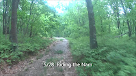
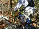
Photos of Carlisle Mountain Bike

Recent Trail Reports
| status | trail | date | condition | info | user |
|---|---|---|---|---|---|
| Heartbreak Ridge | Nov 4, 2025 @ 7:16am (America/New_York) Nov 4, 2025 | Unknown | blahn | ||
| Acorn Trail | Dec 3, 2024 @ 9:30am Dec 3, 2024 | Variable | irafcummings | ||
| Tophet West | Dec 3, 2024 @ 9:30am Dec 3, 2024 | Dry | irafcummings | ||
| Keyes Loop | Dec 3, 2024 @ 9:30am Dec 3, 2024 | Dry | irafcummings | ||
| Beaver Loop | Dec 3, 2024 @ 9:30am Dec 3, 2024 | Dry | irafcummings | ||
| Jones Road Link | Sep 29, 2024 @ 4:40pm Sep 29, 2024 | Ideal | SizeableSender | ||
| East Farm Trail | Sep 29, 2024 @ 4:40pm Sep 29, 2024 | Ideal | SizeableSender | ||
| Litchfield Loop | Sep 29, 2024 @ 4:40pm Sep 29, 2024 | Ideal | SizeableSender | ||
| Stone Row | Sep 29, 2024 @ 4:40pm Sep 29, 2024 | Ideal | SizeableSender | ||
| Indian Hill Turnpike | Sep 29, 2024 @ 4:40pm Sep 29, 2024 | Ideal | SizeableSender |
Activity Feed
| username | action | type | title | date |
|---|---|---|---|---|
| Rlacourse | wishlist | route | activity #97481589 | Jun 21, 2026 @ 7:15am 4 hours |
| AdamoIkjF5 | wishlist | route | activity #97360229 | Jun 19, 2026 @ 6:53pm 2 days |
| MassFatRider | wishlist | region | activity #96494927 | Jun 7, 2026 @ 1:48pm Jun 7, 2026 |
| kdigs27 | wishlist | route | activity #95601899 | May 26, 2026 @ 5:25pm May 26, 2026 |
| Treik | wishlist | region | activity #95305140 | May 23, 2026 @ 4:43am May 23, 2026 |
Recent Comments
| username | type | title | comment | date |
|---|---|---|---|---|
| trail | it doesn't—at least, not outside the few... | Nov 11, 2024 @ 8:37am Nov 11, 2024 | ||
| trail | this definitely is not a green or a blue.... | Jul 1, 2024 @ 4:12pm Jul 1, 2024 | ||
| trail | I don’t think this trail exists | Jun 15, 2024 @ 9:20am Jun 15, 2024 | ||
| trail | Update: The people who put the sign up for... | Jan 13, 2021 @ 5:40pm Jan 13, 2021 | ||
| trail | This is probably the most (and only) technical... | Oct 22, 2020 @ 4:23pm Oct 22, 2020 |
Local Badges
-

10 Green Trails279 awarded -

10 Blue Trails218 awarded -

Epic Ride Climb 2k2 awarded -

Climbing 10k Badge57 awarded -

Climbing 100k Badge0 awarded -

Epic Ride Descent 2k2 awarded
Activity Type Stats
| activitytype | trails | distance | descent | descent distance | total vertical | rating | global rank | state rank | photos | reports | routes | ridelogs |
|---|---|---|---|---|---|---|---|---|---|---|---|---|
| Mountain Bike | 108 | 36 miles | 1,755 ft | 12 miles | 184 ft | #1,545 | #578 | 15 | 169 | 12 | 11,673 | |
| Gravel Bike | 2 | 1 mile | 49 ft | 1,781 ft | 33 ft | #689 | #1,198 | 17 | 1 | 50 | ||
| Hike | 108 | 36 miles | 1,752 ft | 12 miles | 184 ft | #3,741 | #1,322 | 163 | 3 | 418 | ||
| Trail Running | 108 | 36 miles | 1,752 ft | 12 miles | 184 ft | #4,049 | #1,228 | 163 | 2 | 334 | ||
| Nordic Ski | 34 | 10 miles | 315 ft | 3 miles | 108 ft | #658 | #228 | 3 | 400 |
Frequently Asked Questions About Carlisle
▼
What are the best places to ride in Carlisle?
Carlisle has 8 areas to explore for mountain biking. The top rated areas are:
▼
What are the highest rated mountain biking trails in Carlisle?
The highest rated mountain biking trails in Carlisle are:
- Deer Run (4.2/5)
- 10 to 12 Crosscut (4.2/5)
- Acorn Trail (4.2/5)
- Keyes Loop (4.2/5)
- Stone Row (4.1/5)
▼
What is the best time of the year to ride in Carlisle?
Based on ride log data, the most popular months to ride in Carlisle are:
- July (197 activities)
- May (176 activities)
- June (162 activities)
▼
Where can I park to ride in Carlisle?
There are 14 parking locations listed in Carlisle. The most popular parking spots are: View all parking and trailhead locations on the map to plan your visit.
Activities
Trails
- By Sofakingfast
 MV NEMBA & contributors
 - Admins: MV NEMBA, NEPM
- #12184 - 4,244 views
- carlisle activity log | embed map of Carlisle mountain bike trails | carlisle mountain biking points of interest polygons
Downloading of trail gps tracks in kml & gpx formats is enabled for Carlisle.
You must login to download files.