close
-
Layers w
- Weather Layers
- Pro
- Pro
- Pro
- Pro
- Pro
- Pro
- More Layers
- Pro
- Pro
- Pro
- Pro
-
Upgrade to

3D
Trail Conditions
- Unknown
- Snow Groomed
- Snow Packed
- Snow Covered
- Snow Cover Partial
- Freeze/thaw Cycle
- Icy
- Prevalent Mud
- Wet
- Variable
- Ideal
- Dry
- Very Dry
Trail Flow (Ridden Direction)
Trailforks scans users ridelogs to determine the most popular direction each trail is ridden. A good flowing trail network will have most trails flowing in a single direction according to their intension.
The colour categories are based on what percentage of riders are riding a trail in its intended direction.
The colour categories are based on what percentage of riders are riding a trail in its intended direction.
- > 96%
- > 90%
- > 80%
- > 70%
- > 50%
- < 50%
- bi-directional trail
- no data
Trail Last Ridden
Trailforks scans ridelogs to determine the last time a trail was ridden.
- < 2 days
- < 1 week
- < 2 weeks
- < 1 month
- < 6 months
- > 6 months
Trail Ridden Direction
The intended direction a trail should be ridden.
- Downhill Only
- Downhill Primary
- Both Directions
- Uphill Primary
- Uphill Only
- One Direction
Contribute Details
Colors indicate trail is missing specified detail.
- Description
- Photos
- Description & Photos
- Videos
Trail Popularity ?
Trailforks scans ridelogs to determine which trails are ridden the most in the last 9 months.
Trails are compared with nearby trails in the same city region with a possible 25 colour shades.
Think of this as a heatmap, more rides = more kinetic energy = warmer colors.
- most popular
- popular
- less popular
- not popular
ATV/ORV/OHV Filter
Max Vehicle Width
inches
US Cell Coverage
Legend

Radar Time
Activity Recordings
Trailforks uses anonymized public activity data.
?
Activity Recordings
Trailforks uses anonymized public activity data.
?
Personal Heatmap
▶
Activity Types
all
/
none
▶
Options
2
Date range
month
–
Winter Trails
Warning
A routing network for winter maps does not exist. Selecting trails using the winter trails layer has been disabled.
Missing Trails
Most Popular
Least Popular
Trails are colored based on popularity. The more popular a trail is, the more red. Less popular trails trend towards green.
Jump Magnitude Heatmap
Heatmap of where riders jump on trails. Zoom in to see individual jumps, click circles to view jump details.
BC Backroad Status
![map legend]()
Service Road Atlas is a free to use, community-driven service for viewing and creating reports on the numerous back-country service roads around B.C. and Alberta.

Slope Aspect
Direction the slope faces
Trails Deemphasized
Trails are shown in grey.
Only show trails with no bike usage.
Suggested Layers
Based on selected activity type
Save the current map location and zoom level as your default home location whenever this page is loaded.
SaveThe Carmel mountain range is one of the first spots in Israel to support mountain biking on singletrack, since the early 2000's. Most trails are unofficial but very popular. Trails vary between XC to short enduro tracks, rocky, short and lots of fun
Main spots are Ofer forest and the surrounding of the Haifa University.
Main spots are Ofer forest and the surrounding of the Haifa University.
AKA: כרמל
This region uses the Uk/Euro style trail grading system.
Region Details
- 30
- 36
- 55
- 18
- 10
Stats
- Avg Trail Rating
- Trails (view details)
- 155
- Trails Mountain Bike
- 152
- Trails E-Bike
- 145
- Trails Horse
- 2
- Trails Hike
- 148
- Trails Trail Running
- 146
- Trails Dirtbike/Moto
- 1
- Trails ATV/ORV/OHV
- 1
- Total Distance
- 136 miles
- Total Descent
- 29,394 ft
- Total Vertical
- 1,647 ft
- Highest Trailhead
- 1,710 ft
- Reports
- 954
- Photos
- 35
- Ridden Counter
- 15,060
Sub Regions
- Haifa (71)
- Ofer Forest (73)
- Shfeya (3)
Popular Carmel Mountain Mountain Biking Trails
• 100 ★ 4.0 • 966 ft • 27 ft • 338 •
Popular blue difficulty singletrack. This mountain bike primary trail can be used downhill primary. On average it takes 2 minutes to complete this trail.
• 100 ★ 0.0 • 993 ft • 9 ft • 318 •
Popular green difficulty singletrack. This mountain bike primary trail can be used downhill primary and has a easy overall physical rating with a 9 ft green climb. On average it takes minutes to complete this trail.
• 100 ★ 3.5 • 1,006 ft • 1 ft • 315 •
Popular green difficulty singletrack. This mountain bike primary trail can be used both directions and has a easy overall physical rating. On average it takes 1 minutes to complete this trail.
• 95 ★ 4.0 • 3,120 ft • 126 ft • 273 •
Popular green difficulty singletrack. This mountain bike primary trail can be used one direction. On average it takes 6 minutes to complete this trail.
• 95 ★ 4.0 • 3,058 ft • 40 ft • 270 •
Popular green difficulty singletrack. This mountain bike primary trail can be used one direction. On average it takes 4 minutes to complete this trail.
• 95 ★ 3.0 • 2 miles • 209 ft • 260 •
Popular green difficulty singletrack. This mountain bike primary trail can be used one direction. On average it takes 19 minutes to complete this trail.
• 85 ★ 5.0 • 3 miles • 311 ft • 247 •
Popular green difficulty singletrack. This mountain bike primary trail can be used one direction. On average it takes 25 minutes to complete this trail.
• 80 ★ 4.0 • 1,044 ft • 0 ft • 240 •
Popular blue difficulty singletrack. This mountain bike primary trail can be used both directions. On average it takes 1 minutes to complete this trail.
Carmel Mountain Mountain Bike Routes
★ 5.0 • 13 miles • 1,682 ft • 13 • Loop •
An offical KKL route, marked in Yellow, climbs are not steep, it has no technical features. Most of the...
24 miles • 2,652 ft • 11 • Loop •
Beautiful 40Km mainly single trail manmade rout. great for long slightly technical training rides or just...
9 miles • 944 ft • 4 • Loop •
The route is marked with yellow drop showing the direction, This loop is marked with Red triangles on the...
8 miles • 777 ft • 4 • Loop •
The route is marked with yellow drop showing the direction, This loop is marked with Cyan triangles on the...
13 miles • 1,754 ft • 0 • Loop •
עבר להנאות הרכיבה הרבות שהסינגל יספק לנו, הרי שהוא טבול...
13 miles • 1,748 ft • 0 •
A nice loop in Ofer Forest, features the flowy side of the forest
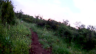
Photos of Carmel Mountain Mountain Bike
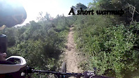
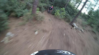
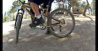
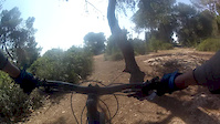
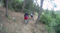
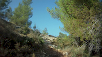
Videos of Carmel Mountain Mountain Bike
7:28 |
67 |
Apr 7, 2019
trail: Yagur Descender
3:12 |
301 |
Feb 29, 2016
trail: Gozemet
4:24 |
113 |
Nov 9, 2015

3:36 |
158 |
Dec 6, 2014
2:06 |
432 |
Jun 27, 2014
2:08 |
353 |
Apr 25, 2014
3:57 |
164 |
Apr 15, 2014
trail: Rock Garden
0:17 |
347 |
Jul 25, 2012
Recent Trail Reports
Activity Feed
| username | action | type | title | date |
|---|---|---|---|---|
| rOPJuu | wishlist | route | activity #95226410 | May 22, 2026 @ 12:18am May 22, 2026 |
| rOPJuu | wishlist | route | activity #95226362 | May 22, 2026 @ 12:16am May 22, 2026 |
| Frodo-collins | ridden | trail | activity #94966433 and 1 more | May 18, 2026 @ 3:39am May 18, 2026 |
| Bigben80 | vote | trail | activity #94668196 | May 13, 2026 @ 8:45pm May 13, 2026 |
| Yakioz | add | report | activity #94638144 | May 13, 2026 @ 10:53am May 13, 2026 |
Recent Comments
| username | type | title | comment | date |
|---|---|---|---|---|
| trail | Definitely more red trail than blue | Sep 30, 2025 @ 10:39am Sep 30, 2025 | ||
| trail | Brutal ,technical ,rocky short Single... | Nov 28, 2023 @ 3:01am Nov 28, 2023 | ||
| trail | Seems to not exist anymore | Aug 14, 2023 @ 8:46am Aug 14, 2023 | ||
| report | Surface mud: sticky soil, slippy roots | Nov 6, 2020 @ 6:27am Nov 6, 2020 | ||
| report | Hello! I'm in Pardes Hanna for a week and am... | Jan 21, 2020 @ 9:19am Jan 21, 2020 |
Local Badges
-

Epic Ride Climb 2k54 awarded -

Climbing 10k Badge52 awarded -

Climbing 100k Badge8 awarded -

Epic Ride Descent 2k65 awarded -

Descent 10k Badge52 awarded -

Descent 100k Badge9 awarded
Bike & Skill Parks
| name | type | city | rating |
|---|---|---|---|
| Haifa Pump track | skill park | Haifa |
Local Products
Activity Type Stats
| activitytype | trails | distance | descent | descent distance | total vertical | rating | global rank | state rank | photos | reports | routes | ridelogs |
|---|---|---|---|---|---|---|---|---|---|---|---|---|
| Mountain Bike | 152 | 129 miles | 25,814 ft | 64 miles | 1,647 ft | 27 | 954 | 7 | 17,420 | |||
| E-Bike | 145 | 112 miles | 22,995 ft | 57 miles | 1,647 ft | 1 | 941 | 3 | 3,076 | |||
| Horse | 2 | 15 miles | 1,801 ft | 7 miles | 535 ft | 128 | ||||||
| Hike | 148 | 134 miles | 28,222 ft | 67 miles | 1,647 ft | 1 | 961 | 610 | ||||
| Trail Running | 146 | 132 miles | 27,303 ft | 65 miles | 1,627 ft | 6 | 961 | 175 | ||||
| Dirtbike/Moto | 1 | 14 miles | 1,352 ft | 7 miles | 522 ft | 128 | 3 | |||||
| ATV/ORV/OHV | 1 | 14 miles | 1,352 ft | 7 miles | 522 ft | 128 | 15 |
Activities
Trails
Points of Interest
- By Sababike & contributors
- Admins: ziv2102
- #7213 - 4,293 views
- carmel mountain activity log | embed map of Carmel Mountain mountain bike trails | carmel mountain mountain biking points of interest
Downloading of trail gps tracks in kml & gpx formats is enabled for Carmel Mountain.
You must login to download files.