close
-
Layers w
- Weather Layers
- Pro
- Pro
- Pro
- Pro
- Pro
- Pro
- More Layers
- Pro
- Pro
- Pro
- Pro
-
Upgrade to

3D
Trail Conditions
- Unknown
- Snow Groomed
- Snow Packed
- Snow Covered
- Snow Cover Partial
- Freeze/thaw Cycle
- Icy
- Prevalent Mud
- Wet
- Variable
- Ideal
- Dry
- Very Dry
Trail Flow (Ridden Direction)
Trailforks scans users ridelogs to determine the most popular direction each trail is ridden. A good flowing trail network will have most trails flowing in a single direction according to their intension.
The colour categories are based on what percentage of riders are riding a trail in its intended direction.
The colour categories are based on what percentage of riders are riding a trail in its intended direction.
- > 96%
- > 90%
- > 80%
- > 70%
- > 50%
- < 50%
- bi-directional trail
- no data
Trail Last Ridden
Trailforks scans ridelogs to determine the last time a trail was ridden.
- < 2 days
- < 1 week
- < 2 weeks
- < 1 month
- < 6 months
- > 6 months
Trail Ridden Direction
The intended direction a trail should be ridden.
- Downhill Only
- Downhill Primary
- Both Directions
- Uphill Primary
- Uphill Only
- One Direction
Contribute Details
Colors indicate trail is missing specified detail.
- Description
- Photos
- Description & Photos
- Videos
Trail Popularity ?
Trailforks scans ridelogs to determine which trails are ridden the most in the last 9 months.
Trails are compared with nearby trails in the same city region with a possible 25 colour shades.
Think of this as a heatmap, more rides = more kinetic energy = warmer colors.
- most popular
- popular
- less popular
- not popular
ATV/ORV/OHV Filter
Max Vehicle Width
inches
US Cell Coverage
Legend

Radar Time
Activity Recordings
Trailforks uses anonymized public activity data.
?
Activity Recordings
Trailforks uses anonymized public activity data.
?
Personal Heatmap
▶
Activity Types
all
/
none
▶
Options
2
Date range
month
–
Winter Trails
Warning
A routing network for winter maps does not exist. Selecting trails using the winter trails layer has been disabled.
Missing Trails
Most Popular
Least Popular
Trails are colored based on popularity. The more popular a trail is, the more red. Less popular trails trend towards green.
Jump Magnitude Heatmap
Heatmap of where riders jump on trails. Zoom in to see individual jumps, click circles to view jump details.
BC Backroad Status
![map legend]()
Service Road Atlas is a free to use, community-driven service for viewing and creating reports on the numerous back-country service roads around B.C. and Alberta.

Slope Aspect
Direction the slope faces
Trails Deemphasized
Trails are shown in grey.
Only show trails with no bike usage.
Suggested Layers
Based on selected activity type
Save the current map location and zoom level as your default home location whenever this page is loaded.
Save
No description for Carnation has been added yet!
Login or register to submit one.
Activities Click to view
- Mountain Bike
102 trails
- E-Bike
96 trails
- Gravel Bike
0 trails
- Adaptive Bike
0 trails
- Winter Fat Bike
0 trails
- Horse
25 trails
- Hike
122 trails
- Trail Running
122 trails
Region Details
- 11
- 1
- 14
- 45
- 5
Region Status
Caution as of 23 hoursLocal Trail Association
Stats
- Avg Trail Rating
- Trails (view details)
- 82
- Trails Mountain Bike
- 128
- Trails E-Bike
- 96
- Trails Horse
- 25
- Trails Hike
- 124
- Trails Trail Running
- 122
- Total Distance
- 38 miles
- Total Descent
- 4,818 ft
- Total Vertical
- 549 ft
- Highest Trailhead
- 591 ft
- Reports
- 837
- Photos
- 150
- Ridden Counter
- 20,029
Sub Regions
-
Tolt MacDonald Park
- 17
- 55
- 5
Popular Carnation Mountain Biking Trails
• 100 ★ 2.8 • 3,855 ft • 461 ft • 583 •
Black designation for the climb. Steep grade and loose surface in spots when its dry. There are a few spots of exposure on the way down, but not a trail worthy of single black designation unless you are talking about the climb....
• 100 ★ 3.5 • 1,778 ft • 64 ft • 402 •
Quick little bit of fun tech, a couple of roots off kilter, nothing major, super fun. Rebuilt July 2021 mostly along the same route as the old Spine. A nice alternate to riding the road.
• 90 ★ 3.5 • 2,221 ft • 19 ft • 365 •
Pronounced "Wine-D-Ninety", a windier remake of the old I-90 trail that was destroyed by logging. It's a fun winding cross country trail similar to the others nearby. The north entrance sports a very short jump line alternate from and...
• 95 ★ 3.5 • 1,854 ft • 3 ft • 364 •
starts off of the north road and hits the top of . It does have two optional stump drops on it. The second one is not rollable so go big. Turns are tight and the whole trail is a blast if you pedal hard. Some real fun style trail.
• 75 ★ 0.0 • 1,942 ft • 56 ft • 346 •
Popular blue difficulty singletrack. This mountain bike primary trail can be used both directions. On average it takes 5 minutes to complete this trail.
• 80 ★ 3.9 • 3,743 ft • 50 ft • 330 •
Rebuilt in 2019/2020 after clear-cut damage. A tight, twisty and fun trail with plenty of little stuff to challenge you. It seems to flow better in the easterly direction, which is slightly downhill. Continue onto the new Bob's for more...
Carnation Mountain Bike Routes
★ 5.0 • 5 miles • 607 ft • 6 • Loop •
A quick, fun loop around Tolt. Starts with an unavoidable warm-up climb on IAB, then relax and enjoy the...
★ 5.0 • 9 miles • 1,286 ft • 17 • Loop •
This route is a crescendo from pure XC to jumpier and jumpier until you get to a series of 5-6 double...
9 miles • 1,126 ft • 21 • Point to Point •
Created as a tour of the park in 1-2 hours riding time.
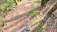
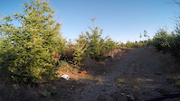
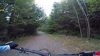
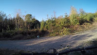
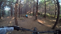
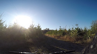
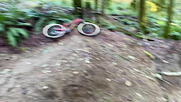
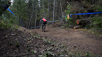
Photos of Carnation Mountain Bike
Videos of Carnation Mountain Bike
trail: Steeper Way Down
0:00 |
45 |
Mar 28, 2026
trail: Tour de Stump
3:43 |
27 |
Oct 8, 2025
trail: Whiplash
0:53 |
19 |
Oct 8, 2025
trail: Green Mamba
6:29 |
65 |
Oct 8, 2025
trail: LOTL
5:45 |
41 |
Oct 8, 2025
trail: Bordercurve (Upper)
2:10 |
13 |
Oct 8, 2025
trail: Dancing
0:10 |
323 |
Feb 8, 2020
trail: The Plunge
12:19 |
297 |
Apr 28, 2016
Current Trail Warnings
| status | trail | date | condition | user | info |
|---|---|---|---|---|---|
| Itt | Jun 16, 2026 @ 7:42pm (America/Los_Angeles) Jun 16, 2026 | Unknown | RyanVars | Trail cannot be found because of... | |
| Slow Burn | Jun 16, 2026 @ 7:34pm (America/Los_Angeles) Jun 16, 2026 | Unknown | RyanVars | I was unable to enter the trail because... | |
| OGXC | May 26, 2026 @ 6:10pm (America/Vancouver) May 26, 2026 | Ideal | TravisFulton | Very thick already. Needs a brushing |
Recent Trail Reports
| status | trail | date | condition | info | user |
|---|---|---|---|---|---|
| In & Out | Jun 24, 2026 @ 3:00pm (America/Vancouver) 23 hours | Dry | jarmanator | ||
| Cousins | Jun 12, 2026 @ 10:28pm (America/Los_Angeles) Jun 12, 2026 | Ideal | FogeyStogey C2S-TOLT | ||
| Phoenix | Jun 12, 2026 @ 10:27pm (America/Los_Angeles) Jun 12, 2026 | Ideal | FogeyStogey C2S-TOLT | ||
| MLR | Jun 12, 2026 @ 3:15pm (America/Los_Angeles) Jun 12, 2026 | Unknown | FogeyStogey C2S-TOLT | ||
| Mossy Mountain Way (It's A Bitch) | Jun 12, 2026 @ 1:29pm (America/Vancouver) Jun 12, 2026 | Ideal | Clogstonian | ||
| BW's | Jun 7, 2026 @ 6:14pm (America/Los_Angeles) Jun 7, 2026 | Unknown | valko206 EMBA-C2S | ||
| Sidewinder North | May 26, 2026 @ 6:10pm (America/Vancouver) May 26, 2026 | Unknown | TravisFulton | ||
| Stroller Coaster | May 26, 2026 @ 6:10pm (America/Vancouver) May 26, 2026 | Ideal | TravisFulton | ||
| Bob's Run | May 26, 2026 @ 6:10pm (America/Vancouver) May 26, 2026 | Ideal | TravisFulton | ||
| Tour de Stump | May 26, 2026 @ 6:10pm (America/Vancouver) May 26, 2026 | Ideal | TravisFulton |
Activity Feed
| username | action | type | title | date |
|---|---|---|---|---|
| jarmanator | add | report | activity #97733584 | Jun 24, 2026 @ 4:57pm 21 hours |
| d7jpp5 | wishlist | region | activity #97560562 | Jun 22, 2026 @ 7:33am Jun 22, 2026 |
| Robinarnold829 | wishlist | trail | activity #97508620 | Jun 21, 2026 @ 12:07pm Jun 21, 2026 |
| snokarver | ridden | skillpark | activity #97447340 | Jun 20, 2026 @ 6:09pm Jun 20, 2026 |
| RyanVars | add | report | activity #97157293 and 1 more | Jun 16, 2026 @ 7:34pm Jun 16, 2026 |
Recent Comments
| username | type | title | comment | date |
|---|---|---|---|---|
| trail | Kinda overgrown, nothing good | Apr 10, 2026 @ 6:44pm Apr 10, 2026 | ||
| report | @alastairswan: Thanks | Dec 18, 2025 @ 10:07pm Dec 18, 2025 | ||
| report | Thank you. I appreciate you reporting it. | Dec 18, 2025 @ 10:07pm Dec 18, 2025 | ||
| report | It’s in the park, reported to Parks along... | Dec 14, 2025 @ 3:36pm Dec 14, 2025 | ||
| report | I think on the king county property section.... | Dec 13, 2025 @ 11:45pm Dec 13, 2025 |
Local Badges
-

10 Green Trails93 awarded -

10 Blue Trails296 awarded -

Epic Ride Climb 2k38 awarded -

Climbing 10k Badge38 awarded -

Climbing 100k Badge0 awarded -

Epic Ride Descent 2k37 awarded
Bike & Skill Parks
| name | type | city | rating |
|---|---|---|---|
| Valley Memorial Park Pump Track | skill park | Carnation |
Activity Type Stats
| activitytype | trails | distance | descent | descent distance | total vertical | rating | global rank | state rank | photos | reports | routes | ridelogs |
|---|---|---|---|---|---|---|---|---|---|---|---|---|
| Mountain Bike | 102 | 35 miles | 4,606 ft | 14 miles | 548 ft | #1,673 | #627 | 172 | 941 | 8 | 8,554 | |
| E-Bike | 96 | 6 miles | 374 ft | 2 miles | 443 ft | #4,007 | #1,335 | 3 | 746 | 1 | 708 | |
| Horse | 25 | 7 miles | 538 ft | 2 miles | 489 ft | #2,508 | #1,381 | 218 | 2 | |||
| Hike | 122 | 37 miles | 4,485 ft | 14 miles | 531 ft | #4,293 | #1,509 | 1 | 935 | 1 | 771 | |
| Trail Running | 122 | 36 miles | 4,429 ft | 14 miles | 531 ft | #3,951 | #1,187 | 923 | 407 |
Frequently Asked Questions About Carnation
▼
What are the best places to ride in Carnation?
Carnation has 2 areas to explore for mountain biking. The top rated areas are:
▼
What are the highest rated mountain biking trails in Carnation?
The highest rated mountain biking trails in Carnation are:
- Hot Wok (4.2/5)
- Sidewinder North (4.1/5)
- In & Out (4.1/5)
- Bordercurve (Lower) (4.1/5)
- Two Craters (4.1/5)
▼
What is the best time of the year to ride in Carnation?
Based on ride log data, the most popular months to ride in Carnation are:
- July (104 activities)
- May (91 activities)
- April (74 activities)
▼
Where can I park to ride in Carnation?
Activities
Trails
Points of Interest
- By jebike
 & contributors
 - Admins: EMBA-C2S, EMBA-C2S
- #5468 - 7,024 views
- carnation activity log | embed map of Carnation mountain bike trails | carnation mountain biking points of interest
Downloading of trail gps tracks in kml & gpx formats is enabled for Carnation.
You must login to download files.