close
-
Layers w
- Weather Layers
- Pro
- Pro
- Pro
- Pro
- Pro
- Pro
- More Layers
- Pro
- Pro
- Pro
- Pro
-
Upgrade to

3D
Trail Conditions
- Unknown
- Snow Groomed
- Snow Packed
- Snow Covered
- Snow Cover Partial
- Freeze/thaw Cycle
- Icy
- Prevalent Mud
- Wet
- Variable
- Ideal
- Dry
- Very Dry
Trail Flow (Ridden Direction)
Trailforks scans users ridelogs to determine the most popular direction each trail is ridden. A good flowing trail network will have most trails flowing in a single direction according to their intension.
The colour categories are based on what percentage of riders are riding a trail in its intended direction.
The colour categories are based on what percentage of riders are riding a trail in its intended direction.
- > 96%
- > 90%
- > 80%
- > 70%
- > 50%
- < 50%
- bi-directional trail
- no data
Trail Last Ridden
Trailforks scans ridelogs to determine the last time a trail was ridden.
- < 2 days
- < 1 week
- < 2 weeks
- < 1 month
- < 6 months
- > 6 months
Trail Ridden Direction
The intended direction a trail should be ridden.
- Downhill Only
- Downhill Primary
- Both Directions
- Uphill Primary
- Uphill Only
- One Direction
Contribute Details
Colors indicate trail is missing specified detail.
- Description
- Photos
- Description & Photos
- Videos
Trail Popularity ?
Trailforks scans ridelogs to determine which trails are ridden the most in the last 9 months.
Trails are compared with nearby trails in the same city region with a possible 25 colour shades.
Think of this as a heatmap, more rides = more kinetic energy = warmer colors.
- most popular
- popular
- less popular
- not popular
ATV/ORV/OHV Filter
Max Vehicle Width
inches
US Cell Coverage
Legend

Radar Time
Activity Recordings
Trailforks uses anonymized public activity data.
?
Activity Recordings
Trailforks uses anonymized public activity data.
?
Personal Heatmap
▶
Activity Types
all
/
none
▶
Options
2
Date range
month
–
Winter Trails
Warning
A routing network for winter maps does not exist. Selecting trails using the winter trails layer has been disabled.
Missing Trails
Most Popular
Least Popular
Trails are colored based on popularity. The more popular a trail is, the more red. Less popular trails trend towards green.
Jump Magnitude Heatmap
Heatmap of where riders jump on trails. Zoom in to see individual jumps, click circles to view jump details.
BC Backroad Status
![map legend]()
Service Road Atlas is a free to use, community-driven service for viewing and creating reports on the numerous back-country service roads around B.C. and Alberta.

Slope Aspect
Direction the slope faces
Trails Deemphasized
Trails are shown in grey.
Only show trails with no bike usage.
Suggested Layers
Based on selected activity type
Save the current map location and zoom level as your default home location whenever this page is loaded.
SaveE-Bike Description:
Carson City follows State of Nevada law regarding e-bikes and e-bike definitions. See NRS 482.0287 and NRS 484B.017.\r\n"Municipality of Carson City: Carson City does not have an eBike ordinance or regulations, so State law prevails, and eBikes are allowed to be ridden where bicycles are allowed, including bicycle paths, shared-use paths, and natural surface trails that are within the City’s jurisdiction."\r\neBike Riding in Carson City https://www.carson.org/home/showpublisheddocument/88133/638403891577470000
Carson City follows State of Nevada law regarding e-bikes and e-bike definitions. See NRS 482.0287 and NRS 484B.017.\r\n"Municipality of Carson City: Carson City does not have an eBike ordinance or regulations, so State law prevails, and eBikes are allowed to be ridden where bicycles are allowed, including bicycle paths, shared-use paths, and natural surface trails that are within the City’s jurisdiction."\r\neBike Riding in Carson City https://www.carson.org/home/showpublisheddocument/88133/638403891577470000
source: eBike Riding in Carson City
Region Supporters & Maintainers
Activities Click to view
- Mountain Bike
173 trails
- E-Bike
32 trails
- Gravel Bike
3 trails
- Adaptive Bike
3 trails
- Winter Fat Bike
3 trails
- Horse
86 trails
- Hike
178 trails
- Trail Running
181 trails
- Dirtbike/Moto
46 trails
- Observed Trials
8 trails
- ATV/ORV/OHV
43 trails
Region Details
- 46
- 4
- 26
- 83
- 5
Region Status
Open as of Jun 15, 2026Stats
- Avg Trail Rating
- Trails (view details)
- 201
- Trails Mountain Bike
- 173
- Trails E-Bike
- 32
- Trails Gravel Bike
- 3
- Trails Adaptive Bike
- 3
- Trails Winter Fat Bike
- 3
- Trails Horse
- 86
- Trails Hike
- 180
- Trails Trail Running
- 181
- Trails Dirtbike/Moto
- 46
- Trails Observed Trials
- 8
- Trails ATV/ORV/OHV
- 43
- Trails Snowmobile
- 2
- Trails Snowshoe
- 1
- Total Distance
- 244 miles
- Total Descent
- 41,658 ft
- Total Vertical
- 4,612 ft
- Highest Trailhead
- 9,191 ft
- Reports
- 1,294
- Photos
- 476
- Ridden Counter
- 26,429
Articles

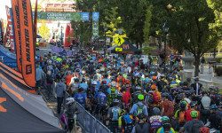
Day 3 Race Report: Carson City Off-Road
Jul 1, 2019 from pinkbike.com
See all the action from the final day of the 2019 Carson City Off-Road.
Day 2 Race Report: Carson City Off-Road
Jun 30, 2019 from pinkbike.com
Check out all the action from the second day of the 2019 Carson City Off-Road.

Day 1 Race Report: Carson City Off-Road
Jun 29, 2019 from pinkbike.com
Check out all the action from day one of the 4th edition of Epic Rides Carson City Off-Road.
Sub Regions
-
Ash Canyon
- 9
- 12
-
Centennial Park
- 5
- 26
- 2
-
Kings Canyon
- 3
- 1
-
Prison Hill Recreation Area
- 2
- 6
- 24
- 2
-
Spooner Lake and Backcountry State Park
- 3
- 4
Popular Carson City Mountain Biking Trails
• 60 ★ 4.8 • 4 miles • 41 ft • 869 •
The climb up from Marlette Lake trail is pretty tough, but relatively short. The decent to the upper parking area is an amazing finish to what was likely a great ride with amazing views. Several high speed, low risk sections take you...
• 100 ★ 4.7 • 7 miles • 1,234 ft • 833 •
Very nicely built trail, with consistent grade and great views. Some small rock features and discrete jumps exist, but this trail has been designed to be appealing for all ability levels -so don't expect any gnar. Great climb in either...
• 100 ★ 3.8 • 3,071 ft • 0 ft • 727 •
This is the main access trail to the Ash Canyon Trail network. The climb up isn't technical but is deceptively steep, the decent can be ripping fast. There is good line of sight for the majority of the trail although it gets a bit...
• 100 ★ 3.0 • 2,382 ft • 0 ft • 717 •
Popular green difficulty singletrack. This multi-use trail can be used both directions and has a easy overall physical rating with a 0 ft green climb. On average it takes 2 minutes to complete this trail.
• 100 ★ 4.0 • 1,375 ft • 41 ft • 654 •
Popular green difficulty singletrack. This multi-use trail can be used both directions. On average it takes 2 minutes to complete this trail.
• 90 ★ 4.4 • 1 mile • 43 ft • 576 •
This is a very fun downhill that parallels Ash Canyon . The trail flows through a narrow canyon lined with cottonwood, aspen, and manzanita; it can become slightly overgrown in the spring time which will limit your line-of-sight. The...
Carson City Mountain Bike Routes
★ 5.0 • 13 miles • 2,022 ft • 4 • Loop •
This is a great ride Kings to Ash Canyon, it has some road segments but mostly single track.
★ 4.5 • 14 miles • 2,214 ft • 16 •
Enduro ride up fire road and Kings Canyon to Ash Canyon downhill
7 miles • 787 ft • 1 •
23 miles • 2,279 ft • 8 • Point to Point •
This is the shortest route for those wanting to ride the from the top. Starting at State Park (fee area),...
★ 1.0 • 33 miles • 3,300 ft • 10 • Point to Point •
A point-to-point backcountry epic, showcasing some of State Park's best trails, ending in Carson City,...
Photos of Carson City Mountain Bike
Videos of Carson City Mountain Bike
trail: Bob's Trail (Upper)
0:33 |
76 |
May 5, 2022

2:33 |
171 |
Dec 19, 2018

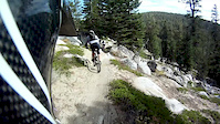
trail: Chimney Beach Trail
3:29 |
1660 |
Dec 9, 2018
trail: Secret Trail
0:11 |
284 |
Feb 23, 2018
trail: Chimney Beach Trail
2:30 |
440 |
Nov 4, 2016
trail: 4 Day
8:22 |
351 |
Nov 19, 2013
youtuber
![Chimney Beach / Lake Tahoe, NV / MTB]()
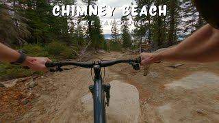
trail: Chimney Beach Trail
8:25 |
76 |
Nov 25, 2025 , Carson City
youtuber
![Lincoln Bypass AKA Longview / Carson City, NV...]()
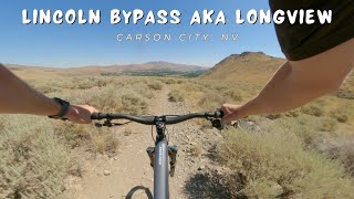
trail: Lincoln Bypass
3:44 |
114 |
Sep 2, 2025 , Carson City
Recent Trail Reports
| status | trail | date | condition | info | user |
|---|---|---|---|---|---|
| North Loop Connector | Jun 14, 2026 @ 10:35pm (America/Los_Angeles) Jun 14, 2026 | Dry | JacksonY6rOpv | ||
| Chimney Beach Trail | Jun 6, 2026 @ 9:39pm (America/Los_Angeles) Jun 6, 2026 | Dry | matthost | ||
| Dead Truck Canyon | Apr 18, 2026 @ 4:42pm (America/Los_Angeles) Apr 18, 2026 | Dry | SWestre | ||
| Lincoln Bypass | Mar 19, 2026 @ 12:04pm (America/Los_Angeles) Mar 19, 2026 | Variable | namor216 | ||
| Lincoln Bypass | Mar 19, 2026 @ 12:04pm (America/Los_Angeles) Mar 19, 2026 | Variable | namor216 | ||
| Saddle Express | Mar 11, 2026 @ 11:30am (America/Los_Angeles) Mar 11, 2026 | Ideal | namor216 | ||
| EZ Trail | Mar 10, 2026 @ 9:54am (America/Los_Angeles) Mar 10, 2026 | Ideal | skiingabby | ||
| Prison Hill North Loop | Mar 5, 2026 @ 12:11pm (America/Los_Angeles) Mar 5, 2026 | Ideal | namor216 | ||
| Capitol Automotive Trail | Mar 4, 2026 @ 10:30am (America/Los_Angeles) Mar 4, 2026 | Snow Covered | WillieJacobsz Trailforks | ||
| Timberline Road | Mar 4, 2026 @ 10:29am (America/Los_Angeles) Mar 4, 2026 | Snow Covered | WillieJacobsz Trailforks |
National Scenic Trails & Official Routes
-
Tahoe Rim Trail
- Mountain Bike
- E-Bike
- Horse
- Hike
- Trail Running
Activity Feed
| username | action | type | title | date |
|---|---|---|---|---|
| katrintomanek | wishlist | trail | activity #97293420 | Jun 18, 2026 @ 8:08pm 7 hours |
| tahoemtbr | add | report | activity #97075546 | Jun 15, 2026 @ 5:09pm Jun 15, 2026 |
| JacksonY6rOpv | add | report | activity #97023773 | Jun 14, 2026 @ 10:35pm Jun 14, 2026 |
| matthost | add | report | activity #97022981 | Jun 14, 2026 @ 9:57pm Jun 14, 2026 |
| JordanZIy1FQ | wishlist | trail | activity #96869803 | Jun 13, 2026 @ 6:30am Jun 13, 2026 |
Recent Comments
| username | type | title | comment | date |
|---|---|---|---|---|
| trail | Nice mellow flow | Sep 30, 2025 @ 4:32pm Sep 30, 2025 | ||
| trail | Very well-maintained and flowy trail, with... | Jul 8, 2025 @ 4:56pm Jul 8, 2025 | ||
| trail | 2" tires minimum, it's quite sandy in the top half | Jun 17, 2025 @ 4:33pm Jun 17, 2025 | ||
| report | Upper body is not o | May 23, 2025 @ 10:46am May 23, 2025 | ||
| report | I'm | May 23, 2025 @ 10:44am May 23, 2025 |
Local Badges
-

Completionist0 awarded -

Big Ride 30k3,947 awarded -

Epic Ride 50k1,300 awarded -

Top 10 Trails58 awarded -
Completionist0 awarded -
Completionist0 awarded
Bike & Skill Parks
| name | type | city | rating |
|---|---|---|---|
| Silverstate Mx | skill park | Carson City |
Activity Type Stats
| activitytype | trails | distance | descent | descent distance | total vertical | rating | global rank | state rank | photos | reports | routes | ridelogs |
|---|---|---|---|---|---|---|---|---|---|---|---|---|
| Mountain Bike | 173 | 214 miles | 31,394 ft | 90 miles | 4,613 ft | #635 | #238 | 448 | 1,293 | 14 | 20,051 | |
| E-Bike | 32 | 61 miles | 11,030 ft | 32 miles | 4,219 ft | #2,391 | #985 | 2 | 1,038 | 1,855 | ||
| Gravel Bike | 3 | #457 | #1,037 | 2 | 25 | 180 | ||||||
| Adaptive Bike | 3 | #367 | #1,698 | 8 | 3 | |||||||
| Winter Fat Bike | 3 | #267 | #1,049 | 3 | ||||||||
| Horse | 86 | 99 miles | 16,214 ft | 45 miles | 4,416 ft | #354 | #473 | 305 | 2 | |||
| Hike | 178 | 227 miles | 34,334 ft | 97 miles | 4,613 ft | #569 | #260 | 12 | 1,294 | 5 | 1,683 | |
| Trail Running | 181 | 227 miles | 34,485 ft | 97 miles | 4,613 ft | #400 | #157 | 11 | 1,294 | 5 | 1,722 | |
| Dirtbike/Moto | 46 | 45 miles | 14,226 ft | 32 miles | 2,769 ft | #557 | #185 | 286 | 46 | |||
| Observed Trials | 8 | 4 miles | 1,207 ft | 2 miles | 902 ft | #184 | #31 | 6 | 7 | |||
| ATV/ORV/OHV | 43 | 39 miles | 13,402 ft | 29 miles | 2,116 ft | #305 | #95 | 3 | 288 | 11 | ||
| Snowmobile | 2 | 5 miles | 1,289 ft | 4 miles | 922 ft | |||||||
| Snowshoe | 1 | 2 miles | 899 ft | 2 miles | 899 ft | 30 |
Frequently Asked Questions About Carson City
▼
What are the best places to ride in Carson City?
Carson City has 6 areas to explore for mountain biking. The top rated areas are:
▼
What are the highest rated mountain biking trails in Carson City?
The highest rated mountain biking trails in Carson City are:
- Ash Canyon to Kings Canyon Trail (4.6/5)
- Chimney Beach Trail (4.6/5)
- Lincoln Bypass (4.3/5)
- Creek Trail (4.3/5)
- Wild Horse Trail (4.3/5)
▼
What is the best time of the year to ride in Carson City?
Based on ride log data, the most popular months to ride in Carson City are:
- July (122 activities)
- April (108 activities)
- May (108 activities)
▼
Where can I park to ride in Carson City?
There are 13 parking locations listed in Carson City. The most popular parking spots are: View all parking and trailhead locations on the map to plan your visit.
Activities
Trails
- By TheAngryTomato
 TRAILFORKS & contributors
 - Admins: TAMBA, MP, CCPROP, TAMBA
- #7298 - 25,843 views
- carson city activity log | embed map of Carson City mountain bike trails | carson city mountain biking points of interest polygons
Downloading of trail gps tracks in kml & gpx formats is enabled for Carson City.
You must login to download files.