close
-
Layers w
- Weather Layers
- Pro
- Pro
- Pro
- Pro
- Pro
- Pro
- More Layers
- Pro
- Pro
- Pro
- Pro
-
Upgrade to

3D
Trail Conditions
- Unknown
- Snow Groomed
- Snow Packed
- Snow Covered
- Snow Cover Partial
- Freeze/thaw Cycle
- Icy
- Prevalent Mud
- Wet
- Variable
- Ideal
- Dry
- Very Dry
Trail Flow (Ridden Direction)
Trailforks scans users ridelogs to determine the most popular direction each trail is ridden. A good flowing trail network will have most trails flowing in a single direction according to their intension.
The colour categories are based on what percentage of riders are riding a trail in its intended direction.
The colour categories are based on what percentage of riders are riding a trail in its intended direction.
- > 96%
- > 90%
- > 80%
- > 70%
- > 50%
- < 50%
- bi-directional trail
- no data
Trail Last Ridden
Trailforks scans ridelogs to determine the last time a trail was ridden.
- < 2 days
- < 1 week
- < 2 weeks
- < 1 month
- < 6 months
- > 6 months
Trail Ridden Direction
The intended direction a trail should be ridden.
- Downhill Only
- Downhill Primary
- Both Directions
- Uphill Primary
- Uphill Only
- One Direction
Contribute Details
Colors indicate trail is missing specified detail.
- Description
- Photos
- Description & Photos
- Videos
Trail Popularity ?
Trailforks scans ridelogs to determine which trails are ridden the most in the last 9 months.
Trails are compared with nearby trails in the same city region with a possible 25 colour shades.
Think of this as a heatmap, more rides = more kinetic energy = warmer colors.
- most popular
- popular
- less popular
- not popular
ATV/ORV/OHV Filter
Max Vehicle Width
inches
US Cell Coverage
Legend

Radar Time
Activity Recordings
Trailforks uses anonymized public activity data.
?
Activity Recordings
Trailforks uses anonymized public activity data.
?
Personal Heatmap
▶
Activity Types
all
/
none
▶
Options
2
Date range
month
–
Winter Trails
Warning
A routing network for winter maps does not exist. Selecting trails using the winter trails layer has been disabled.
Missing Trails
Most Popular
Least Popular
Trails are colored based on popularity. The more popular a trail is, the more red. Less popular trails trend towards green.
Jump Magnitude Heatmap
Heatmap of where riders jump on trails. Zoom in to see individual jumps, click circles to view jump details.
BC Backroad Status
![map legend]()
Service Road Atlas is a free to use, community-driven service for viewing and creating reports on the numerous back-country service roads around B.C. and Alberta.

Slope Aspect
Direction the slope faces
Trails Deemphasized
Trails are shown in grey.
Only show trails with no bike usage.
Suggested Layers
Based on selected activity type
Save the current map location and zoom level as your default home location whenever this page is loaded.
SaveCarterton, located in the Wairarapa approximately 45 minutes drive from Wellington City.
Activities Click to view
- Mountain Bike
43 trails
- E-Bike
36 trails
- Gravel Bike
0 trails
- Adaptive Bike
0 trails
- Hike
8 trails
- Trail Running
8 trails
Region Details
- 10
- 7
- 10
- 1
- 10
Region Status
Open as of Apr 5, 2026Stats
- Avg Trail Rating
- Trails (view details)
- 43
- Trails Mountain Bike
- 43
- Trails E-Bike
- 36
- Trails Hike
- 9
- Trails Trail Running
- 8
- Total Distance
- 25 miles
- Total Descent
- 10,953 ft
- Total Vertical
- 1,593 ft
- Highest Trailhead
- 1,780 ft
- Reports
- 107
- Photos
- 146
- Ridden Counter
- 3,492
Sub Regions
-
Carterton Mountain Bike Park
- 2
- 1
-
Rivenrock
- 3
- 6
- 1
- 7
Popular Carterton Mountain Biking Trails
• 70 ★ 3.5 • 3,530 ft • 76 ft • 277 •
is at the base of the park, You can do a short climb up to the top of the descent to do laps or feed into it from various other trails. descent is made up of berms and rollers, making a pump/flow trail.
• 65 ★ 4.0 • 2,703 ft • 45 ft • 155 •
Technical singletrack trail leading off from the shuttle drop off point. Some tight switchbacks, Drops, Steep chutes and off camber corners, Short skinny across stream.
• 50 ★ 4.1 • 2 miles • 340 ft • 152 •
A mixture of hand-built trail and digger dug. Initial section of trail has a very slight climb then becomes a hand dug descent through. Trail has some fast sections, some slower techy sections and two switchbacks. makes for an easier...
• 75 ★ 4.3 • 2,687 ft • 7 ft • 146 •
Fun, Hand dug flowy singletrack, starts off with some switchbacks then opens out into wide corners and woops. leads straight into trail connecting to for extra descent time.
• 35 ★ 4.3 • 2,933 ft • 75 ft • 138 •
heads off over a wooden bridge and then has a short steepish section before turning into singletrack in pine trees. There are electric fence barriers that you can ride through without problem as long as you have rubber tyres and no feet...
• 95 ★ 4.4 • 1,299 ft • 91 ft • 135 •
Fun little trail linking into the start of , , , and . optional features on the sides of the trail including rock drops and jumps. A nicely flowing trail
• 85 ★ 0.0 • 633 ft • 29 ft • 129 •
short connector from and to , slight climb up then drops across the shuttle road
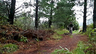
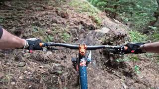
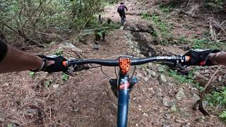
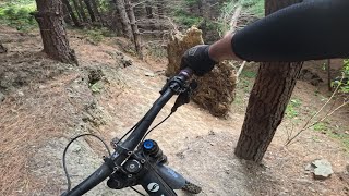
Photos of Carterton Mountain Bike
Videos of Carterton Mountain Bike
trail: Mt Dick
0:21 |
332 |
Jun 22, 2020
youtuber
![This Or That @ Rivenrock MTB Park]()
trail: This Or That
4:20 |
207 |
Apr 15, 2024 , Carterton
youtuber
![Blackberry Lane @ Rivenrock MTB Park]()
trail: Blackberry Lane
3:20 |
171 |
Mar 18, 2024 , Carterton

trail: Radiata Rumble
20:14 |
133 |
Feb 24, 2024 , Carterton
trail: This Or That
8:49 |
125 |
Feb 24, 2024 , Carterton
youtuber
![Going Postal @ Rivenrock MTB Park]()
trail: Going Postal
3:53 |
242 |
Feb 19, 2024 , Carterton
youtuber
![Corona Coaster @ Rivenrock MTB Park]()
trail: Corona-coaster
2:52 |
252 |
Jan 1, 2024 , Carterton
Recent Trail Reports
| status | trail | date | condition | info | user |
|---|---|---|---|---|---|
| Waiohine Gorge Loop | Feb 22, 2026 @ 8:03pm (Pacific/Auckland) Feb 21, 2026 | Variable | Itstimmyj | ||
| Mt Dick Descent | Jan 2, 2026 @ 3:12pm (Pacific/Auckland) Jan 1, 2026 | Variable | markmontgomerie | ||
| Mt Dick | Apr 20, 2025 @ 3:23pm Apr 20, 2025 | Ideal | Russell_Pearless | ||
| Fred | Jan 3, 2024 @ 12:00am Jan 3, 2024 | Unknown | CoreyAM | ||
| Splice | Jan 3, 2024 @ 12:00am Jan 3, 2024 | Unknown | CoreyAM | ||
| Coast to Pin | Oct 21, 2023 @ 6:08am Oct 21, 2023 | Ideal | JoceScott | ||
| U/K | Oct 21, 2023 @ 6:08am Oct 21, 2023 | Dry | JoceScott | ||
| Langlands - Pinball link | Oct 21, 2023 @ 6:08am Oct 21, 2023 | Ideal | JoceScott | ||
| Uplift / Access Climb | Oct 21, 2023 @ 6:08am Oct 21, 2023 | Dry | JoceScott | ||
| Ebb | Apr 14, 2023 @ 7:23am Apr 14, 2023 | Variable | highburyeye |
Activity Feed
| username | action | type | title | date |
|---|---|---|---|---|
| xCoster | wishlist | region | activity #95288485 | May 22, 2026 @ 9:05pm May 22, 2026 |
| ikendothis | update | trail | activity #92170131 | Apr 8, 2026 @ 1:43am Apr 8, 2026 |
| Amonsta | wishlist | trail | activity #91152302 | Mar 23, 2026 @ 10:25am Mar 23, 2026 |
| kazza88 | ridden | trail | activity #90964013 | Mar 20, 2026 @ 11:25pm Mar 20, 2026 |
| be4ecfam | wishlist | trail | activity #90533806 | Mar 14, 2026 @ 12:49am Mar 14, 2026 |
Recent Comments
| username | type | title | comment | date |
|---|---|---|---|---|
| trail | Start of track was fine, however quickly... | Feb 21, 2026 @ 11:07pm Feb 21, 2026 | ||
| trail | Overgrowing, trees down and very rocky from... | Feb 20, 2026 @ 5:55pm Feb 20, 2026 | ||
| trail | Gates at edge of road were open but small sign... | Sep 12, 2025 @ 3:15pm Sep 12, 2025 | ||
| trail | Really good trail, one of the best blacks in... | Apr 18, 2025 @ 9:52pm Apr 18, 2025 | ||
| trail | This whole park is only open Saturday, Sunday... | Apr 24, 2023 @ 3:36pm Apr 24, 2023 |
Local Badges
-

Epic Ride Climb 2k64 awarded -

Climbing 10k Badge19 awarded -

Climbing 100k Badge1 awarded -

Epic Ride Descent 2k75 awarded -

Descent 10k Badge20 awarded -

Descent 100k Badge2 awarded
Bike & Skill Parks
| name | type | city | rating |
|---|---|---|---|
| Rivenrock | bike park | Carterton |
Activity Type Stats
| activitytype | trails | distance | descent | descent distance | total vertical | rating | global rank | state rank | photos | reports | routes | ridelogs |
|---|---|---|---|---|---|---|---|---|---|---|---|---|
| Mountain Bike | 43 | 25 miles | 10,955 ft | 13 miles | 1,594 ft | #3,111 | #54 | 146 | 107 | 3,553 | ||
| E-Bike | 36 | 15 miles | 6,417 ft | 8 miles | 1,565 ft | #1,014 | #24 | 78 | 286 | |||
| Hike | 8 | 11 miles | 5,049 ft | 6 miles | 1,509 ft | #7,160 | #82 | 70 | 545 | |||
| Trail Running | 8 | 11 miles | 5,036 ft | 6 miles | 1,509 ft | #6,761 | #81 | 70 | 13 |
Frequently Asked Questions About Carterton
▼
What are the best places to ride in Carterton?
Carterton has 2 areas to explore for mountain biking. The top rated areas are:
▼
What are the highest rated mountain biking trails in Carterton?
The highest rated mountain biking trails in Carterton are:
- U/K (4.2/5)
- Boulder Dash (4.2/5)
- Corona-coaster (4.1/5)
- This Or That (4.1/5)
- Going Postal (4.1/5)
▼
What is the best time of the year to ride in Carterton?
Based on ride log data, the most popular months to ride in Carterton are:
- November (114 activities)
- March (103 activities)
- December (90 activities)
▼
Where can I park to ride in Carterton?
There are 1 parking locations listed in Carterton. The most popular parking spots are:
Activities
Trails
Points of Interest
- By nikholden & contributors
- Admins: WMBC
- #5798 - 4,531 views
- carterton activity log | embed map of Carterton mountain bike trails | carterton mountain biking points of interest
Downloading of trail gps tracks in kml & gpx formats is enabled for Carterton.
You must login to download files.