close
-
Layers w
- Weather Layers
- Pro
- Pro
- Pro
- Pro
- Pro
- Pro
- More Layers
- Pro
- Pro
- Pro
- Pro
-
Upgrade to

3D
Trail Conditions
- Unknown
- Snow Groomed
- Snow Packed
- Snow Covered
- Snow Cover Partial
- Freeze/thaw Cycle
- Icy
- Prevalent Mud
- Wet
- Variable
- Ideal
- Dry
- Very Dry
Trail Flow (Ridden Direction)
Trailforks scans users ridelogs to determine the most popular direction each trail is ridden. A good flowing trail network will have most trails flowing in a single direction according to their intension.
The colour categories are based on what percentage of riders are riding a trail in its intended direction.
The colour categories are based on what percentage of riders are riding a trail in its intended direction.
- > 96%
- > 90%
- > 80%
- > 70%
- > 50%
- < 50%
- bi-directional trail
- no data
Trail Last Ridden
Trailforks scans ridelogs to determine the last time a trail was ridden.
- < 2 days
- < 1 week
- < 2 weeks
- < 1 month
- < 6 months
- > 6 months
Trail Ridden Direction
The intended direction a trail should be ridden.
- Downhill Only
- Downhill Primary
- Both Directions
- Uphill Primary
- Uphill Only
- One Direction
Contribute Details
Colors indicate trail is missing specified detail.
- Description
- Photos
- Description & Photos
- Videos
Trail Popularity ?
Trailforks scans ridelogs to determine which trails are ridden the most in the last 9 months.
Trails are compared with nearby trails in the same city region with a possible 25 colour shades.
Think of this as a heatmap, more rides = more kinetic energy = warmer colors.
- most popular
- popular
- less popular
- not popular
ATV/ORV/OHV Filter
Max Vehicle Width
inches
US Cell Coverage
Legend

Radar Time
Activity Recordings
Trailforks uses anonymized public activity data.
?
Activity Recordings
Trailforks uses anonymized public activity data.
?
Personal Heatmap
▶
Activity Types
all
/
none
▶
Options
2
Date range
month
–
Winter Trails
Warning
A routing network for winter maps does not exist. Selecting trails using the winter trails layer has been disabled.
Missing Trails
Most Popular
Least Popular
Trails are colored based on popularity. The more popular a trail is, the more red. Less popular trails trend towards green.
Jump Magnitude Heatmap
Heatmap of where riders jump on trails. Zoom in to see individual jumps, click circles to view jump details.
BC Backroad Status
![map legend]()
Service Road Atlas is a free to use, community-driven service for viewing and creating reports on the numerous back-country service roads around B.C. and Alberta.

Slope Aspect
Direction the slope faces
Trails Deemphasized
Trails are shown in grey.
Only show trails with no bike usage.
Suggested Layers
Based on selected activity type
Save the current map location and zoom level as your default home location whenever this page is loaded.
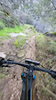
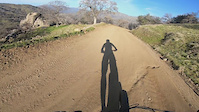
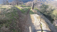
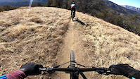
SaveCase Mountain BLM area
Primary Trail Type: Cross-Country
eBikes Allowed:
Yes
AKA: Skyline, Salt Creek
Land Status: Conservation Reserve
Land Manager: Bureau of Land Management
 google parking directions
 Access Info:
Take HWY 198 east through the community of Three Rivers. Right turn at Santa Theresa retreat, and follow Craig Ranch Road to the trailhead parking. Ample parking space, restrooms, and information kiosk with maps.
Disclaimer:
The gate closes at 8pm sharp. Game cameras have been installed to protect the property. There is no running water. Temperatures can exceed 100f in the summer months. Snow and ice, high water flows are common in winter. Free maps are for reference only. You are responsible for navigating the open lands. There are very few trail markers.
Links
Region Supporters & Maintainers
Activities Click to view
- Mountain Bike
45 trails
- E-Bike
2 trails
- Horse
2 trails
- Hike
50 trails
- Trail Running
50 trails
Region Details
- 9
- 11
- 24
- 1
Region Status
Open as of Jun 5, 2026Stats
- Avg Trail Rating
- Trails (view details)
- 50
- Trails Mountain Bike
- 47
- Trails E-Bike
- 2
- Trails Horse
- 2
- Trails Hike
- 50
- Trails Trail Running
- 50
- Trails Backcountry Ski
- 1
- Total Distance
- 35 miles
- Total Descent
- 12,244 ft
- Total Vertical
- 9,973 ft
- Highest Trailhead
- 10,038 ft
- Reports
- 894
- Photos
- 119
- Ridden Counter
- 3,548
Popular Case Mountain Mountain Biking Trails
• 100 ★ 3.8 • 551 ft • 0 ft • 175 •
Popular blue difficulty singletrack. This mountain bike primary trail can be used downhill primary. It features berm, jump and rock garden. On average it takes 1 minutes to complete this trail.
• 95 ★ 3.9 • 3,241 ft • 4 ft • 143 •
Popular blue difficulty singletrack. This mountain bike primary trail can be used downhill primary. On average it takes 11 minutes to complete this trail.
• 100 ★ 3.8 • 598 ft • 5 ft • 135 •
Popular blue difficulty singletrack. This mountain bike primary trail can be used downhill primary. On average it takes 1 minutes to complete this trail.
• 90 ★ 4.0 • 495 ft • 0 ft • 128 •
Popular black diamond difficulty singletrack. This mountain bike primary trail can be used downhill primary. On average it takes minutes to complete this trail.
• 75 ★ 3.6 • 2,648 ft • 3 ft • 115 •
Popular blue difficulty singletrack. This mountain bike primary trail can be used downhill primary. On average it takes 4 minutes to complete this trail.
• 80 ★ 3.8 • 1,549 ft • 0 ft • 108 •
Popular green difficulty singletrack. This mountain bike primary trail can be used downhill primary. On average it takes 1 minutes to complete this trail.
• 70 ★ 3.6 • 4,252 ft • 0 ft • 107 •
Popular black diamond difficulty singletrack. This mountain bike primary trail can be used downhill primary. On average it takes 8 minutes to complete this trail.
• 95 ★ 3.0 • 1,634 ft • 0 ft • 105 •
Quick flow with some Three Rivers Chunk and several jumps
Case Mountain Mountain Bike Routes
★ 3.2 • 8 miles • 2,042 ft • 31 • Loop •
A common route/loop for the Case Mountain area. This route includes a few of the best trails in the area:...
★ 3.0 • 5 miles • 999 ft • 28 • Loop •
A quick to ride route/loop at Case Mtn. if you are pressed for time. This is also a fun and short night ride.
1 mile • 245 ft • 1 •
3 miles • 454 ft • 3 •
• 15 miles • 4,269 ft • 26 •
• 2 miles • 78 ft • 7 •
Photos of Case Mountain Mountain Bike
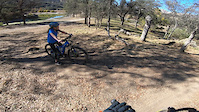
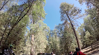
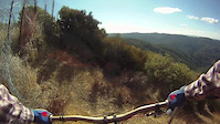
Videos of Case Mountain Mountain Bike
trail: Chutes & Ladders
0:11 |
74 |
Dec 29, 2025
trail: Lower Connector
0:17 |
93 |
Dec 3, 2020
trail: Upper Connector
0:27 |
85 |
Dec 3, 2020
trail: Mud Room
2:24 |
|
Dec 3, 2020
trail: Bear Crack
3:25 |
70 |
Dec 2, 2020
trail: Creek Trail
5:24 |
418 |
Sep 5, 2014
trail: Ridge Trail
4:29 |
534 |
Nov 21, 2013

trail: Creek Trail
6:57 |
250 |
Sep 22, 2011
Recent Trail Reports
Activity Feed
| username | action | type | title | date |
|---|---|---|---|---|
| 3rsager | add | report | activity #96305894 and 8 more | Jun 5, 2026 @ 10:15am Jun 5, 2026 |
| lancemason15 | wishlist | route | activity #95457996 | May 24, 2026 @ 5:39pm May 24, 2026 |
| MikeJensen2145 | wishlist | region | activity #94868585 | May 16, 2026 @ 7:02pm May 16, 2026 |
| Wanderwegger | wishlist | region | activity #94176876 | May 6, 2026 @ 2:07pm May 6, 2026 |
| FatCatWalkin | wishlist | trail | activity #93470003 | Apr 26, 2026 @ 12:46pm Apr 26, 2026 |
Recent Comments
| username | type | title | comment | date |
|---|---|---|---|---|
| trail | Super rutty and not very well maintained. I... | Oct 7, 2025 @ 9:48pm Oct 7, 2025 | ||
| trail | Another hiking trail turned into mtb for some... | Aug 10, 2025 @ 10:41am Aug 10, 2025 | ||
| trail | Closed due to wildfire damage | Jun 5, 2025 @ 9:13am Jun 5, 2025 | ||
| trail | Challenging spots with rocks on this one. ... | Dec 14, 2024 @ 8:44pm Dec 14, 2024 | ||
| trail | Rode this trail today, it’s a lot of fun. I... | Apr 13, 2024 @ 10:01pm Apr 13, 2024 |
Nearby Areas
| name | distance | ||||
|---|---|---|---|---|---|
| Redwood Mountain | 1 | 5 | 16.1 km | ||
| Mountain Home Demonstration State Forest | 1 | 4 | 3 | 16.3 km | |
| Sequoia National Park | 1 | 16.7 km | |||
| Northern Sequoia National Forest | 12 | 24 | 3 | 1 | 28.7 km |
| Upper Kings River Trails | 32.2 km |
Local Badges
-

Completionist0 awarded
Activity Type Stats
| activitytype | trails | distance | descent | descent distance | total vertical | rating | global rank | state rank | photos | reports | routes | ridelogs |
|---|---|---|---|---|---|---|---|---|---|---|---|---|
| Mountain Bike | 45 | 25 miles | 8,789 ft | 14 miles | 7,037 ft | #2,837 | #982 | 119 | 894 | 4 | 2,852 | |
| E-Bike | 2 | #7,017 | #2,033 | 308 | 519 | |||||||
| Horse | 2 | 3 miles | 220 ft | 2,241 ft | 1,138 ft | #3,063 | #1,783 | 94 | ||||
| Hike | 50 | 28 miles | 8,766 ft | 14 miles | 9,170 ft | #4,398 | #1,568 | 1 | 893 | 44 | 202 | |
| Trail Running | 50 | 28 miles | 8,766 ft | 14 miles | 9,170 ft | #4,021 | #1,132 | 844 | 43 | 251 | ||
| Backcountry Ski | 1 | 7 miles | 3,281 ft | 6 miles | 2,759 ft | 29 |
Frequently Asked Questions About Case Mountain
▼
What are the highest rated mountain biking trails in Case Mountain?
The highest rated mountain biking trails in Case Mountain are:
- Face (4.2/5)
- Bedrock (4.1/5)
- Creek Trail (4.1/5)
- Gas Can (4/5)
- Screen Door (4/5)
▼
What is the best time of the year to ride in Case Mountain?
Based on ride log data, the most popular months to ride in Case Mountain are:
- February (30 activities)
- April (17 activities)
- May (16 activities)
▼
Where can I park to ride in Case Mountain?
There are 3 parking locations listed in Case Mountain. The most popular parking spots are: View all parking and trailhead locations on the map to plan your visit.
▼
What is the longest trail in Case Mountain?
The longest trail in Case Mountain is East Holland Loop at 1.9 miles. View all trails sorted by distance.
Activities
Trails
- By aoneal & contributors
- Admins: CMSCTC
- #7854 - 14,240 views
- case mountain activity log | embed map of Case Mountain mountain bike trails | case mountain mountain biking points of interest
Downloading of trail gps tracks in kml & gpx formats is enabled for Case Mountain.
You must login to download files.