close
-
Layers w
- Weather Layers
- Pro
- Pro
- Pro
- Pro
- Pro
- Pro
- More Layers
- Pro
- Pro
- Pro
- Pro
-
Upgrade to

3D
Trail Conditions
- Unknown
- Snow Groomed
- Snow Packed
- Snow Covered
- Snow Cover Partial
- Freeze/thaw Cycle
- Icy
- Prevalent Mud
- Wet
- Variable
- Ideal
- Dry
- Very Dry
Trail Flow (Ridden Direction)
Trailforks scans users ridelogs to determine the most popular direction each trail is ridden. A good flowing trail network will have most trails flowing in a single direction according to their intension.
The colour categories are based on what percentage of riders are riding a trail in its intended direction.
The colour categories are based on what percentage of riders are riding a trail in its intended direction.
- > 96%
- > 90%
- > 80%
- > 70%
- > 50%
- < 50%
- bi-directional trail
- no data
Trail Last Ridden
Trailforks scans ridelogs to determine the last time a trail was ridden.
- < 2 days
- < 1 week
- < 2 weeks
- < 1 month
- < 6 months
- > 6 months
Trail Ridden Direction
The intended direction a trail should be ridden.
- Downhill Only
- Downhill Primary
- Both Directions
- Uphill Primary
- Uphill Only
- One Direction
Contribute Details
Colors indicate trail is missing specified detail.
- Description
- Photos
- Description & Photos
- Videos
Trail Popularity ?
Trailforks scans ridelogs to determine which trails are ridden the most in the last 9 months.
Trails are compared with nearby trails in the same city region with a possible 25 colour shades.
Think of this as a heatmap, more rides = more kinetic energy = warmer colors.
- most popular
- popular
- less popular
- not popular
ATV/ORV/OHV Filter
Max Vehicle Width
inches
US Cell Coverage
Legend

Radar Time
Activity Recordings
Trailforks uses anonymized public activity data.
?
Activity Recordings
Trailforks uses anonymized public activity data.
?
Personal Heatmap
▶
Activity Types
all
/
none
▶
Options
2
Date range
month
–
Winter Trails
Warning
A routing network for winter maps does not exist. Selecting trails using the winter trails layer has been disabled.
Missing Trails
Most Popular
Least Popular
Trails are colored based on popularity. The more popular a trail is, the more red. Less popular trails trend towards green.
Jump Magnitude Heatmap
Heatmap of where riders jump on trails. Zoom in to see individual jumps, click circles to view jump details.
BC Backroad Status
![map legend]()
Service Road Atlas is a free to use, community-driven service for viewing and creating reports on the numerous back-country service roads around B.C. and Alberta.

Slope Aspect
Direction the slope faces
Trails Deemphasized
Trails are shown in grey.
Only show trails with no bike usage.
Suggested Layers
Based on selected activity type
Save the current map location and zoom level as your default home location whenever this page is loaded.
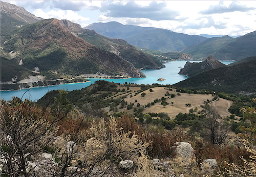
SaveCastellane est une commune française, sous-préfecture du département des Alpes-de-Haute-Provence, dans la région Provence-Alpes-Côte d'Azur. Avec environ 1 500 habitants, Castellane a la particularité d'être la sous-préfecture la moins peuplée de France. Le nom de ses habitants est Castellanais
This region uses the Uk/Euro style trail grading system.
Activities Click to view
- Mountain Bike
58 trails
- E-Bike
28 trails
- Gravel Bike
3 trails
- Adaptive Bike
3 trails
- Hike
58 trails
- Trail Running
57 trails
Region Details
- 15
- 2
- 16
- 19
- 6
Region Status
Caution as of Jun 8, 2026Stats
- Avg Trail Rating
- Trails (view details)
- 58
- Trails Mountain Bike
- 58
- Trails E-Bike
- 28
- Trails Gravel Bike
- 3
- Trails Adaptive Bike
- 3
- Trails Horse
- 2
- Trails Hike
- 58
- Trails Trail Running
- 57
- Trails Dirtbike/Moto
- 2
- Trails ATV/ORV/OHV
- 2
- Total Distance
- 97 miles
- Total Descent
- 42,500 ft
- Total Vertical
- 4,009 ft
- Highest Trailhead
- 6,234 ft
- Reports
- 62
- Photos
- 48
- Ridden Counter
- 794
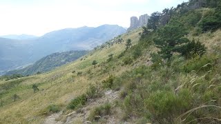
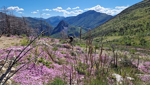
Popular Castellane Mountain Biking Trails
• 100 ★ 3.0 • 2 miles • 220 ft • 58 •
Popular blue difficulty singletrack. This mountain bike primary trail can be used downhill primary. On average it takes 9 minutes to complete this trail.
• 100 ★ 0.0 • 2,074 ft • 39 ft • 46 •
Popular red difficulty doubletrack. This mountain bike primary trail can be used downhill only. On average it takes 5 minutes to complete this trail.
• 85 ★ 0.0 • 2 miles • 0 ft • 45 •
Popular red difficulty singletrack. This mountain bike primary trail can be used downhill primary. On average it takes 38 minutes to complete this trail.
• 95 ★ 0.0 • 2,052 ft • 29 ft • 44 •
Popular blue difficulty singletrack. This mountain bike primary trail can be used downhill primary. On average it takes 4 minutes to complete this trail.
• 95 ★ 0.0 • 2,125 ft • 0 ft • 43 •
Popular green difficulty doubletrack. This mountain bike primary trail can be used both directions. On average it takes 2 minutes to complete this trail.
• 75 ★ 0.0 • 2 miles • 95 ft • 28 •
Popular red difficulty doubletrack. This mountain bike primary trail can be used downhill primary. On average it takes 14 minutes to complete this trail.
• 75 ★ 0.0 • 2 miles • 869 ft • 27 •
Popular blue difficulty doubletrack. This mountain bike primary trail can be used downhill primary. On average it takes 26 minutes to complete this trail.
• 100 ★ 2.0 • 1 mile • 171 ft • 26 •
Popular blue difficulty singletrack. This mountain bike primary trail can be used both directions. On average it takes 11 minutes to complete this trail.
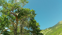
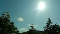
Photos of Castellane Mountain Bike
Videos of Castellane Mountain Bike
8:28 |
120 |
Jul 27, 2019
8:31 |
109 |
Jul 27, 2019
14:00 |
84 |
Feb 11, 2024 , Castellane
trail: les Reversets
7:30 |
143 |
Mar 2, 2023 , Castellane
trail: les Reversets
7:30 |
91 |
Jan 23, 2023 , Castellane
8:37 |
7 |
Jun 27, 2025
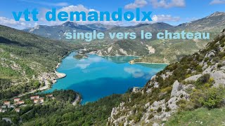
trail: La Clue -> Demandolx
6:08 |
6 |
Jun 27, 2025
10:11 |
7 |
Jun 27, 2025
Current Trail Warnings
| status | trail | date | condition | user | info |
|---|---|---|---|---|---|
| Descente De La Croix De Melle | Jun 8, 2026 @ 4:18pm (Europe/Paris) Jun 8, 2026 | Ideal | Tsegade | Pas mal de sections assez refermées à... |
Recent Trail Reports
National Scenic Trails & Official Routes
-
Grande Traversée VTT des Préalpes - Les Chemins du Soleil
- Mountain Bike
- E-Bike
-
Grande Traversée VTT TransVerdon
- Mountain Bike
- E-Bike
Activity Feed
| username | action | type | title | date |
|---|---|---|---|---|
| Tsegade | add | report | activity #96537704 and 2 more | Jun 8, 2026 @ 7:20am Jun 8, 2026 |
| 02F3fx | wishlist | trail | activity #93897460 | May 2, 2026 @ 3:02pm May 2, 2026 |
| hpman83 | add | trail | activity #93703774 and 2 more | Apr 30, 2026 @ 4:21am Apr 30, 2026 |
| Meven81 | ridden | trail | activity #87849313 | Jan 26, 2026 @ 9:02am Jan 26, 2026 |
| jbjvPy | wishlist | trail | activity #86101530 | Dec 26, 2025 @ 12:09pm Dec 26, 2025 |
Recent Comments
| username | type | title | comment | date |
|---|---|---|---|---|
| trail | Très beau & long trail avec des vues... | Sep 7, 2025 @ 9:32pm Sep 7, 2025 | ||
| trail | Took the trail using a simple man powered... | Aug 18, 2025 @ 10:40pm Aug 18, 2025 | ||
| trail | Nice single track. Clean and no major differences. | Jul 11, 2024 @ 7:57am Jul 11, 2024 | ||
| report | good conditions | Nov 17, 2023 @ 8:14am Nov 17, 2023 | ||
| trail | Doesn’t see a lot of bikers, overgrown and... | Aug 31, 2023 @ 7:25am Aug 31, 2023 |
Local Badges
-

10 Blue Trails2 awarded -

10 Black Trails0 awarded -

Epic Ride Climb 2k37 awarded -

Climbing 10k Badge7 awarded -

Climbing 100k Badge0 awarded -

Epic Ride Descent 2k39 awarded
Activity Type Stats
| activitytype | trails | distance | descent | descent distance | total vertical | rating | global rank | state rank | photos | reports | routes | ridelogs |
|---|---|---|---|---|---|---|---|---|---|---|---|---|
| Mountain Bike | 58 | 97 miles | 42,500 ft | 59 miles | 4,009 ft | #2,769 | #70 | 45 | 62 | 524 | ||
| E-Bike | 28 | 42 miles | 12,211 ft | 20 miles | 2,503 ft | #2,986 | #169 | 3 | 56 | 65 | ||
| Gravel Bike | 3 | #222 | #53 | 7 | ||||||||
| Adaptive Bike | 3 | #182 | #137 | |||||||||
| Horse | 2 | 12 miles | 1,621 ft | 4 miles | 2,326 ft | 16 | ||||||
| Hike | 58 | 97 miles | 42,500 ft | 59 miles | 4,009 ft | #2,316 | #57 | 62 | 76 | |||
| Trail Running | 57 | 96 miles | 41,654 ft | 58 miles | 4,009 ft | #1,967 | #53 | 62 | 9 | |||
| Dirtbike/Moto | 2 | 12 miles | 1,621 ft | 4 miles | 2,326 ft | 15 | ||||||
| ATV/ORV/OHV | 2 | 12 miles | 1,621 ft | 4 miles | 2,326 ft | 15 |
Frequently Asked Questions About Castellane
▼
What are the highest rated mountain biking trails in Castellane?
The highest rated mountain biking trails in Castellane are:
- sp des blaches (4.2/5)
- Le Coulet (4.2/5)
- Col de Demandolx vers St Julien (4.1/5)
- Col de Demandolx > Lac de Castillon (4.1/5)
- Portail de Blieux > Les Chauvets (4.1/5)
▼
What is the best time of the year to ride in Castellane?
Based on ride log data, the most popular months to ride in Castellane are:
- September (1 activities)
▼
Where can I park to ride in Castellane?
Check the Castellane trail map for trailhead and parking information. Community members regularly update access and parking details for trails in the area.
▼
What is the longest trail in Castellane?
The longest trail in Castellane is Crêtes de la Bernarde et du Crémon at 3.8 miles. View all trails sorted by distance.
Activities
Trails
- By hpman83
 TRAILFORKS TFFRANCE & contributors
 - Admins: tomzaniroli, provencemb
- #15315 - 4,477 views
- castellane activity log | embed map of Castellane mountain bike trails | castellane mountain biking points of interest
Downloading of trail gps tracks in kml & gpx formats is enabled for Castellane.
You must login to download files.