close
-
Layers w
- Weather Layers
- Pro
- Pro
- Pro
- Pro
- Pro
- Pro
- More Layers
- Pro
- Pro
- Pro
- Pro
-
Upgrade to

3D
Trail Conditions
- Unknown
- Snow Groomed
- Snow Packed
- Snow Covered
- Snow Cover Partial
- Freeze/thaw Cycle
- Icy
- Prevalent Mud
- Wet
- Variable
- Ideal
- Dry
- Very Dry
Trail Flow (Ridden Direction)
Trailforks scans users ridelogs to determine the most popular direction each trail is ridden. A good flowing trail network will have most trails flowing in a single direction according to their intension.
The colour categories are based on what percentage of riders are riding a trail in its intended direction.
The colour categories are based on what percentage of riders are riding a trail in its intended direction.
- > 96%
- > 90%
- > 80%
- > 70%
- > 50%
- < 50%
- bi-directional trail
- no data
Trail Last Ridden
Trailforks scans ridelogs to determine the last time a trail was ridden.
- < 2 days
- < 1 week
- < 2 weeks
- < 1 month
- < 6 months
- > 6 months
Trail Ridden Direction
The intended direction a trail should be ridden.
- Downhill Only
- Downhill Primary
- Both Directions
- Uphill Primary
- Uphill Only
- One Direction
Contribute Details
Colors indicate trail is missing specified detail.
- Description
- Photos
- Description & Photos
- Videos
Trail Popularity ?
Trailforks scans ridelogs to determine which trails are ridden the most in the last 9 months.
Trails are compared with nearby trails in the same city region with a possible 25 colour shades.
Think of this as a heatmap, more rides = more kinetic energy = warmer colors.
- most popular
- popular
- less popular
- not popular
ATV/ORV/OHV Filter
Max Vehicle Width
inches
US Cell Coverage
Legend

Radar Time
Activity Recordings
Trailforks uses anonymized public activity data.
?
Activity Recordings
Trailforks uses anonymized public activity data.
?
Personal Heatmap
▶
Activity Types
all
/
none
▶
Options
2
Date range
month
–
Winter Trails
Warning
A routing network for winter maps does not exist. Selecting trails using the winter trails layer has been disabled.
Missing Trails
Most Popular
Least Popular
Trails are colored based on popularity. The more popular a trail is, the more red. Less popular trails trend towards green.
Jump Magnitude Heatmap
Heatmap of where riders jump on trails. Zoom in to see individual jumps, click circles to view jump details.
BC Backroad Status
![map legend]()
Service Road Atlas is a free to use, community-driven service for viewing and creating reports on the numerous back-country service roads around B.C. and Alberta.

Slope Aspect
Direction the slope faces
Trails Deemphasized
Trails are shown in grey.
Only show trails with no bike usage.
Suggested Layers
Based on selected activity type
Save the current map location and zoom level as your default home location whenever this page is loaded.
SaveRead info below regarding trail closure in 2017.
Wild boar hunting with dogs! please use care, trails may be closed. If you go riding, respect these dates in 2017:
September 30
October 7, 21, 28
November 18, 25
Wild boar hunting with dogs! please use care, trails may be closed. If you go riding, respect these dates in 2017:
September 30
October 7, 21, 28
November 18, 25
This region uses the Uk/Euro style trail grading system.
Activities Click to view
- Mountain Bike
107 trails
- E-Bike
101 trails
- Gravel Bike
0 trails
- Adaptive Bike
2 trails
- Winter Fat Bike
0 trails
- Horse
10 trails
- Hike
110 trails
- Trail Running
108 trails
- Dirtbike/Moto
11 trails
Region Details
- 32
- 22
- 26
- 13
- 10
Region Status
Open as of May 14, 2026Stats
- Avg Trail Rating
- Trails (view details)
- 108
- Trails Mountain Bike
- 107
- Trails E-Bike
- 101
- Trails Adaptive Bike
- 2
- Trails Horse
- 10
- Trails Hike
- 110
- Trails Trail Running
- 108
- Trails Dirtbike/Moto
- 11
- Total Distance
- 45 miles
- Total Descent
- 12,436 ft
- Total Vertical
- 1,787 ft
- Highest Trailhead
- 1,798 ft
- Reports
- 277
- Photos
- 90
- Ridden Counter
- 8,214
Sub Regions
-
Canyars Forest
- 9
- 8
- 6
- 2
-
El Garraf - Castelldefels
- 11
- 18
- 8
- 7
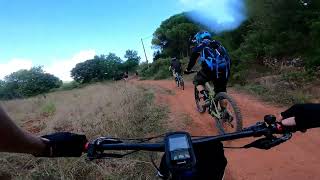
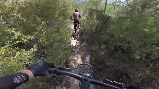
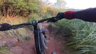
Popular Castelldefels Mountain Biking Trails
• 70 ★ 4.5 • 2,046 ft • 17 ft • 103 •
Mostly dirt trail through woods, which is quite twisty and very interesting, Often used at the end of El Moro, but can be accessed from unpaved roads.
• 75 ★ 4.0 • 4,406 ft • 31 ft • 97 •
Enjoyable trail that leads from La Clota to the access road. Mostly a heavy rocky trail, with a couple of climb sections, not that steep but quite tricky. Often accessed from the Desfeta trail for a longer descent. Part of the GR 92...
• 85 ★ 4.7 • 1,650 ft • 35 ft • 89 •
Rocky descent, with some small drop offs, the bottom has a really nice drop which could be technical for some, but it can be avoided.
• 55 ★ 3.9 • 1 mile • 89 ft • 88 •
Moderately popular red difficulty singletrack. This multi-use trail can be used downhill only and has a hard overall physical rating. It features rock garden. Trail visibility is always easy to follow. On average it takes 16 minutes to complete this trail.
• 35 ★ 4.0 • 961 ft • 0 ft • 85 •
Rock short section and good fun, usually used as the start of the descent as it starts at a peak in the hills.
• 80 ★ 4.0 • 2,375 ft • 0 ft • 85 •
Mostly dirt and rocky trail descending from La Desfeta, crosses over the access road twice so be careful of other users, leads onto the GR 92 trail and is often used to feed onto El Moro.
Castelldefels Mountain Bike Routes
★ 4.0 • 15 miles • 2,774 ft • 21 • Loop •
Very difficult climb up the Purgatorio, but then followed by some of the best descents in the area, mostly...
2 miles • 234 ft • 4 • Loop •
Short loop perfect for improving bike skills. Twisting dirt sections through forests with very close...
11 miles • 2,193 ft • 11 • Loop •
The toughest climb the Garraf has to offer, the infamous Purgatorio, followed by the Las Zetas rocky...
34 miles • 4,652 ft • 0 • Loop •
This route starts at the Castelldefels train station and climbs through pine forests via Purgatorio to...
4 miles • 372 ft • 0 • Loop •
Easy circular route, Beginning with with descent, ending with a small interesting climb section parallel...
Photos of Castelldefels Mountain Bike
Videos of Castelldefels Mountain Bike
trail: La No Kamikaze
17:57 |
46 |
Apr 22, 2025 , Castelldefels
22:14 |
105 |
Apr 21, 2025 , Castelldefels

trail: El Moro
22:14 |
85 |
Apr 21, 2025 , Castelldefels

trail: El Moro Alt
22:14 |
84 |
Apr 21, 2025 , Castelldefels

trail: Twister
22:14 |
110 |
Apr 21, 2025 , Castelldefels

trail: Derserter
22:14 |
70 |
Apr 21, 2025 , Castelldefels

trail: Backdraft
22:14 |
92 |
Apr 21, 2025 , Castelldefels
trail: El Moro
192 |
Apr 21, 2024 , Castelldefels
Recent Trail Reports
| status | trail | date | condition | info | user |
|---|---|---|---|---|---|
| El Carxol | Mar 28, 2026 @ 12:11pm (Europe/Andorra) Mar 28, 2026 | Dry | Atzucat TFSPAIN | ||
| Fireman | Sep 27, 2025 @ 9:01pm (Europe/Madrid) Sep 27, 2025 | Variable | MarcAureliHVxpxV | ||
| La Nanny lower | Sep 27, 2025 @ 9:00pm (Europe/Madrid) Sep 27, 2025 | Variable | MarcAureliHVxpxV | ||
| Agustina Aragón BDC | Sep 27, 2025 @ 8:59pm (Europe/Madrid) Sep 27, 2025 | Ideal | MarcAureliHVxpxV | ||
| Boulder Dash | Jul 20, 2025 @ 1:24am Jul 20, 2025 | Unknown | Magrioski | ||
| El Moro Alt | Mar 2, 2025 @ 3:57am Mar 2, 2025 | Ideal | NicoNubiola | ||
| Castle Coil | Mar 2, 2025 @ 3:26am Mar 2, 2025 | Ideal | NicoNubiola | ||
| La Sister | Jan 27, 2025 @ 1:31am Jan 27, 2025 | Dry | snaker4 TFSPAIN | ||
| Heels down, heads up | Jan 4, 2025 @ 8:33am Jan 4, 2025 | Ideal | dafonseca | ||
| Desfeta - Eramprunyà_03 | Dec 16, 2024 @ 2:09pm Dec 16, 2024 | Ideal | Atzucat TFSPAIN |
Activity Feed
| username | action | type | title | date |
|---|---|---|---|---|
| nikoroma | comment | trail | activity #96956299 | Jun 14, 2026 @ 5:01am Jun 14, 2026 |
| nikoroma | comment | trail | activity #96956190 | Jun 14, 2026 @ 5:00am Jun 14, 2026 |
| nikoroma | ridden | trail | activity #96956116 | Jun 14, 2026 @ 4:58am Jun 14, 2026 |
| KSBSNOWBOARDTEAMNIgiRD | wishlist | trail | activity #96948305 | Jun 14, 2026 @ 2:52am Jun 14, 2026 |
| EduardSS | wishlist | route | activity #96923565 | Jun 13, 2026 @ 4:05pm Jun 13, 2026 |
Recent Comments
| username | type | title | comment | date |
|---|---|---|---|---|
| trail | Overgrown and someone lives there | Jun 14, 2026 @ 5:01am Jun 14, 2026 | ||
| trail | Slightly overgrown | Jun 14, 2026 @ 5:00am Jun 14, 2026 | ||
| trail | It’s very old and most jumps and berms... | Jun 13, 2026 @ 6:01am Jun 13, 2026 | ||
| report | Desquite a by n he much cmg o | Jun 6, 2026 @ 5:43am Jun 6, 2026 | ||
| report | Bye nun | Jun 6, 2026 @ 5:37am Jun 6, 2026 |
Local Badges
-

10 Blue Trails105 awarded -

10 Black Trails5 awarded -

Epic Ride Climb 2k341 awarded -

Climbing 10k Badge92 awarded -

Climbing 100k Badge13 awarded -

Epic Ride Descent 2k342 awarded
Bike & Skill Parks
| name | type | city | rating |
|---|---|---|---|
| Campillo Canyars | skill park | Castelldefels | |
| Campillo "Cross" | skill park | Castelldefels |
Activity Type Stats
| activitytype | trails | distance | descent | descent distance | total vertical | rating | global rank | state rank | photos | reports | routes | ridelogs |
|---|---|---|---|---|---|---|---|---|---|---|---|---|
| Mountain Bike | 107 | 44 miles | 12,008 ft | 23 miles | 1,788 ft | #2,175 | #183 | 88 | 275 | 7 | 10,741 | |
| E-Bike | 101 | 42 miles | 10,522 ft | 21 miles | 1,788 ft | #1,561 | #271 | 1 | 270 | 2 | 2,582 | |
| Adaptive Bike | 2 | #276 | #125 | |||||||||
| Horse | 10 | 3 miles | 144 ft | 1 mile | 226 ft | #1,282 | #93 | 63 | ||||
| Hike | 110 | 45 miles | 12,359 ft | 23 miles | 1,788 ft | #2,921 | #231 | 1 | 260 | 426 | ||
| Trail Running | 108 | 45 miles | 12,346 ft | 23 miles | 1,788 ft | #2,496 | #226 | 259 | 665 | |||
| Dirtbike/Moto | 11 | 3,806 ft | 358 ft | 2,497 ft | 1,558 ft | #112 | #3 | 70 | 1 |
Frequently Asked Questions About Castelldefels
▼
What are the best places to ride in Castelldefels?
Castelldefels has 2 areas to explore for mountain biking. The top rated areas are:
▼
What are the highest rated mountain biking trails in Castelldefels?
The highest rated mountain biking trails in Castelldefels are:
- La Nanny upper (4.3/5)
- Big Brother (4.2/5)
- Backdraft (4.2/5)
- El Moro Link (4.2/5)
- El Moro Alt (4.1/5)
▼
What is the best time of the year to ride in Castelldefels?
Based on ride log data, the most popular months to ride in Castelldefels are:
- July (62 activities)
- March (42 activities)
- August (41 activities)
▼
Where can I park to ride in Castelldefels?
There are 4 parking locations listed in Castelldefels. The most popular parking spots are: View all parking and trailhead locations on the map to plan your visit.
Activities
Trails
- By paolista
 & contributors
 - Admins: snaker4, kai-bcn, henrikenduro, Galis
- #17598 - 6,149 views
- castelldefels activity log | embed map of Castelldefels mountain bike trails | castelldefels mountain biking points of interest
Downloading of trail gps tracks in kml & gpx formats is enabled for Castelldefels.
You must login to download files.