close
-
Layers w
- Weather Layers
- Pro
- Pro
- Pro
- Pro
- Pro
- Pro
- More Layers
- Pro
- Pro
- Pro
- Pro
-
Upgrade to

3D
Trail Conditions
- Unknown
- Snow Groomed
- Snow Packed
- Snow Covered
- Snow Cover Partial
- Freeze/thaw Cycle
- Icy
- Prevalent Mud
- Wet
- Variable
- Ideal
- Dry
- Very Dry
Trail Flow (Ridden Direction)
Trailforks scans users ridelogs to determine the most popular direction each trail is ridden. A good flowing trail network will have most trails flowing in a single direction according to their intension.
The colour categories are based on what percentage of riders are riding a trail in its intended direction.
The colour categories are based on what percentage of riders are riding a trail in its intended direction.
- > 96%
- > 90%
- > 80%
- > 70%
- > 50%
- < 50%
- bi-directional trail
- no data
Trail Last Ridden
Trailforks scans ridelogs to determine the last time a trail was ridden.
- < 2 days
- < 1 week
- < 2 weeks
- < 1 month
- < 6 months
- > 6 months
Trail Ridden Direction
The intended direction a trail should be ridden.
- Downhill Only
- Downhill Primary
- Both Directions
- Uphill Primary
- Uphill Only
- One Direction
Contribute Details
Colors indicate trail is missing specified detail.
- Description
- Photos
- Description & Photos
- Videos
Trail Popularity ?
Trailforks scans ridelogs to determine which trails are ridden the most in the last 9 months.
Trails are compared with nearby trails in the same city region with a possible 25 colour shades.
Think of this as a heatmap, more rides = more kinetic energy = warmer colors.
- most popular
- popular
- less popular
- not popular
ATV/ORV/OHV Filter
Max Vehicle Width
inches
US Cell Coverage
Legend

Radar Time
Activity Recordings
Trailforks uses anonymized public activity data.
?
Activity Recordings
Trailforks uses anonymized public activity data.
?
Personal Heatmap
▶
Activity Types
all
/
none
▶
Options
2
Date range
month
–
Winter Trails
Warning
A routing network for winter maps does not exist. Selecting trails using the winter trails layer has been disabled.
Missing Trails
Most Popular
Least Popular
Trails are colored based on popularity. The more popular a trail is, the more red. Less popular trails trend towards green.
Jump Magnitude Heatmap
Heatmap of where riders jump on trails. Zoom in to see individual jumps, click circles to view jump details.
BC Backroad Status
![map legend]()
Service Road Atlas is a free to use, community-driven service for viewing and creating reports on the numerous back-country service roads around B.C. and Alberta.

Slope Aspect
Direction the slope faces
Trails Deemphasized
Trails are shown in grey.
Only show trails with no bike usage.
Suggested Layers
Based on selected activity type
Save the current map location and zoom level as your default home location whenever this page is loaded.
Save
No description for Castlegar has been added yet!
Login or register to submit one.
Activities Click to view
- Mountain Bike
82 trails
- E-Bike
38 trails
- Gravel Bike
0 trails
- Adaptive Bike
0 trails
- Winter Fat Bike
0 trails
- Hike
82 trails
- Trail Running
84 trails
- Dirtbike/Moto
4 trails
- ATV/ORV/OHV
4 trails
- Snowshoe
14 trails
Region Details
- 13
- 1
- 27
- 24
- 9
- 2
Region Status
Caution as of Jun 14, 2026Stats
- Avg Trail Rating
- Trails (view details)
- 80
- Trails Mountain Bike
- 85
- Trails E-Bike
- 38
- Trails Hike
- 85
- Trails Trail Running
- 84
- Trails Dirtbike/Moto
- 4
- Trails ATV/ORV/OHV
- 4
- Trails Snowmobile
- 3
- Trails Snowshoe
- 14
- Total Distance
- 84 miles
- Total Descent
- 17,237 ft
- Total Vertical
- 3,598 ft
- Highest Trailhead
- 4,961 ft
- Reports
- 925
- Photos
- 658
- Ridden Counter
- 17,391
Articles

Video: Trail Building in British Columbia's Kootenay Mountains
May 15, 2022 from pinkbike.com
A series of short films featuring the work done by trail builders in the Kootenay region of British Columbia.
Exploring BC's Lesser Known Riding Destinations on the Bikes & Beers Tour
Sep 14, 2019 from pinkbike.com
Seven days of full-on riding on some of British Columbia's best trail networks.
Sub Regions
-
Goose Creek
-
Merry Creek
- 1
- 3
- 5
- 1
-
Millennium Park
- 1
-
Rialto
- 6
- 3
- 1
-
Selkirk College
- 11
- 7
-
Syringa Provincial Park
- 4
- 3
-
Urban Trails
- 1
- 5
- 1
-
Waterloo Trails
- 4
- 3
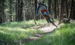
Popular Castlegar Mountain Biking Trails
• 100 ★ 4.8 • 1 mile • 740 ft • 1,935 •
The climbing trail to access and also a great beginner descent. No TTFs but the infamous "Cliff Hanger" bridge is something that needs to be seen. The climb is quite strenuous with lots of challenging switchbacks and a fairly consistent...
• 100 ★ 4.9 • 4 miles • 1,790 ft • 1,797 •
Highly rated popular blue difficulty singletrack. This mountain bike primary trail can be used uphill primary. On average it takes 46 minutes to complete this trail.
• 95 ★ 4.8 • 3 miles • 90 ft • 1,561 •
is an expert level ride with numerous rock rolls, rock slabs, boardwalks and a steep forested section with a few log skinnies to test your skill! It's well worth the climb up the Mr. Green Jeans trail to access the Captain.
• 100 ★ 4.7 • 1 mile • 0 ft • 1,464 •
This trail has it all. Extremely well built trail that is generally low angle side hill flowy ripping with lots of berms and a few more difficult options and features as well. Short and oh so sweet.
• 100 ★ 4.8 • 4,016 ft • 31 ft • 1,023 •
A mix of raw and flow, fast and action packed.
• 85 ★ 4.5 • 3 miles • 15 ft • 693 •
Highly rated popular black diamond difficulty singletrack. This mountain bike primary trail can be used downhill only and has a moderate overall physical rating. It features a-frame, bridge, drop, jump, gap jump, log ride, rock face, rock garden, roller coaster and skinny. Trail visibility is always easy to follow. On average it takes 39 minutes to complete this trail.
• 95 ★ 4.1 • 2,927 ft • 6 ft • 650 •
Short and sweet flowy downhill. The trail consists of sweet single track, swooping corners and several side jump options. It is sandy and steep in some areas. Some more technical rocky sections at the very end.
• 90 ★ 4.6 • 4,088 ft • 0 ft • 489 •
Another trail showcasing the skills and dedication of the volunteers of Castlegar and the West Kootenays, this trail will test your mettle with the gap jumps on a few huge features. It's a super smooth ride for those looking to check it...
Castlegar Mountain Bike Routes
★ 5.0 • 14 miles • 3,923 ft • 6 • Race •
9 miles • 2,275 ft • 4 • Race •
• 19 miles • 5,090 ft • 15 •
• 15 miles • 4,386 ft • 10 •
• 5 miles • 711 ft • 7 •
• 13 miles • 3,332 ft • 5 •
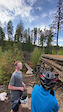
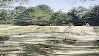
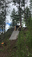
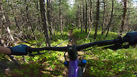
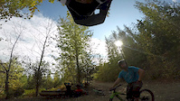
Photos of Castlegar Mountain Bike
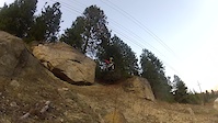
Videos of Castlegar Mountain Bike

trail: Crazy Merry
2:48 |
149 |
Aug 15, 2024
trail: Crazy Merry
0:10 |
707 |
Oct 27, 2021
0:11 |
|
Jul 16, 2021
trail: Dirty Dreams
0:10 |
323 |
Mar 26, 2021
trail: Grandiflorum
0:08 |
175 |
Feb 11, 2021
trail: Grandiflorum
2:04 |
161 |
Jan 28, 2021
trail: Crazy Merry
4:02 |
706 |
Oct 4, 2020
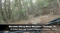
trail: Captain Kangaroo
15:52 |
169 |
Oct 3, 2019
Current Trail Warnings
| status | trail | date | condition | user | info |
|---|---|---|---|---|---|
| The Awakener | May 29, 2026 @ 3:58pm (America/Vancouver) May 29, 2026 | Unknown | Cgalligos | 12-15 Trees down on the bottom section. ... |
Recent Trail Reports
| status | trail | date | condition | info | user |
|---|---|---|---|---|---|
| Rocky Confluence Bypass | Jun 14, 2026 @ 11:57am (America/Vancouver) Jun 14, 2026 | Ideal | Metric-MrShades | ||
| Spring Savior | Jun 14, 2026 @ 11:57am (America/Vancouver) Jun 14, 2026 | Dry | Metric-MrShades | ||
| Confluence Trail | Jun 14, 2026 @ 11:57am (America/Vancouver) Jun 14, 2026 | Dry | Metric-MrShades | ||
| Unnamed | Jun 14, 2026 @ 11:57am (America/Vancouver) Jun 14, 2026 | Ideal | Metric-MrShades | ||
| Riverbank Trail | Jun 14, 2026 @ 11:57am (America/Vancouver) Jun 14, 2026 | Dry | Metric-MrShades | ||
| Trail | Jun 14, 2026 @ 11:57am (America/Vancouver) Jun 14, 2026 | Ideal | Metric-MrShades | ||
| Trail | Jun 14, 2026 @ 11:57am (America/Vancouver) Jun 14, 2026 | Ideal | Metric-MrShades | ||
| Captain Kangaroo | Jun 13, 2026 @ 3:31pm (America/Vancouver) Jun 13, 2026 | Ideal | Castro86 | ||
| Hail Merry | Jun 8, 2026 @ 2:23pm (America/Vancouver) Jun 8, 2026 | Dry | ethanm | ||
| Mr. Green Jeans | Jun 8, 2026 @ 2:21pm (America/Vancouver) Jun 8, 2026 | Dry | ethanm |
Activity Feed
| username | action | type | title | date |
|---|---|---|---|---|
| Ameliasmerch | wishlist | trail | activity #97136445 | Jun 16, 2026 @ 1:59pm 2 days |
| deathfuntaxes | ridden | trail | activity #97119629 and 1 more | Jun 16, 2026 @ 10:06am 2 days |
| stuy763 | vote | trail | activity #97081739 and 5 more | Jun 15, 2026 @ 7:00pm 3 days |
| Metric-MrShades | add | report | activity #97006175 and 1 more | Jun 14, 2026 @ 2:46pm Jun 14, 2026 |
| Metric-MrShades | add | report | activity #97006171 and 4 more | Jun 14, 2026 @ 2:46pm Jun 14, 2026 |
Recent Comments
| username | type | title | comment | date |
|---|---|---|---|---|
| trail | Few trees down in mellow spots | Jun 9, 2026 @ 5:27pm Jun 9, 2026 | ||
| trail | I cut the smaller one out today. The others... | May 22, 2026 @ 7:53pm May 22, 2026 | ||
| trail | Great climbing trail! 3 trees down but easy to... | May 21, 2026 @ 1:22pm May 21, 2026 | ||
| trail | Absolute banger, top 3 trail for me. Get it! | Apr 27, 2026 @ 12:26pm Apr 27, 2026 | ||
| report | @rockymountainrob what do you recon, this... | Dec 11, 2025 @ 10:55am Dec 11, 2025 |
Local Badges
-

10 Green Trails35 awarded -

10 Blue Trails172 awarded -

Epic Ride Climb 2k82 awarded -

Climbing 10k Badge61 awarded -

Climbing 100k Badge4 awarded -

Epic Ride Descent 2k152 awarded
Bike & Skill Parks
| name | type | city | rating |
|---|---|---|---|
| Castlegar Bike Park | skill park | Castlegar | |
| Rotary Skatepark | skill park | Castlegar |
Activity Type Stats
| activitytype | trails | distance | descent | descent distance | total vertical | rating | global rank | state rank | photos | reports | routes | ridelogs |
|---|---|---|---|---|---|---|---|---|---|---|---|---|
| Mountain Bike | 82 | 78 miles | 16,145 ft | 31 miles | 3,599 ft | #1,159 | #53 | 466 | 925 | 2 | 13,408 | |
| E-Bike | 38 | 54 miles | 12,234 ft | 22 miles | 3,566 ft | #2,055 | #54 | 757 | 1,184 | |||
| Hike | 82 | 68 miles | 12,700 ft | 28 miles | 3,563 ft | #1,421 | #63 | 193 | 829 | 1 | 1,378 | |
| Trail Running | 84 | 68 miles | 12,700 ft | 28 miles | 3,563 ft | 827 | 2 | 898 | ||||
| Dirtbike/Moto | 4 | 10 miles | 177 ft | 3,491 ft | 3,448 ft | #640 | #46 | 115 | 42 | |||
| ATV/ORV/OHV | 4 | 10 miles | 177 ft | 3,491 ft | 3,448 ft | #474 | #36 | 115 | 4 | |||
| Snowmobile | 3 | 9 miles | 3 ft | 456 ft | 3,448 ft | 3 | 5 | |||||
| Snowshoe | 14 | 30 miles | 5,719 ft | 12 miles | 3,320 ft | #464 | #37 | 107 | 12 |
Frequently Asked Questions About Castlegar
▼
What are the best places to ride in Castlegar?
Castlegar has 8 areas to explore for mountain biking. The top rated areas are:
▼
What are the highest rated mountain biking trails in Castlegar?
The highest rated mountain biking trails in Castlegar are:
- Mr. Green Jeans (4.8/5)
- Captain Kangaroo (4.7/5)
- Merry Go Round (4.6/5)
- Wings for Merry (4.6/5)
- Hail Merry (4.6/5)
▼
What is the best time of the year to ride in Castlegar?
Based on ride log data, the most popular months to ride in Castlegar are:
- July (321 activities)
- August (191 activities)
- September (178 activities)
▼
Where can I park to ride in Castlegar?
There are 8 parking locations listed in Castlegar. The most popular parking spots are: View all parking and trailhead locations on the map to plan your visit.
Activities
Trails
- By barry-mclane & contributors
- Admins: barry-mclane, CPTS, sawalaskwa, KCTS
- #4592 - 38,567 views
- castlegar activity log | embed map of Castlegar mountain bike trails | castlegar mountain biking points of interest
Downloading of trail gps tracks in kml & gpx formats is enabled for Castlegar.
You must login to download files.