close
-
Layers w
- Weather Layers
- Pro
- Pro
- Pro
- Pro
- Pro
- Pro
- More Layers
- Pro
- Pro
- Pro
- Pro
-
Upgrade to

3D
Trail Conditions
- Unknown
- Snow Groomed
- Snow Packed
- Snow Covered
- Snow Cover Partial
- Freeze/thaw Cycle
- Icy
- Prevalent Mud
- Wet
- Variable
- Ideal
- Dry
- Very Dry
Trail Flow (Ridden Direction)
Trailforks scans users ridelogs to determine the most popular direction each trail is ridden. A good flowing trail network will have most trails flowing in a single direction according to their intension.
The colour categories are based on what percentage of riders are riding a trail in its intended direction.
The colour categories are based on what percentage of riders are riding a trail in its intended direction.
- > 96%
- > 90%
- > 80%
- > 70%
- > 50%
- < 50%
- bi-directional trail
- no data
Trail Last Ridden
Trailforks scans ridelogs to determine the last time a trail was ridden.
- < 2 days
- < 1 week
- < 2 weeks
- < 1 month
- < 6 months
- > 6 months
Trail Ridden Direction
The intended direction a trail should be ridden.
- Downhill Only
- Downhill Primary
- Both Directions
- Uphill Primary
- Uphill Only
- One Direction
Contribute Details
Colors indicate trail is missing specified detail.
- Description
- Photos
- Description & Photos
- Videos
Trail Popularity ?
Trailforks scans ridelogs to determine which trails are ridden the most in the last 9 months.
Trails are compared with nearby trails in the same city region with a possible 25 colour shades.
Think of this as a heatmap, more rides = more kinetic energy = warmer colors.
- most popular
- popular
- less popular
- not popular
ATV/ORV/OHV Filter
Max Vehicle Width
inches
US Cell Coverage
Legend

Radar Time
Activity Recordings
Trailforks uses anonymized public activity data.
?
Activity Recordings
Trailforks uses anonymized public activity data.
?
Personal Heatmap
▶
Activity Types
all
/
none
▶
Options
2
Date range
month
–
Winter Trails
Warning
A routing network for winter maps does not exist. Selecting trails using the winter trails layer has been disabled.
Missing Trails
Most Popular
Least Popular
Trails are colored based on popularity. The more popular a trail is, the more red. Less popular trails trend towards green.
Jump Magnitude Heatmap
Heatmap of where riders jump on trails. Zoom in to see individual jumps, click circles to view jump details.
BC Backroad Status
![map legend]()
Service Road Atlas is a free to use, community-driven service for viewing and creating reports on the numerous back-country service roads around B.C. and Alberta.

Slope Aspect
Direction the slope faces
Trails Deemphasized
Trails are shown in grey.
Only show trails with no bike usage.
Suggested Layers
Based on selected activity type
Save the current map location and zoom level as your default home location whenever this page is loaded.
Save
No description for Castro Valley has been added yet!
Login or register to submit one.
Activities Click to view
- Mountain Bike
49 trails
- Gravel Bike
0 trails
- Adaptive Bike
0 trails
- Winter Fat Bike
0 trails
- Hike
60 trails
- Trail Running
60 trails
Region Details
- 13
- 3
- 17
- 16
Region Status
Caution as of Jun 4, 2026Stats
- Avg Trail Rating
- Trails (view details)
- 54
- Trails Mountain Bike
- 49
- Trails E-Bike
- 3
- Trails Horse
- 3
- Trails Hike
- 60
- Trails Trail Running
- 60
- Total Distance
- 73 miles
- Total Descent
- 12,112 ft
- Total Vertical
- 2,995 ft
- Highest Trailhead
- 3,108 ft
- Reports
- 361
- Photos
- 75
- Ridden Counter
- 10,672
Sub Regions
-
Anthony Chabot Regional Park
- 3
- 14
- 12
-
Chabot
- 1
- 1
-
Five Canyons Open Space
- 2
- 2
Popular Castro Valley Mountain Biking Trails
• 95 ★ 2.0 • 1 mile • 113 ft • 526 •
Popular green difficulty singletrack. This mountain bike primary trail can be used both directions. On average it takes 7 minutes to complete this trail.
• 90 ★ 4.4 • 2 miles • 423 ft • 457 •
Popular white difficulty singletrack. This mountain bike primary trail can be used both directions and has a easy overall physical rating with a 423 ft green climb. On average it takes 22 minutes to complete this trail.
• 60 ★ 3.2 • 4,709 ft • 519 ft • 424 •
Moderately popular blue difficulty mixed. This mountain bike primary trail can be used both directions. On average it takes 17 minutes to complete this trail.
• 100 ★ 4.4 • 2 miles • 477 ft • 383 •
A wide fire road that can be both ridden from west to east and vice versa though most people tend to ride it from west to east. trail is one of the more popular trails in the park and it is common to see a few hikers. Do watch your...
• 85 ★ 3.6 • 2 miles • 514 ft • 346 •
Popular green difficulty singletrack. This mountain bike primary trail can be used both directions and has a moderate overall physical rating with a 514 ft blue climb. On average it takes 22 minutes to complete this trail.
• 80 ★ 3.7 • 4,212 ft • 23 ft • 345 •
This is almost a shortcut of the trail, just cuts out a bit of climbing and a distance.
Castro Valley Mountain Bike Routes
★ 5.0 • 9 miles • 1,306 ft • 5 • Loop •
Quick loop at Lake Chabot Regional Park with some decent climbs and some fun downhills
12 miles • 1,663 ft • 6 • Loop •
This >Cottontail Lake Chabot Loop is a good ride for those looking to get some faster downhills and...
31 miles • 4,331 ft • 12 • Loop •
A solid ride loop that has mostly cross country trails with some black diamonds in JMP, Cinderella and...
★ 4.0 • 7 miles • 1,014 ft • 10 •
Lake Chabot Quick Loop from Golf Course Parking
Photos of Castro Valley Mountain Bike
Videos of Castro Valley Mountain Bike
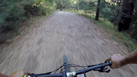
trail: Jackson Grade
0:29 |
131 |
Oct 23, 2019
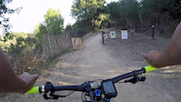
trail: Live Oak
8:34 |
238 |
Oct 23, 2019
trail: Grass Valley
0:31 |
175 |
Nov 17, 2017
![Lake Chabot MTB | Ten Hills & Towhee [4K]](https://ev1.pinkbike.org/tf/vt/1/yvt-69199-4.jpg)
trail: Towhee
13:19 |
414 |
Dec 13, 2020 , Castro Valley
![Lake Chabot MTB | Ten Hills & Towhee [4K]](https://ev1.pinkbike.org/tf/vt/1/yvt-69198-4.jpg)
trail: Ten Hills
13:19 |
349 |
Dec 13, 2020 , Castro Valley
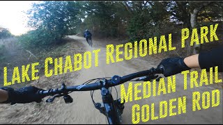
trail: Median Trail
11:37 |
495 |
Nov 6, 2020 , Castro Valley

trail: Golden Rod
11:37 |
568 |
Nov 6, 2020 , Castro Valley
trail: Honker Bay
7:52 |
321 |
Oct 16, 2020 , Castro Valley
Recent Trail Reports
| status | trail | date | condition | info | user |
|---|---|---|---|---|---|
| Live Oak | Apr 27, 2026 @ 10:20am (America/Los_Angeles) Apr 27, 2026 | Dry | rickinlo | ||
| Cameron Loop | Apr 27, 2026 @ 10:20am (America/Los_Angeles) Apr 27, 2026 | Dry | rickinlo | ||
| McGregor George | Apr 27, 2026 @ 10:20am (America/Los_Angeles) Apr 27, 2026 | Dry | rickinlo | ||
| Bass Cove | Feb 28, 2026 @ 8:16am (America/Los_Angeles) Feb 28, 2026 | Variable | aj7049 | ||
| Golden Rod (South) | Feb 28, 2026 @ 8:16am (America/Los_Angeles) Feb 28, 2026 | Variable | aj7049 | ||
| Horseshoe Trail | Feb 28, 2026 @ 8:16am (America/Los_Angeles) Feb 28, 2026 | Variable | aj7049 | ||
| Redtail | Feb 28, 2026 @ 8:16am (America/Los_Angeles) Feb 28, 2026 | Prevalent Mud | aj7049 | ||
| East Shore | Feb 28, 2026 @ 8:16am (America/Los_Angeles) Feb 28, 2026 | Variable | aj7049 | ||
| West Shore | Jan 10, 2026 @ 4:12pm (America/Los_Angeles) Jan 10, 2026 | Ideal | robert-v-simon | ||
| Jackson Grade | Dec 31, 2025 @ 3:08pm (America/Los_Angeles) Dec 31, 2025 | Variable | robert-v-simon |
Activity Feed
| username | action | type | title | date |
|---|---|---|---|---|
| budski001 | vote | trail | activity #96925796 | Jun 13, 2026 @ 4:40pm Jun 13, 2026 |
| jdbrickhouse | wishlist | route | activity #96654422 | Jun 9, 2026 @ 10:39pm Jun 9, 2026 |
| Downtownjbrown | wishlist | route | activity #96635187 | Jun 9, 2026 @ 4:01pm Jun 9, 2026 |
| penguinni | wishlist | route | activity #96473455 | Jun 7, 2026 @ 10:01am Jun 7, 2026 |
| CarolineLoSs3n | wishlist | route | activity #96469291 | Jun 7, 2026 @ 9:18am Jun 7, 2026 |
Recent Comments
| username | type | title | comment | date |
|---|---|---|---|---|
| trail | Temporary closed | May 20, 2026 @ 7:53pm May 20, 2026 | ||
| trail | Northern side: steep, machine graded smooth... | Sep 29, 2025 @ 7:53pm Sep 29, 2025 | ||
| trail | Reasonably fun rolling fire road following the... | May 12, 2025 @ 10:52am May 12, 2025 | ||
| trail | Hardly a trail - it follows the roadway in... | May 12, 2025 @ 10:51am May 12, 2025 | ||
| trail | Nothing out of the ordinary. Rutted fire road,... | May 12, 2025 @ 10:49am May 12, 2025 |
Local Badges
-

10 Green Trails120 awarded -

10 Blue Trails106 awarded -

Epic Ride Climb 2k32 awarded -

Climbing 10k Badge98 awarded -

Climbing 100k Badge9 awarded -

Epic Ride Descent 2k32 awarded
Local Mountain Biking Directory
-
Eden BicyclesBike Shop
-
Castro Valley CycleryBike Shop
-
Area CyclesBike Shop
Activity Type Stats
| activitytype | trails | distance | descent | descent distance | total vertical | rating | global rank | state rank | photos | reports | routes | ridelogs |
|---|---|---|---|---|---|---|---|---|---|---|---|---|
| Mountain Bike | 49 | 69 miles | 11,138 ft | 31 miles | 2,995 ft | #1,920 | #698 | 70 | 361 | 10 | 16,212 | |
| E-Bike | 3 | 11 miles | 1,289 ft | 4 miles | 1,280 ft | 5 | 294 | 1 | 899 | |||
| Horse | 3 | 6 miles | 479 ft | 1 mile | 614 ft | 25 | 1 | |||||
| Hike | 60 | 73 miles | 12,113 ft | 33 miles | 2,995 ft | #3,123 | #1,119 | 361 | 1 | 1,579 | ||
| Trail Running | 60 | 73 miles | 12,113 ft | 33 miles | 2,995 ft | #2,805 | #806 | 361 | 1 | 930 |
Frequently Asked Questions About Castro Valley
▼
What are the best places to ride in Castro Valley?
Castro Valley has 3 areas to explore for mountain biking. The top rated areas are:
▼
What are the highest rated mountain biking trails in Castro Valley?
The highest rated mountain biking trails in Castro Valley are:
- Ten Hills (4.3/5)
- Brandon (4.2/5)
- Horseshoe Trail (4.1/5)
- Deer Canyon Trail (4.1/5)
- Shady Canyon Trail (4.1/5)
▼
What is the best time of the year to ride in Castro Valley?
Based on ride log data, the most popular months to ride in Castro Valley are:
- July (136 activities)
- August (122 activities)
- September (94 activities)
▼
Where can I park to ride in Castro Valley?
There are 7 parking locations listed in Castro Valley. The most popular parking spots are: View all parking and trailhead locations on the map to plan your visit.
Activities
Trails
Points of Interest
- By fantoman & contributors
- Admins: BTCEB
- #19259 - 3,808 views
- castro valley activity log | embed map of Castro Valley mountain bike trails | castro valley mountain biking points of interest
Downloading of trail gps tracks in kml & gpx formats is enabled for Castro Valley.
You must login to download files.