close
-
Layers w
- Weather Layers
- Pro
- Pro
- Pro
- Pro
- Pro
- Pro
- More Layers
- Pro
- Pro
- Pro
- Pro
-
Upgrade to

3D
Trail Conditions
- Unknown
- Snow Groomed
- Snow Packed
- Snow Covered
- Snow Cover Partial
- Freeze/thaw Cycle
- Icy
- Prevalent Mud
- Wet
- Variable
- Ideal
- Dry
- Very Dry
Trail Flow (Ridden Direction)
Trailforks scans users ridelogs to determine the most popular direction each trail is ridden. A good flowing trail network will have most trails flowing in a single direction according to their intension.
The colour categories are based on what percentage of riders are riding a trail in its intended direction.
The colour categories are based on what percentage of riders are riding a trail in its intended direction.
- > 96%
- > 90%
- > 80%
- > 70%
- > 50%
- < 50%
- bi-directional trail
- no data
Trail Last Ridden
Trailforks scans ridelogs to determine the last time a trail was ridden.
- < 2 days
- < 1 week
- < 2 weeks
- < 1 month
- < 6 months
- > 6 months
Trail Ridden Direction
The intended direction a trail should be ridden.
- Downhill Only
- Downhill Primary
- Both Directions
- Uphill Primary
- Uphill Only
- One Direction
Contribute Details
Colors indicate trail is missing specified detail.
- Description
- Photos
- Description & Photos
- Videos
Trail Popularity ?
Trailforks scans ridelogs to determine which trails are ridden the most in the last 9 months.
Trails are compared with nearby trails in the same city region with a possible 25 colour shades.
Think of this as a heatmap, more rides = more kinetic energy = warmer colors.
- most popular
- popular
- less popular
- not popular
ATV/ORV/OHV Filter
Max Vehicle Width
inches
US Cell Coverage
Legend

Radar Time
Activity Recordings
Trailforks uses anonymized public activity data.
?
Activity Recordings
Trailforks uses anonymized public activity data.
?
Personal Heatmap
▶
Activity Types
all
/
none
▶
Options
2
Date range
month
–
Winter Trails
Warning
A routing network for winter maps does not exist. Selecting trails using the winter trails layer has been disabled.
Missing Trails
Most Popular
Least Popular
Trails are colored based on popularity. The more popular a trail is, the more red. Less popular trails trend towards green.
Jump Magnitude Heatmap
Heatmap of where riders jump on trails. Zoom in to see individual jumps, click circles to view jump details.
BC Backroad Status
![map legend]()
Service Road Atlas is a free to use, community-driven service for viewing and creating reports on the numerous back-country service roads around B.C. and Alberta.

Slope Aspect
Direction the slope faces
Trails Deemphasized
Trails are shown in grey.
Only show trails with no bike usage.
Suggested Layers
Based on selected activity type
Save the current map location and zoom level as your default home location whenever this page is loaded.
SaveCataluña (en catalán: Catalunya; en aranés: Catalonha) es una comunidad autónoma española considerada como nacionalidad histórica, situada al nordeste de la península ibérica. Ocupa un territorio de unos 32 000 km² que limita al norte con Francia (Mediodía-Pirineos y Languedoc-Rosellón) y Andorra, al este con el mar Mediterráneo a lo largo de una franja marítima de unos 580 kilómetros, al sur con la Comunidad Valenciana, y al oeste con Aragón. Esta situación estratégica ha favorecido una relación muy intensa con los territorios de la cuenca mediterránea y con la Europa continental. Cataluña está formada por las provincias de Barcelona, Gerona, Lérida y Tarragona. Su capital es la ciudad de Barcelona.
eBikes Allowed:
Yes
AKA: Catalonia Cataluña
This region uses the Uk/Euro style trail grading system.
Region Details
- 7,344
- 82
- 3,989
- 5,964
- 2,586
- 819
Stats
- Avg Trail Rating
- Trails (view details)
- 21,578
- Trails Mountain Bike
- 20,966
- Trails E-Bike
- 20,375
- Trails Gravel Bike
- 569
- Trails Adaptive Bike
- 2,266
- Trails Winter Fat Bike
- 791
- Trails Horse
- 1,537
- Trails Hike
- 20,125
- Trails Trail Running
- 20,011
- Trails Dirtbike/Moto
- 404
- Trails Observed Trials
- 62
- Trails ATV/ORV/OHV
- 240
- Trails Snowmobile
- 9
- Trails Snowshoe
- 12
- Trails Downhill Ski
- 530
- Trails Backcountry Ski
- 22
- Trails Nordic Ski
- 12
- Total Distance
- 17,176 miles
- Total Descent
- 868 miles
- Total Vertical
- 9,527 ft
- Highest Trailhead
- 9,528 ft
- Reports
- 98,115
- Photos
- 14,292
- Ridden Counter
- 1,335,284
Articles

Course Preview: Sasha & Bailey Mills Ride the iXS EDC #3 in La Molina
Jun 5, 2026 from pinkbike.com
From high-speed flow to technical European rock gardens, watch the siblings from Down Under show us the fastest lines ahead of race weekend in La...
Video: How César Rojo Built Unno - The Story Behind Barcelona’s Most Obsessive Brand
Feb 2, 2026 from pinkbike.com
César Rojo opens the doors to the obsession, risks, and 'All on Red' mindset that defined the birth of Unno.
Video: Gregoire Bachmann Chases Sun & Dirt at La Poma
Apr 22, 2025 from pinkbike.com
Some stylish combos in this dirt jump shredit.

Video: Adrien Loron Takes on Urban Riding in Barcelona in "Salsa Brava"
Jan 24, 2025 from pinkbike.com
The 2-time king of Crankworx champion trades the race track in for the streets and keeps the pace.
Popular Trail Networks
view all areas »Sub Regions
- Barcelona (provincia) (9,582)
- Aiguafreda (47)
- Alella (70)
- Arenys de munt (171)
- Collsacreu (9)
- Sant Vicenç de Montalt (106)
- Sobirans (25)
- Badalona (226)
- Barcelona (1,524)
- Castellbisbal (55)
- Collserola (1,216)
- Els Tres Turons (39)
- Montjuic (86)
- Sant Fost De Campsentelles (29)
- Vallromanes (38)
- Berga (623)
- 4 Riders Bike Park (8)
- El Berguedà (561)
- Lluçanès Enduro (27)
- Bigues I Riells (7)
- Cabrera de Mar (38)
- Calaf (182)
- Alta Segarra (162)
- Caldes de Montbui (65)
- Canet de Mar (46)
- Creu de Canet (43)
- Cánoves (37)
- Cantonigròs (2)
- Castellar del Vallès (220)
- Castelldefels (107)
- Canyars Forest (45)
- El Garraf - Castelldefels (65)
- Castellgalí (36)
- Castellnou De Bages (4)
- Castellvi De Rosanes (22)
- Centelles (85)
- Copons (43)
- ALLRIDE BikeLand (4)
- Corbera de Llobregat (27)
- Dosrius (19)
- El Pont de Vilomara (3)
- El Prat De Llobregat (2)
- Folgueroles (86)
- Gavá (75)
- Gelida (33)
- Igualada (660)
- ALLRIDE BikeLand (47)
- Barranc de la Coma (20)
- Castellfollit de Riubregós (91)
- Castellfollit del Boix (36)
- La Llacuna (8)
- Montbui & Vilanova (100)
- Terra de Gats (128)
- Territori Maioles (176)
- L'ametlla Del Valles (9)
- l'Esquirol (39)
- Cabrerès (35)
- La Garriga (133)
- La Sorrera Bikepark (18)
- La Roca del Valles (138)
- La Roca (99)
- Llinars del Vallès (113)
- Manlleu (56)
- Manresa (814)
- Artés (60)
- Cardona (32)
- El Poal (49)
- El Serrat de Castellnou (143)
- Manresa Est (283)
- Manresa Oest (236)
- Martorell (35)
- Mataró (244)
- Argentona (110)
- Vilassar-Premià de Dalt (32)
- Moià (1)
- Molins de rei (1)
- Mollet Del Vallès (154)
- Gallecs I Palaudaries (152)
- Monistrol De Montserrat (107)
- Montserrat (82)
- Montornès (51)
- Olesa De Montserrat (42)
- Pallejà (27)
- Piera (129)
- Pineda de Mar (301)
- Pineda-Malgrat (300)
- Rubí (8)
- Sabadell (28)
- Serra de Galliners (115)
- Sallent (104)
- Sallent - Avinyó (101)
- Sant Andreu de la Barca (103)
- Sant Andreu de Llavaneres (53)
- Sant Boi (62)
- Sant Celoni (11)
- Sant Climent de Llobregat (65)
- Sant Climent (47)
- Sant Esteve de Palautordera (20)
- Sant Feliu De Llobregat (3)
- Sant Iscle de Vallalta (11)
- Sant Just Desvern (11)
- Sant Pere de Torelló (64)
- Sant Pere De Vilamajor (10)
- Sant Pol De Mar (33)
- Sant Quirze Safaja (32)
- Sant Vicenç dels Horts (84)
- El Remei Bikepark (45)
- Sitges (442)
- Begues-Voltants (63)
- El Foix (86)
- El Garraf - Begues (123)
- El Garraf - Canyelles (14)
- El Garraf - Olivella (85)
- El Garraf - Ribes (163)
- El Garraf - Sitges (114)
- El Garraf - Vilanova i la Geltrú (100)
- Muntanyes d'Ordal (94)
- Terrassa (421)
- Tiana (52)
- Torrelles de Llobregat (63)
- Vacarisses (36)
- Rellinars-Vacarisses (179)
- Vallgorguina (20)
- Olzinelles (13)
- Vallirana (19)
- Vic (263)
- Creu de Gurb (22)
- Muntanyola (20)
- Oristà (58)
- Taradell (119)
- Tona (10)
- Viladrau (8)
- Vilafranca del Penedès (394)
- Les Gunyoles (44)
- Moja (40)
- Olèrdola (61)
- Olesa de Bonesvalls (26)
- Sant Quintí (60)
- Sant Sadurní d'Anoia (86)
- Torrelles de Foix-Sant Martí (61)
- Montnegre (10)
- Montseny Natural Park (133)
- Serralada Marina - Litoral (68)
- Aiguafreda (47)
- Girona (provincia) (4,725)
- Arbucies (4)
- Banyoles (603)
- Blanes (213)
- Blanes Entorns (159)
- Camprodon (52)
- Vall De Camprodon (49)
- Figueres (375)
- Alt Empordà (137)
- Cap de Creus (227)
- Girona (914)
- Cadiretes-Llagostera (101)
- Gavarres Interiors (154)
- Guilleries (160)
- Sant Grau (103)
- La Bisbal d'Empordà (1,106)
- Baix Empordà (21)
- Gavarres Maritimes (1,018)
- La Jonquera (22)
- L'Albera (47)
- Llívia (8)
- Maçanet de Cabrenys (38)
- Maçanet de la Selva (26)
- Martinet (2)
- Olot (178)
- Osor (15)
- Palafrugell (53)
- Massis de Begur (14)
- Puigcerda (216)
- Bellver de Cerdanya (74)
- Guils (18)
- La Molina (59)
- Martinet (29)
- Ripoll (340)
- Sant Joan de les Abadesses (101)
- Vall de Nuria (11)
- Vall de Ribes (155)
- Sant Feliu de Guixols (191)
- Santa Coloma de Farners (300)
- Riudarenes (188)
- Vidreres-Caldes de Malavella (48)
- Torroella De Montgri (186)
- Montgri (119)
- Arbucies (4)
- Lleida (provincia) (3,448)
- Balaguer (701)
- Àger-Fontdepou (53)
- Artesa de Segre (103)
- Castello De Farfanya (131)
- Gerb Trails (94)
- Ponts (146)
- Sant Llorenç - Camarasa (114)
- Barruera (51)
- Ribagorça Enduro (50)
- Cervera (32)
- Guimerà (2)
- La Pobla de Segur (83)
- La Pobleta De Bellveí (87)
- Vall Fosca (73)
- la Seu d'Urgell (391)
- Alt Urgell (9)
- Arfa (66)
- Castellbò (48)
- Fígols-Coll de Nargó (53)
- Oliana (40)
- Les Borges Blanques (450)
- Garrigues Trails (368)
- La Granadella (78)
- Serra de la Llena (0)
- Lleida (261)
- Almatret & Riba-Roja Trails (15)
- Camins de Pedra (45)
- La Granja d'Escarp (31)
- La Serreta de Corbins (35)
- Serra de Rosselló (44)
- Sudtrails (63)
- Mas de Bondia (5)
- Pont de Suert (96)
- Igüerri Land (36)
- Llesp (4)
- Sarreres (14)
- VentoLand (31)
- Rocallaura (20)
- Rocallaura Bikepark (20)
- Sant Joan (1)
- Solsona (61)
- Sort (589)
- Baix Pallars (62)
- Espot (44)
- Esterri d'Aneu (16)
- Llavorsí (22)
- Sort, Soriguera i Rialp (7)
- Vall d'Àneu (91)
- Vall de Cardós (51)
- Vall Ferrera (66)
- Valls d'Aguilar (1)
- Tàrrega (95)
- Tremp (319)
- Vall de Boí (15)
- Vallbona de les Monges (149)
- Vall del Maldanell (139)
- Vilaller (6)
- Sant Joan de l'Erm (18)
- Balaguer (701)
- Tarragona (provincia) (2,971)
- Castellvell Del Camp (6)
- El Vendrell (152)
- La Selva del Camp (32)
- Les Borges Del Camp (8)
- Mora d'Ebre (299)
- Endumora (253)
- Prades (395)
- Muntanyes de Prades (265)
- Reus (171)
- Baix Camp (58)
- Mont-Roig del Camp (52)
- Picarany (90)
- Riudecols (16)
- Siurana (1)
- Tarragona (956)
- Bonastre (28)
- El Catllar (124)
- L'Albiol (24)
- Margalef (31)
- Mas Enric (84)
- Montsant (335)
- Muntanyes de Montblanc (122)
- Muntanyes de Poblet (31)
- Pont del Diable (83)
- Pradell Teixeta (21)
- Pratdip (57)
- Tortosa (557)
- Deltebre (7)
- El Perelló (28)
- EnduBítem (53)
- La Sénia (58)
- Ports de Tortosa - Beseit (159)
- Serra del Montsià (89)
- Vallfogona de Riu Corb (74)
- Vall del Corb (74)
- Valls (308)
- Miramar (205)
- Valls del Brugent i del Glorieta (94)
- Serres De Pandols I Cavalls (51)
- Castellvell Del Camp (6)
- Val d'Aran (224)
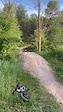
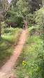
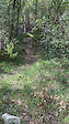
Popular Catalunya Mountain Biking Trails
• 100 ★ 2.6 • 2,887 ft • 14 ft • 1,197 •
Pretty flat singletrack with a few rocky bits and two small drops. Ideal as a fun alternative to the bike path when coming back to Girona!
• 100 ★ 4.7 • 1 mile • 3 ft • 1,070 •
Very attractive single track, twisted, with jumps and technical descents. Good visibility and traceability. Good fo XCO, All-Mountain and also Enduro.
• 100 ★ 4.1 • 1,821 ft • 34 ft • 1,063 •
“Forapistas” is an easy trail right next to “Camí de Can Borni” Is the perfect trail for riders of all levels, especially beginners. The trail is nice and clean. Is not skinny and you have a good view of what do you have in the...
• 100 ★ 4.7 • 2 miles • 18 ft • 1,060 •
One of the classical descents on the area. Not too technical but with about 70 jumps/drops makes a fun trail to ride.
• 100 ★ 3.2 • 1,079 ft • 17 ft • 1,018 •
A trail starting just next to Casa Juanco. It starts as a narrow singletrack and just after the tower it becomes open and with few easy rock garden and loose rocks. Few brave people does it also uphill.
• 100 ★ 3.0 • 666 ft • 0 ft • 966 •
Pequeña alternativa a la . Asequible para todo el mundo
• 100 ★ 4.5 • 1,112 ft • 0 ft • 951 •
Highly rated popular black difficulty singletrack. This multi-use trail can be used downhill only and has a moderate overall physical rating. It features drop. Trail visibility is always easy to follow. On average it takes 3 minutes to complete this trail.
Catalunya Mountain Bike Routes
Visit Capolat Featured
★ 4.7 • 14 miles • 2,912 ft • 10 • Loop •
The perfect introduction to the dryer southern part of our riding paradise. Here the rock type is...
Catllaràs Dreams Featured
★ 4.2 • 13 miles • 3,534 ft • 5 • Loop •
EN: Possible one of the better forest enduro routes in Spain. Incredible +1100 vertical meters of downhill...
Visit Vilada Featured
★ 5.0 • 16 miles • 4,780 ft • 8 • Loop •
EN: Long uphill on gravel road with nice views and a chance to stop in the nice hut midway for a refill of...
Gallecs Trails Time Attack Featured
★ 4.5 • 18 miles • 1,931 ft • 43 • Loop •
Ruta que nos lleva por casi todas las trialeras de sin descanso y repite algunas de ellas para poder...
★ 5.0 • 18 miles • 4,728 ft • 11 • Loop •
Ruta coneguda com Les 4 Reines què es consideren les millors baixades d'aquesta cara de la muntanya....
★ 5.0 • 16 miles • 2,441 ft • 5 • Loop •
Ruta cap a passant per altres trails interessants. ESP: Ruta que va a y que pasa por otros trails...
Photos of Catalunya Mountain Bike
Videos of Catalunya Mountain Bike
featured
![Trails with a view]()
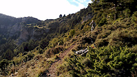
trail: Serra de Corbera
0:10 |
163 |
Oct 2, 2018
featured
![MTB ENDUMORA - Santa Magdalena Trail 2024 -...]()
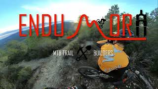
trail: Santa Magdalena
2:37 |
400 |
Jan 22, 2024 , Mora d'Ebre
trail: Bunker
0:04 |
4 |
Jun 7, 2026
trail: Bunker
0:10 |
5 |
Jun 7, 2026
trail: Parada de la Guineu
0:05 |
6 |
May 18, 2026
trail: Parada de la Guineu
0:05 |
7 |
May 18, 2026

trail: Tamarro
4:54 |
11 |
May 14, 2026
trail: Carl Sagan
2:25 |
6 |
Apr 29, 2026
Current Trail Warnings
| status | trail | date | condition | user | info |
|---|---|---|---|---|---|
| Bancos Vallesana Badalona | Jun 7, 2026 @ 2:04pm (Europe/Madrid) Jun 7, 2026 | Dry | trailsxplorer | Árbol caído en el drop que da a la clariana | |
| La Nau Serralada Marina - Litoral | Jun 19, 2026 @ 12:36am (Europe/Madrid) 20 hours | Unknown | Eskate | Corriol en mal estat, té molta... | |
| Somato De Hache Pineda-Malgrat | Jun 18, 2026 @ 1:46pm (Europe/Madrid) 1 day | Variable | ibaiaierra | Es una odisea pasar por ahi, mucha maleza... |
Recent Trail Reports
National Scenic Trails & Official Routes
-
GR 17 Vía Arán Pirineos
- Mountain Bike
- E-Bike
- Hike
- Trail Running
-
GR 99 Camino Natural del Ebro
- Mountain Bike
- E-Bike
- Horse
- Hike
- Trail Running
Activity Feed
| username | action | type | title | date |
|---|---|---|---|---|
| Fonru | vote | trail | activity #97317197 and 1 more | Jun 19, 2026 @ 7:49am 4 hours |
| Fonru | vote | trail | activity #97317194 | Jun 19, 2026 @ 7:49am 4 hours |
| Fonru | vote | trail | activity #97317191 | Jun 19, 2026 @ 7:49am 4 hours |
| Fonru | vote | trail | activity #97317185 | Jun 19, 2026 @ 7:49am 4 hours |
| elcuquito | add | trail | activity #97317151 | Jun 19, 2026 @ 7:48am 4 hours |
Recent Comments
| username | type | title | comment | date |
|---|---|---|---|---|
| trail | Boníssima, fàcil, fluida i ràpida! | Jun 17, 2026 @ 12:14pm 2 days | ||
| trail | Baixada molt guapa! Les primeres corbes son... | Jun 16, 2026 @ 1:06pm 3 days | ||
| trail | This is pure fun! | Jun 16, 2026 @ 11:58am Jun 16, 2026 | ||
| trail | Algú pot explicar per què apareix com a... | Jun 15, 2026 @ 3:53am Jun 15, 2026 | ||
| trail | Muy divertida muy plana y se hace larga... | Jun 14, 2026 @ 4:59pm Jun 14, 2026 |
Local Badges
-

Gallecs Trail Attack1 awarded -

Gallecs 30 Blue Trails52 awarded -

Gallecs Descent 10k82 awarded -
Gallecs 30 Green Trails67 awarded -

Gallecs Big Ride1,225 awarded -

Gallecs Descent 100k0 awarded
Bike & Skill Parks
| name | type | city | rating |
|---|---|---|---|
| La Sorrera Bikepark | bike park | La Garriga | |
| La Molina | bike park | Puigcerda | |
| 4 Riders Bike Park | bike park | Berga | |
| Pure Riding Bike Park | bike park | Osor | |
| La Poma Bikepark | skill park | Premià de Dalt |
Upcoming Local Events
Local Trail Supporters
- Lo Podall
- Wilson and friends
- Espot Enduro and Downhill
- TRENKABIKERS
![]()
- Espot Enduro & Downhill
![]()
![]()
- ENDUMORA
- GARRIGUES TRAILS
- Antic Balneari de Rocallaura
![]()
Local Trail Supporters
- Lo Podall
- Wilson and friends
- Espot Enduro and Downhill
- TRENKABIKERS
![]()
- Espot Enduro & Downhill
![]()
![]()
- ENDUMORA
- GARRIGUES TRAILS
- Antic Balneari de Rocallaura
![]()
Activity Type Stats
| activitytype | trails | distance | descent | descent distance | total vertical | rating | global rank | state rank | photos | reports | routes | ridelogs |
|---|---|---|---|---|---|---|---|---|---|---|---|---|
| Mountain Bike | 20,966 | 16,654 miles | 806 miles | 8,435 miles | 9,528 ft | 13,302 | 98,048 | 656 | 779,407 | |||
| E-Bike | 20,375 | 16,047 miles | 778 miles | 8,127 miles | 9,528 ft | 709 | 94,045 | 467 | 157,575 | |||
| Gravel Bike | 569 | 597 miles | 61,089 ft | 186 miles | 8,317 ft | 46 | 3,040 | 33 | 10,663 | |||
| Adaptive Bike | 2,266 | 2,898 miles | 240,643 ft | 848 miles | 8,330 ft | 10,389 | 10 | 6 | ||||
| Winter Fat Bike | 791 | 736 miles | 122,290 ft | 342 miles | 8,317 ft | 298 | 2 | |||||
| Horse | 1,537 | 1,458 miles | 197,320 ft | 593 miles | 7,428 ft | 3,206 | 3 | 13 | ||||
| Hike | 20,125 | 16,206 miles | 765 miles | 8,086 miles | 9,528 ft | 111 | 93,025 | 104 | 44,772 | |||
| Trail Running | 20,011 | 16,123 miles | 762 miles | 8,053 miles | 9,528 ft | 45 | 92,623 | 36 | 66,319 | |||
| Dirtbike/Moto | 404 | 440 miles | 55,932 ft | 173 miles | 8,163 ft | 9 | 2,603 | 2 | 61 | |||
| Observed Trials | 62 | 83 miles | 11,867 ft | 35 miles | 4,432 ft | 274 | 1 | 5 | ||||
| ATV/ORV/OHV | 240 | 344 miles | 36,660 ft | 119 miles | 7,408 ft | 2,626 | 26 | |||||
| Snowmobile | 9 | 33 miles | 7,598 ft | 17 miles | 6,168 ft | 29 | 1 | |||||
| Snowshoe | 12 | 35 miles | 7,825 ft | 17 miles | 7,142 ft | 39 | 200 | |||||
| Downhill Ski | 530 | 289 miles | 235,636 ft | 254 miles | 8,422 ft | 17 | 78 | 6,555 | ||||
| Backcountry Ski | 22 | 54 miles | 18,438 ft | 24 miles | 8,560 ft | 36 | 5,474 | |||||
| Nordic Ski | 12 | 36 miles | 6,273 ft | 17 miles | 7,142 ft | 37 | 1,388 |
Activities
- Catalunya Mountain Biking Trails
- Catalunya E-Biking Trails
- Catalunya Gravel Biking Trails
- Catalunya Adaptive Biking Trails
- Catalunya Winter Fat Biking Trails
- Catalunya Horseback Trails
- Catalunya Hiking Trails
- Catalunya Trail Running Trails
- Catalunya Dirtbiking Trails
- Catalunya Observed Trials Trails
- Catalunya ATVing/Offroading Trails
- Catalunya Snowmobiling Trails
- Catalunya Snowshoeing Trails
- Catalunya Skiing Trails
- Catalunya Backcountry Skiing Trails
- Catalunya Nordic Skiing Trails
Trails
Points of Interest
- Mirador d'Aguilera Viewpoint
- Parking Information
- Cap de la serra Viewpoint
- Roc de Neret Viewpoint
- Wildcoast Bikes Other
- Ermita Mare De Déu De La Salut Del Papiol. Sight
- Restaurant Santa Bàrbara Other
- Bar/restaurant La Rectoria Other
- Rasos de Baix Other
- Slickrocks of Avià TTF
- Besiberri Sud (9,810 ft)
- Pic de Comaloforno (9,777 ft)
- Punta Alta de Comalesbienes (9,738 ft)
- By xaibeeh
 & contributors
 - Admins: mul0w, elyari, AMG, juanx, Angelreing, snaker4, kai-bcn
- #4001 - 35,483 views
- catalunya activity log | embed map of Catalunya mountain bike trails | catalunya mountain biking points of interest polygons
Downloading of trail gps tracks in kml & gpx formats is enabled for Catalunya.
You must login to download files.