close
-
Layers w
- Weather Layers
- Pro
- Pro
- Pro
- Pro
- Pro
- Pro
- More Layers
- Pro
- Pro
- Pro
- Pro
-
Upgrade to

3D
Trail Conditions
- Unknown
- Snow Groomed
- Snow Packed
- Snow Covered
- Snow Cover Partial
- Freeze/thaw Cycle
- Icy
- Prevalent Mud
- Wet
- Variable
- Ideal
- Dry
- Very Dry
Trail Flow (Ridden Direction)
Trailforks scans users ridelogs to determine the most popular direction each trail is ridden. A good flowing trail network will have most trails flowing in a single direction according to their intension.
The colour categories are based on what percentage of riders are riding a trail in its intended direction.
The colour categories are based on what percentage of riders are riding a trail in its intended direction.
- > 96%
- > 90%
- > 80%
- > 70%
- > 50%
- < 50%
- bi-directional trail
- no data
Trail Last Ridden
Trailforks scans ridelogs to determine the last time a trail was ridden.
- < 2 days
- < 1 week
- < 2 weeks
- < 1 month
- < 6 months
- > 6 months
Trail Ridden Direction
The intended direction a trail should be ridden.
- Downhill Only
- Downhill Primary
- Both Directions
- Uphill Primary
- Uphill Only
- One Direction
Contribute Details
Colors indicate trail is missing specified detail.
- Description
- Photos
- Description & Photos
- Videos
Trail Popularity ?
Trailforks scans ridelogs to determine which trails are ridden the most in the last 9 months.
Trails are compared with nearby trails in the same city region with a possible 25 colour shades.
Think of this as a heatmap, more rides = more kinetic energy = warmer colors.
- most popular
- popular
- less popular
- not popular
ATV/ORV/OHV Filter
Max Vehicle Width
inches
US Cell Coverage
Legend

Radar Time
Activity Recordings
Trailforks uses anonymized public activity data.
?
Activity Recordings
Trailforks uses anonymized public activity data.
?
Personal Heatmap
▶
Activity Types
all
/
none
▶
Options
2
Date range
month
–
Winter Trails
Warning
A routing network for winter maps does not exist. Selecting trails using the winter trails layer has been disabled.
Missing Trails
Most Popular
Least Popular
Trails are colored based on popularity. The more popular a trail is, the more red. Less popular trails trend towards green.
Jump Magnitude Heatmap
Heatmap of where riders jump on trails. Zoom in to see individual jumps, click circles to view jump details.
BC Backroad Status
![map legend]()
Service Road Atlas is a free to use, community-driven service for viewing and creating reports on the numerous back-country service roads around B.C. and Alberta.

Slope Aspect
Direction the slope faces
Trails Deemphasized
Trails are shown in grey.
Only show trails with no bike usage.
Suggested Layers
Based on selected activity type
Save the current map location and zoom level as your default home location whenever this page is loaded.
SaveOnly one trail, the Middle Trail in the riding area in Cave Hill Country Park is fully sanctioned and maintained by Cavehill Mountain bike Club. Other Trails are unofficial built by local riders, ride at own risk.
Cavehill Mountain Bike Club have a Memorandum of Understanding with Belfast City Council to develop, manage, and maintain the Middle Trail.
Lots of steep, twisting single track descents, bumps and jumps through the trees, dozens of options. Great descents off the summit to both north and south, including the fantastic "quarry trail".
Getting onto the quarry trail - summit Cave Hill, and look out over Belfast. To your right there is a single-track path that follows the ridge - follow it. It follows to the right for a long way, and eventually you go through a stream, over a wee cattle grid and along a fence. At this point, turn down the hill and turn left following the track, or look up the hill and you will see a faint path that will take you back to path from the Hightown Road carpark, back to the summit.
Another great option (but pretty technical at the top): just behind the Napoleon's Nose (view over Belfast) at the bottom of the steps, there is a black iron marker post. Head over the edge here, but be careful You can pick your way down if you are confident and have good balance, and once things flatten out, stay to the right, and you are onto a fantastic twisting singletrack through the trees, pretty much the whole way down to the castle. Very rooty and a bit mucky when you get into the trees, so best in the dry.
Be careful on the lower slopes of Cave Hill on the obvious walking paths, as the area, particularly the low section just above Belfast Castle, is a popular place for families / walkers, so safety and courtesy are of the utmost importance.
There are also some fine trails on old former walking paths (now disused) close to the zoo, as shown on the marked map linked below.
source: Trail Badger
Primary Trail Type: All-Mountain & Downhill
eBikes Allowed:
Yes
AKA: Cavey, Cavehill, Beann Mhadagáin
Land Status: Municipal Park
Land Manager: Belfast City Council
 google parking directions
 Disclaimer:
Cavehill's trails are natural DH trails and are much more challenging than their trail centre counterparts. For instance, a blue trail here is equivalent to a black trail centre trail.
This region uses the Uk/Euro style trail grading system.
Region Supporters & Maintainers
![]()
Grassroots MountainbikingSponsor![]()
Cavehill Mountainbikers ClubSponsor
Activities Click to view
- Mountain Bike
22 trails
- E-Bike
23 trails
- Hike
14 trails
- Trail Running
14 trails
Region Details
- 5
- 3
- 6
- 7
- 1
Region Status
Caution as of May 26, 2026Local Trail Association
Stats
- Avg Trail Rating
- Trails (view details)
- 23
- Trails Mountain Bike
- 22
- Trails E-Bike
- 23
- Trails Hike
- 14
- Trails Trail Running
- 14
- Total Distance
- 10 miles
- Total Descent
- 3,610 ft
- Total Vertical
- 896 ft
- Highest Trailhead
- 1,162 ft
- Reports
- 80
- Photos
- 150
- Ridden Counter
- 1,060
Popular Cave Hill Mountain Biking Trails
• 75 ★ 3.7 • 2,129 ft • 0 ft • 75 •
Fully sanctioned trail managed and maintained by Cavehill Mountainbike Club under licence from Belfast City Council.
• 25 ★ 3.3 • 4,003 ft • 0 ft • 51 • • hike
Less popular red difficulty singletrack. This hike primary trail can be used downhill primary and has a moderate overall physical rating with a 0 ft green climb. It features bridge and rock garden. Trail visibility is always easy to follow. On average it takes 7 minutes to complete this trail.
• 50 ★ 2.5 • 1,696 ft • 3 ft • 44 • • hike
A walking path in cave hill country part. Part off an official hill walk, no official bike use. Use only as a push/ride up path and only descend slowly if must.
• 25 ★ 4.4 • 938 ft • 0 ft • 37 •
A hill walk in cavehill country park, no official bike use. Be prepared to stop and wait for walkers. Popular with hill walkers and runners.
• 15 ★ 3.0 • 3,304 ft • 268 ft • 18 • • hike
Less popular blue difficulty singletrack. This hike primary trail can be used both directions. Trail visibility is always easy to follow. On average it takes 15 minutes to complete this trail.
• 40 ★ 0.0 • 978 ft • 0 ft • 7 •
Steep in places, a few drops at the top with very off camber ledges. Gets faster as you go down
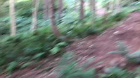
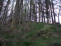
Photos of Cave Hill Mountain Bike
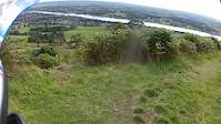
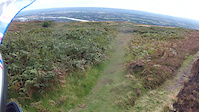
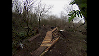
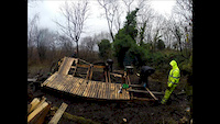
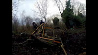
Videos of Cave Hill Mountain Bike
trail: Middle Trail Hiking Shortcut
0:08 |
61 |
Aug 19, 2022
trail: Middle
0:07 |
980 |
Nov 6, 2014
trail: Middle
0:23 |
489 |
Sep 9, 2014
trail: Middle
0:44 |
468 |
Sep 9, 2014
trail: Middle
0:15 |
68 |
Aug 14, 2014
trail: Quarry
5:32 |
499 |
Jan 12, 2014
trail: Quarry
0:18 |
885 |
Jan 5, 2014
trail: Quarry
0:41 |
235 |
Jan 2, 2014
Recent Trail Reports
| status | trail | date | condition | info | user |
|---|---|---|---|---|---|
| Middle | May 26, 2026 @ 3:51pm (Europe/Isle_of_Man) May 26, 2026 | Variable | Jxroussel | ||
| Mad Again | May 26, 2026 @ 3:51pm (Europe/Isle_of_Man) May 26, 2026 | Dry | Jxroussel | ||
| Gaga | Mar 24, 2026 @ 7:50am (Europe/London) Mar 24, 2026 | Unknown | TheCorminator GRASS | ||
| Rush | Mar 23, 2026 @ 5:21pm (Europe/London) Mar 23, 2026 | Ideal | TheCorminator GRASS | ||
| Swayze Train | Mar 23, 2026 @ 5:21pm (Europe/London) Mar 23, 2026 | Ideal | TheCorminator GRASS | ||
| Forest Path Shortcut | Mar 23, 2026 @ 5:21pm (Europe/London) Mar 23, 2026 | Ideal | TheCorminator GRASS | ||
| Forest Path | Mar 23, 2026 @ 5:21pm (Europe/London) Mar 23, 2026 | Dry | TheCorminator GRASS | ||
| Quarry | Apr 4, 2025 @ 7:46am Apr 4, 2025 | Dry | TheCorminator GRASS | ||
| Middle Trail Hiking Shortcut | May 25, 2023 @ 1:37pm May 25, 2023 | Dry | TheCorminator GRASS | ||
| Devil's Punchbowl | Aug 14, 2022 @ 12:53am Aug 14, 2022 | Dry | bern GRASS |
Activity Feed
| username | action | type | title | date |
|---|---|---|---|---|
| Jxroussel | add | karma | activity #95585661 | May 26, 2026 @ 1:06pm May 26, 2026 |
| Jxroussel | add | report | activity #95585428 and 1 more | May 26, 2026 @ 1:02pm May 26, 2026 |
| Carim | add | video | activity #95200363 and 3 more | May 21, 2026 @ 2:21pm May 21, 2026 |
| CoreyWHlmIR | ridden | trail | activity #94483417 and 2 more | May 11, 2026 @ 1:52am May 11, 2026 |
| Carim | wishlist | trail | activity #94114430 | May 5, 2026 @ 2:23pm May 5, 2026 |
Recent Comments
| username | type | title | comment | date |
|---|---|---|---|---|
| report | Still closed with no imminent hope of... | Sep 27, 2021 @ 1:54pm Sep 27, 2021 | ||
| trail | Forest path running at the back of the Zoo has... | Apr 15, 2021 @ 1:00pm Apr 15, 2021 |
Nearby Areas
| name | distance | ||||
|---|---|---|---|---|---|
| Belvoir Forest | 2 | 6 | 6.2 km | ||
| Barnett Demesne | 1 | 5 | 6.5 km | ||
| Woodburn Forest | 2 | 7.7 km | |||
| Billy Neill | 4 | 4 | 8 km | ||
| Conor Road Quarry | 9.2 km |
Activity Type Stats
| activitytype | trails | distance | descent | descent distance | total vertical | rating | global rank | state rank | photos | reports | routes | ridelogs |
|---|---|---|---|---|---|---|---|---|---|---|---|---|
| Mountain Bike | 22 | 9 miles | 3,314 ft | 5 miles | 896 ft | #7,925 | #266 | 150 | 80 | 2,277 | ||
| E-Bike | 23 | 10 miles | 3,609 ft | 5 miles | 896 ft | #4,603 | #191 | 77 | 92 | |||
| Hike | 14 | 8 miles | 2,687 ft | 4 miles | 896 ft | #8,464 | #212 | 71 | 149 | |||
| Trail Running | 14 | 8 miles | 2,687 ft | 4 miles | 896 ft | #8,154 | #217 | 71 | 67 |
Frequently Asked Questions About Cave Hill
▼
What are the highest rated mountain biking trails in Cave Hill?
The highest rated mountain biking trails in Cave Hill are:
- Swayze Train (4.3/5)
- Mad Again (4.1/5)
- Gaga (3.9/5)
- Quarry Hike Trail (3.8/5)
- Middle (3.8/5)
▼
What is the best time of the year to ride in Cave Hill?
Based on ride log data, the most popular months to ride in Cave Hill are:
- August (17 activities)
- July (16 activities)
- June (11 activities)
▼
Where can I park to ride in Cave Hill?
There are 1 parking locations listed in Cave Hill. The most popular parking spots are:
▼
What is the longest trail in Cave Hill?
The longest trail in Cave Hill is Quarry at 4,003 ft. View all trails sorted by distance.
Activities
Trails
Points of Interest
- By bern
 GRASS & contributors
 - Admins: apply
- #6609 - 14,147 views
- cave hill activity log | embed map of Cave Hill mountain bike trails | cave hill mountain biking points of interest
Downloading of trail gps tracks in kml & gpx formats is enabled for Cave Hill.
You must login to download files.