close
-
Layers w
- Weather Layers
- Pro
- Pro
- Pro
- Pro
- Pro
- Pro
- More Layers
- Pro
- Pro
- Pro
- Pro
-
Upgrade to

3D
Trail Conditions
- Unknown
- Snow Groomed
- Snow Packed
- Snow Covered
- Snow Cover Partial
- Freeze/thaw Cycle
- Icy
- Prevalent Mud
- Wet
- Variable
- Ideal
- Dry
- Very Dry
Trail Flow (Ridden Direction)
Trailforks scans users ridelogs to determine the most popular direction each trail is ridden. A good flowing trail network will have most trails flowing in a single direction according to their intension.
The colour categories are based on what percentage of riders are riding a trail in its intended direction.
The colour categories are based on what percentage of riders are riding a trail in its intended direction.
- > 96%
- > 90%
- > 80%
- > 70%
- > 50%
- < 50%
- bi-directional trail
- no data
Trail Last Ridden
Trailforks scans ridelogs to determine the last time a trail was ridden.
- < 2 days
- < 1 week
- < 2 weeks
- < 1 month
- < 6 months
- > 6 months
Trail Ridden Direction
The intended direction a trail should be ridden.
- Downhill Only
- Downhill Primary
- Both Directions
- Uphill Primary
- Uphill Only
- One Direction
Contribute Details
Colors indicate trail is missing specified detail.
- Description
- Photos
- Description & Photos
- Videos
Trail Popularity ?
Trailforks scans ridelogs to determine which trails are ridden the most in the last 9 months.
Trails are compared with nearby trails in the same city region with a possible 25 colour shades.
Think of this as a heatmap, more rides = more kinetic energy = warmer colors.
- most popular
- popular
- less popular
- not popular
ATV/ORV/OHV Filter
Max Vehicle Width
inches
US Cell Coverage
Legend

Radar Time
Activity Recordings
Trailforks uses anonymized public activity data.
?
Activity Recordings
Trailforks uses anonymized public activity data.
?
Personal Heatmap
▶
Activity Types
all
/
none
▶
Options
2
Date range
month
–
Winter Trails
Warning
A routing network for winter maps does not exist. Selecting trails using the winter trails layer has been disabled.
Missing Trails
Most Popular
Least Popular
Trails are colored based on popularity. The more popular a trail is, the more red. Less popular trails trend towards green.
Jump Magnitude Heatmap
Heatmap of where riders jump on trails. Zoom in to see individual jumps, click circles to view jump details.
BC Backroad Status
![map legend]()
Service Road Atlas is a free to use, community-driven service for viewing and creating reports on the numerous back-country service roads around B.C. and Alberta.

Slope Aspect
Direction the slope faces
Trails Deemphasized
Trails are shown in grey.
Only show trails with no bike usage.
Suggested Layers
Based on selected activity type
Save the current map location and zoom level as your default home location whenever this page is loaded.
Save
No description for Ceará has been added yet!
Login or register to submit one.
Activities Click to view
- Mountain Bike
143 trails
- E-Bike
126 trails
- Gravel Bike
1 trails
- Horse
17 trails
- Hike
142 trails
- Trail Running
142 trails
- Dirtbike/Moto
14 trails
- Observed Trials
11 trails
- ATV/ORV/OHV
4 trails
Region Details
- 49
- 3
- 22
- 48
- 14
- 5
Stats
- Avg Trail Rating
- Trails (view details)
- 141
- Trails Mountain Bike
- 143
- Trails E-Bike
- 126
- Trails Gravel Bike
- 1
- Trails Horse
- 17
- Trails Hike
- 142
- Trails Trail Running
- 142
- Trails Dirtbike/Moto
- 14
- Trails Observed Trials
- 11
- Trails ATV/ORV/OHV
- 4
- Total Distance
- 272 miles
- Total Descent Distance
- 137 miles
- Total Descent
- 44,282 ft
- Total Vertical
- 3,396 ft
- Highest Trailhead
- 3,421 ft
- Reports
- 348
- Photos
- 245
- Ridden Counter
- 573
Sub Regions
- Beberibe (6)
- Uruau (6)
- Caucaia (12)
- Pedra do Garrote (4)
- Serra do Juá (7)
- Fortaleza (4)
- Guaramiranga (40)
- Maranguape (78)
- Serra da Aratanha (24)
- Serra de Maranguape (42)
- Terra na Veia Bike Park (24)
- Tianguá (2)
Popular Ceará Mountain Biking Trails
• 5 ★ 5.0 • 1 mile • 27 ft • 18 •
The Salvação trail takes you to downhill, which is one of the most fast and fun trail in the region, but to get there you must reach salvation by going up steep hills that takes lots of effort and energy. Be prepared. When coming the...
• 5 ★ 5.0 • 5,102 ft • 20 ft • 16 •
Less popular blue difficulty singletrack. This mountain bike primary trail can be used downhill primary and has a moderate overall physical rating with a 20 ft blue climb. Trail visibility is always easy to follow. On average it takes 6 minutes to complete this trail.
• 100 ★ 0.0 • 2 miles • 135 ft • 15 •
Trail that takes you to Lages Umarizeiras area at the bottom of Aratanha
• 60 ★ 5.0 • 4,570 ft • 57 ft • 14 •
Very fun and fast trail when going down. Pretty nice ascent when going up. Singletrack with few rockgardens, mostly dirt, and a couple switchbacks. Avoid going on very sunny days, and close to midday as it gets extremely hot.
• 5 ★ 5.0 • 2,543 ft • 63 ft • 14 •
Trilha com várias descidas e subidas, algumas valas, mas muito divertida.
• 95 ★ 0.0 • 2,582 ft • 27 ft • 12 •
Popular green difficulty family friendly singletrack. This mountain bike primary trail can be used one direction and has a easy overall physical rating with a 27 ft green climb. Trail visibility is always easy to follow. On average it takes 3 minutes to complete this trail.
• 95 ★ 5.0 • 4 miles • 426 ft • 11 •
Popular green difficulty mixed. This mountain bike primary trail can be used both directions and has a moderate overall physical rating with a 426 ft blue climb. Trail visibility is always easy to follow. On average it takes 30 minutes to complete this trail.
Ceará Mountain Bike Routes
18 miles • 2,690 ft • 0 •
Rota de subida do Paraupeba que segue saindo de Redenção através da Estrada Redenção-Pacoti via...
3 miles • 175 ft • 0 •
Rota que liga da Pousada Le Reve para o Sitio São Roque
18 miles • 2,531 ft • 0 •
Subida do Paraupeba - Redençao/Pacoti
Photos of Ceará Mountain Bike
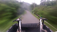
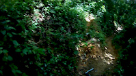
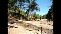
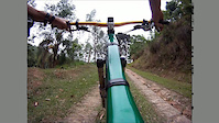
Videos of Ceará Mountain Bike
trail: Taquara Rock Garden
0:42 |
18 |
Dec 28, 2020
trail: 11
0:10 |
23 |
Nov 30, 2017
trail: 11
2:48 |
65 |
Apr 14, 2015
trail: 11
0:25 |
229 |
Nov 24, 2014
trail: 11
8:31 |
130 |
Nov 17, 2012
trail: Jubaia
13:09 |
298 |
Jun 4, 2012
trail: 11
3:01 |
228 |
Oct 26, 2011
trail: 11
3:23 |
143 |
Oct 11, 2011
Recent Trail Reports
Activity Feed
| username | action | type | title | date |
|---|---|---|---|---|
| naganocs | add | photo | activity #96015217 and 5 more | Jun 1, 2026 @ 7:11am Jun 1, 2026 |
| Karmaz5RkIQ | ridden | trail | activity #94804695 | May 16, 2026 @ 5:20am May 16, 2026 |
| naganocs | add | photo | activity #93479806 and 1 more | Apr 26, 2026 @ 2:42pm Apr 26, 2026 |
| naganocs | add | photo | activity #93479799 and 2 more | Apr 26, 2026 @ 2:42pm Apr 26, 2026 |
| naganocs | add | photo | activity #90686429 and 7 more | Mar 16, 2026 @ 5:42am Mar 16, 2026 |
Recent Comments
| username | type | title | comment | date |
|---|---|---|---|---|
| trail | Trilha impossível de pedalar em 18/04/21 | Apr 18, 2021 @ 11:30am Apr 18, 2021 |
Local Badges
-

Descent 100k Badge1 awarded -

Epic Ride 50k247 awarded -
Descent 100k Badge0 awarded -
Epic Ride 50k16 awarded -

Descent 10k Badge3 awarded -
Descent 10k Badge10 awarded
Bike & Skill Parks
| name | type | city | rating |
|---|---|---|---|
| Terra na Veia Bike Park | bike park | Maranguape | |
| Caboré Pump Track | skill park | Fortaleza | |
| Skate Park Dom Helder Camara | skill park | Fortaleza |
Activity Type Stats
| activitytype | trails | distance | descent | descent distance | total vertical | rating | global rank | state rank | photos | reports | routes | ridelogs |
|---|---|---|---|---|---|---|---|---|---|---|---|---|
| Mountain Bike | 143 | 272 miles | 44,281 ft | 137 miles | 3,396 ft | 231 | 348 | 4 | 4,593 | |||
| E-Bike | 126 | 256 miles | 42,615 ft | 130 miles | 3,396 ft | 347 | 3 | 438 | ||||
| Gravel Bike | 1 | 2 | 1 | |||||||||
| Horse | 17 | 57 miles | 6,243 ft | 27 miles | 2,992 ft | 5 | ||||||
| Hike | 142 | 272 miles | 44,281 ft | 137 miles | 3,396 ft | 348 | 2 | 74 | ||||
| Trail Running | 142 | 272 miles | 44,281 ft | 137 miles | 3,396 ft | 348 | 2 | 46 | ||||
| Dirtbike/Moto | 14 | 44 miles | 5,121 ft | 21 miles | 2,674 ft | 5 | ||||||
| Observed Trials | 11 | 36 miles | 2,959 ft | 16 miles | 1,647 ft | 3 | 1 | |||||
| ATV/ORV/OHV | 4 | 10 miles | 210 ft | 4 miles | 377 ft | 3 |
Frequently Asked Questions About Ceará
▼
What are the best places to ride in Ceará?
Ceará has 8 areas to explore for mountain biking. The top rated areas are:
▼
What are the highest rated mountain biking trails in Ceará?
The highest rated mountain biking trails in Ceará are:
- Salvação (4.1/5)
- Indios (4.1/5)
- Coquinhos (4.1/5)
- Beneditinho (4.1/5)
- Feijão (4.1/5)
▼
What is the best time of the year to ride in Ceará?
Based on ride log data, the most popular months to ride in Ceará are:
- July (20 activities)
- September (13 activities)
- August (13 activities)
▼
What is the longest trail in Ceará?
The longest trail in Ceará is Jubaia at 8.1 miles. View all trails sorted by distance.
Activities
Trails
- By brenthillier
 NSMBA TRAILFORKS & contributors
 - Admins: chpw, rdfrota
- #8019 - 2,810 views
- ceará activity log | embed map of Ceará mountain bike trails | ceará mountain biking points of interest
Downloading of trail gps tracks in kml & gpx formats is enabled for Ceará.
You must login to download files.