close
-
Layers w
- Weather Layers
- Pro
- Pro
- Pro
- Pro
- Pro
- Pro
- More Layers
- Pro
- Pro
- Pro
- Pro
-
Upgrade to

3D
Trail Conditions
- Unknown
- Snow Groomed
- Snow Packed
- Snow Covered
- Snow Cover Partial
- Freeze/thaw Cycle
- Icy
- Prevalent Mud
- Wet
- Variable
- Ideal
- Dry
- Very Dry
Trail Flow (Ridden Direction)
Trailforks scans users ridelogs to determine the most popular direction each trail is ridden. A good flowing trail network will have most trails flowing in a single direction according to their intension.
The colour categories are based on what percentage of riders are riding a trail in its intended direction.
The colour categories are based on what percentage of riders are riding a trail in its intended direction.
- > 96%
- > 90%
- > 80%
- > 70%
- > 50%
- < 50%
- bi-directional trail
- no data
Trail Last Ridden
Trailforks scans ridelogs to determine the last time a trail was ridden.
- < 2 days
- < 1 week
- < 2 weeks
- < 1 month
- < 6 months
- > 6 months
Trail Ridden Direction
The intended direction a trail should be ridden.
- Downhill Only
- Downhill Primary
- Both Directions
- Uphill Primary
- Uphill Only
- One Direction
Contribute Details
Colors indicate trail is missing specified detail.
- Description
- Photos
- Description & Photos
- Videos
Trail Popularity ?
Trailforks scans ridelogs to determine which trails are ridden the most in the last 9 months.
Trails are compared with nearby trails in the same city region with a possible 25 colour shades.
Think of this as a heatmap, more rides = more kinetic energy = warmer colors.
- most popular
- popular
- less popular
- not popular
ATV/ORV/OHV Filter
Max Vehicle Width
inches
US Cell Coverage
Legend

Radar Time
Activity Recordings
Trailforks uses anonymized public activity data.
?
Activity Recordings
Trailforks uses anonymized public activity data.
?
Personal Heatmap
▶
Activity Types
all
/
none
▶
Options
2
Date range
month
–
Winter Trails
Warning
A routing network for winter maps does not exist. Selecting trails using the winter trails layer has been disabled.
Missing Trails
Most Popular
Least Popular
Trails are colored based on popularity. The more popular a trail is, the more red. Less popular trails trend towards green.
Jump Magnitude Heatmap
Heatmap of where riders jump on trails. Zoom in to see individual jumps, click circles to view jump details.
BC Backroad Status
![map legend]()
Service Road Atlas is a free to use, community-driven service for viewing and creating reports on the numerous back-country service roads around B.C. and Alberta.

Slope Aspect
Direction the slope faces
Trails Deemphasized
Trails are shown in grey.
Only show trails with no bike usage.
Suggested Layers
Based on selected activity type
Save the current map location and zoom level as your default home location whenever this page is loaded.
Save
No description for Cedar Mountain has been added yet!
Login or register to submit one.
Activities Click to view
- Mountain Bike
76 trails
- E-Bike
0 trails
- Gravel Bike
35 trails
- Adaptive Bike
2 trails
- Winter Fat Bike
0 trails
- Horse
41 trails
- Hike
82 trails
- Trail Running
81 trails
Region Details
- 22
- 17
- 31
- 6
Region Status
Open as of 15 hoursStats
- Avg Trail Rating
- Trails (view details)
- 82
- Trails Mountain Bike
- 76
- Trails Gravel Bike
- 35
- Trails Adaptive Bike
- 2
- Trails Horse
- 41
- Trails Hike
- 82
- Trails Trail Running
- 81
- Total Distance
- 88 miles
- Total Descent
- 10,978 ft
- Total Vertical
- 1,488 ft
- Highest Trailhead
- 3,616 ft
- Reports
- 5,280
- Photos
- 714
- Ridden Counter
- 158,967
Articles

North Carolina's 5 Most Popular Trail Networks According to Trailforks Data
Oct 20, 2021 from pinkbike.com
North Carolina is covered by trails of all varieties, and offers up opportunities for riders of all stripes.
Sub Regions
-
Dupont State Recreational Forest
- 17
- 30
- 7
Popular Cedar Mountain Mountain Biking Trails
• 95 ★ 4.0 • 4,026 ft • 58 ft • 7,271 •
Highly rated popular blue difficulty singletrack. This multi-use trail can be used both directions and has a moderate overall physical rating with a 58 ft blue climb. Trail visibility is always easy to follow. On average it takes 4 minutes to complete this trail.
• 100 ★ 4.0 • 1 mile • 292 ft • 6,128 •
is primarily used as a climbing trail from the Lake Imaging parking lot. It's a long climb with many pitches but offers the quickest climb to loop .
• 100 ★ 4.6 • 2 miles • 8 ft • 5,995 •
is a crown jewel of Dupont State Recreational Forest. For the ultimate downhill blast, ride to the top of , take a minute to catch your breath and prepare to smile all the way to the parking lot, barely needing to pedal. (Read the Trail...
• 100 ★ 4.5 • 3,629 ft • 145 ft • 5,521 •
This trail is probably fun in both directions, but should not be skipped on the way to . Ridden either direction, it's about half descending and half climbing back up. The trail is pretty smooth overall, with some nice flow, and a few...
• 100 ★ 4.1 • 4,964 ft • 40 ft • 5,212 •
Highly rated popular green difficulty singletrack. This multi-use trail can be used both directions and has a easy overall physical rating with a 40 ft green climb. On average it takes 6 minutes to complete this trail.
• 95 ★ 4.6 • 1 mile • 252 ft • 5,207 •
can be done from either direction. Counter-clockwise is a less technically difficult climb. There is a shaded area to stop at the top before you head back down the trail. Each separate end of the loop connects to .
• 90 ★ 4.7 • 3,996 ft • 10 ft • 4,792 •
Trail is a 'must do' trail for the serious mountain biker. Going up is an aerobic challenge and coming down gets pretty technical in places so this is not a beginner friendly trail.
• 90 ★ 4.9 • 1 mile • 407 ft • 4,245 •
trail is a steep, rocky trail with great views at the top of . It is similar to Trail which it intersects at the top of . Both ends of the trail are about the same difficulty with the end closest to Road probably a bit steeper and more...
Cedar Mountain Mountain Bike Routes
★ 4.0 • 6 miles • 744 ft • 3 • Loop •
This is one of our favorite routes for and is featured in Freehub Magazine's Pisgah Photo Book: Issue 6.3....
★ 5.0 • 5 miles • 626 ft • 2 •
The ultra-classic Ridgeline loop. This is the 45 minute quick option.
★ 5.0 • 5 miles • 626 ft • 9 •
An easy ride that you could take a new rider on, and one that your kids might really enjoy. The...
★ 4.0 • 13 miles • 1,475 ft • 10 • Loop •
This allstar, rockstar route starts and ends at Lake Imaging Parking Lot. Head outta the lot and climb up...
★ 4.5 • 13 miles • 1,722 ft • 1 •
- Isaac - - - Buck Forest - Thomas - Talking Branch - Sky Valley - Frank - - - Hooker - Hickory -
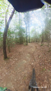
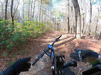
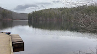
Photos of Cedar Mountain Mountain Bike
Videos of Cedar Mountain Mountain Bike
trail: Burnt Mountain Trail
0:54 |
43 |
Aug 27, 2025
trail: Rocky Ridge Trail
6:37 |
33 |
Aug 22, 2025
trail: Reasonover Creek Connector
0:26 |
8 |
Jul 23, 2024

trail: Bridal Veil Falls Trail
0:37 |
10 |
Jul 23, 2024
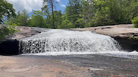
trail: Bridal Veil Falls Trail
0:07 |
5 |
Jul 23, 2024
trail: Bridal Veil Falls Trail
0:20 |
4 |
Jul 23, 2024

trail: Cascade Loop
0:10 |
344 |
May 1, 2021
trail: Jim Branch Trail
0:10 |
320 |
Feb 15, 2021
Recent Trail Reports
| status | trail | date | condition | info | user |
|---|---|---|---|---|---|
| Rocky Ridge Trail | Jun 22, 2026 @ 11:19am (America/New_York) 15 hours | Unknown | Jpshaloiko | ||
| Ridgeline Trail | Jun 19, 2026 @ 6:02pm (America/Kentucky/Monticello) Jun 19, 2026 | Ideal | Mellowcat | ||
| Hickory Mountain Road | Jun 19, 2026 @ 6:02pm (America/Kentucky/Monticello) Jun 19, 2026 | Ideal | Mellowcat | ||
| Lake Imaging Road | Jun 19, 2026 @ 6:02pm (America/Kentucky/Monticello) Jun 19, 2026 | Ideal | Mellowcat | ||
| Longside Trail | Jun 19, 2026 @ 3:29pm (America/Kentucky/Monticello) Jun 19, 2026 | Variable | Pmartone | ||
| Airstrip Trail | Jun 19, 2026 @ 3:29pm (America/Kentucky/Monticello) Jun 19, 2026 | Variable | Pmartone | ||
| Three Lakes Trail | Jun 19, 2026 @ 3:29pm (America/Kentucky/Monticello) Jun 19, 2026 | Variable | Pmartone | ||
| Joanna Road | Jun 19, 2026 @ 5:05pm (America/New_York) Jun 19, 2026 | Variable | grannygear63 FODF | ||
| Reasonover Creek Trail | Jun 11, 2026 @ 10:00am (America/New_York) Jun 11, 2026 | Ideal | grannygear63 FODF | ||
| Grassy Creek Trail | Jun 4, 2026 @ 5:03pm (America/New_York) Jun 4, 2026 | Unknown | grannygear63 FODF |
Activity Feed
| username | action | type | title | date |
|---|---|---|---|---|
| ZacharyUJCgIr | wishlist | route | activity #97601916 | Jun 22, 2026 @ 8:17pm 3 hours |
| zastring | wishlist | route | activity #97601367 | Jun 22, 2026 @ 8:03pm 4 hours |
| BrucePisarekxln | wishlist | route | activity #97568922 | Jun 22, 2026 @ 9:57am 14 hours |
| SH4 | wishlist | route | activity #97564395 | Jun 22, 2026 @ 8:41am 15 hours |
| Jpshaloiko | add | report | activity #97563087 | Jun 22, 2026 @ 8:19am 15 hours |
Recent Comments
| username | type | title | comment | date |
|---|---|---|---|---|
| trail | The bridge that had been out is open as of today. | Jun 12, 2026 @ 2:30pm Jun 12, 2026 | ||
| trail | you're crazy.. way too short. It's like this... | May 14, 2026 @ 9:01am May 14, 2026 | ||
| trail | Cool trail, worth the ride up the gravel road. | Apr 27, 2026 @ 7:14pm Apr 27, 2026 | ||
| trail | Best green trail I’ve ridden in a while,... | Apr 23, 2026 @ 6:50pm Apr 23, 2026 | ||
| trail | I’m not sure why’d you ride this counter... | Apr 23, 2026 @ 2:55pm Apr 23, 2026 |
Local Badges
-

Epic Mountain Bike Climb 2k370 awarded -

Epic Ride Descent 2k370 awarded -

Mountain Biking 100k Badge8 awarded -

Climbing 10k Badge296 awarded -

Descent 10k Badge301 awarded -

10 Black Trails549 awarded
Local Products
Activity Type Stats
| activitytype | trails | distance | descent | descent distance | total vertical | rating | global rank | state rank | photos | reports | routes | ridelogs |
|---|---|---|---|---|---|---|---|---|---|---|---|---|
| Mountain Bike | 76 | 85 miles | 10,328 ft | 43 miles | 984 ft | #175 | #68 | 675 | 5,274 | 80 | 75,311 | |
| Gravel Bike | 35 | 42 miles | 3,921 ft | 20 miles | 1,490 ft | #312 | #924 | 1,082 | 1 | 188 | ||
| Adaptive Bike | 2 | 1 mile | 75 ft | 1,165 ft | 243 ft | #58 | #666 | 219 | 1 | 5 | ||
| Horse | 41 | 37 miles | 3,507 ft | 18 miles | 984 ft | #1,031 | #675 | 2,235 | 2 | 15 | ||
| Hike | 82 | 88 miles | 10,978 ft | 44 miles | 1,490 ft | #1,209 | #556 | 38 | 5,279 | 4 | 4,303 | |
| Trail Running | 81 | 88 miles | 10,978 ft | 44 miles | 1,490 ft | #1,777 | #590 | 5,276 | 5 | 1,076 |
Frequently Asked Questions About Cedar Mountain
▼
What are the best places to ride in Cedar Mountain?
Cedar Mountain has 1 areas to explore for mountain biking. The top rated areas are:
▼
What are the highest rated mountain biking trails in Cedar Mountain?
The highest rated mountain biking trails in Cedar Mountain are:
- Cedar Rock Trail (4.7/5)
- Big Rock Trail (4.6/5)
- Ridgeline Trail (4.6/5)
- Hickory Mountain Loop (4.5/5)
- Turkey Knob Trail (4.5/5)
▼
What is the best time of the year to ride in Cedar Mountain?
Based on ride log data, the most popular months to ride in Cedar Mountain are:
- July (1,050 activities)
- October (866 activities)
- June (853 activities)
▼
Where can I park to ride in Cedar Mountain?
There are 8 parking locations listed in Cedar Mountain. The most popular parking spots are:
- Lake Imaging Parking
- Corn Mill Shoals Access Area
- Guion Farm Parking
- Fawn Lake Access Area
- Buck Forest Parking
Activities
Trails
Points of Interest
- Reasonover Creek - Water Crossing TTF
- Turkey Knob Bridge
- Grassy Creek Bridge Open Information
- Grassy Creek Bridge OPEN Information
- Cedar Rock Summit
- Water Crossing - Briery Fork Trail TTF
- Water Crossing - Briery Fork Trail TTF
- Conservation Rd - Bridge
- Upper Wasabi Gap TTF
- Jim Branch Rock Garden TTF
- Rich Mountain (3,691 ft)
- Stone Mountain (3,593 ft)
- Slick Rock Mountain (3,586 ft)
- By caleb93
 & contributors
 - Admins: apply
- #4414 - 13,370 views
- cedar mountain activity log | embed map of Cedar Mountain mountain bike trails | cedar mountain mountain biking points of interest
Downloading of trail gps tracks in kml & gpx formats is enabled for Cedar Mountain.
You must login to download files.