close
-
Layers w
- Weather Layers
- Pro
- Pro
- Pro
- Pro
- Pro
- Pro
- More Layers
- Pro
- Pro
- Pro
- Pro
-
Upgrade to

3D
Trail Conditions
- Unknown
- Snow Groomed
- Snow Packed
- Snow Covered
- Snow Cover Partial
- Freeze/thaw Cycle
- Icy
- Prevalent Mud
- Wet
- Variable
- Ideal
- Dry
- Very Dry
Trail Flow (Ridden Direction)
Trailforks scans users ridelogs to determine the most popular direction each trail is ridden. A good flowing trail network will have most trails flowing in a single direction according to their intension.
The colour categories are based on what percentage of riders are riding a trail in its intended direction.
The colour categories are based on what percentage of riders are riding a trail in its intended direction.
- > 96%
- > 90%
- > 80%
- > 70%
- > 50%
- < 50%
- bi-directional trail
- no data
Trail Last Ridden
Trailforks scans ridelogs to determine the last time a trail was ridden.
- < 2 days
- < 1 week
- < 2 weeks
- < 1 month
- < 6 months
- > 6 months
Trail Ridden Direction
The intended direction a trail should be ridden.
- Downhill Only
- Downhill Primary
- Both Directions
- Uphill Primary
- Uphill Only
- One Direction
Contribute Details
Colors indicate trail is missing specified detail.
- Description
- Photos
- Description & Photos
- Videos
Trail Popularity ?
Trailforks scans ridelogs to determine which trails are ridden the most in the last 9 months.
Trails are compared with nearby trails in the same city region with a possible 25 colour shades.
Think of this as a heatmap, more rides = more kinetic energy = warmer colors.
- most popular
- popular
- less popular
- not popular
ATV/ORV/OHV Filter
Max Vehicle Width
inches
US Cell Coverage
Legend

Radar Time
Activity Recordings
Trailforks uses anonymized public activity data.
?
Activity Recordings
Trailforks uses anonymized public activity data.
?
Personal Heatmap
▶
Activity Types
all
/
none
▶
Options
2
Date range
month
–
Winter Trails
Warning
A routing network for winter maps does not exist. Selecting trails using the winter trails layer has been disabled.
Missing Trails
Most Popular
Least Popular
Trails are colored based on popularity. The more popular a trail is, the more red. Less popular trails trend towards green.
Jump Magnitude Heatmap
Heatmap of where riders jump on trails. Zoom in to see individual jumps, click circles to view jump details.
BC Backroad Status
![map legend]()
Service Road Atlas is a free to use, community-driven service for viewing and creating reports on the numerous back-country service roads around B.C. and Alberta.

Slope Aspect
Direction the slope faces
Trails Deemphasized
Trails are shown in grey.
Only show trails with no bike usage.
Suggested Layers
Based on selected activity type
Save the current map location and zoom level as your default home location whenever this page is loaded.
Save
No description for Cedar Rapids has been added yet!
Login or register to submit one.
Activities Click to view
- Mountain Bike
87 trails
- E-Bike
64 trails
- Gravel Bike
0 trails
- Adaptive Bike
0 trails
- Winter Fat Bike
0 trails
- Hike
78 trails
- Trail Running
79 trails
- Snowshoe
9 trails
Region Details
- 7
- 9
- 28
- 34
- 7
- 1
Region Status
Caution as of Jan 28, 2026Stats
- Avg Trail Rating
- Trails (view details)
- 86
- Trails Mountain Bike
- 87
- Trails E-Bike
- 64
- Trails Horse
- 3
- Trails Hike
- 78
- Trails Trail Running
- 79
- Trails Snowshoe
- 9
- Total Distance
- 61 miles
- Total Descent
- 3,151 ft
- Total Vertical
- 252 ft
- Highest Trailhead
- 947 ft
- Reports
- 216
- Photos
- 175
- Ridden Counter
- 4,663
Sub Regions
-
Beverly Park
- 12
- 12
- 5
- 1
-
Mt. Trashmore
- 1
-
Sac & Fox Trail City Park
- 2
- 5
- 5
- 1
-
Seminole Valley Park
- 4
- 5
- 1
-
Wanatee Park
- 7
- 12
Popular Cedar Rapids Mountain Biking Trails
• 95 ★ 4.4 • 1,335 ft • 31 ft • 154 •
Another professionally-built singletrack at Wanatee Park, is a blue rated (more difficult) singletrack with flow elements (berms, rollers, lifts, etc.) and two boardwalks that ride just as good, if not better, than the trail. This trail...
• 100 ★ 5.0 • 909 ft • 0 ft • 149 •
This fast and flowy blue trail is a one way downhill trail that descends from the Gravity Zone twisting and turning through the trees along the edge of the . The first half has many bermed corners followed by a rollable jump that...
• 80 ★ 4.7 • 961 ft • 35 ft • 142 •
This black trail features a small drop, two log overs, and a couple very tight switchbacks. Combine that with some steep climbs and you have a trail set to raise your heart rate to the max. It can be ridden either direction. Try it in...
• 70 ★ 3.5 • 4,852 ft • 82 ft • 140 •
The loop is a beginner level trail that traverses the of the hill next to the parking lot. Along the top of the ridge is a skills area that contains an elevated boardwalk with a skinny teeter totter or drop option, large log over with a...
• 95 ★ 4.5 • 2 miles • 177 ft • 133 •
LAMBA's original installation of singletrack at Wanatee Park in 2011, with updated routing and addition of flow elements (berms, rollers, jumps, etc.) in 201. This particular trail is rated blue (more difficult) often tight and twisty,...
• 90 ★ 4.8 • 2 miles • 115 ft • 132 •
The is LAMBA and Linn County’s professional installation of natural surface singletrack at Wanatee Park. The is a green rated (less difficult) bi-directional singletrack trail packed with flow elements (berms, rollers, lifts, etc.)....
Cedar Rapids Mountain Bike Routes
3 miles • 345 ft • 16 • Loop •
Are you up for taking your riding skills to the next level? The Dark Web Tour takes you through all the...
4 miles • 333 ft • 7 • Loop •
The is an easier route that traverses most of the green (less difficult) trails in the park. This route is...
4 miles • 383 ft • 13 • Loop •
The travels along a majority of the blue (more difficult) trails in the park. Most features on blue trails...
• 14 miles • 1,042 ft • 65 •
• 4 miles • 426 ft • 16 •
• 5 miles • 520 ft • 14 •
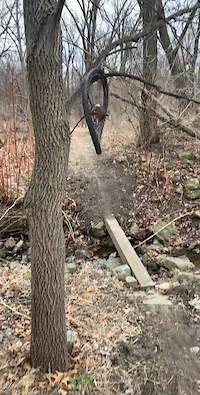
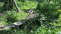
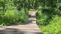
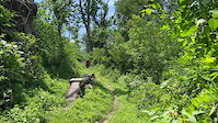
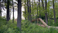
Photos of Cedar Rapids Mountain Bike
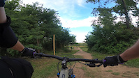
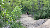
Videos of Cedar Rapids Mountain Bike

0:02 |
10 |
Sep 13, 2022
0:07 |
8 |
Sep 13, 2022
trail: Twisted Sister
0:46 |
232 |
Jul 24, 2022
trail: Porterhouse
0:33 |
40 |
Jul 14, 2022
trail: Porterhouse
0:07 |
42 |
Jul 14, 2022
trail: Mineck Connector
0:35 |
28 |
Jul 14, 2022
trail: Twisted Sister
0:09 |
157 |
Jul 14, 2022
trail: Twisted Sister
0:13 |
132 |
Jul 14, 2022
Recent Trail Reports
| status | trail | date | condition | info | user |
|---|---|---|---|---|---|
| Aspen | Jan 28, 2026 @ 12:18pm (America/Chicago) Jan 28, 2026 | Unknown | viw-trails LAMBA | ||
| Red Cedar | Apr 30, 2025 @ 5:39pm Apr 30, 2025 | Ideal | Stumpy12-9 | ||
| Billy Goat | Apr 30, 2025 @ 5:39pm Apr 30, 2025 | Ideal | Stumpy12-9 | ||
| Derecho | Apr 30, 2025 @ 5:39pm Apr 30, 2025 | Ideal | Stumpy12-9 | ||
| Irene | Sep 29, 2024 @ 11:54am Sep 29, 2024 | Very Dry | Mandylyn70 QC FORC | ||
| Troll Holler | Sep 29, 2024 @ 11:54am Sep 29, 2024 | Very Dry | Mandylyn70 QC FORC | ||
| Meadowlark | Jun 21, 2024 @ 11:07am Jun 21, 2024 | Ideal | Stumpy12-9 | ||
| Little Sister | Oct 7, 2022 @ 7:58am Oct 7, 2022 | Ideal | JReeder9 | ||
| Flowy McFlowface | Oct 7, 2022 @ 7:58am Oct 7, 2022 | Ideal | JReeder9 | ||
| Rob's Elbow | Oct 7, 2022 @ 7:58am Oct 7, 2022 | Ideal | JReeder9 |
Activity Feed
| username | action | type | title | date |
|---|---|---|---|---|
| mepotts | ridden | trail | activity #97155321 | Jun 16, 2026 @ 6:55pm Jun 16, 2026 |
| uQ0BC1 | wishlist | region | activity #97015082 | Jun 14, 2026 @ 5:25pm Jun 14, 2026 |
| patrickveronda | wishlist | region | activity #96974046 | Jun 14, 2026 @ 8:50am Jun 14, 2026 |
| Bloomer94 | wishlist | region | activity #94710811 | May 14, 2026 @ 2:07pm May 14, 2026 |
| Bloomer94 | wishlist | region | activity #94710793 | May 14, 2026 @ 2:07pm May 14, 2026 |
Recent Comments
| username | type | title | comment | date |
|---|---|---|---|---|
| trail | Very easy trail, green. Nice view of the... | Nov 19, 2025 @ 8:10am Nov 19, 2025 | ||
| trail | More challenging inner loop of the campground... | Nov 19, 2025 @ 7:23am Nov 19, 2025 | ||
| trail | Well established trail that follows an almost... | Nov 19, 2025 @ 7:22am Nov 19, 2025 | ||
| trail | Rough trail, not for the beginner. Sand and... | Nov 19, 2025 @ 6:51am Nov 19, 2025 | ||
| trail | Natural trail, little grooming, a lot of log... | Nov 19, 2025 @ 6:43am Nov 19, 2025 |
Local Badges
-

Epic Ride Climb 2k3 awarded -

Climbing 10k Badge21 awarded -

Climbing 100k Badge1 awarded -

Epic Ride Descent 2k3 awarded -

Descent 10k Badge21 awarded -

Descent 100k Badge1 awarded
Bike & Skill Parks
| name | type | city | rating |
|---|---|---|---|
| Hawkeye Downs Motocross | skill park | Cedar Rapids | |
| Wanatee Skills Park | skill park | Cedar Rapids |
Activity Type Stats
| activitytype | trails | distance | descent | descent distance | total vertical | rating | global rank | state rank | photos | reports | routes | ridelogs |
|---|---|---|---|---|---|---|---|---|---|---|---|---|
| Mountain Bike | 87 | 61 miles | 3,150 ft | 20 miles | 253 ft | #1,491 | #564 | 175 | 216 | 3 | 6,266 | |
| E-Bike | 64 | 18 miles | 1,581 ft | 6 miles | 217 ft | #4,002 | #1,336 | 166 | 110 | |||
| Horse | 3 | 43 | ||||||||||
| Hike | 78 | 60 miles | 3,074 ft | 20 miles | 253 ft | #3,932 | #1,392 | 216 | 307 | |||
| Trail Running | 79 | 60 miles | 3,074 ft | 20 miles | 253 ft | #3,438 | #1,018 | 216 | 136 | |||
| Snowshoe | 9 | 7 miles | 200 ft | 1 mile | 56 ft | #1,214 | #646 | 1 | 11 |
Frequently Asked Questions About Cedar Rapids
▼
What are the best places to ride in Cedar Rapids?
Cedar Rapids has 5 areas to explore for mountain biking. The top rated areas are:
▼
What are the highest rated mountain biking trails in Cedar Rapids?
The highest rated mountain biking trails in Cedar Rapids are:
- Red Cedar (4.4/5)
- Irene (4.2/5)
- Ditch Digger East (4.2/5)
- Little Sister (4.2/5)
- Billy Goat (4.2/5)
▼
What is the best time of the year to ride in Cedar Rapids?
Based on ride log data, the most popular months to ride in Cedar Rapids are:
- August (100 activities)
- July (86 activities)
- June (62 activities)
▼
Where can I park to ride in Cedar Rapids?
There are 9 parking locations listed in Cedar Rapids. The most popular parking spots are: View all parking and trailhead locations on the map to plan your visit.
Activities
Trails
Points of Interest
- By brenthillier
 NSMBA TRAILFORKS & contributors
 - Admins: LAMBA, BackyardTrails
- #3476 - 6,459 views
- cedar rapids activity log | embed map of Cedar Rapids mountain bike trails | cedar rapids mountain biking points of interest polygons
Downloading of trail gps tracks in kml & gpx formats is enabled for Cedar Rapids.
You must login to download files.