close
-
Layers w
- Weather Layers
- Pro
- Pro
- Pro
- Pro
- Pro
- Pro
- More Layers
- Pro
- Pro
- Pro
- Pro
-
Upgrade to

3D
Trail Conditions
- Unknown
- Snow Groomed
- Snow Packed
- Snow Covered
- Snow Cover Partial
- Freeze/thaw Cycle
- Icy
- Prevalent Mud
- Wet
- Variable
- Ideal
- Dry
- Very Dry
Trail Flow (Ridden Direction)
Trailforks scans users ridelogs to determine the most popular direction each trail is ridden. A good flowing trail network will have most trails flowing in a single direction according to their intension.
The colour categories are based on what percentage of riders are riding a trail in its intended direction.
The colour categories are based on what percentage of riders are riding a trail in its intended direction.
- > 96%
- > 90%
- > 80%
- > 70%
- > 50%
- < 50%
- bi-directional trail
- no data
Trail Last Ridden
Trailforks scans ridelogs to determine the last time a trail was ridden.
- < 2 days
- < 1 week
- < 2 weeks
- < 1 month
- < 6 months
- > 6 months
Trail Ridden Direction
The intended direction a trail should be ridden.
- Downhill Only
- Downhill Primary
- Both Directions
- Uphill Primary
- Uphill Only
- One Direction
Contribute Details
Colors indicate trail is missing specified detail.
- Description
- Photos
- Description & Photos
- Videos
Trail Popularity ?
Trailforks scans ridelogs to determine which trails are ridden the most in the last 9 months.
Trails are compared with nearby trails in the same city region with a possible 25 colour shades.
Think of this as a heatmap, more rides = more kinetic energy = warmer colors.
- most popular
- popular
- less popular
- not popular
ATV/ORV/OHV Filter
Max Vehicle Width
inches
US Cell Coverage
Legend

Radar Time
Activity Recordings
Trailforks uses anonymized public activity data.
?
Activity Recordings
Trailforks uses anonymized public activity data.
?
Personal Heatmap
▶
Activity Types
all
/
none
▶
Options
2
Date range
month
–
Winter Trails
Warning
A routing network for winter maps does not exist. Selecting trails using the winter trails layer has been disabled.
Missing Trails
Most Popular
Least Popular
Trails are colored based on popularity. The more popular a trail is, the more red. Less popular trails trend towards green.
Jump Magnitude Heatmap
Heatmap of where riders jump on trails. Zoom in to see individual jumps, click circles to view jump details.
BC Backroad Status
![map legend]()
Service Road Atlas is a free to use, community-driven service for viewing and creating reports on the numerous back-country service roads around B.C. and Alberta.

Slope Aspect
Direction the slope faces
Trails Deemphasized
Trails are shown in grey.
Only show trails with no bike usage.
Suggested Layers
Based on selected activity type
Save the current map location and zoom level as your default home location whenever this page is loaded.
Save
No description for Centennial Cone has been added yet!
Login or register to submit one.
 google parking directions
Primary Trail Type: Cross-Country
eBikes Allowed:
Yes
google parking directionsLinks
Activities Click to view
- Mountain Bike
7 trails
- E-Bike
7 trails
- Hike
7 trails
- Trail Running
7 trails
Region Details
- 3
- 4
Region Status
Open as of Jun 16, 2026Stats
- Avg Trail Rating
- Trails (view details)
- 7
- Trails Mountain Bike
- 7
- Trails E-Bike
- 7
- Trails Hike
- 7
- Trails Trail Running
- 7
- Total Distance
- 20 miles
- Total Descent
- 3,730 ft
- Total Vertical
- 1,186 ft
- Highest Trailhead
- 7,922 ft
- Reports
- 252
- Photos
- 52
- Ridden Counter
- 6,239
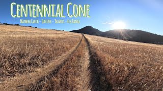
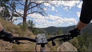
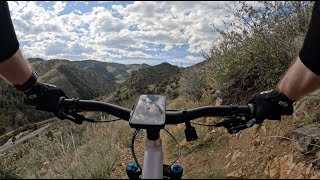
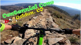
Popular Centennial Cone Mountain Biking Trails
• 50 ★ 4.0 • 9 miles • 1,436 ft • 1,393 •
Beautiful singletrack tour through open meadows and forests around Centennial Cone. Awesome views of CCC and nearby peaks. Trail is mostly very moderate and smooth with two sections of rocky steps - one downhill with a few switchbacks,...
• 55 ★ 4.0 • 2 miles • 255 ft • 1,265 •
CLOSED TO BIKES ON ODD WEEKEND DAYS and all of December and January. While fairly smooth, this is a fairly consistent grind going uphill. Hitting this climb right out of the lower parking lot without a warmup will make it seem tougher...
• 50 ★ 4.0 • 4,102 ft • 69 ft • 1,165 •
Moderately popular blue difficulty singletrack. This mountain bike primary trail can be used both directions. On average it takes 4 minutes to complete this trail.
• 40 ★ 0.0 • 3,612 ft • 62 ft • 688 •
Moderately popular blue difficulty singletrack. This mountain bike primary trail can be used both directions. On average it takes 3 minutes to complete this trail.
Photos of Centennial Cone Mountain Bike
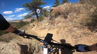
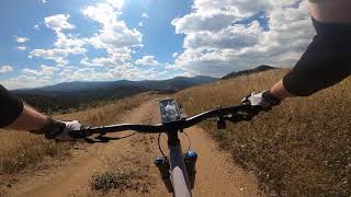
Videos of Centennial Cone Mountain Bike
trail: Mayhem Gulch
0:45 |
18 |
Dec 12, 2025 , Golden
trail: Juniper
6:07 |
81 |
Sep 30, 2024 , Golden
trail: Mayhem Gulch
12:33 |
107 |
Sep 27, 2024 , Golden
13:34 |
428 |
Jan 15, 2024

trail: Travois
0:01 |
315 |
Aug 21, 2023 , Golden
trail: Travois
0:12 |
636 |
Sep 19, 2021 , Golden
trail: Elk Range
2:56 |
426 |
Sep 18, 2021 , Golden

16:50 |
339 |
Sep 10, 2020
Recent Trail Reports
| status | trail | date | condition | info | user |
|---|---|---|---|---|---|
| Elk Range | Jun 16, 2026 @ 7:38am (America/Denver) Jun 16, 2026 | Dry | tfl2u2 | ||
| Mayhem Gulch | Apr 21, 2026 @ 9:26am (America/Denver) Apr 21, 2026 | Very Dry | davessn763 | ||
| Juniper | Apr 21, 2026 @ 9:26am (America/Denver) Apr 21, 2026 | Very Dry | davessn763 | ||
| Travois | Apr 12, 2026 @ 9:09pm (America/Denver) Apr 12, 2026 | Dry | tim-berjack | ||
| Mayhem Gulch Trail | Sep 3, 2025 @ 10:05am Sep 3, 2025 | Dry | camerdb | ||
| Evening Sun Loop | Apr 26, 2025 @ 8:14pm Apr 26, 2025 | Ideal | m85476585 |
Activity Feed
| username | action | type | title | date |
|---|---|---|---|---|
| tfl2u2 | add | report | activity #97105651 | Jun 16, 2026 @ 6:38am Jun 16, 2026 |
| Zacharyyk8vgx | wishlist | trail | activity #96921822 | Jun 13, 2026 @ 3:39pm Jun 13, 2026 |
| kauaibobby | wishlist | trail | activity #96331893 | Jun 5, 2026 @ 5:20pm Jun 5, 2026 |
| scott77evans | wishlist | trail | activity #95537301 | May 25, 2026 @ 6:22pm May 25, 2026 |
| ConorCcsnaR | ridden | trail | activity #95486140 | May 25, 2026 @ 7:18am May 25, 2026 |
Recent Comments
| username | type | title | comment | date |
|---|---|---|---|---|
| report | Thanks! | Oct 22, 2025 @ 10:26am Oct 22, 2025 | ||
| report | Evening Sun, not Evening Song, parallels Travois | Oct 22, 2025 @ 10:03am Oct 22, 2025 | ||
| report | Evening Song? | Oct 22, 2025 @ 9:22am Oct 22, 2025 | ||
| report | Gc | Mar 2, 2024 @ 9:18am Mar 2, 2024 | ||
| report | Yes it is open. Bikes only on certain days. | May 20, 2023 @ 3:08pm May 20, 2023 |
Nearby Areas
| name | distance | ||||
|---|---|---|---|---|---|
| Floyd Hill Open Space | 3 | 4 | 4 | 3 | 3.1 km |
| Genesee Park | 1 | 4.6 km | |||
| Elk Meadow Park | 11 | 2 | 2 | 6.1 km | |
| White Ranch Park | 5 | 5 | 7 | 6.7 km | |
| Windy Saddle Park | 1 | 4 | 2 | 6.8 km |
Local Mountain Biking Directory
-
Colorowdies
![Colorowdies]()
-
C3 Bike Shop
![C3 Bike Shop]()
-
Continental Divide Trail Coalition
![Continental Divide Trail Coalition]()
-
Golden Bike ShopBike Shop
![Golden Bike Shop]()
-
Big Ring CyclesBike Shop
![Big Ring Cycles]()
Local Products
Activity Type Stats
| activitytype | trails | distance | descent | descent distance | total vertical | rating | global rank | state rank | photos | reports | routes | ridelogs |
|---|---|---|---|---|---|---|---|---|---|---|---|---|
| Mountain Bike | 7 | 20 miles | 3,730 ft | 10 miles | 1,188 ft | #5,247 | #1,896 | 54 | 252 | 4,709 | ||
| E-Bike | 7 | 20 miles | 3,730 ft | 10 miles | 1,188 ft | #5,210 | #1,440 | 252 | 196 | |||
| Hike | 7 | 20 miles | 3,730 ft | 10 miles | 1,188 ft | #9,201 | #3,510 | 252 | 202 | |||
| Trail Running | 7 | 20 miles | 3,730 ft | 10 miles | 1,188 ft | #8,484 | #2,986 | 252 | 98 |
Frequently Asked Questions About Centennial Cone
▼
What are the highest rated mountain biking trails in Centennial Cone?
The highest rated mountain biking trails in Centennial Cone are:
- Travois (4/5)
- Mayhem Gulch (4/5)
- Juniper (4/5)
- Evening Sun Loop (0/5)
▼
What is the best time of the year to ride in Centennial Cone?
Based on ride log data, the most popular months to ride in Centennial Cone are:
- July (67 activities)
- June (48 activities)
- September (45 activities)
▼
Where can I park to ride in Centennial Cone?
There are 6 parking locations listed in Centennial Cone. The most popular parking spots are:
- Sourdough Springs
- White Ranch Park (Belcher Hill)
- Centennial Cone South
- Centennial Cone North
- Centennial Cone Road
▼
What is the longest trail in Centennial Cone?
The longest trail in Centennial Cone is Travois at 8.9 miles. View all trails sorted by distance.
Activities
- By todd
 Trailforks & contributors
 - Admins: Giddyup
- #4927 - 15,455 views
- centennial cone activity log | embed map of Centennial Cone mountain bike trails | centennial cone mountain biking points of interest
Downloading of trail gps tracks in kml & gpx formats is enabled for Centennial Cone.
You must login to download files.